Outlook: 21 May 2012 (Day 1, Week 3)

For the week of 21-25 May, our distinguished NWS guests will be  Matt Hirsch (WFO Phoenix, AZ), Andy Kleinsasser (WFO Wichita, KS), Chris McKinney (WFO Houston, TX), and Gordon Strassberg (CWSU New York City, NY).  Other visiting participants this week will include James McCormick (AFWA, Offutt AFB, Omaha, NE), Helge Tuschy (Deutscher Wetterdienst, Germany), Lee Cronce (CIMSS/UW-Madison), Chris Jewett (UAH), and Dan Lindsey (CIRA/CSU).

Focus for day 1 is over the West Texas region; forecasters are currently set up in the Lubbock and Amarillo CWAs.  Right now they’re in the process of familiarizing themselves with both the regional weather and AWIPS2.

Finally caught an event pre-CI and over the OUN-WRF domain, so much of the focus for the forecasters to begin with are on the high-resolution models, CIRA simulated satellite from the NSSL-WRF and satellite CI/CTC products.

Weaker storms from this morning have moved SE out of the domain leaving a number of outflow boundaries across the region.  The high-res models seem a bit mixed regarding the CI time, anywhere between 2100-0000 UTC (OUN-WRF earlier/NSSL-WRF later).  The HRRR, OUN-WRF, and TTU-WRF all seem to briefly include weakly rotating supercells for a short time (with large hail and wind the primary concern) before merging into a SE moving line.

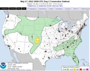
SPC Day 1 outlook. HWT operations set-up over eastern part of slight risk in West Texas.

K. Calhoun, EWP 2012 Week 3 coordinator

Tags: None

Outlook: 2012 May 18

Today’s situational environment remains little changed from our expectations yesterday.  An upper-level low has moved in from the Gulf yesterday to South Carolina today.  Deep, moist convection (DMC) has already erupted around the perimeter of the upper low.  To the south, unusually strong mid-level flow continues along the central Gulf to the FL peninsula.  With plenty of moisture resident over FL, and southwesterly low-level flow, it appears we have a good juxtaposition of shear and CAPE in a climatologically unusual location.  Supercells are likely, especially where the shear is strongest from St. Augustine and south.  However the question of the day is expected coverage of DMC.  The coolest air aloft resides close to the upper low meaning that northern FL would see the steepest lapse rates and least inhibition.  Early DMC in southeast GA helps confirm this thinking.  Further south, the air aloft is warmer and coverage is expected to be less.  We’ll also have to rely on the initiation of the west coast seabreeze to help provide the strongest low-level forcing to overcome the greater inhibition to the south.  The eastern seabreeze may help to provide enhanced low-level shear but the poor boundary-relative convective steering layer flow will limit residence time of any incipient DMC in its lifting zone.  While some time may lapse before we get mature storms in the central FL peninsula, whatever storms that form could turn into supercells, especially if they latch onto the enhance shear along the eastern seabreeze. Damaging winds and large hail are possible with these storms though an unusual intersection between outflows and seabreeze interaction may enhance low-level vertical or horizontal vorticity enough for a tornado.

At this time, Todd and Stephen have localized to MLB while Brian and Julia are covering JAX.

Jim LaDue: EWP week 2 coordinator

Tags: None

The beat GOES on

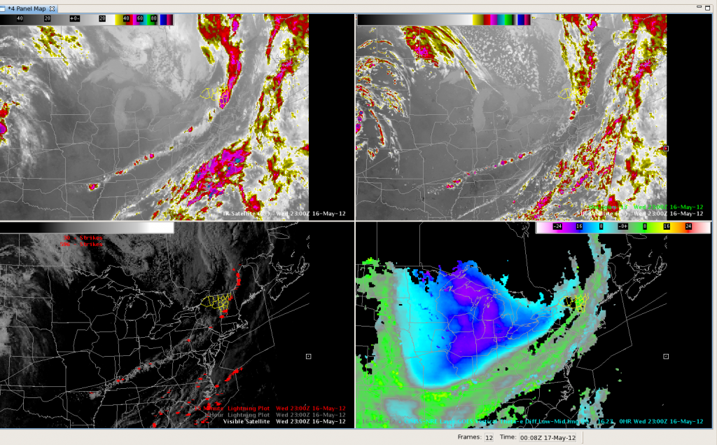
The synthetic imagery did a nice job of placing convection southward along the cold front through the Ohio and Lower Mississippi Valleys.  Here’s a screen capture from 2300UTC, with the actual IR on the upper left and the model forecast on the upper right.  Visible imagery with lightning is shown in the lower left pane, with the theta-e Nearcast product on the lower right.  All in all, the GOES products did well today depicting where convection would be in relation to the cold front.  This would be an excellent application to the CWSU environment for air traffic planning purposes.

Outlook: 2012 May 16

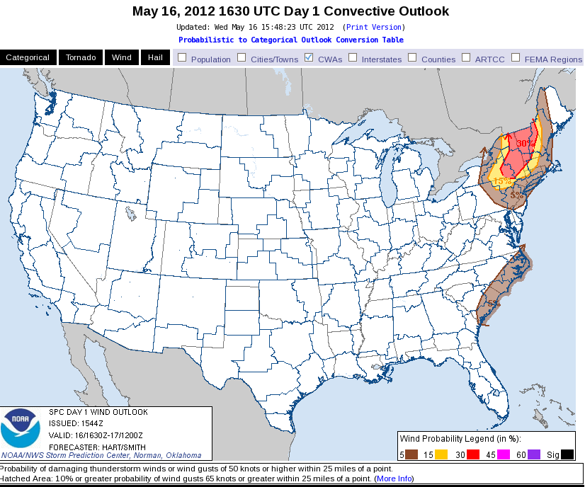
Yesterday’s outlook appears to be still on track.  One strong northern stream wave is approaching eastern NY and New England along with a significant cold front.  The front still has to interact with the axis of best moisture from the Hudson valley to the east and yet higher based convection is forming in the high terrain in northern PA to the Adirondacks.  Convection should consolidate once the front hits the moisture in 2-3 hours.  Deep layer shear is strong enough to generate supercells, however the majority of the convection may fall into small multicell forms, perhaps some bow echoes.  Low level lapse rates from the Hudson valley to the west are strong but midlevel lapse rates are somewhat marginal (6-7 c/km).  Thus I expect that large hail will be a threat though giant hail (>2.5″ diameter) prospects will be very small.  Tornadoes are unlikely given somewhat weak low-level shear (10kts).  Severe winds are much more likely as strong convective downdrafts are possible with the more intense storms.  We have both teams in the northeast; Todd and Stephen are localized to BTV while Brian and Julia are taking on ALY.  Convection has already initiated with the most coverage in BTV.

Meanwhile, steep, near saturated, low-level lapse rates have again initiated seabreeze convection along coastal NC.  New storms may form further southwest into coastal SC.  The Floriday play is somewhat muddied up by fairly dense high cloud cover.  However instability is quite sufficient for thunderstorms and the upper-level system is approaching from the west.

Jim LaDue: EWP week 2 coordinator

Tags: None

Outlook: 2012 May 15

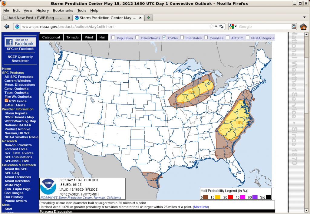
The eastern mid-level trough and near surface cold front moved extremely slowly overnight allowing the east coast another day of good surface-based instability.  Morning soundings in DC, Wallops Island and Blacksburg show near saturation over at least 300 mb above the surface and little cap. Surface moisture values are in excess of 12 g/kg. However lapse rates are relatively poor and deep layer shear is only 25 kts.  The result is expected to be areas of scattered to numerous small multicells forming relatively early in the day off of high terrain to the west and subtle axis of enhanced moisture extending just east of DC.  Steeper lapse rates and similar saturation along coastal North Carolina have allowed the morning sea breeze to more quickly initiate vigorous convection.  Any of these areas will be susceptible to moist downbursts and marginally severe hail.

Further west, a northern stream midlevel short-wave trough is dropping into the western Great Lakes.  A trailing cold front is expected to initiate convection from southeastern MN eastward to central MI.  Here, moisture is sparse with surface values only around 8 g/kg.  But we expect this limited moisture will be able to sustain convection owing to very steep lapse rates in the lowest 400 mb of the atmosphere.  Shear is also expected to remain weak (<30 kts/6km) and thus small multicells are expected.  Due to the limited moisture, we don’t expect any upscale growth here.

The plan is to work the DC LMA area and the Roanoke CWA for the early convection and then shift our focus to WI and MI for the later afternoon.

Jim LaDue, EWP2012 Week#2 Weekly Coordinator

Tags: None

Outlook: 2012 May 14

For the week of 14-18 May, our distinguished NWS guests will be Brian Carcione (WFO Huntsville, AL), Todd Dankers (WFO Boulder/Denver, CO), Stephen Kearney (CWSU Memphis, TN), and Julia Ruthford (WFO Charleston, WV).  Other visiting participants this week will include Dave Carlsen (Environment Canada), Bob Aune (UW-CIMSS), Jordan Gerth (UW-CIMSS), Lori Schultz (UAH), and Chad Gravelle (GOES-R NWSTC liaison).

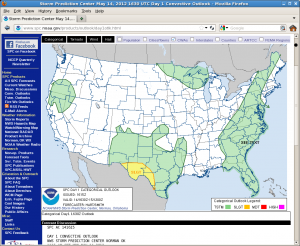
The pattern at upper-levels features a large ridge in the western US and a weak but large trough in the eastern third of the CONUS.  Two areas of potential severe convection exists in the CONUS, along the Rio Grande valley in TX and the southeast Atlantic coastal states.

SPC day 1 categorical outlook

The southwest TX threat area comes in response to one weak short-wave trough embedded in northwesterly flow east of the ridge settling southeastward from NM yesterday.  This trough is phasing with a low-level front along the Rio Grande river from south of Marfa to near Del Rio and eastward.  However the moisture has been scoured a bit from an overnight MCS that passed southeast from Del Rio.  We expect diurnal heating and moisture return from the east to destabilize the atmosphere and allow new diurnal convection to form from the Big Bend region, east.  There are factors limiting potential severity of convection including uncertain amounts of destabilization and weak low-level shear.  Nevertheless, supercells  producing large hail and some damaging winds are possible in this threat area.

The second area in the southeastern Atlantic coastal states is already active with convection.  A QLCS is progressing across the central Carolinas while more isolated convective forms are developing all the way down into FL.  The deep layer shear is a modest 25-30 kts/6km in the Carolinas, and weaker further to the south.  The QLCS should continue moving eastward with a small threat of damaging winds while isolated downbursts and marginally severe hail is possible down into FL.

A forecast team is already monitoring Wilmington, NC’s area (Brian Carcioni and Todd Dankers) and the second team is monitoring San Antonio’s area (Stephen Kearney and Julia Ruthford).

Jim LaDue, EWP2012 Week#2 Weekly Coordinator

Tags: None

Outlook: 10 May 2012

The SW U.S./Mexico cutoff low is now ejecting through SW Texas, with a strong subtropical jet bending under it providing ample deep-layer shear.  Very warm and moist onshore flow from the Gulf of Mexico is impact south Texas.  At the starting time of operations, severe convection was already on-going.  Also expect additional development within the warm sector, perhaps initiating over the higher terrain of NE Mexico before moving across the Rio Grande into the U.S. later this afternoon and evening.

Our teams are operating as Corpus Christie, TX (CRP) and Brownsville, TX (BRO).  The CRP team is jumping in on active severe convection.  The BRO team is waiting for CI in their CWA and to the west in Mexico.

Here is the SPC Day 1 outlook:

Greg Stumpf, EWP2012 Week #1 Coordinator

Tags: None

9 May 2012: Outlook

Today is a day we’re going to struggle for severe weather.  We have a risk along a cold front along the southeast coast, but instability and shear are marginal.  Convection in a line is ongoing in South Carolina at the time of our briefing, and the front is expected to move offshore from SC by about 6pm.  Further SW, the front trails to the FL Panhandle.  There is a marginal chance of severe all along the front.  So, we have started the day with one team working the Charleston, SC (CHS) WFO, and the other team working Jacksonville, FL (JAX).  The CHS team is diving into a situation where storms are ongoing (and CAE issued a SVR at the start of ops).  The JAX team will be primarily focusing on CI and nowcast issues if and until storms develop in SE Georgia.

For the evening, we may have one team operate a “CWSU” operation over the northeast Gulf of Mexico, making nowcasts for aircraft routing.  We’ll set them up as a WFO (either TLH or TBW), but “products” will be issued via the blog.  The other team may still work a land mass and issuing warnings.  There is also the outside chance we move back to south Texas if severe storms threaten there (in a “SEE TEXT”).  That decision will be made around 5pm.

Here is the SPC Day 1 outlook map:

Greg Stumpf, EWP2012 Week#1 Coordinator

Tags: None

8 May 2012: Outlook

Looks like we are operating in S and SW Texas again.  The upper level flow and shear remains best under the sub-tropical jet, and ample moisture remains in place.  Unfortunately, there is no cap in the south Texas area, and convection is already ongoing, with some embedded severe, in that area.  Shear is adequate for severe, and a small chance of tornadoes.  But there is a lot of current convection owing to the weak cap.  And there is a chance for storms to move out of Old Mexico across the Rio Grande.  Nevertheless, we are going to have one team operate as Brownsville (BRO) and the MRMS and 3DVAR domains will be available to them over that area.  We have a contingency to also add Corpus Christie (CRP) as well if needed.

A second area of convection, with CI just beginning, is over far west Texas and southern New Mexico, as well as adjacent Old Mexico.  Moisture is mre lacking in that area, so the main threat will be microbursts.  We will have our second team operating as the El Paso, TX (EPZ) office and look primarily at the nowcast and CI products only, since this is too far west to include in the MRMS domain.

Here is the SPC DAY1 outlook for comparison:

Greg Stumpf, EWP2012 Week#1 Coordinator


Tags: None

Outlook – 7 May 2012

The 2012 edition of the Experimental Warning Program’s spring experiment, or EWP2012, kicked off today.  We want to welcome our first set of visiting forecasters:  Ryan Barnes (WFO, Norman, OK), Jeffrey Hovis (WFO, Charleston, WV), Roland Nuñez (CWSU, Houston, TX), and Andrea Schoettmer (WFO, Louisville, KY).

Today, the forecasters are becoming familiar with how to access the various experimental products and loading and building new procedures.  Currently, an MCS is underway in SC Texas, and we have localized to both San Angelo, TX (KSJT) and Austin/San Antonio, TX (KEWX).  The SPC DAY1 outlook shows the approximate area of concern (probability of severe hail shown below).

Greg Stumpf, EWP2012 Week 1 Weekly Coordinator

Tags: None