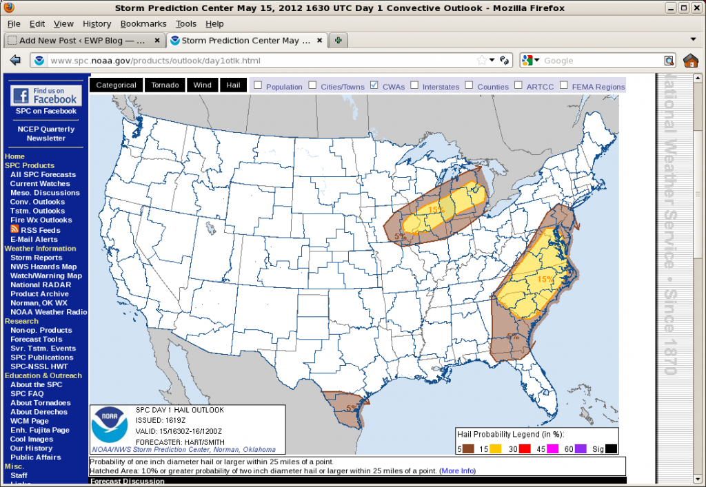
The eastern mid-level trough and near surface cold front moved extremely slowly overnight allowing the east coast another day of good surface-based instability. Morning soundings in DC, Wallops Island and Blacksburg show near saturation over at least 300 mb above the surface and little cap. Surface moisture values are in excess of 12 g/kg. However lapse rates are relatively poor and deep layer shear is only 25 kts. The result is expected to be areas of scattered to numerous small multicells forming relatively early in the day off of high terrain to the west and subtle axis of enhanced moisture extending just east of DC. Steeper lapse rates and similar saturation along coastal North Carolina have allowed the morning sea breeze to more quickly initiate vigorous convection. Any of these areas will be susceptible to moist downbursts and marginally severe hail.
Further west, a northern stream midlevel short-wave trough is dropping into the western Great Lakes. A trailing cold front is expected to initiate convection from southeastern MN eastward to central MI. Here, moisture is sparse with surface values only around 8 g/kg. But we expect this limited moisture will be able to sustain convection owing to very steep lapse rates in the lowest 400 mb of the atmosphere. Shear is also expected to remain weak (<30 kts/6km) and thus small multicells are expected. Due to the limited moisture, we don’t expect any upscale growth here.
The plan is to work the DC LMA area and the Roanoke CWA for the early convection and then shift our focus to WI and MI for the later afternoon.
Jim LaDue, EWP2012 Week#2 Weekly Coordinator

