AzShear shows increasing vorticity along a gust front resulting in a weak, brief tornado

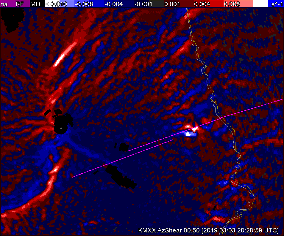
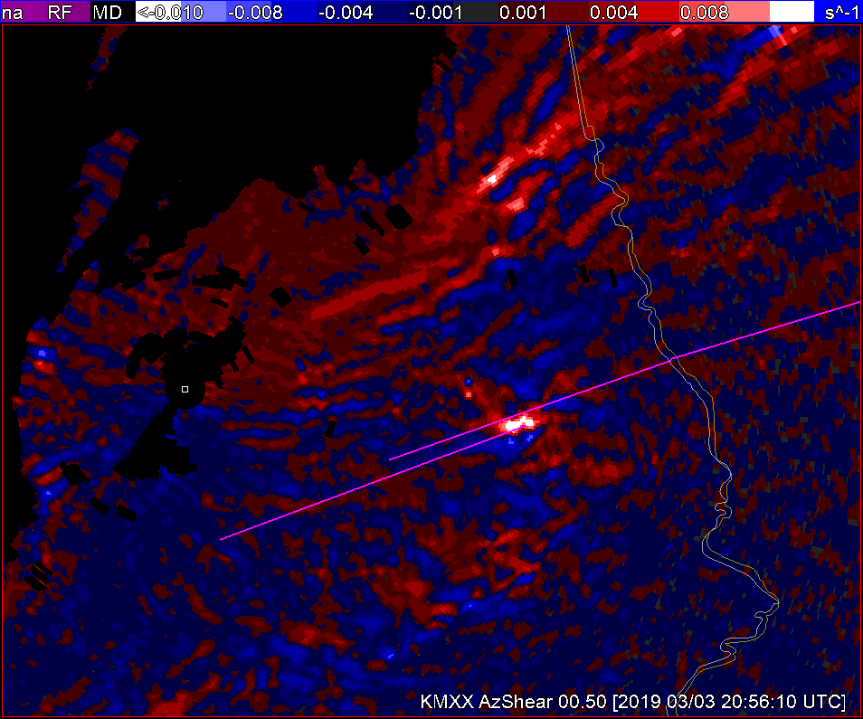
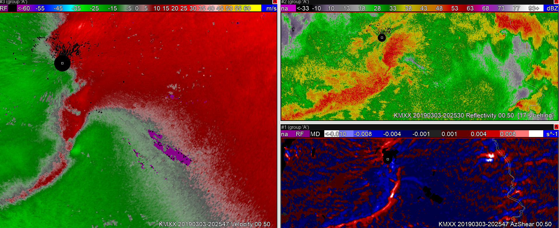
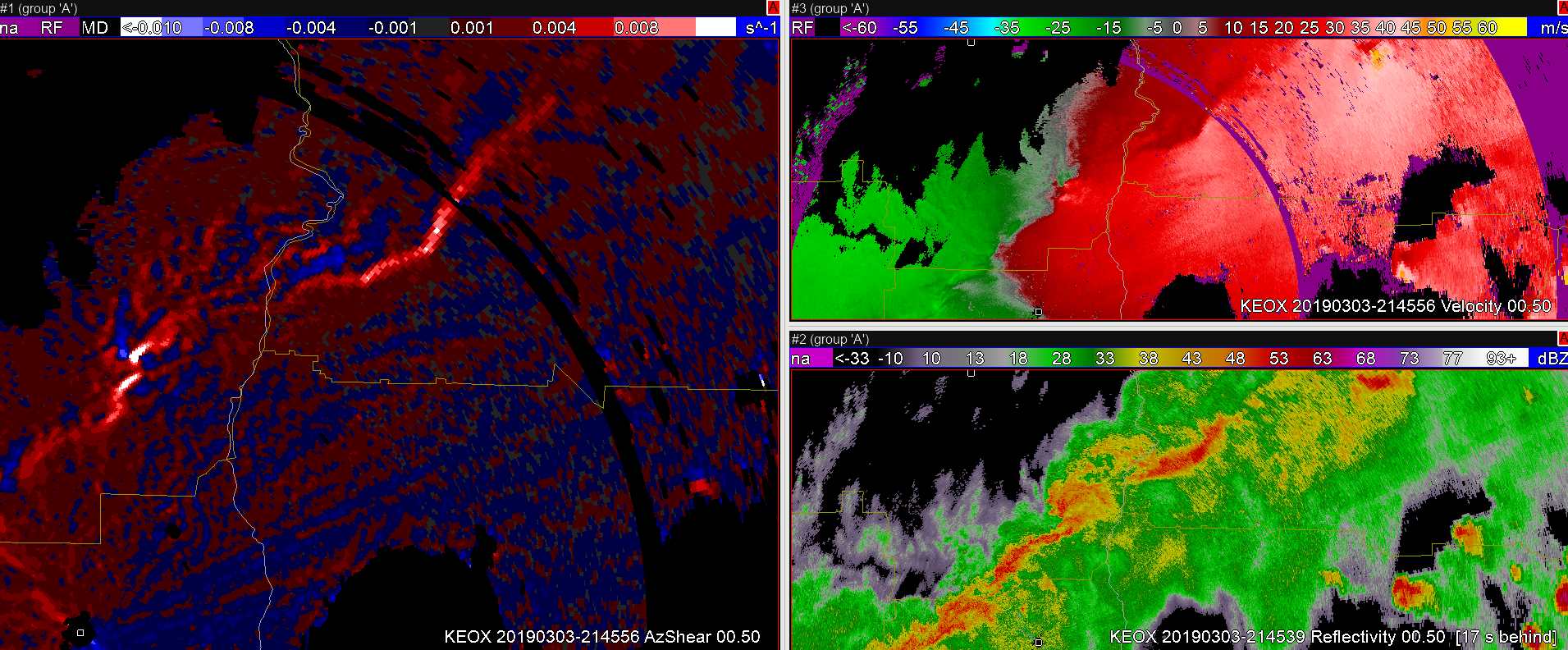
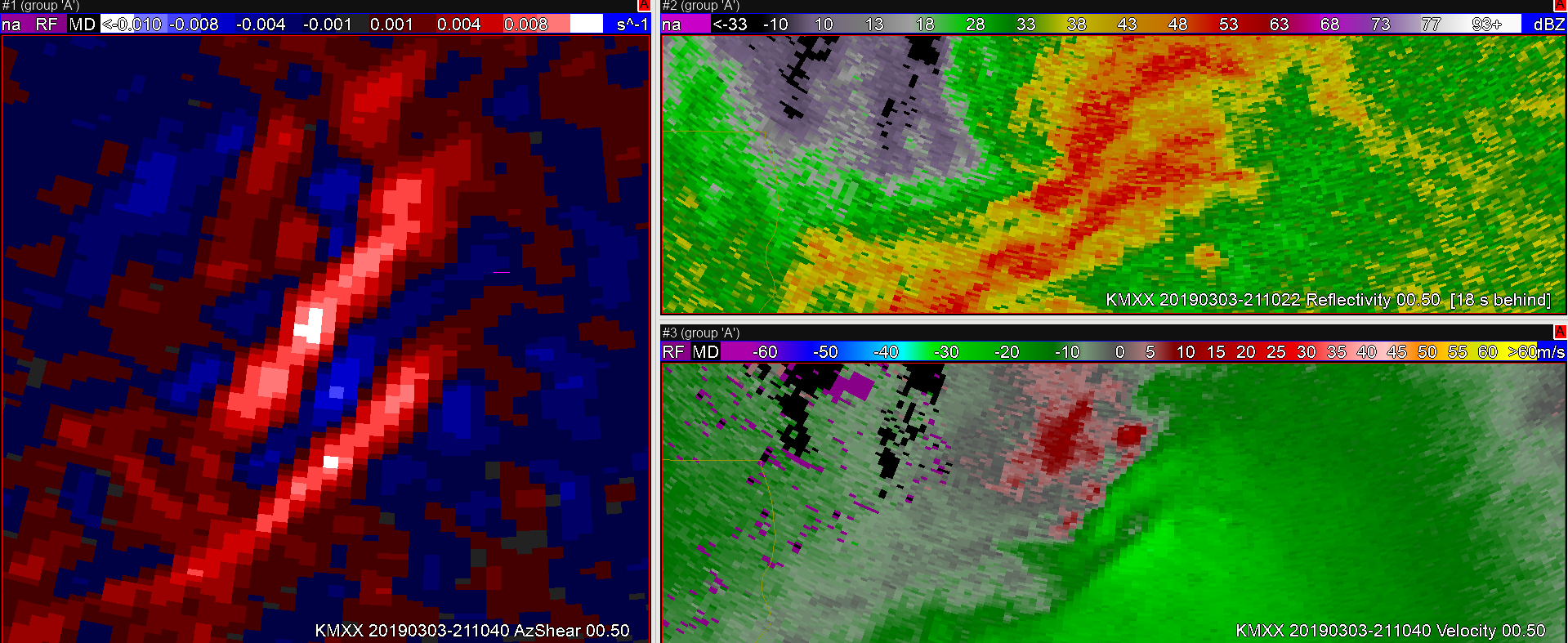
In this case, a weak brief tornado was formed along a QLCS. These are typically the hardest tornadoes to warn upon given their limited impacts, but there are usually storm structures that can be identified within the radial Velocity fields than can give some indication to formation. In this case a convergent vorticity signature can be spotted in the KMXX velocity field, at this time AzShear begins to increase as well.

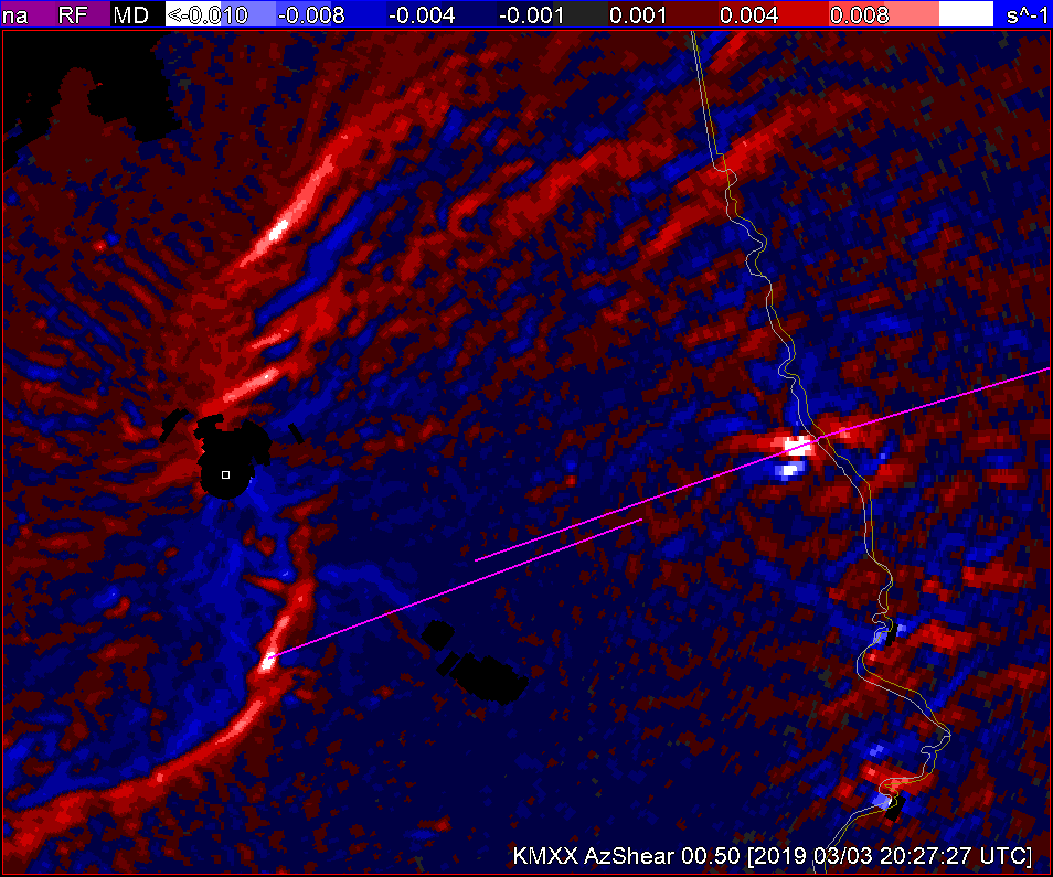
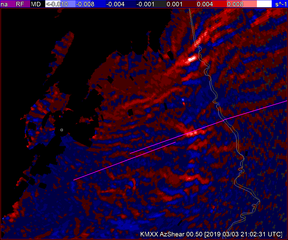
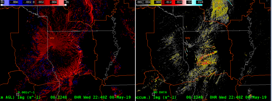
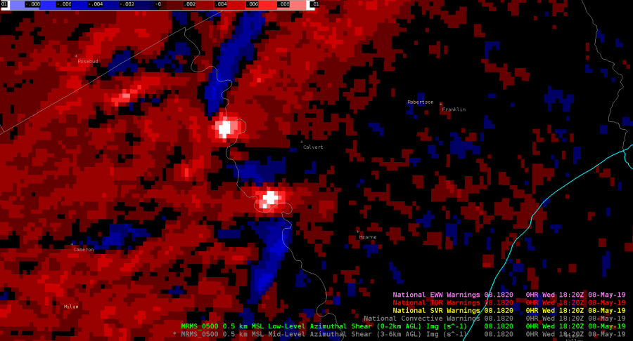
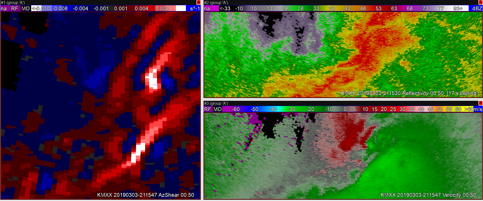
Later AzShear, continues to show a signature of increased vorticity along the gust front.

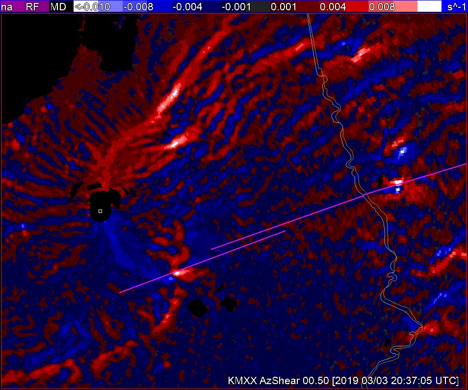
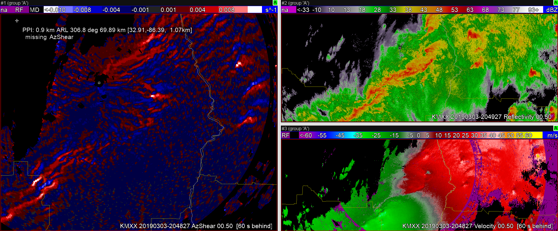
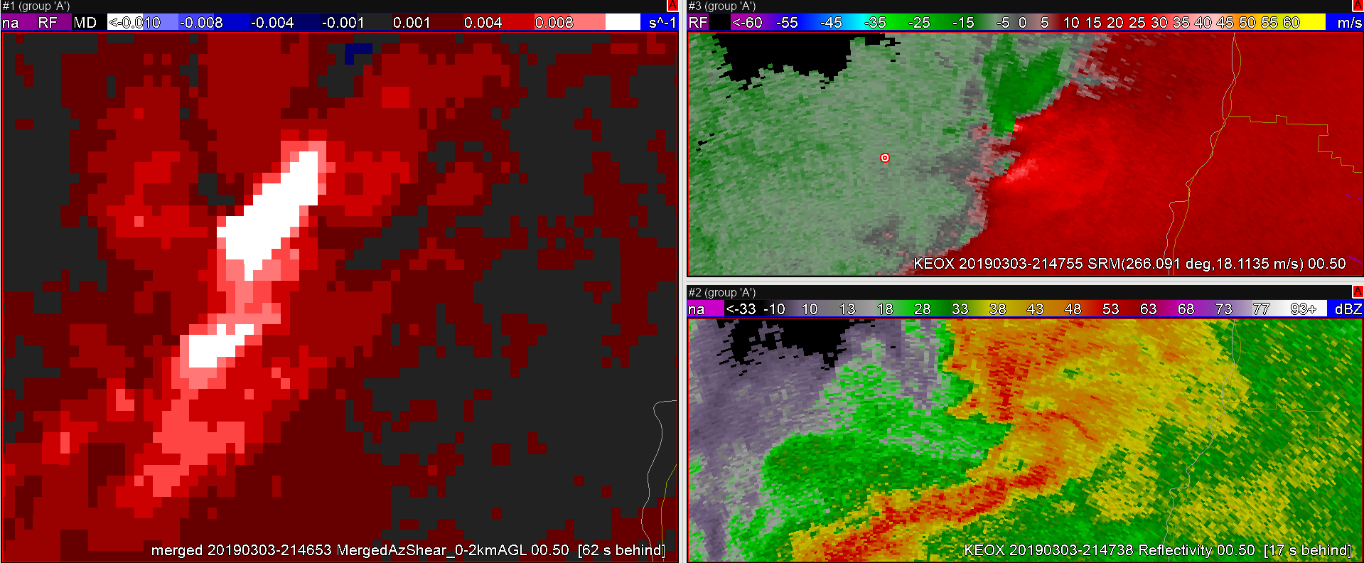
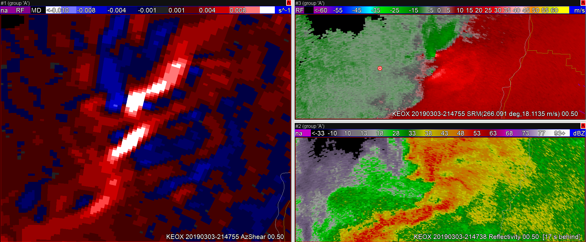
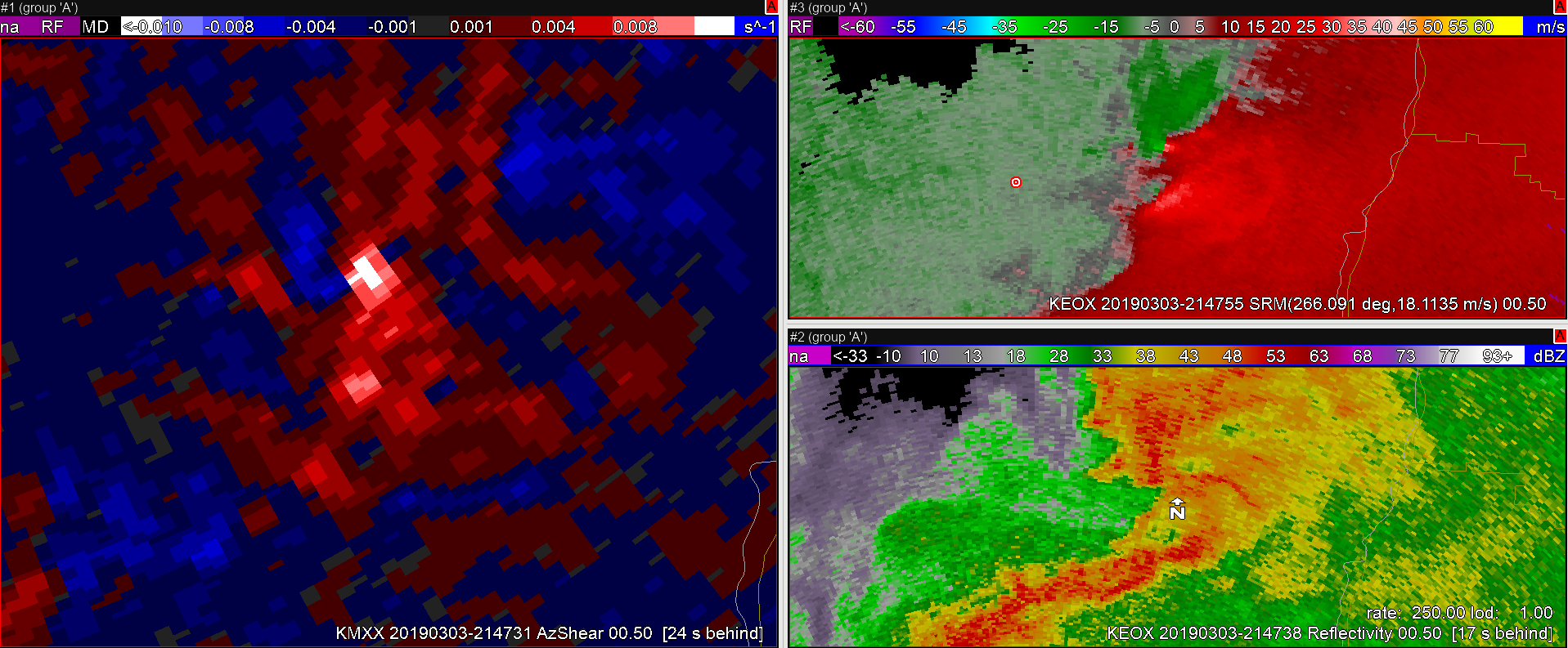
Finally, genesis. TaaDaa!

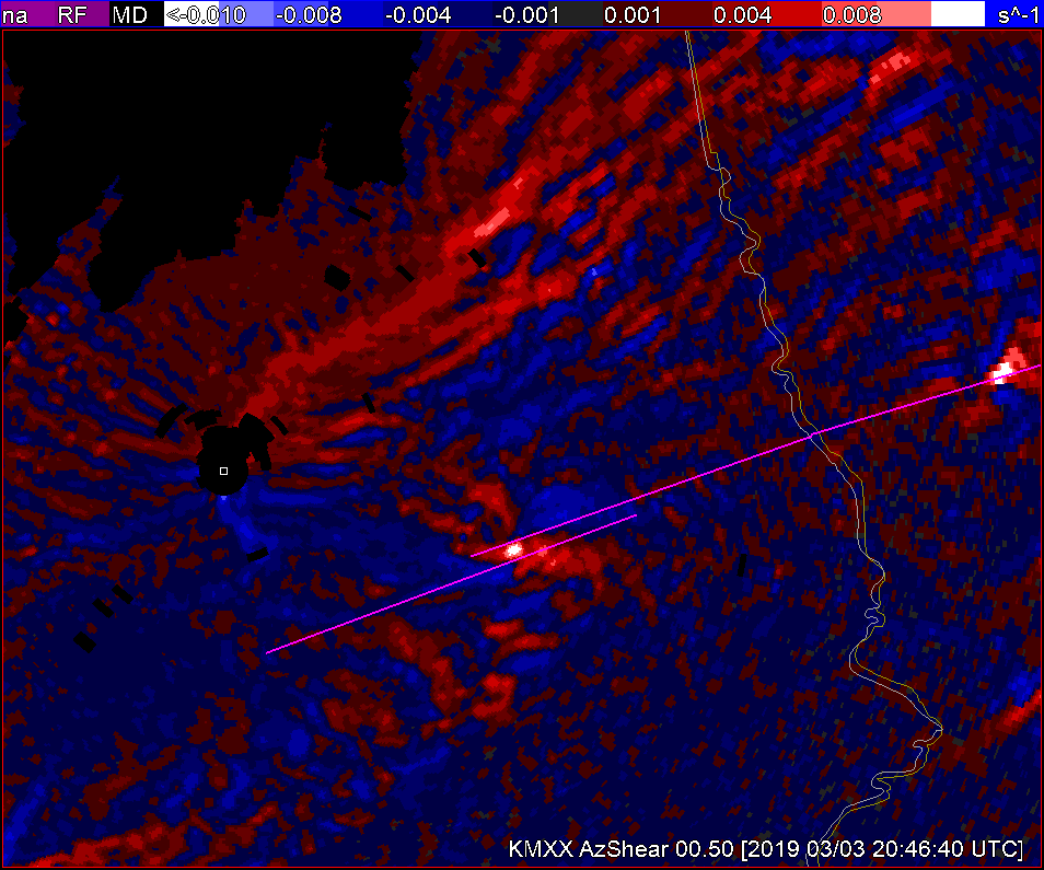
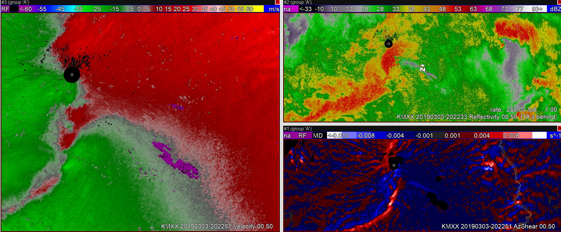
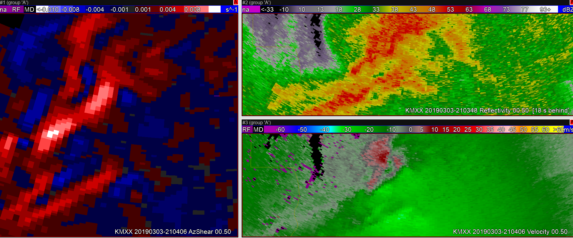
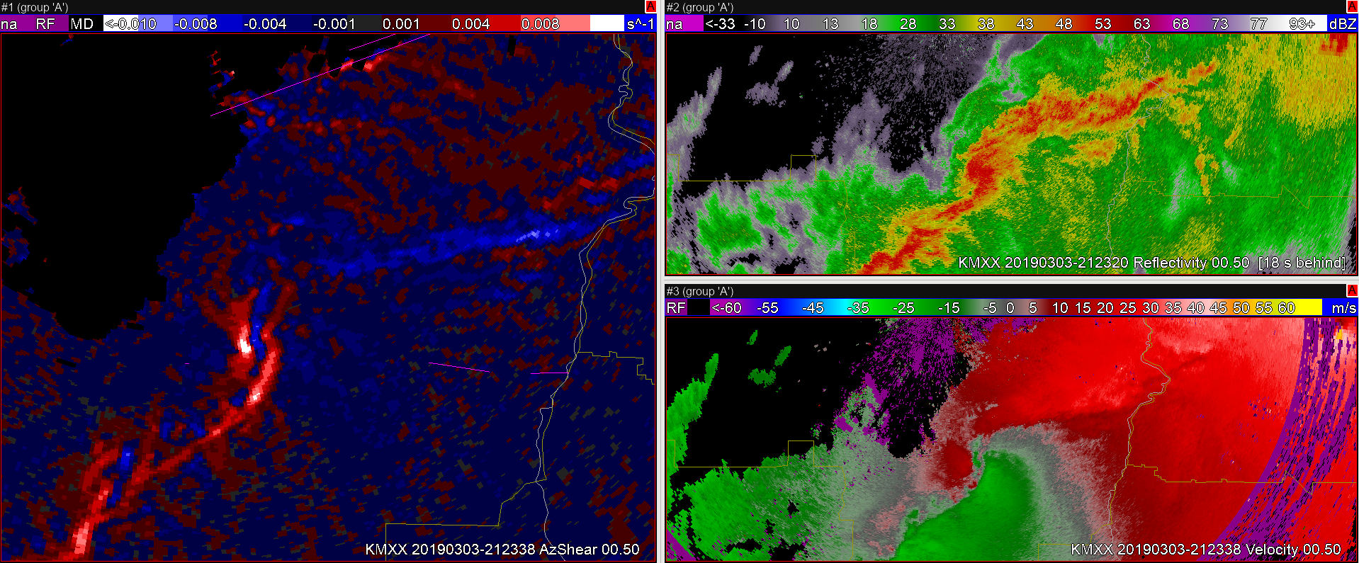
The AzShear threshold, continues to be met well after the tornado dissipates. So it’s not the perfect tornado indicator. However, the velocity field looks as if tornado potential could still be possible, and as a forecaster I would probably hold onto the warning regardless (especially given previous long track tors and guidance).

#ProtectAndDissipate


A Tail of Three AzShear Hot Spots

At 2049Z, AzShear is showing 3 “hot spots”. It still continues to pick out the two tornadoes to the east fairly well, but is also showing an increased signature to the WSW which doesn’t appear to be materializing.

#ProtectAndDissipate

AzShear showing signs of rotation just before TVS appears

No dissipating today! Probably because this case already happened…

Starting out with the AzShear case study, I can already see some of the lead time AzShear can help bring to some of these warnings. On this day, given environmental parameters, it wouldn’t take much to issue a warning with these storms. Even then AzShear help highlight potential areas of rotation where the radar velocity field looked primarily convergent.

2200Z:

2201Z:

2203Z: Now the radar velocity field is showing more signs of a potential TS.

2204Z: Thank goodness for SAILS3! Boom,  AzShear lights up like a Christmas tree with a partial TVS (inbound velocities are a bit wonky)

With the AzShear, lead time may have been increased by about 3-4 minutes if you were waiting for a rotational signature before issuance

#ProtectAndDissipate

Rotation Tracks in a QLCS

In today’s case, MRMS rotation tracks did a better job at showing where the most likely tornadic storms were in a QLCS compared to the 0-2 km merged AzShear, at least over the entire period which makes sense. I would never warn just based on rotation tracks, but I couldn’t find a better SA tool today. It was easy to step back in after working way too long on a previous blog post and get an idea of what happened while I was away. I still feel like the single-radar AzShear would have been extremely useful with today’s QLCS.

Alignment is Everything

Another advantage of single radar AzShear – orientation to the radar.

Here is an ongoing tornado (according to the report shapefile from this event) as seen in the merged 0-2km AzShear product:

Yeah, likely TVS in the velocity data from KEOX (top right pane), Reflectivity is…messy…, and Merged AzShear shows an area of white (when sampled showed 0.023 s-1 values) associated with the TVS.  That is pretty strong!

However, the Merged product loses some key information that could come in handy in figuring out details of the vortex; how is this oriented with respect to the radar?  This is where the single-radar AzShear comes in handy:

Each single-radar (KEOX top image, KMXX bottom image) now shows much better information on how the area of shear is oriented with respect to the radar.  This becomes essential in situations where there are multiple areas of strong AzShear in and around a possible tornado; things like a new circulation in the flanking line that could eventually merge with the original tornado, mesocyclone occlusion with new development, weakening tornado rotating back into the core of the storm, anticyclonic tornado development, and so on.  Many of these features may be lost in the merged products but will stand out to the discerning eye on the single-radar products.  Add in the fact that these update scan-by-scan and during quickly evolving features in critical periods of the life cycle of small-scale vorticies, and single-radar becomes pretty valuable.

Have I mentioned yet that I would like this in my office? Now?  Please…

-Dusty

QLCS spinup detected by low-level AzShear

QLCS situation just outside of the HGX CWA where low-level combined AzShear spotted two areas of increased low-level shear entering Robertson County. The northern circulation eventually led to  downed trees east of Calvert 12 minutes later, and may have been a tornado, according to the LSR. This product would have given me more confidence to at least have a severe thunderstorm warning out, if not a tornado warning, and would most likely have led to a greater amount of lead time than I would have had otherwise.

ZDR_Arcophile

Would YOU issue a convective warning based solely off Single-Radar Az Shear data? 

What if you’re on shift and convection has become more widespread or robust than what was currently forecast? What if that happened during a time where staffing levels at the office were not ideal (for whatever reason)?

-Convection is rapidly developing.
-Minimal people around to sectorize radar/warning operations
– Limited time to interrogate all the storms, especially with a potentially tornadic situation developing.

Taking a look at Single-Radar AzShear, there are very high values near a velocity couplet north of the radar site. This couplet becomes your primary area of concern to where you want to focus most of your attention and analysis. However, there is also some bowing in the reflectivity signature coincident with some bowing/enhancement in the Single-Radar Az Shear output well to the northeast of the radar site. The angle of the radar beam with the bowing storm makes you question the strength of the storm and you realize the velocity values may be too low.

Would you consider issuing a SVR based solely on the enhanced bowing segment of the Single-Radar AzShear data, so that you can focus your attention on the tornadic storm? Something to think about…

Correlation between Single-Radar Az Shear and a TDS?

A tornadic debris signature was noted during this event with a loop (not shown) of low CC values, with depth,  coinciding with a strong velocity couplet and high Single-Radar AzShear values. Is there any correlation to a TDS signature with Single-Radar AzShear values? To be determined…

Place marker denotes the TDS location in this image.