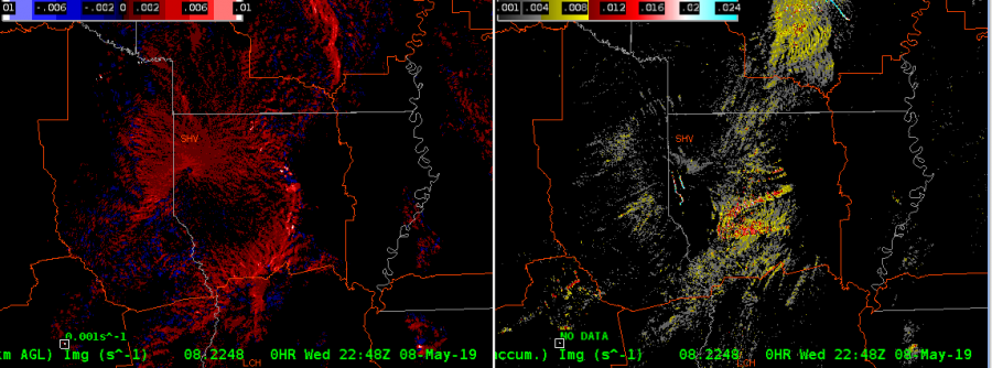
In today’s case, MRMS rotation tracks did a better job at showing where the most likely tornadic storms were in a QLCS compared to the 0-2 km merged AzShear, at least over the entire period which makes sense. I would never warn just based on rotation tracks, but I couldn’t find a better SA tool today. It was easy to step back in after working way too long on a previous blog post and get an idea of what happened while I was away. I still feel like the single-radar AzShear would have been extremely useful with today’s QLCS.