

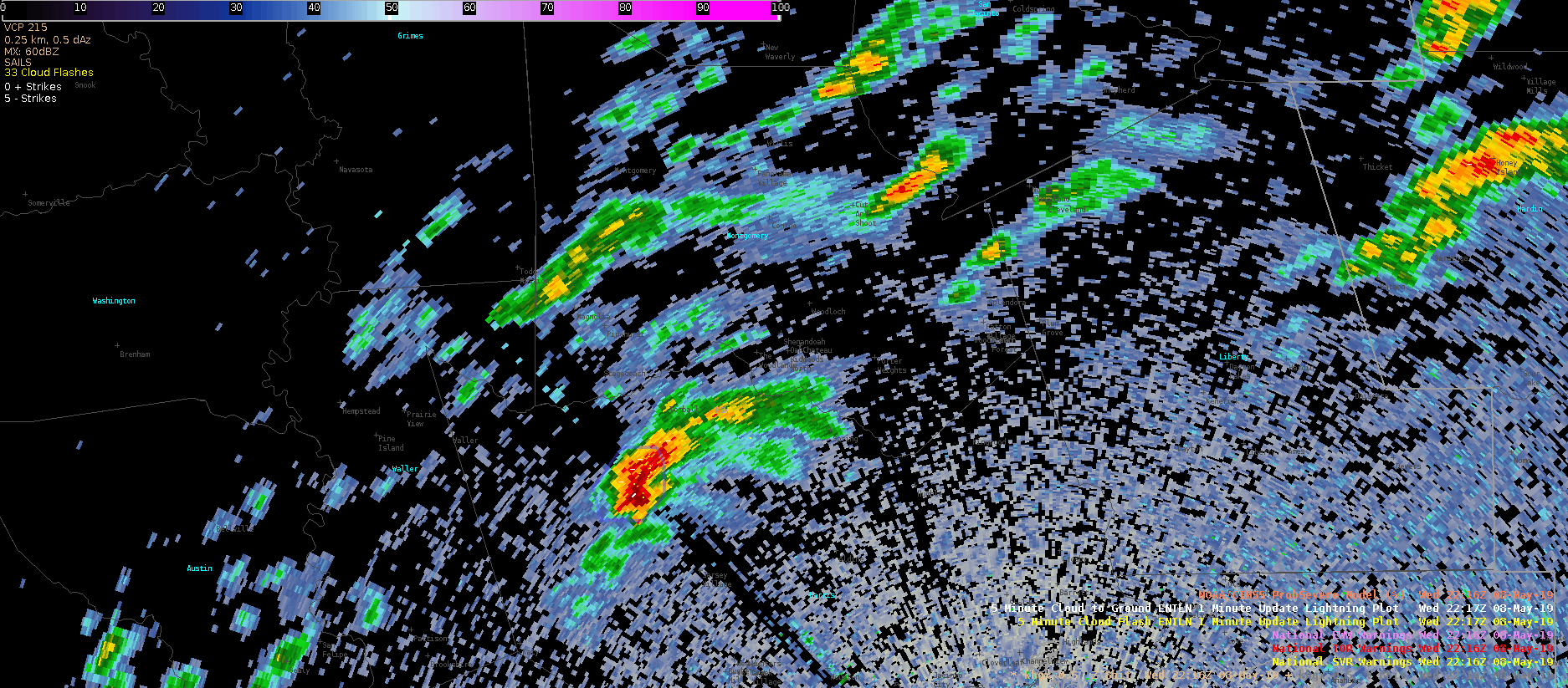
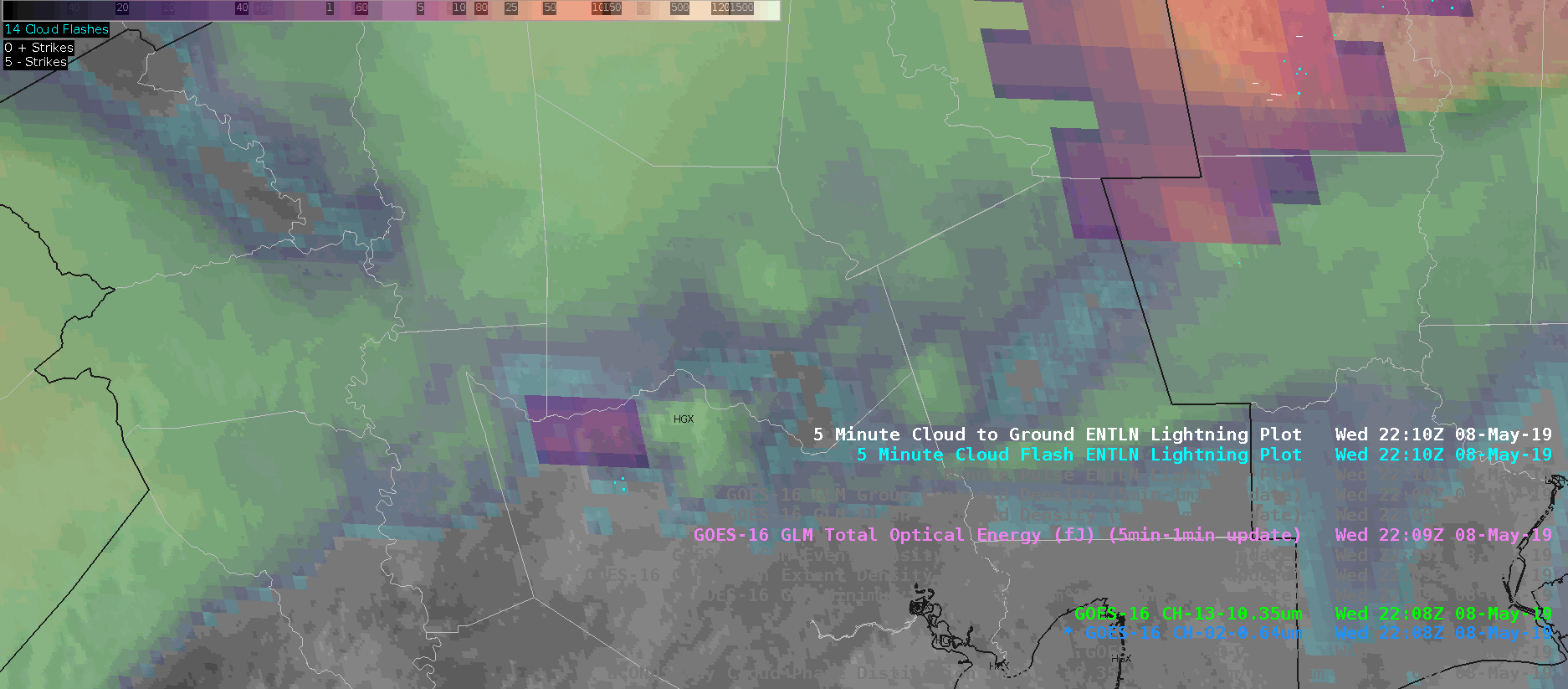
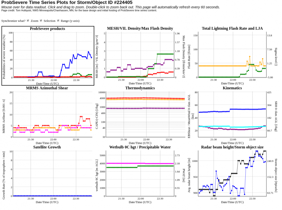
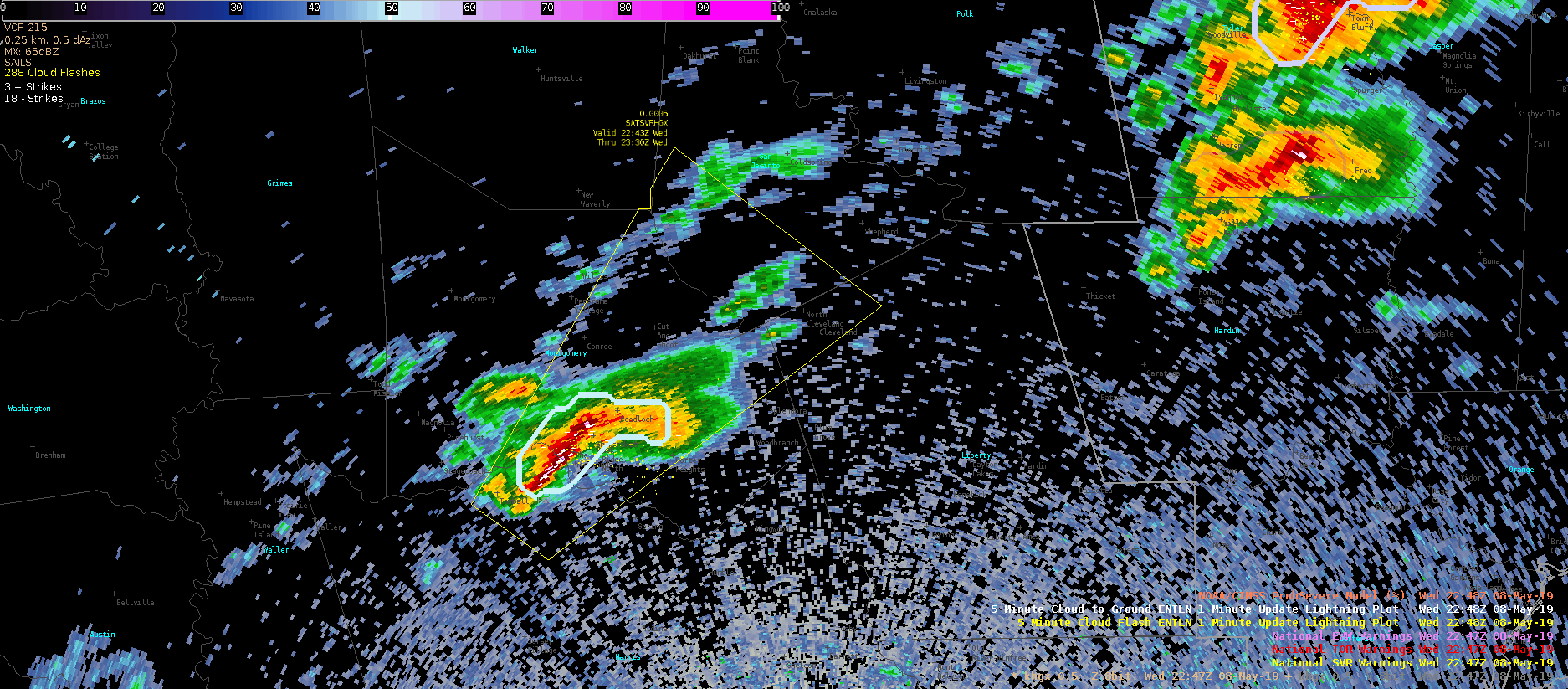
In this case of a rapidly developing storm, GLM data was leaned on to issue a SVR Warning on what otherwise may have been a marginal storm. AllSkyLAP showed the storm was developing in an area of MLCAPE values over 2000 J/kg, and ProbWind model had rapidly increased to ~50%. GOES-16 1-minute imagery showed rapidly cooling cloud tops, with a sharp increase in lightning activity. Given GLM values comparable to other severe storms on the day a SVR warning was placed on the storm. The warning was sent out relatively early to try to capitalize on lead time.
Radar w/ ProbSevere:
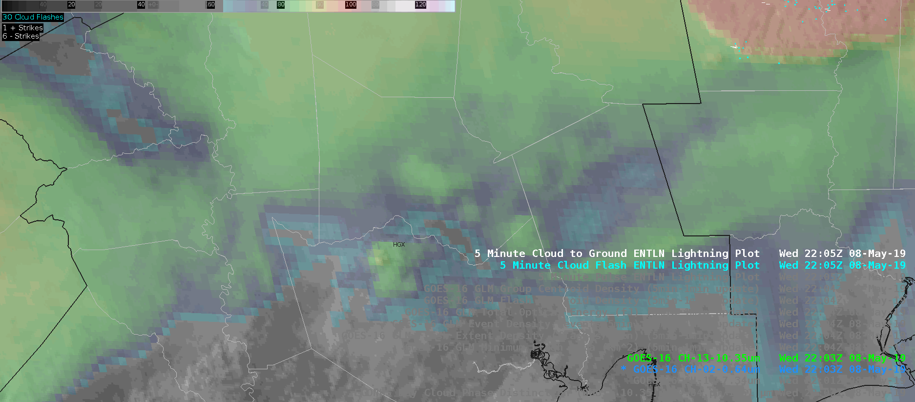
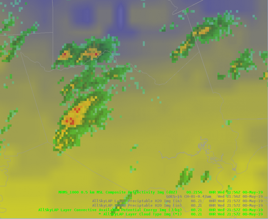
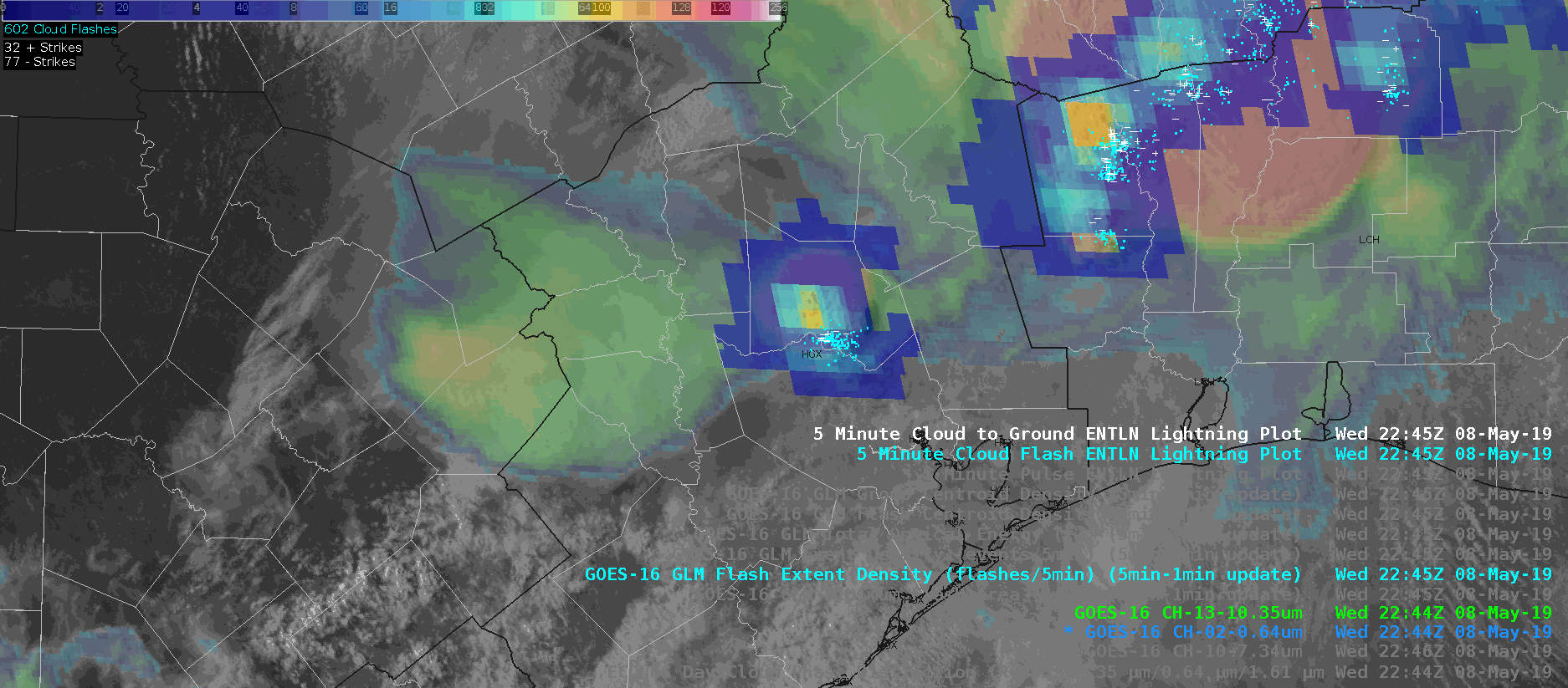
IR-Sandwich:
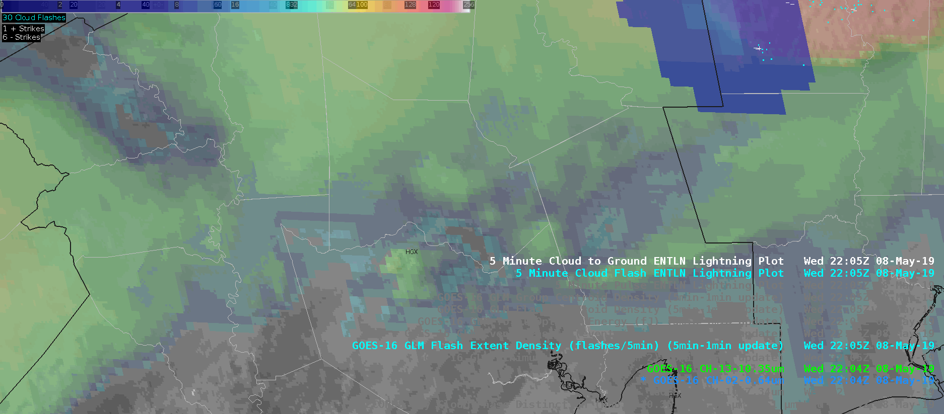
Flash Event Density:
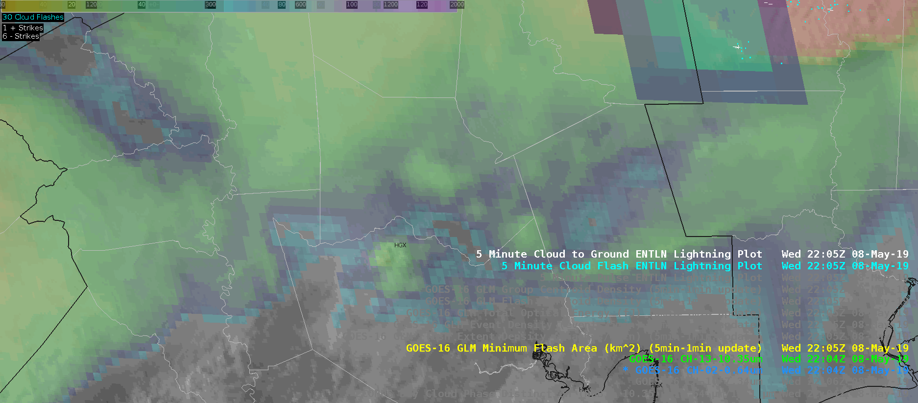
Minimum Flash Area:
Event Density: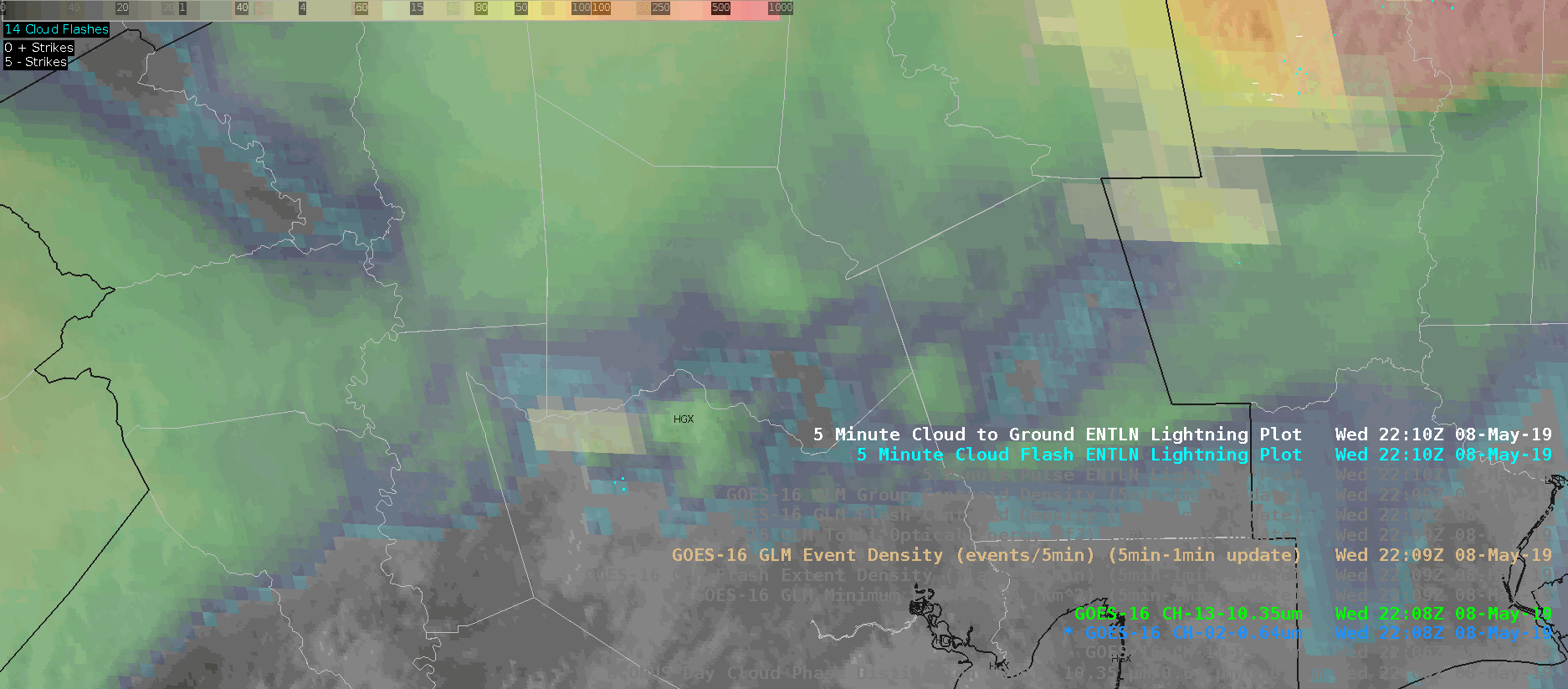
Total Optical Energy (too fast, whoops!):
AllSkyLAP CAPE:
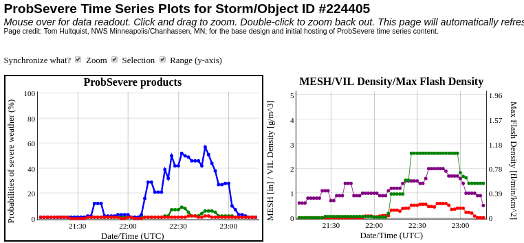
ProbWind Model Increase:
UPDATE: Shortly after warning on the storm, it completely fell apart after failing to become rooted in the boundary layer and all indicators (i.e., ProbSevere, GLM imagry) dropped to null. Initial warning was shamefully cancelled.
Really living up up to my name!
Radar w/ProbSevere:
Flash Event Density:
ProbWind Model Increase:
#ProtectAndDissipate