EWX ProbHail Case

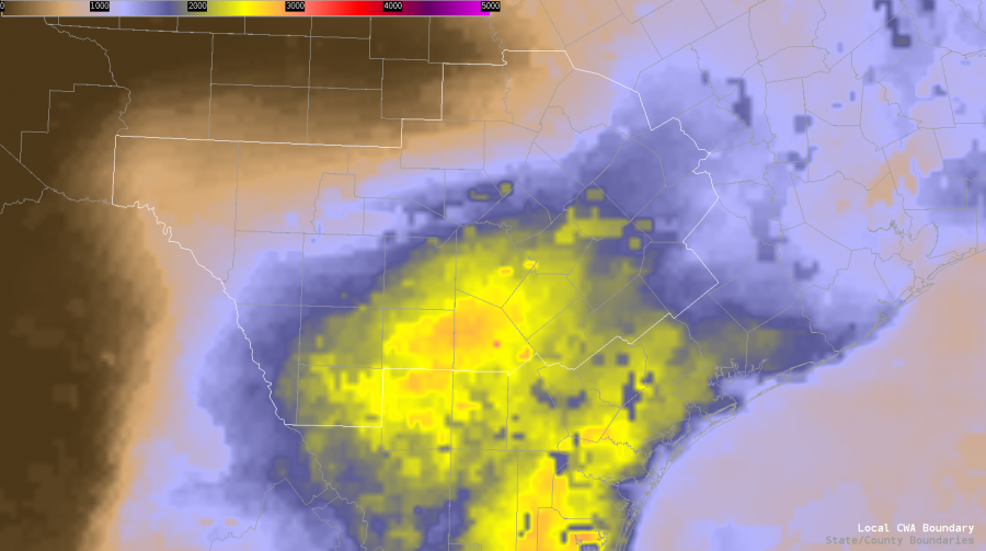
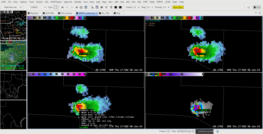
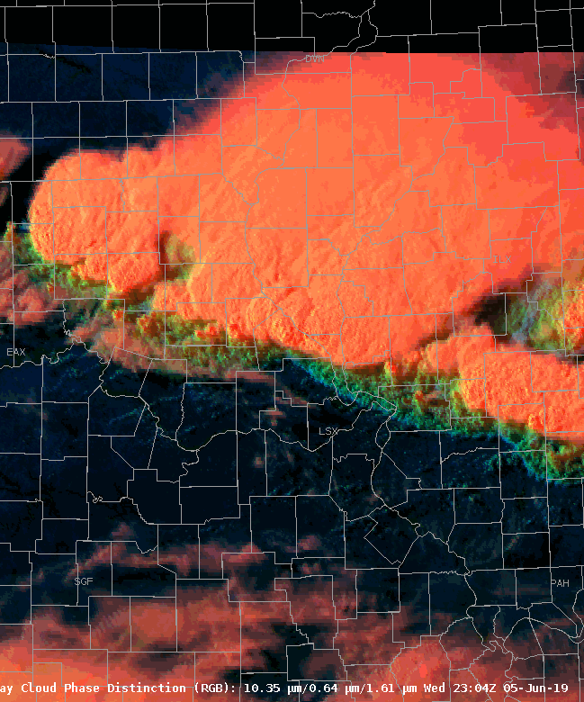
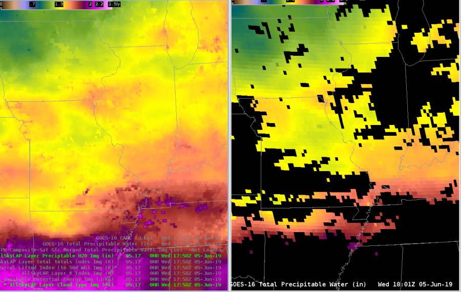
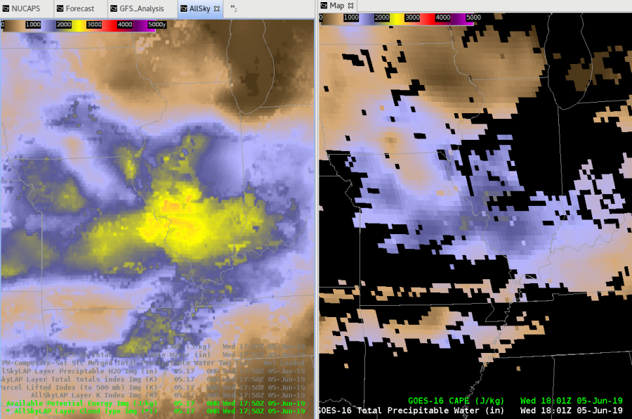
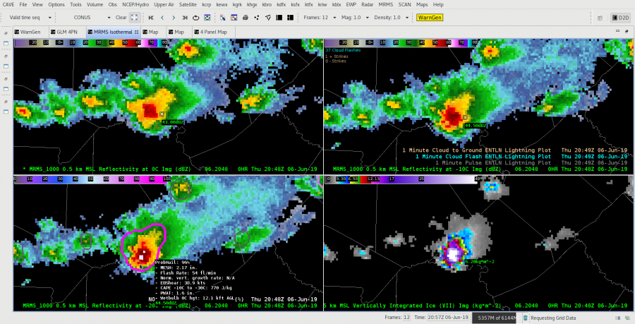
Had an interesting opportunity to watch a quickly intensifying cell relatively close to the radar.  While ProbHail did a decent job monitoring the trend in this cell, its (2 to 4 minute) latency in an environment conducive of rapidly intensifying cell could possibly lead to a reduction in Lead Time. By monitoring the cell via All-Tilts BR/BV/CC/ZDR and GOES-East Satellite Imagery via Mesosector, I was able to get roughly 5 additional minutes of lead time on my warning (ProbHail was less than 45% by warning issuance). A good reminder as to how the ProbSevere suite is best utilized as an additional tool, and not necessarily the deciding factor in warning ops, especially in freshly forming cells.

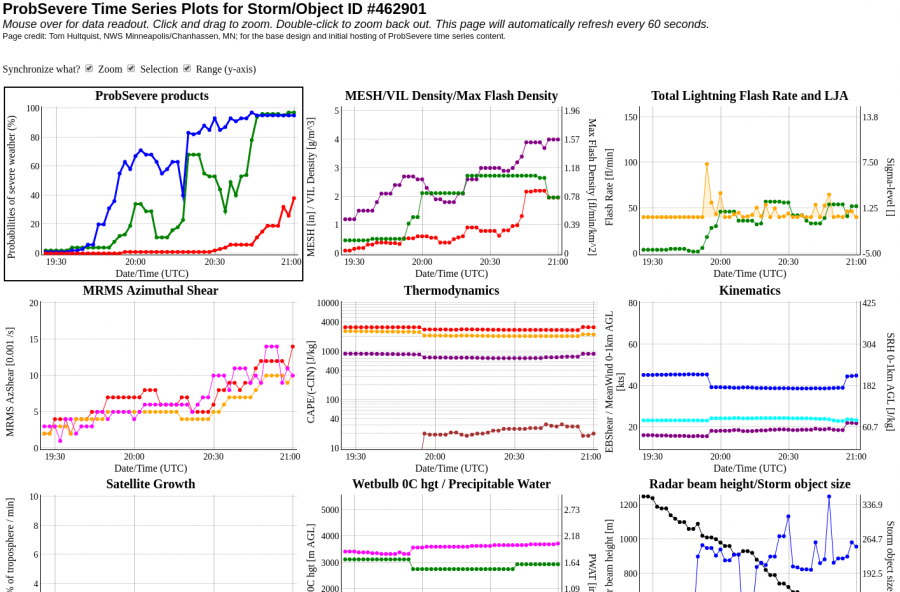
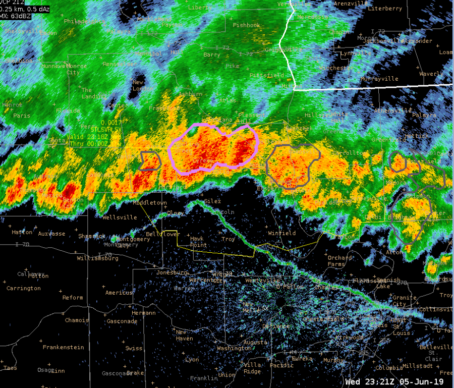
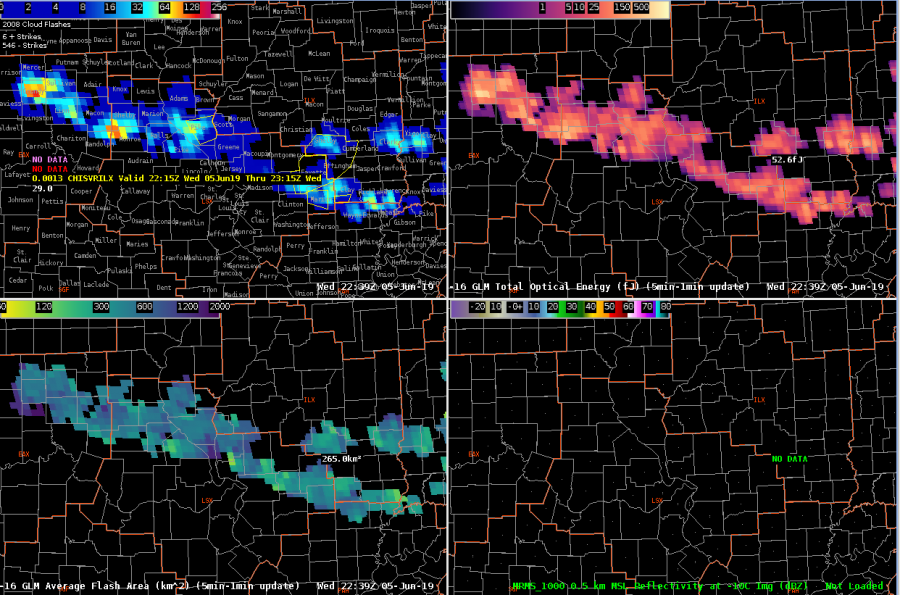
Quick update: The earlier warning did verify with quarter-sized hail. I did find some utility with the ProbHail when it came to making the decision to re-issue the warning or not, especially as the storm began to near the “cone of silence.” Accessing the time series  which continued to show >95% ProbHail and a quick glance at a neighboring radar, I had enough forecasting confidence to continue the warning downstream.

—————————————————————————————————- Mountain Bone

EWX Mesoscale Discussion

AllSky_LAP ML CAPE Forecast as of 1930z

19z Surface analysis shows the nearly stationary effective dryline boundary draped SW to NE across the CWA from roughly Del Rio through Briggs, TX. This boundary continues to play epicenter for semi-discrete super-cellular development this afternoon, with additional cold pool driven activity likely to form over the next few hours, especially as a back door cold front begins to slide southward through south-central TX. Latest AllSkyLAP CAPE analysis shows destabilization continues southeast of the dryline, with ML CAPE values nearing 3000 J/KG in and around San Antonio as of 19z. TPW values also remain relatively high southeast of the boundary, with 1.5 to 1.75 inch readings common place. Mid to upper-level kinematics remain favorable for some supercellular structures, so we’ll continue to  keep large hail, damaging winds, and an isolated tornado threat in the forecast. Best chance for seeing a tornado (even with relatively week 0-1km shear values) will likely be through 7pm tonight in a cells that can remain discrete for awhile. Flash flooding concerns will continue thanks to the abnormally high PWAT values, especially in areas that see several rounds of convection this afternoon and evening.

—————————————————————————————————-Mountain Bone

Tags: None

Suggested Hail 4-Panel Procedure

This is a 4-panel display that I find very useful with respect to hail potential monitoring in a convective environment. By incorporating Prob-Hail and/or GLM, along with MRMS Isothermal reflectivity, a forecaster can really get a good feel for hail potential within cells. Due to up to 2 minute latency within MRMS products, would not recommend as a substitute for All-Tilts methodology, but certainly could be used for situational awareness.

Top Left: MRMS_1000 0.5 km MSL Isotherm Reflectivity at 0*C

Top Right: MRMS_1000 0.5 km MSL Isotherm Reflectivity at -10*C with blinking ENTLN C-G and C-C Flashes (Could substitute GLM data here also).

Bottom Left: MRMS_1000 0.5 km MSL Isotherm Reflectivity at -10*C with ProbHail Model output

Bottom Right: MRMS VII or legacy VIL.

————————————————————————————————— Mountain Bone

Tags: None

Storms tracking toward St. Louis

A line of storms is north of St. Louis as of 630 pm CDT and is tracking southward toward an area of increased CAPE per All Sky LAP product.  This convection continues to trigger along the leading outflow.  The overall environment has limited shear so it is primarily cold pool driven.  ProbWind has consistently displayed around 65-78% since around 600 pm CDT.

Tags: None

Merger of storms

SPC issued a meso discussion talking about the threat for severe wind gusts on cells bowing out towards St. Louis.  The cell in Pike county on the look above has the outflow boundary tied into it on this RGB (in blue) and the updraft still is stronger with waves radiating out from the overshooting top.  We decided to issue a large SVR for winds traveling southeast out of this storm.

Tags: None

Line Running Into Drier Air?

IR and RGB imagery showing outflow coming out of the storms in the eastern LSX area not firing up additional storms.  NUCAPS 400-200 mb RH product shows quite a bit of drier air that the line is pushing into.  More moisture is west of the MO/IL line, so that part of the line may have a better chance to maintain themselves/develop new cores ahead of the line along that outflow.

Charley

Tags: None

Mesoscale Update

Band of storms dropping in from the north is moving into an environment favorable to at least maintain severe wind gusts as well as some hail potential.  AllSky CAPE parameter shows the line moving into airmass with 2500 J/kg, similar to values given by earlier ILX special sounding and recent modified NUCAPS sounding.  Latest RAP shows DCAPEs up to 1400 J/kg, indicating good potential for severe wind gusts. Had a couple of reports of blackout conditions from blowing field dirt along I-55 near Litchfield.


Charley

Tags: None

Comparing Operational Derived Products

Total PW looks good from the operational version (minus the blacked out data, of course).  It is a little blotchy on the merged TPW (left).  A similar comparison below of the AllSky TPW and Operational product.

CAPE is a different story.

AllSky calculations are mostly in a clear airmass, as you can tell by the operational product not being blacked out.  Peak values on the right are in the 1700-1800 J/kg range, whereas points on the left peak at 2600-2800.

Charley

Tags: None