What if you’re on shift and convection has become more widespread or robust than what was currently forecast? What if that happened during a time where staffing levels at the office were not ideal (for whatever reason)?
-Convection is rapidly developing.
-Minimal people around to sectorize radar/warning operations
– Limited time to interrogate all the storms, especially with a potentially tornadic situation developing.
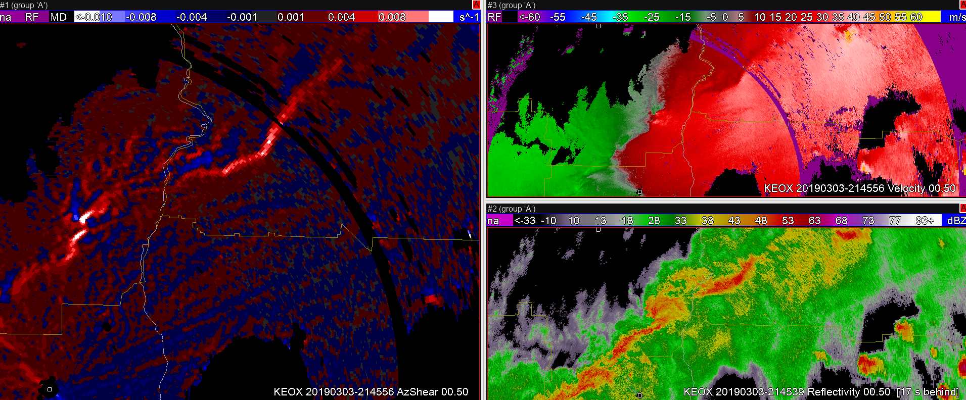
Taking a look at Single-Radar AzShear, there are very high values near a velocity couplet north of the radar site. This couplet becomes your primary area of concern to where you want to focus most of your attention and analysis. However, there is also some bowing in the reflectivity signature coincident with some bowing/enhancement in the Single-Radar Az Shear output well to the northeast of the radar site. The angle of the radar beam with the bowing storm makes you question the strength of the storm and you realize the velocity values may be too low.
Would you consider issuing a SVR based solely on the enhanced bowing segment of the Single-Radar AzShear data, so that you can focus your attention on the tornadic storm? Something to think about…