Miscellaneous musings from ALY

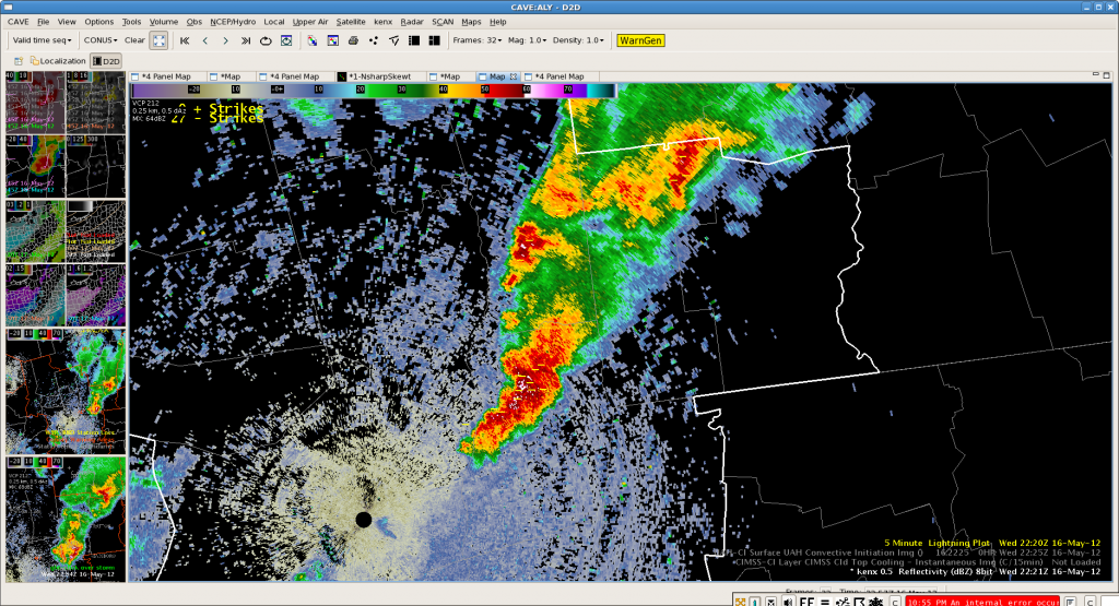
Had an interesting day working with convection in Albany’s CWA today.  Several storms grew big enough to make severe hail, strong winds and show nice organized rotation..also a bow echo looking storm.  In general the 3D Var and MRMS products proved useful for detecting hail concerns and also evaluating whether or not updrafts were strengthening or weakening…how high they were and whether or not there was good updraft helicity/vorticity.  Also the azimuthal shear product from MRMS was useful/interesting.  The nearcast thetha e product had its scale and units reversed since yesterday which caused some initial confusion but did seem to depict the more unstable regions well…though instability was fairly marginal.

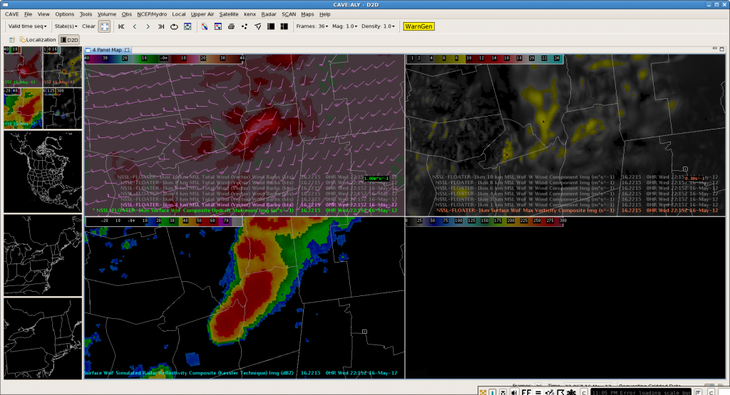
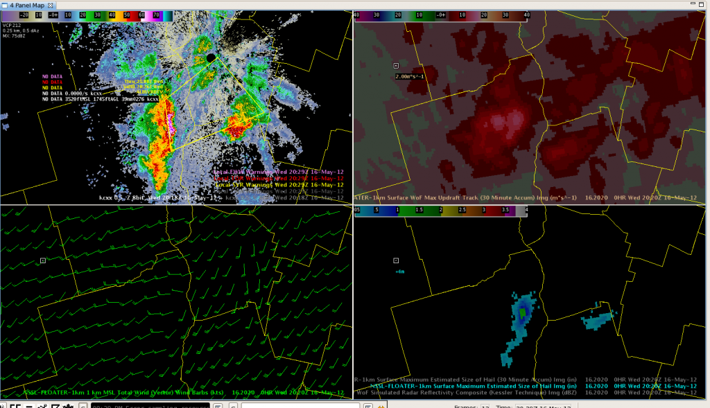
Some product limitations we ran into:  With all the new fancy products we had, there really wasn’t anything to aid with max wind gusts.  With the bow echo storm the 3d var fields were barely perturbed and did not at all seem representative of the probable wind speeds (images below show reflectivity and 3d var quad at same time with 1km (lowest available) winds…higher levels didn’t show much either)…old school use of radar velocities worked much better.

Some other products that would really be nice to have would be a 3-d or cross section way to look at updraft and downdraft strength, the horizontal plots of this could be overlayed at 1 km spacing in 3 d-var and was useful to watch through the life cycle of the storms but was very clunky to step through and hard to mentally visualize. In a 3d view this could be a very powerful way for forecasters to monitor and diagnose storm structure.  Another thing we ran into today were training storms and flash flood concerns…dual pol was handy for this among other things but wonder about what applications of the fancy new products there might be to hydro concerns.

AWIPS 2/Warngen/CAVE issues continued again today with warnings that wouldn’t go out, multiple Cave crashes, lots of random error messages and slow downs.  This system is not at all ready for operational use as they slowed/prevented warning issuances and having Cave crash mid warning ops when all the work station is running are 2 Caves not at all confidence inspiring when you think about everything else AWIPS in WFOs runs and does in addition.  Also found an interesting bug with the map background in the quad panels where they don’t always stay linked and you can unpredictably end up with map scales and alignments in different sections of the quads.

Quick Glance at SimuSat for Today’s Convection

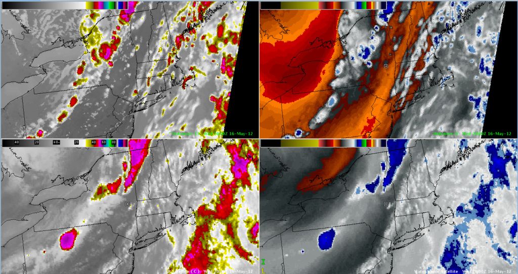
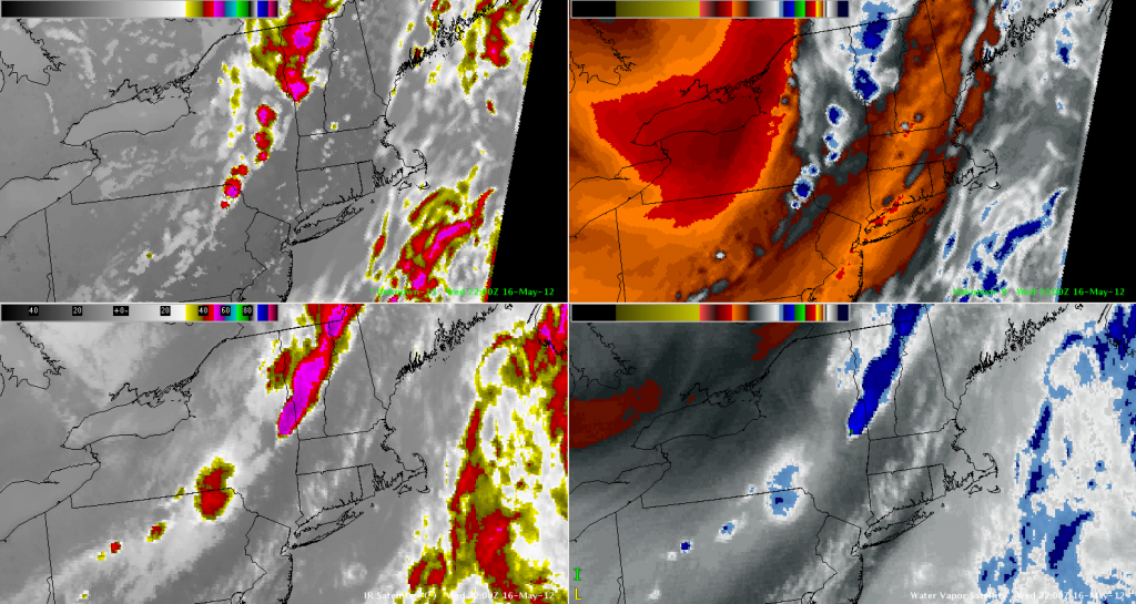
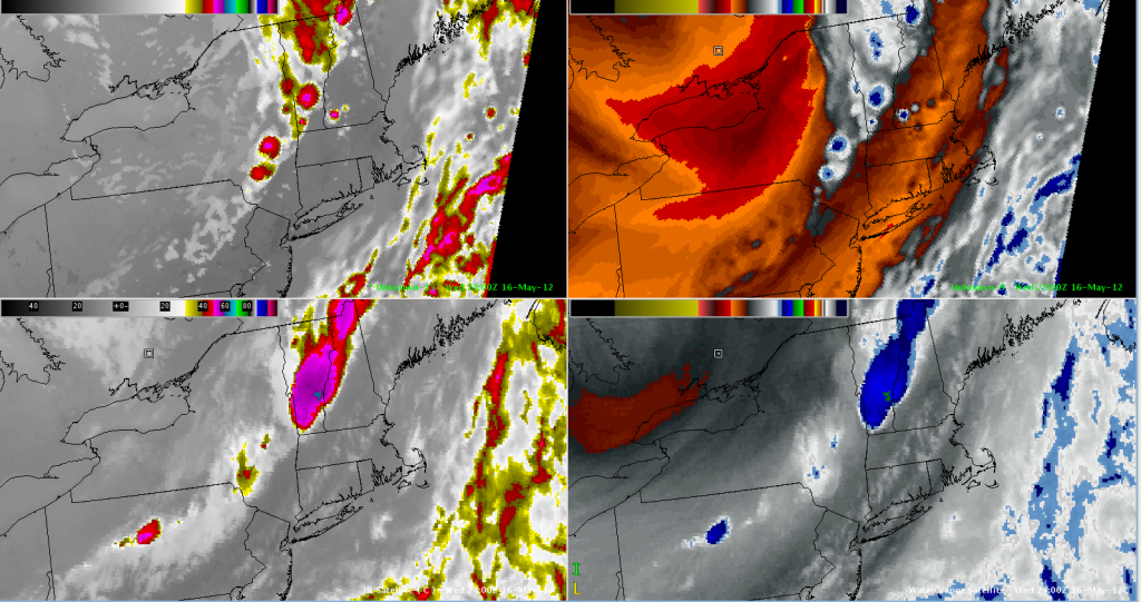
Severe thunderstorms kept the WFO ALY team busy today!  With storms in our area diminishing (and moving out), I wanted to check out the CIRA/CIMSS Simulated Satellite Imagery from the NSSL-WRF to see how it compared to the last few hours.  Overall, I’d say quite well, aside from some placement issues, and the extent of the coldest cloud tops (which was to be anticipated).

CIRA/CIMSS Simulated WRF Satellite Imagery (IR Left/WV Right) - Valid 2012-05-16 2000 UTC
CIRA/CIMSS Simulated WRF Satellite Imagery (IR Left/WV Right) - Valid 2012-05-16 2200 UTC
CIRA/CIMSS Simulated WRF Satellite Imagery (IR Left/WV Right) - Valid 2012-05-16 2300 UTC

Convective Initiation – Verified!

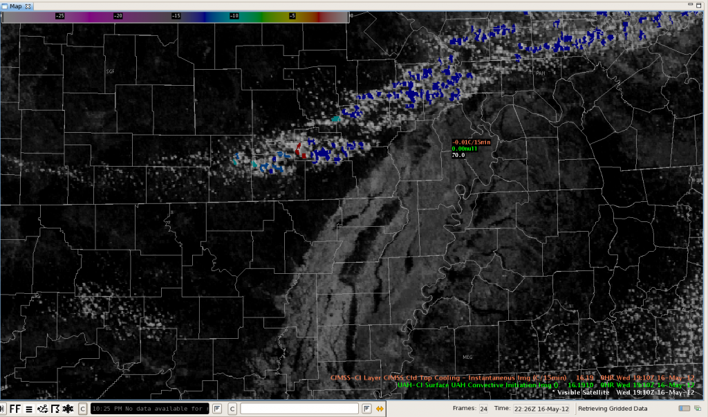
This series of images shows an ideal case of the CI product detecting a rapid development of storms along a cold front in northeast Arkansas.  The first image shows a strong CI signal (red) at 19:10.

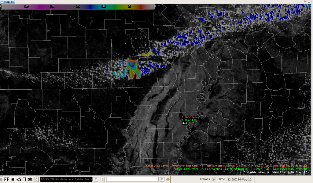
The second image shows the same area about 10 minutes later at 19:25.  The weird tooth-shaped object is the Cloud Top Cooling rate and this indicated -16 deg/15 min.

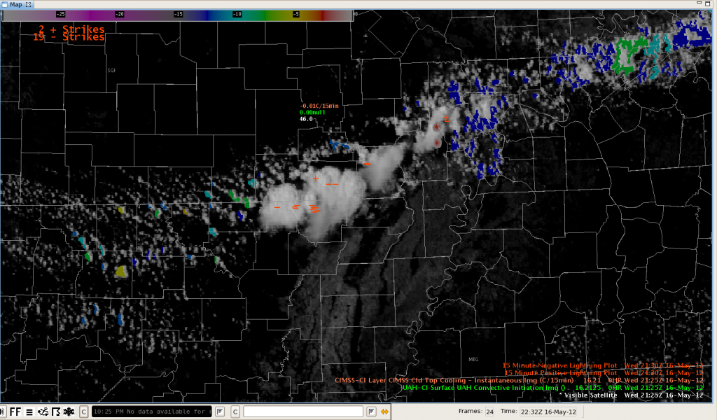
Finally, at 21:25, about two hours later, the visible imagery showed a developing storm with an overshooting top.

Update: 2012 May 16 22z

Convection continues to be active in the Albany CWA keeping Brian and Julia active.  It appears that the moisture axis in the Hudson valley is contributing to storm intensification.  Things have quieted down substantially in Burlington’s CWA and no warnings have been issued by Todd and Stephen for over an hour.  They could move east to Gray Maine’s CWA, however there is no indication that storms will reintensify upon crossing CWA boundaries.  Or perhaps they could move to Taunton, MA’s CWA but storms are unlikely to reach there for another two hours.  Thus Stephen and Todd will continue their focus to looking at CI and Nearcast products on CONUS scale as they have done for the past hour.

Jim LaDue:  EWP week 2 coordinator

Tags: None

Photos from the Testbed

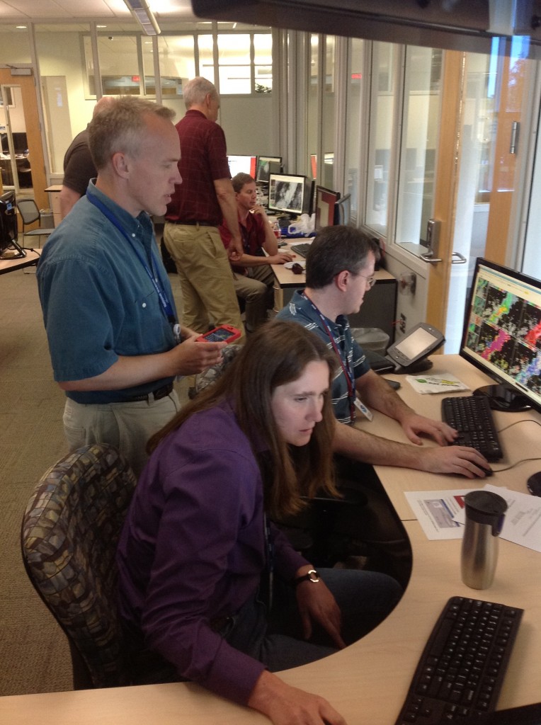
Photo 1:  Our Albany, NY, WFO team.  Julia Ruthford and Brian Carcione.  Jim LaDue observes.


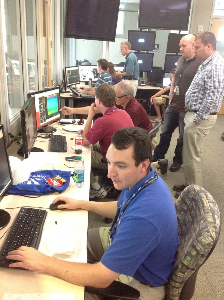
Photo 2:  Our Burlington, VT, WFO team.  Stephen Kearney and Todd Dankers.  Chris Siewert, Bob Aune, and Chad Gravelle observe.

Greg Stumpf, EWP2012 Operations Coordinator

Tags: None

Another SVR in eastern NY

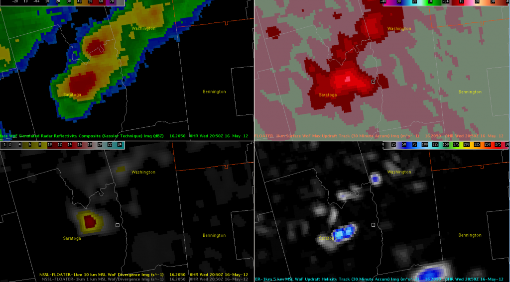
Another storm is affecting eastern Saratoga County and southern Washington County, NY (prompting a severe thunderstorm warning).  3DVAR storm-top divergence has been a pretty solid predictor with other storms in the region today, and this storm was no exception.  However, this was the first storm to show more than marginal updraft helicity, maxing out at 117 m/s^2 at 2045 UTC.

3DVAR Reflectivity, Updraft Composite, Updraft Helicity, and 10km Divergence valid 2012-05-16 2050 UTC

About 15 minutes later, MRMS MESH reached 1.25″ with a 62% POSH; that has since increased to 72% POSH and 1.5″ MESH.

BTV: 3DVAR/MRMS usefulness

A short line of storms developed rapidly over Essex County.  The MRMS data (lower right pane) indicated a MESH of nearly 2 inches!  At the same time, the 3DVAR vertical velocity data (upper right pane) was 14 m/s for the same cell.  Using this data against already high reflectivity (upper left) increased confidence for a warning, especially given the environment.  Unfortunately, the 1KM wind field (lower left) gave a mixed signal at the same time frame, which was possibly an effect of the terrain.

BTV: CI products still useful

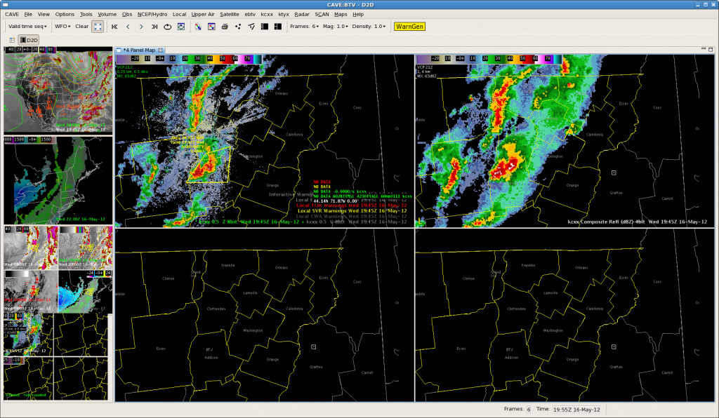
After the convection developed rapidly, the CI and CTC products became masked due to the TS plumes.  However, the convection at the north end of the CWA may have kicked out an outflow bndry to cause more development in clear air.  This was picked up by the CI product with an increasing signal in subsequent frames.

A stronger (yellow) signal was evident on the next frame.

The resulting composite reflectivity (upper right image), showing development to 45dbz 15 minutes later.  Comp reflectivity was used here due to beam blockage at 0.5 degrees.

Monitoring More ALY-area Storms

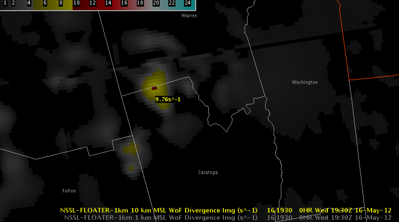
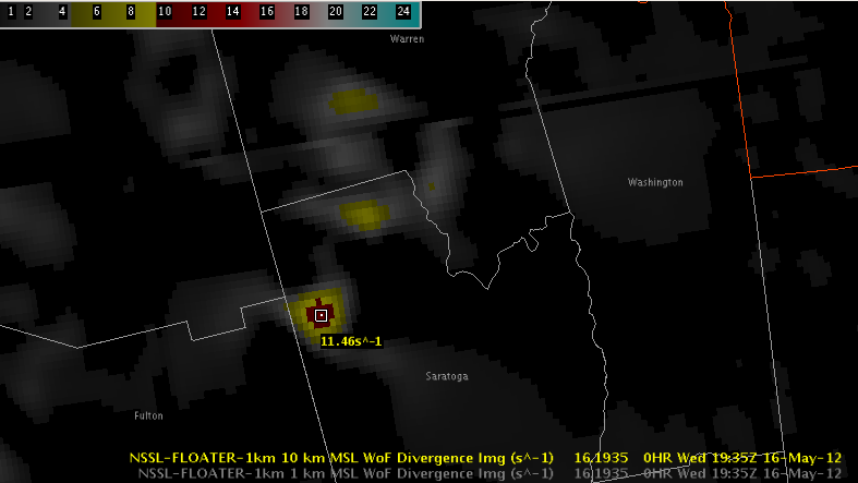
Two more storms in extreme northern Saratoga County, NY are being monitored for warnings (update: an SVR was just issued for the northern storm).  3DVAR has shown the same signals as the Herkimer County storm with strong storm-top divergence:

3DVAR 10km Divergence valid 2012-05-16 1930 UTC
3DVAR 10km Divergence valid 2012-05-16 1935 UTC

MESH was peaking just under 1″ with near-50% POSH.  (Update: it has increased above 1″ and POSH is above 50% now, prompting the warning.)

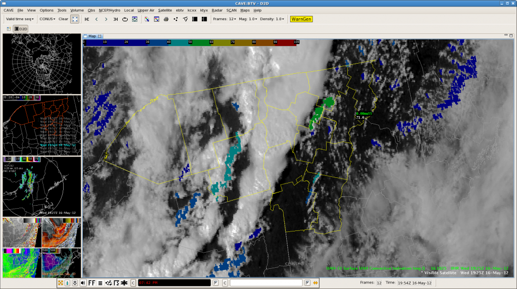
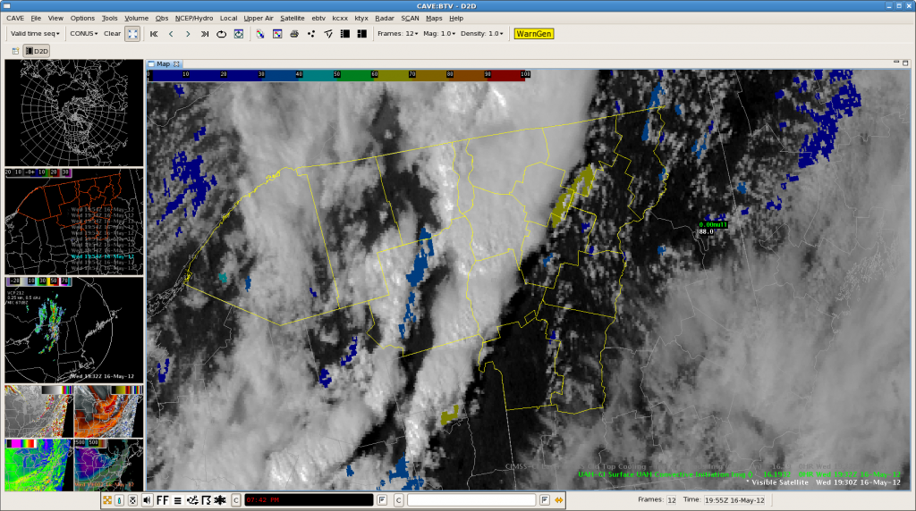
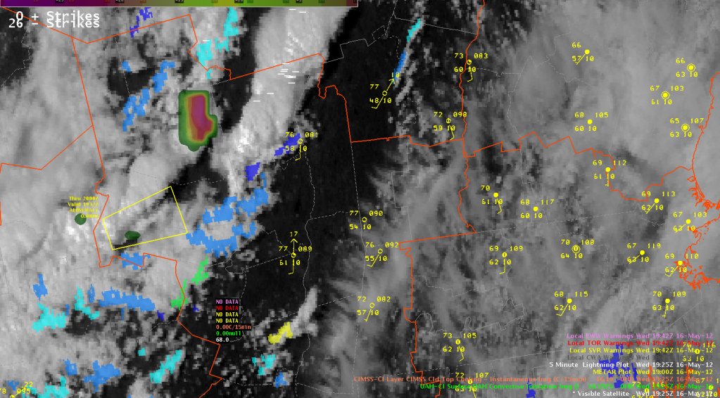
The UW CTC was also strongly negative in eastern Hamilton County at 1925 UTC, indicating a CTC of less than -30 C/15 min, so northern Warren County will need to be monitored.

Visible Satellite, UW CTC, and UAH CI valid 2012-05-16
Visible Satellite, UW CTC, and UAH CI valid 2012-05-16 1925 UTC

ALY: First Warning of the Day

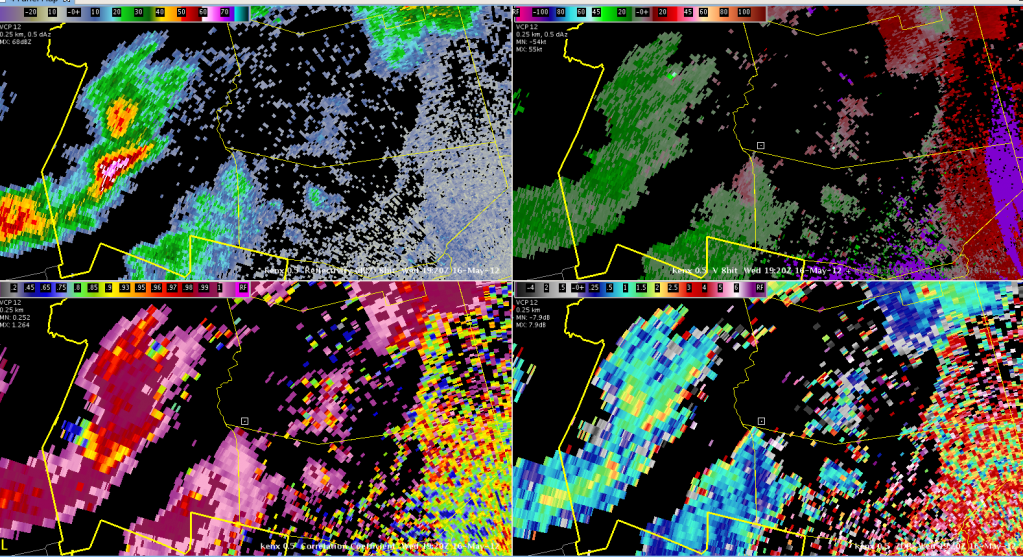
A three-body scatter spike and strong indications in the dual-pol data have led the decision to a severe thunderstorm warning for hail in southern Herkimer County, NY.

KENX Reflectivity, Velocity, ZDR, and CC valid 2012-05-16 1920 UTC
KENX 0.5-degree Reflectivity, Velocity, ZDR, and CC valid 2012-05-16 1920 UTC

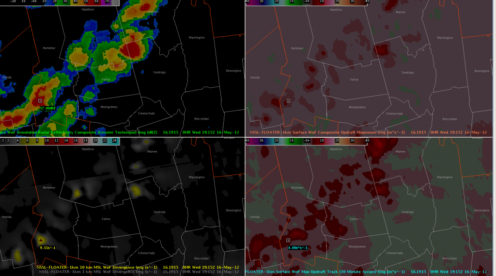
Neither MRMS nor 3DVAR are as impressed with the storm.  Updraft intensity fields in the 3DVAR are rather weak, but there were indications of strong 10km (storm-top) divergence (greater than 9.5 s^-1) starting at 1915 UTC.

3DVAR Analysis Reflectivity Composite, Updraft Composite Maximum, Max Updraft Track, and 10km Divergence valid 2012-05-16 1915 UTC

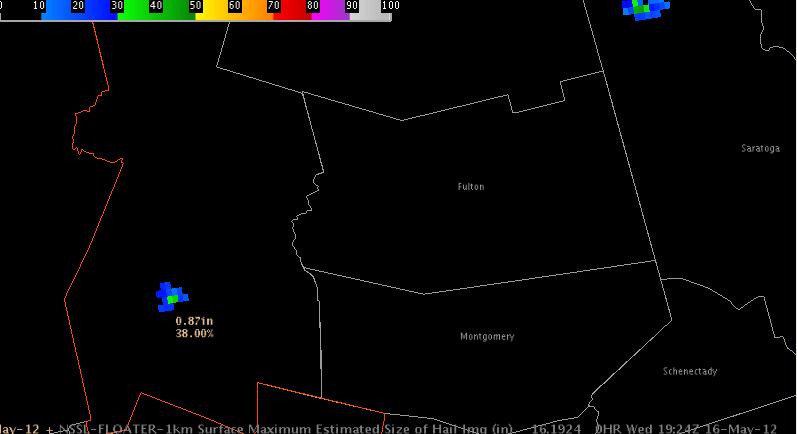
MRMS MESH has peaked under 1″ and had just a 38% POSH.

MRMS MESH & POSH valid 2012-05-16 1924 UTC