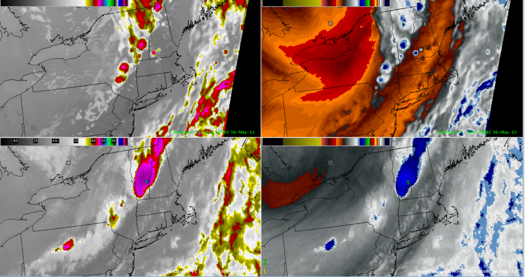
Quick Glance at SimuSat for Today’s Convection

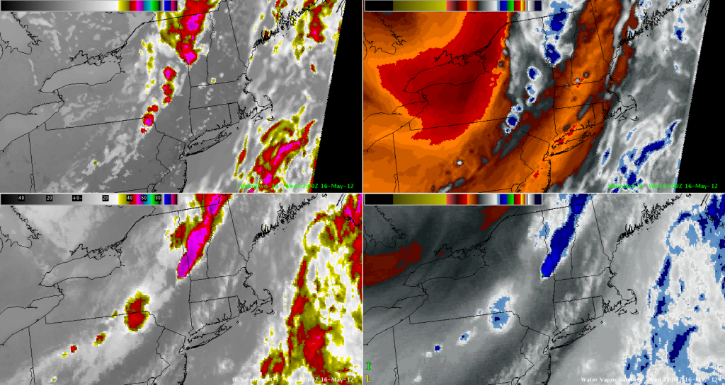
Severe thunderstorms kept the WFO ALY team busy today!  With storms in our area diminishing (and moving out), I wanted to check out the CIRA/CIMSS Simulated Satellite Imagery from the NSSL-WRF to see how it compared to the last few hours.  Overall, I’d say quite well, aside from some placement issues, and the extent of the coldest cloud tops (which was to be anticipated).
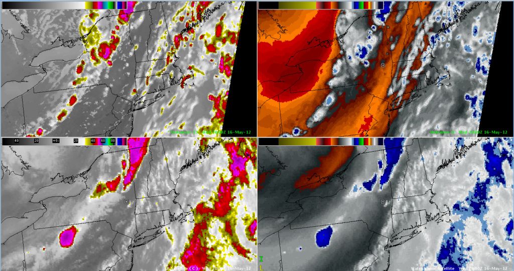
CIRA/CIMSS Simulated WRF Satellite Imagery (IR Left/WV Right) - Valid 2012-05-16 2000 UTC
CIRA/CIMSS Simulated WRF Satellite Imagery (IR Left/WV Right) - Valid 2012-05-16 2200 UTC
CIRA/CIMSS Simulated WRF Satellite Imagery (IR Left/WV Right) - Valid 2012-05-16 2300 UTC