Another SVR in eastern NY

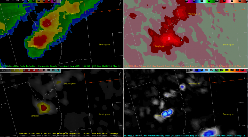
Another storm is affecting eastern Saratoga County and southern Washington County, NY (prompting a severe thunderstorm warning).  3DVAR storm-top divergence has been a pretty solid predictor with other storms in the region today, and this storm was no exception.  However, this was the first storm to show more than marginal updraft helicity, maxing out at 117 m/s^2 at 2045 UTC.

3DVAR Reflectivity, Updraft Composite, Updraft Helicity, and 10km Divergence valid 2012-05-16 2050 UTC

About 15 minutes later, MRMS MESH reached 1.25″ with a 62% POSH; that has since increased to 72% POSH and 1.5″ MESH.

BTV: 3DVAR/MRMS usefulness

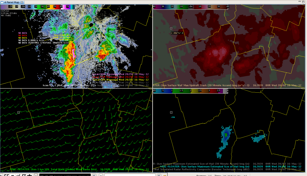
A short line of storms developed rapidly over Essex County.  The MRMS data (lower right pane) indicated a MESH of nearly 2 inches!  At the same time, the 3DVAR vertical velocity data (upper right pane) was 14 m/s for the same cell.  Using this data against already high reflectivity (upper left) increased confidence for a warning, especially given the environment.  Unfortunately, the 1KM wind field (lower left) gave a mixed signal at the same time frame, which was possibly an effect of the terrain.

BTV: CI products still useful

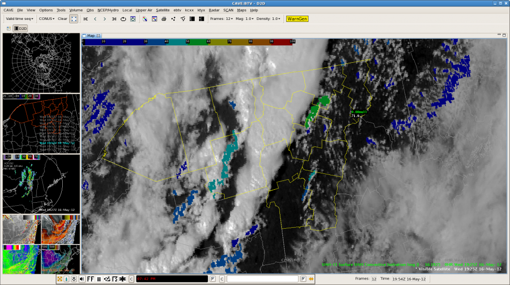
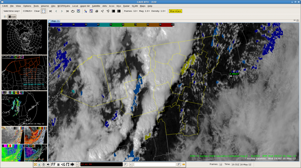
After the convection developed rapidly, the CI and CTC products became masked due to the TS plumes.  However, the convection at the north end of the CWA may have kicked out an outflow bndry to cause more development in clear air.  This was picked up by the CI product with an increasing signal in subsequent frames.

A stronger (yellow) signal was evident on the next frame.

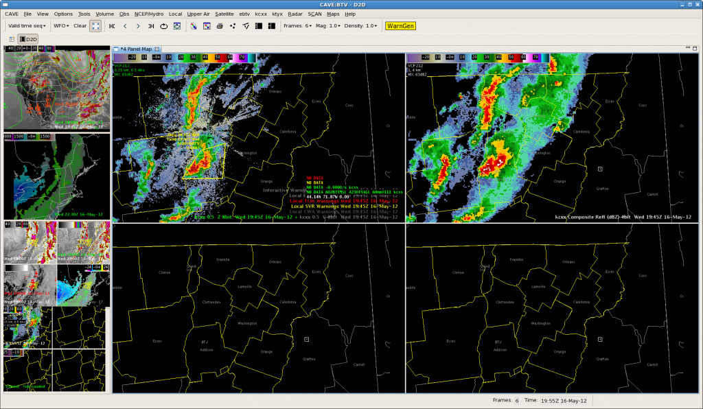
The resulting composite reflectivity (upper right image), showing development to 45dbz 15 minutes later.  Comp reflectivity was used here due to beam blockage at 0.5 degrees.

Monitoring More ALY-area Storms

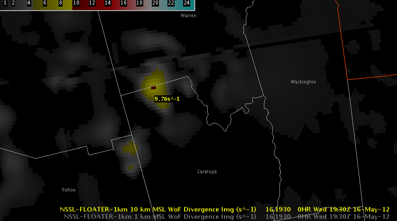
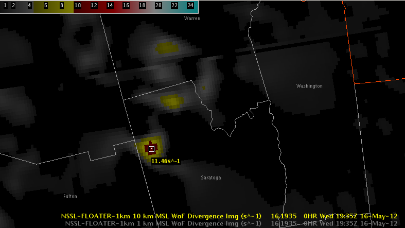
Two more storms in extreme northern Saratoga County, NY are being monitored for warnings (update: an SVR was just issued for the northern storm).  3DVAR has shown the same signals as the Herkimer County storm with strong storm-top divergence:

3DVAR 10km Divergence valid 2012-05-16 1930 UTC
3DVAR 10km Divergence valid 2012-05-16 1935 UTC

MESH was peaking just under 1″ with near-50% POSH.  (Update: it has increased above 1″ and POSH is above 50% now, prompting the warning.)

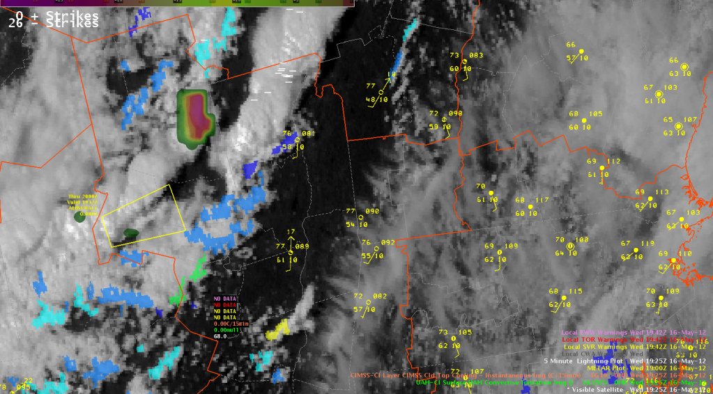
The UW CTC was also strongly negative in eastern Hamilton County at 1925 UTC, indicating a CTC of less than -30 C/15 min, so northern Warren County will need to be monitored.

Visible Satellite, UW CTC, and UAH CI valid 2012-05-16
Visible Satellite, UW CTC, and UAH CI valid 2012-05-16 1925 UTC

ALY: First Warning of the Day

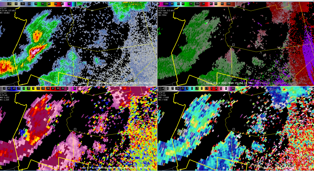
A three-body scatter spike and strong indications in the dual-pol data have led the decision to a severe thunderstorm warning for hail in southern Herkimer County, NY.

KENX Reflectivity, Velocity, ZDR, and CC valid 2012-05-16 1920 UTC
KENX 0.5-degree Reflectivity, Velocity, ZDR, and CC valid 2012-05-16 1920 UTC

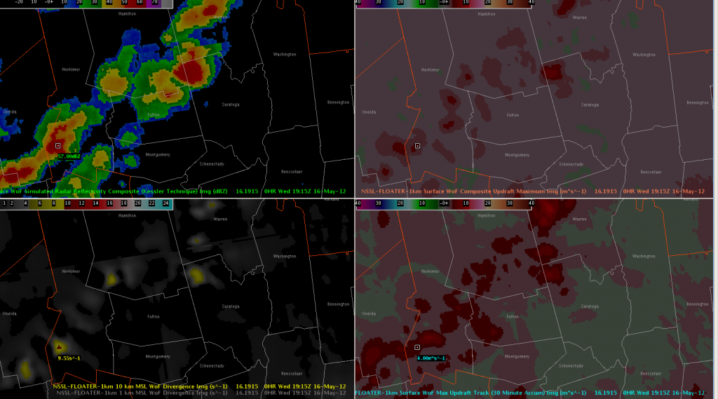
Neither MRMS nor 3DVAR are as impressed with the storm.  Updraft intensity fields in the 3DVAR are rather weak, but there were indications of strong 10km (storm-top) divergence (greater than 9.5 s^-1) starting at 1915 UTC.

3DVAR Analysis Reflectivity Composite, Updraft Composite Maximum, Max Updraft Track, and 10km Divergence valid 2012-05-16 1915 UTC

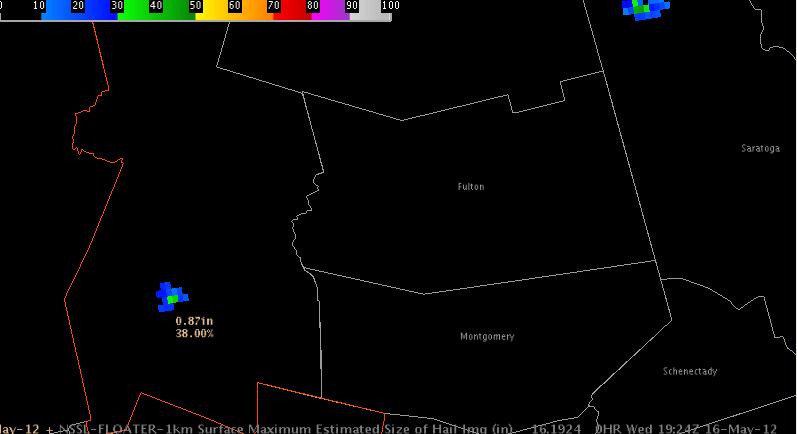
MRMS MESH has peaked under 1″ and had just a 38% POSH.

MRMS MESH & POSH valid 2012-05-16 1924 UTC

SVR for Burlington CWA

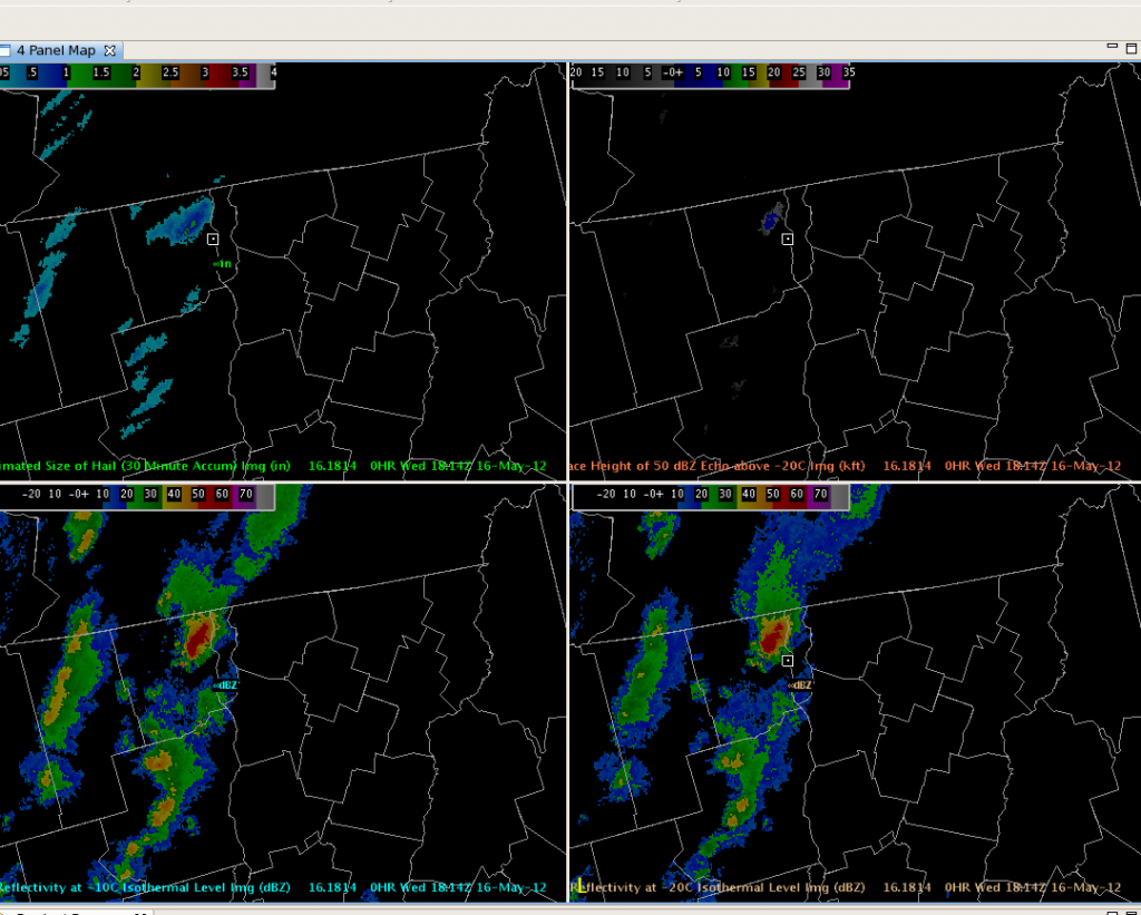
We used MRMS data during storm interrogation and decided to warn for a storm over far northeast New York and far northwest Vermont.  As early as 1812z the MESH was indicating hail just over 1 inch while the height of the 50 dbz echo above -20c was over 5000 feet.  Warning decision was not made until after 1820z after looking at KCXX radar data.  1 inch hail reports were received from about that time.  Attached is a 4 panel showing the Max Expected Size of Hail (MESH), heights of 50 dbz echo above -20C, and reflectivities at the -10C and -20C levels.

Kearney/Dankers

Outlook: 2012 May 16

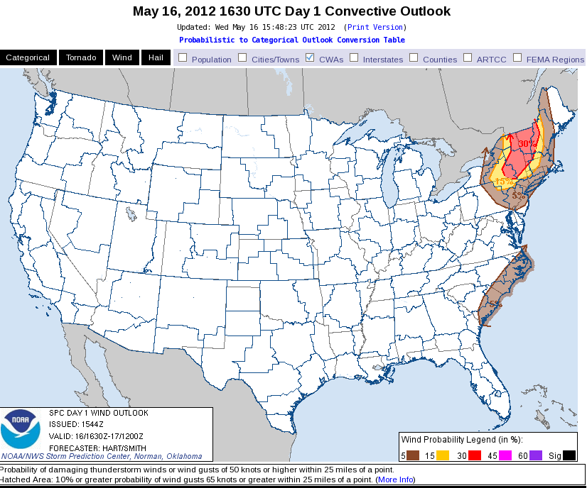
Yesterday’s outlook appears to be still on track.  One strong northern stream wave is approaching eastern NY and New England along with a significant cold front.  The front still has to interact with the axis of best moisture from the Hudson valley to the east and yet higher based convection is forming in the high terrain in northern PA to the Adirondacks.  Convection should consolidate once the front hits the moisture in 2-3 hours.  Deep layer shear is strong enough to generate supercells, however the majority of the convection may fall into small multicell forms, perhaps some bow echoes.  Low level lapse rates from the Hudson valley to the west are strong but midlevel lapse rates are somewhat marginal (6-7 c/km).  Thus I expect that large hail will be a threat though giant hail (>2.5″ diameter) prospects will be very small.  Tornadoes are unlikely given somewhat weak low-level shear (10kts).  Severe winds are much more likely as strong convective downdrafts are possible with the more intense storms.  We have both teams in the northeast; Todd and Stephen are localized to BTV while Brian and Julia are taking on ALY.  Convection has already initiated with the most coverage in BTV.

Meanwhile, steep, near saturated, low-level lapse rates have again initiated seabreeze convection along coastal NC.  New storms may form further southwest into coastal SC.  The Floriday play is somewhat muddied up by fairly dense high cloud cover.  However instability is quite sufficient for thunderstorms and the upper-level system is approaching from the west.

Jim LaDue: EWP week 2 coordinator

Tags: None

Daily summary – 2012 May 15

Today was one of those days where we ended in somewhat different locations than we intended.  Following the morning forecast, we had Stephen and Brian focus on Blacksburg, VA’s CWA while Todd and Julia took on Sterling, VA and the LMA site.  We were enthused about the possibility of severe multicells in both areas given the deep, rich moisture, decent CAPE and about 30 kts of deep layer shear.  However, the storms that formed remained weak with only a few lightning events per minute.  Apparently the weak lapse rates only become worse, likely because the area was on the subsident side of a weak wave lifting into New England.

After a couple hours of failed attempts at vigorous Deep, Moist Convection (DMC).  Brian and Stephen moved to the Davenport, IA CWA to sample DMC in a weak CAPE, steep lapse rate layer with 25 kt 3 km winds along a cold front.  Initiation was painfully slow as the environment was marginally conducive to DMC.  Yet by 6:30 pm storms intensified just enough to produce severe winds just south of Davenport.  3DVAR showed a good example of wind augmentation at 1 km around the south side of one small multicell just before the wind reports.  It also showed convergence from what appeared to be a gust front.  The base velocity 0.5 deg scan from KDVN showed the downburst in more detail.

Meanwhile we noticed that the Melbourne, FL area had a large pocket of strongly unstable, and unworked air surrounded by active outflow boundaries slowly converging on the CWA. Todd and Julia shifted to Melbourne and set up for a better than expected event.  They issued a severe thunderstorm warning for rapid development just northwest of Melbourne.  The LMA showed rapid increases in lightning rates up to 20 fl/min I believe.  Meanwhile 3dVAR showed some rotation around 5 km MSL.  The CI product from UW highlighted some of the initial phases of that thunderstorm.  Later on, one of the storms near Titusville began to rotate.    Soon KMLB base velocity showed a strong azimuthal shear and a tornado warning was issued.  3dVAR had a gap between two domains that prevented early detection until the 3dVAR northern domain was shifted south.  The 3dVAR will need to be redone for a later case review.  Meanwhile the UW CTC product didn’t flag the storm as it developed.

The IA case is a great example of a weak CAPE, marginally convective event with severe winds.  The MLB case is a good severe GOES-R mini scenario for AWOC.

Jim LaDue:  EWP week 2 coordinator
Tags: None

EWP STATUS FOR 16 MAY 2012: 12-8pm SHIFT

EWP STATUS FOR 16 MAY 2012:  12-8pm SHIFT

Based on the available 15 UTC SREF guidance, the east coast again appears to be the best potential for deep, moist convection (DMC).

We have three potential plays of concern.  The first area may be New England as the northern stream system affecting IA to WI today moves to the east and begins to impinge on better moisture along the eastern Seaboard.  With increasing midlevel winds, the deep layer shear will increase enough for a supercell threat as long as the instability is not prematurely extinguished.  The second area will be further south along the coastal regions of the Carolinas.  Similar to the past few days, substantial moisture and marginal midlevel flow from the stalled trough may produce enough shear for organized small multicells.  Boundary interactions will provide for an interesting session for anticipating severe DMC.  The third area will be in FL again as the southern TX upper-tropospheric wave moves eastward.  Mid- and upper-level flow will also be marginal to perhaps sufficient for supercells, especially in regions where low-level backed sea breeze flow augments deep layer shear.

All of these potential targets will likely initiate DMC early enough to warrant a 12 – 8 pm shift.

Jim LaDue, EWP2012 Week #2 Weekly Coordinator

Tags: None

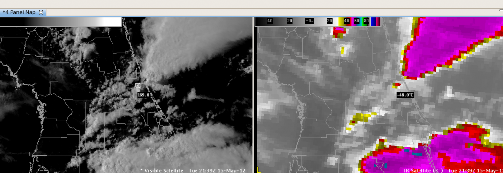
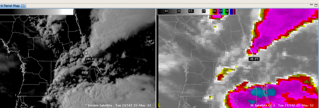
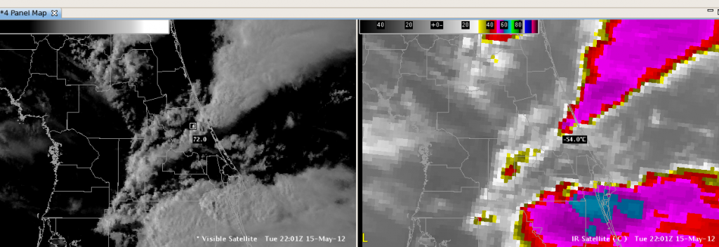
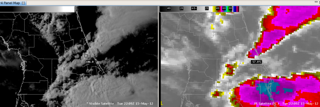
Satellite pictures of Florida storm

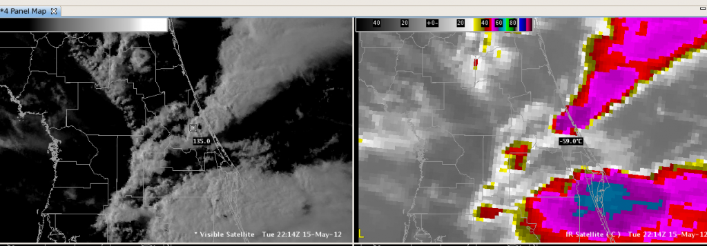
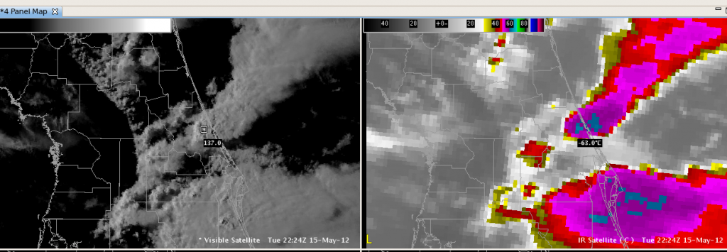
Here is the series of visible and infrared satellite pictures for the storm cell that we issued the tornado warnings.  The Convective Initiation product gave a strong signal as this cell began developing, but the Cloud Top Cooling product never identified this storm.  The infrared pictures are sampled at the coolest part of the cell at each time step, about 5 to 10 minutes.  The storm grew explosively and produced one inch hail along with strong rotation on the radar.  It is my hope that a storm developing this rapidly would be identified and highlighted by an algorithm.  Apparently this is related to the cloud mask used by the CTC algorithm.  I’m just curious why the best storm of the day slipped past the CTC algorithm.

2139z

2144z

2154z

2201z

2209z

2214z

2224z

Dankers