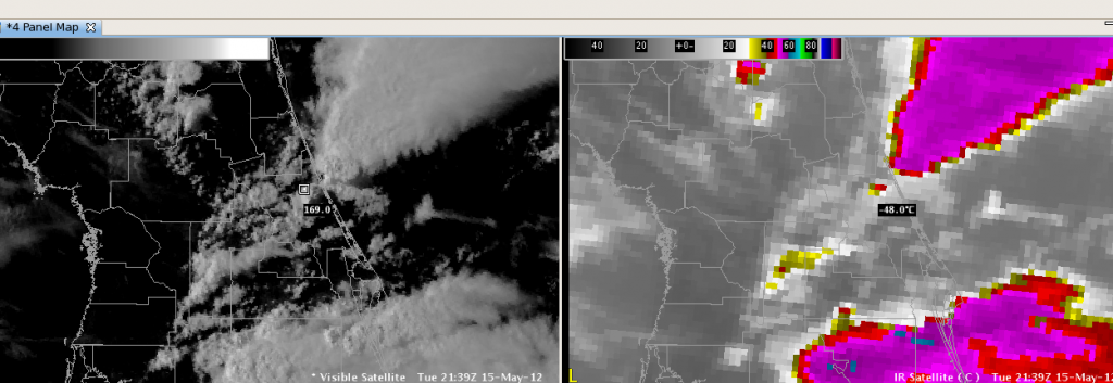
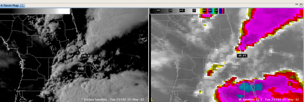
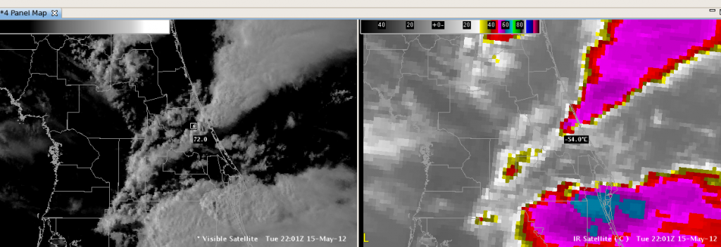
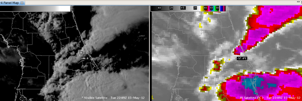
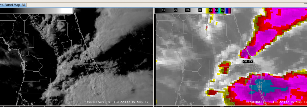
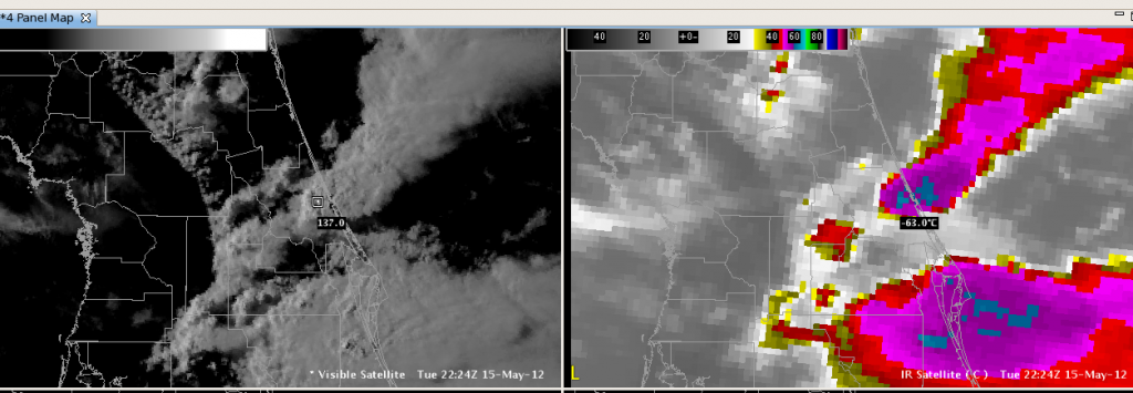
Here is the series of visible and infrared satellite pictures for the storm cell that we issued the tornado warnings. The Convective Initiation product gave a strong signal as this cell began developing, but the Cloud Top Cooling product never identified this storm. The infrared pictures are sampled at the coolest part of the cell at each time step, about 5 to 10 minutes. The storm grew explosively and produced one inch hail along with strong rotation on the radar. It is my hope that a storm developing this rapidly would be identified and highlighted by an algorithm. Apparently this is related to the cloud mask used by the CTC algorithm. I’m just curious why the best storm of the day slipped past the CTC algorithm.
2139z
2144z
2154z
2201z
2209z
2214z
2224z
Dankers

