Outlook – 6 May 2009

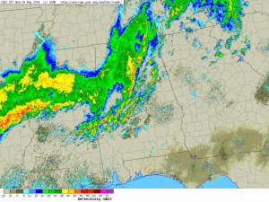
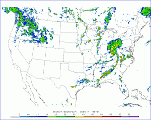
Again today convection was mistimed in travelling through an LMA area during the morning hours.  Currently, a broken cell squall line is moving through Alabama; this is on the eastern edge of a solid line which extends from just east of Dallas into Mississippi.  Currently a tornado watch is out for the broken line until 23Z.  High-res WRF runs break out convection in NC and VA during the evening hours, which should provide for an evening MR/MS IOP area.

Kiel Ortega

Forecasted 1km reflectivity from EMC WRF
Forecasted 1km reflectivity from EMC WRF valid 00Z 7 May 2009
Composite reflectivity at 1510 UTC
Composite reflectivity at 6 May 2009 1510 UTC

Kiel Ortega (EWP Weekly Coordinator, 4 – 8 May 2009)

Tags: None

Outlook – 30 April 2009

A few more days of the southwesterly flow over the Southern Plains is expected.  Today, another (small) MCS affected Oklahoma, although this time more centered on the northeast part of the state.  This has laid several boundaries (blue) across central and northern Oklahoma.  In addition, there is ample moisture; for the first time this spring, central Oklahoma dewpoints are in the upper 60s, and CAPEs are progged to be well over 4000 J/kg this afternoon.  A dryline is entering SW OK (brown) and a cold front (dark blue) is sagging into NW OK.

The SPC DY1 outlook has the area in a SLGT with a 5% tornado contour.  With the huge instability, there is also a hatched (> 2″) hail probability.

Since Central OK is outlooked, our plan is to run a PAR IOP.  If storms enter the CASA domain, we will split one forecaster into a CASA IOP as well.  An LMA IOP will not be run today, as the LMA network went down last night, and is not expected to return online until early next week.  Prior to the start of the evening IOP, we will run the forecasters through a PAR archive case.

Greg Stumpf (EWP Weekly Coordinator, 27 Apr – 1 May 2009)

Tags: None

Outlook – 29 April 2009

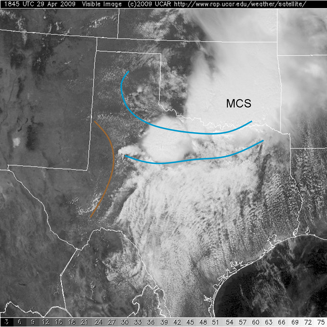
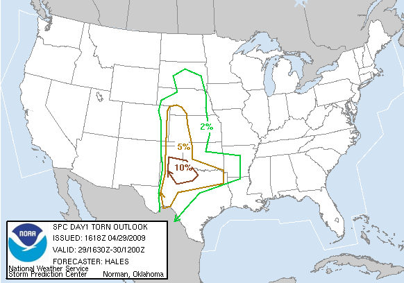
Another day in the pattern of broad southwesterly flow with the western U. S. trough, and ample moisture and instability, will bring a threat of severe weather over the Southern Plains, specifically the eastern Texas Panhandle.  A morning mesoscale convective system provided extreme flooding to parts of southern Oklahoma, with over 11″ of rain reported in areas of Love County (Burneyville, OK).  From the visible satellite image below, this MCS has left behind several outlfow boundaries (blue) that extend westard to intersect with e a dryline (brown) in the Texas Panhandle.

These boundaries will be the focus for convection today.  The SPC DY1 outlook paints this area in a slight risk, with a 10% probability for tornadoes within 25 miles of a point.

We are planning an multi-radar/sensor algorithm IOP today within the 10% tornado risk area during the 5-9pm timeframe, most likely localizing for Lubbock, or perhaps Midland.  Prior to that, the forecasters will be evaluating a Lightning Mapping Array (LMA) archive case.

Greg Stumpf (EWP Weekly Coordinator, 27 Apr – 1 May 2009)

Tags: None

Outlook – 28 April 2009

Southwesterly flow aloft continues with the broad trough over the western U. S.  Small impulses through the flow are likely for the next few days, with some timing to produce convection in the southern High Plains.  On the surface, a strong upslope pattern is prevelent over eastern NM and SW TX, but as of 1pm, most of the area east of the mountains are socked in with low clouds, fog, and cool temperatures.  There is evidence of the erosion of the low clouds on the west edge, and this trend is expected to continue into the evening.

The SPC DY1 outlook is seen here:

So, we are expecting an IOP for the multi-radar/sensor algorithms for SW TX and SE NM starting around 5pm.  Before that, we will have the forecasters run through several CASA archive cases.

Greg Stumpf (EWP Weekly Coordinator, 27 Apr – 1 May 2009)

Tags: None

Outlook – 27 April 2009

Déjà vu!  As like last year, the first day of the first week of the experiment finds us with a developing severe weather event right at the start of the shift.  With little time to get ready, we are having a compressed orientation schedule today so that we can begin our first Intensive Operations Period (IOP) as soon as possible.

A cold front is slowly moving through central Oklahoma, and storms are already firing, and severe, on a SW-NE line to the northwest of Norman.  Storms are presently impacting the PAR, CASA, and LMA domains.

These are on the edge (actually outside) the SPC DY1 SLGT RISK area, and a severe thiunderstorm watch as just been issued to encopass the convection (although some of it is outside the box too!).

The plan is to train our two visiting forecasters (Steve Cobb, LUB – Lubbock, TX; Suzanne Fortin, EAX – Pleasant Hill, MO) on the WDSSII display and the PAR project, then train on CASA.  After that, we will evaluate the situation, and if needed, will commence IOP immediately, splitting up the two forecasters on PAR and CASA, possibly to rotate between the two experiments half-way through.  If the storms are already out of the CSAA domain by the start of the IOP, then we will do an LMA experiment, although we prefer to have the LMA data available at convective initiation, which is already passed.

Greg Stumpf (EWP Weekly Coordinator, 27 April – 1 May 2009)

Tags: None

Outlook – 5 June 2008

Skipping the formalities today as all are expecting something this evening with Mdt risk and PDS watch out for the NW. Apparently we’ll have several NWC employees available to provide ground truth over parts of KS/OK. Current storms are not in testbed range. Forecasters will go through the Prob Warn “exercise” given to all testbed participants. This should conclude by 3-3:30pm. By then we hope to have something in PAR range and hopefully some time after that, storms in CASA range. This is the last day for the Spring EWP.

LizQ

Tags: None

Outlook – 4 June 2008

We expect to create probabilistic threat areas in eastern CO, southwestern NE and northwestern KS this evening. There are existing storms here, but we also hope to develop probability forecasts for new initiating storms today. Any storms should have hail, wind, and tornado threats.

-KScharf

Tags: None

Outlook – 3 June 2008

Participants are getting PAR Overview at this time. Afterward, they will split into 2 groups with 1 group going thru a PAR archive and the other thru a CASA archive. Around 5:30pm we will start IOP with Prob Warn, and may transistion group with PAR exposure to Live PAR if anything develops within network over northern Oklahoma. LizQ

Tags: None

Outlook – 2 June 2008

All undergoing training/familiarization today with CASA/WDSSII/Prob Warn. Will do PAR overview tomorrow.

Looks like nothing in the testbed tonight. Perhaps nothing until Thursday. Will have a PW IOP tonight over whatever area looks best, either new stuff going up along the Rockies or long-lived MCS/bow moving thru southeast MO.

LizQ

Tags: None

Outlook – 29 May 2008

Today the SPC has outlined a High Risk for severe weather in Nebraska/Iowa…with a moderate risk southward into Kansas. Thunderstorms are not anticipated in central Oklahoma, so the choice is obvious for a Prob-Warn IOP this afternoon.

Synopsis: A shortwave trough dug into the base of the standing long wave over the western states last night. This trough will eject over the Plains at a time coincident with peak heating, supporting widespread severe storms this afternoon and evening. A warm front lifted northward…taking up residence from northeast Nebraska through western Iowa and southward. A dryline will overtake the warm front from the west…providing impetus for an enhanced risk of severe weather around and north of Omaha, NE. The southern portion of the dryline will advance into southwest and north central Kansas. With dewpoints in the upper 60s to near 70, CAPE 2500-4000 J/kg, and 50 to 60 knot mid level flow accompanying the shortwave trough, severe storms are a near certainty. The particular mode and evolution is a greater question.

Per the NAM forecast seen below (courtesy College of Dupage), it is possible that two main areas of thunderstorms will develop, one north of the mid level jet and along the warm front, and another ahead of the dryline in northern KS and southern NE. There could be a minimum of activity along the nose of the jet near I-80 in NE.

Plan for 052908

One forecaster, Brad Colman, has other obligations, and must leave us today to head back to Seattle. The other forecasters are going to run through an archived Prob-Warn case early this afternoon. The archived case is a high priority so that we can have feedback from as many forecasters as possible after seeing the exact same data.

After a short break, we will then engage two teams with on Probabilistic Warnings, possibly in the areas shown above. One team will consist of myself and Eric, while the second team will consist of Kevin and Mark. With the potential for a long-lived and significant event, we will begin the IOP early, possibly 2030 or 2100 UTC, and run through 0200 UTC. A PDS tornado watch has already been issued for central Nebraska and northern Kansas, and storms are initiating along the dryline northeast of Goodland.

Patrick Burke (EWP Weekly Coordinator, 27-30 May)
Tags: None