Summary – 4 June 2008

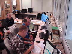
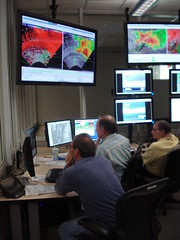
The IOP today lasted from 5:15 pm to 7:30 pm, and we shut down early to save our energy for Thursday’s potentially significant event. For the first time, we concentrated on all 3 threats (severe hail, severe wind, and tornado) for multiple storms near the Northeast Colorado/Southwest Nebraska border region. We had two teams, Chris/Milovan and George/Jon. One team member monitored the near-storm environment and interrogated the base radar data using AWIPS, while the other team member created the probabilistic hazard forecast grids. The team members switched roles around 6:20 pm.

Chris reported it was hard to “ramp up” from a cold start. He added it would be hard to predict how the work load might be distributed around the WFO in a warning event if probabilistic grids were the primary product. George assumed the software would be easier to use and more stable in an operational environment, and he thought there would still be the same difficulties anticipating short-term changes in storm motion and intensity. In terms of workspace management (desktop real estate), Jon said it was a good idea to keep the product generation screen separate from the data interrogation screen. Everyone reported it was not easy to keep the creation polygons visually separate when working all 3 hazards at once on the same storm, and therefore hard to work with them.

Kevin Scharfenberg (EWP Backup Weekly Coordinator, 2-6 June)

Tags: None

Live Blog – 4 June 2008 (6:55pm)

Both storms are producing occasional tornadoes, high winds, and hail, so they are pretty easy from a probabilistic standpoint. Forecasters report some discomfort using the GUI to keep track of lots of interlocked threat areas. New towering cumulus and early echoes going up south and east of the existing storms so we may still be able to do early initiation probabilities.

Kevin Scharfenberg (Gridded Warning Cognizant Scientist)

Tags: None

Live Blog – 4 June 2008 (6:26pm)

Working all threats on two cyclic supercells in far NE CO and far SW NE. Interesting for the forecasters dealing with velocity couplets moving in different directions as they occlude and “hand off” to the next mesocyclone.

Kevin Scharfenberg (Gridded Warning Cognizant Scientist)

Tags: None

Outlook – 4 June 2008

We expect to create probabilistic threat areas in eastern CO, southwestern NE and northwestern KS this evening. There are existing storms here, but we also hope to develop probability forecasts for new initiating storms today. Any storms should have hail, wind, and tornado threats.

-KScharf

Tags: None

Summary – 3 June 2008

Group looks at summary of threat areas during the evening. Greg talks about a way of doing this in the future might be to hand off storm “objects” to next CWA for a more seamless way of doing things. George brings up that the forecaster in the next CWA may very well decide probs are too high and summarily drop them showing a pretty dramatic change across the CWA border. No one issued TORs and discussion was that environment in the area of the storms was not as favorable. Also looks at the storms earlier from DDC was not sampled as well. All had high threat values for hail and wind. Hail reports were upwards of 4 inches with several mesonet sites showing 70+mph winds.

Discussion also brought up the Call to Action statement about tors when in a Tor Watch (NWS Directive). Consider a PW version of this that puts on a low prob tor threat.

Interesting observation that storms tonight moved across a “dry tongue” and seemed to transistion to more of a wind threat. Storms then went back into the moist air and produced more large hail.

LizQ

Followup:

There were some technological challenges to overcome on Tuesday. It appears there might have been a network hiccup or other sort of glitch near the start time of the IOP (6 pm CDT) that caused a chain reaction of other difficulties. First we noticed the NTI switch which controls the situation awareness display was on but the web interface was unresponsive. This required a hard reboot of the switch. Then we noticed we could not add a source in WDSS-II because the source list was empty. The “real time” radar list in Tensor was blank as well. When we would manually type in a radar URL, sometimes we did not get any products back. It seemed the MESH was significantly underestimating the hail threat with some storms as well, so it is possible that algorithm was not “seeing” all the radars either. This required intervention to reset all the radars, which when solved also seemed to help MESH performance. Finally, the fact some products were not updating caused a glitch with the warning generation software, since the current threat areas were attempting to sync to old product valid times.

Kevin Scharfenberg (EWP Backup Weekly Coordinator, 2-6 June)

Tags: None

Summary – 15 May 2008

We did a probwarn mini-IOP on a supercell (and a few other storms) crossing the Rio Grande near Eagle Pass, TX. The storm had an unconfirmed report from law enforcement of a tornado after it crossed into the US, but a chaser on the scene we called from the HWT could not confirm it. This provided an interesting decision by our forecasters on how much confidence they put in the law enforcement report for their initial tornado probabilities. What was more certain to the forecasters is the large hail threat was very high, given the well-defined bounded weak echo region (below). Later, a 2.5″ diameter measured hail report was received from near Eagle Pass, along with downed trees.

Kevin Scharfenberg (EWP Backup Weekly Coordinator, 12-16 May)

Tags: None

Pictures from Week 1

A few pictures from around the Hazardous Weather Testbed during week 1 of the 2008 experiment:

Mike Cammarata and Dr. Pam Heinselman discuss Phased Array Radar data.

Patrick Marsh and Kristin Kuhlman create probabilistic warning grids.

David Blanchard, Paul Schlatter, and CASA scientists explore a CASA case study.

Mike Cammarata and David Blanchard monitor a tornadic supercell in real-time on May 1st using Phased Array radar as Les Lemon looks on.

The developing stages of the May 1st tornadic supercell as viewed from the National Weather Center, looking northwest.

Posted by Kevin Scharfenberg, NWS Severe Storms Services Coordinator

Tags: None