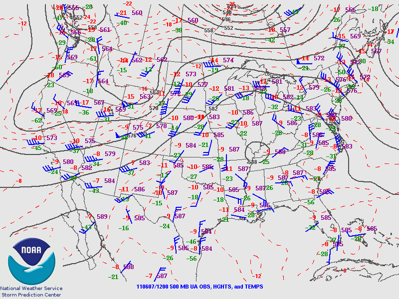
Satellite imagery reveals upper level energy…centered over southern Montana…with associated vort lobe extending through to northeast Colorado. Upper air analysis also indicates jet max from central Rockies region…then curves northward to the western Dakotas. Subjective surface analysis indicates a warm frontal boundary…from southeast North Dakota to northern Wisconsin.
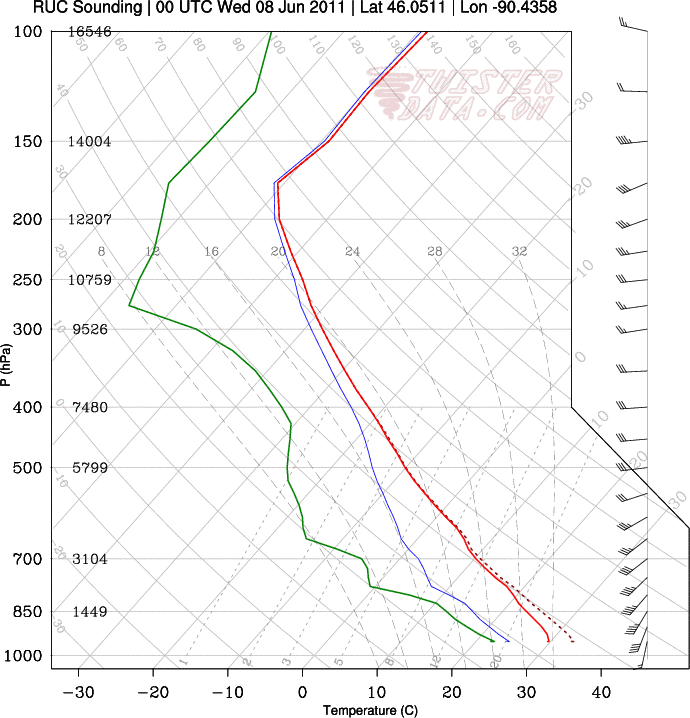
Surface based instability…south of the warm front…has already 2000 + j/kg….immediately south of warm front. Short term model output suggests that instability will reach extreme levels across much of Minnesota and Wisconsin…and the extreme eastern Dakotas…as the warm front lifts slowly northward this afternoon. Forecast soundings indicate deep layer shear will continue to be strong…as jet energy remains near the area. Forecast low level shear fields appear to be strongest…>200 m2/s2 …from long Canadian border from eastern North Dakota…northern Minnesota…to Lake Superior.
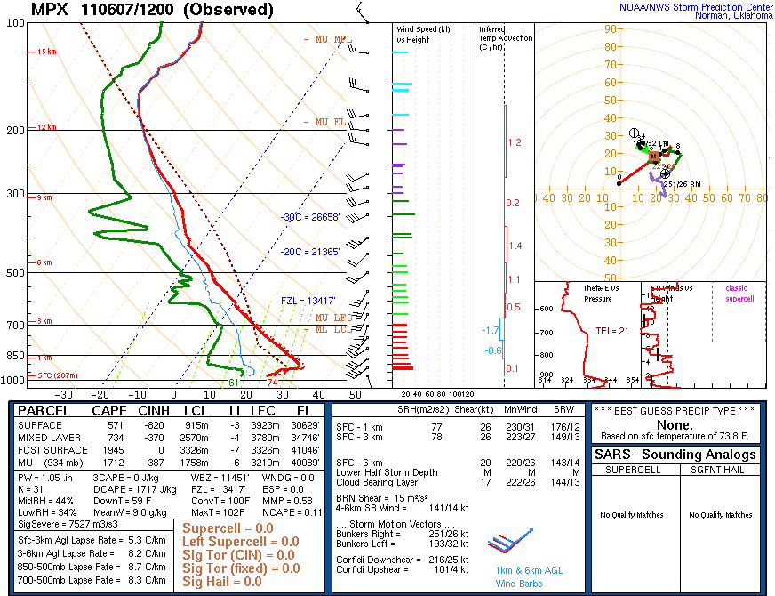
Forecast convective initiation will be affected by a considerable low-mid level cap…per 12z regional soundings.
However…this convective inhibition is expected to weaken…as upper wave rotates through the northern plains this afternoon and evening.
At this time…expect greatest potential for severe convection will be across these areas (in order of greatest potential) :
- DLH
- GRB/MQT
- FGF
- northern areas of MPX/ARX
At this time…supercells appeared to be preferred between 21z-03z..across areas 1 and 2…across areas of best distribution of surface based instability and deep layer shear.
DC LMA —
Limited possibility exists for thunderstorms in the D.C. LMA… as an ongoing mcs complex over eastern Ohio and northern West Virginia may continue to track southeast towards the DC LMA target area and/or provide a low level focus for new development. Models indicate better instabilities will be located over the western part of the LMA. Marginal deep level shear will limit the likelihood for supercell development.
sohl/buonanno


