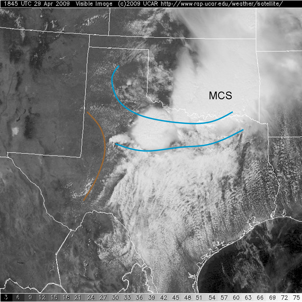
Another day in the pattern of broad southwesterly flow with the western U. S. trough, and ample moisture and instability, will bring a threat of severe weather over the Southern Plains, specifically the eastern Texas Panhandle. A morning mesoscale convective system provided extreme flooding to parts of southern Oklahoma, with over 11″ of rain reported in areas of Love County (Burneyville, OK). From the visible satellite image below, this MCS has left behind several outlfow boundaries (blue) that extend westard to intersect with e a dryline (brown) in the Texas Panhandle.
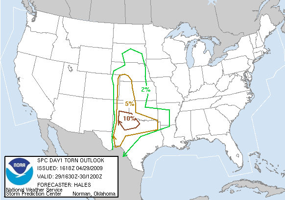
These boundaries will be the focus for convection today. The SPC DY1 outlook paints this area in a slight risk, with a 10% probability for tornadoes within 25 miles of a point.
We are planning an multi-radar/sensor algorithm IOP today within the 10% tornado risk area during the 5-9pm timeframe, most likely localizing for Lubbock, or perhaps Midland. Prior to that, the forecasters will be evaluating a Lightning Mapping Array (LMA) archive case.
Greg Stumpf (EWP Weekly Coordinator, 27 Apr – 1 May 2009)


