The forecasters started off the afternoon running through two archive CASA cases. These were the 10 Feb 2009 Central OK tornado case, and the 8 May 2007 mini-supercell tornado case. A quick summary of the comments relayed during our post-mortem briefing include:
- Nice having a 4 minute “lead-time” to WSR-88D volume scan updates.
- Small scale feature evolution is very detailed on single CASA radars.
- CASA multi-radar merger masked the details seen on the individual radars. Time synching can somethme cause features to be slightly off in space, and are thus mashed.
- Attenuation is nicely filled in by other radars in multi-radar merger, however (see above).
- Still needed KTLX for comparison, especially to determine areas of attenuation.
- Situational awareness is going to be challenging when trying to analyze more than 2 single radars at a time.
- For WDSSII GUI: Add colormap editor, different background colors for each panel/radar; configure placement of legend.
The evening multi-radar/sensor algorithm IOP was for two isolated supercells in SE NM. The first storm occured just N of Roswell, but was unfortunately trending to weaker intensity just as we started working it. We localized to WFO ABQ and used the Cannon AFB 88D (KFDX) radar to support warnings. The forecaters issued several SVR warnings on the cell, but the warning server hiccuped, and these warnings were not saved.
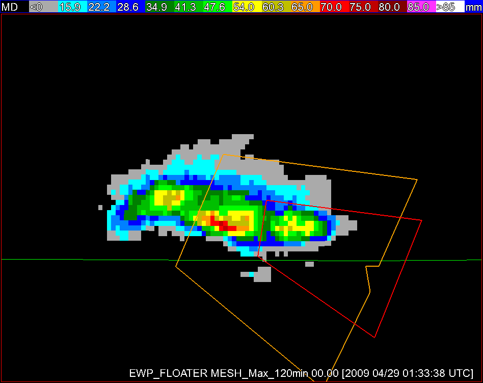
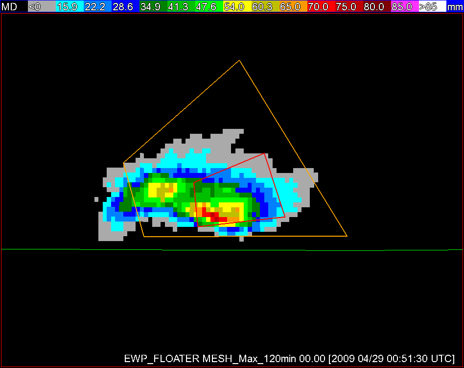
Nevertheless, a second more-severe supercell deveoped just E of Carlsbad, and the forecasters warned on that storm for about 90 minutes, both SVRs and TORs. We localized to WFO MAF and used the Midland 88D radar (KMAF) to support the warnings. To support the severe hail decisions, the forecasters used the H50_Above_H253 (50 dBZ above -20C altitude), 50 dBZ Echo Tops, and the MESH products. The MESH swaths were particularly useful in placing the proper warning polygon angle to capture the storm motion. The figures below show the differences between the EWP experimental warning polygons (Fig. 1) with the offical warnings from WFO MAF (Fig. 2). Note how the EWP warnings capture the storm motion better.
FIgure 1. EWP Warnings (amber = SVR; red = TOR)
Figure 2. WFO MAF warnings (amber = SVR; red = TOR)
There was generally good agreement between the MESH estimates and the very few hail reports from these storms. The forecasdters commented that it would be nice to be able to have a user-configurable Echo Top product so that one could choose the dBZ level on the fly (e.g., 60 dBZ Echo Tops).
The forecasters also issued a TOR on the storm, albeit after the WFO MAF pulled the trigger. The reasoning for holding off on the TOR was a temporary decrease in the LLSD multi-radar azimuthal shear trends. When they re-strnegthened, they issued a TOR.
The forecasters recommended the ability to overlay contours of the multi-radar fields over the single radar images. They also recommended that the EWP have several AWIPS default procedures with the WDSSII grids in place before the new set of forecasters arrive.
Other assorted comments: The MRMS products saved time by calculating heights and reflectivities within hail growth regions, versus traditional analysis methods. The 18 dBZ Echo Top color scale needed to be improved. The 1-3 minute latency on the MRMS grids sometimes impeded the full comparison to 88D data. Anticyclonic rotation tracks would be useful.
Greg Stumpf (EWP Weekly Coordinator, 27 Apr – 1 May 2009)


