EWP Status for 3 June – 1:00pm to 9:00pm Shift

tues_day2 tues_day2_prob

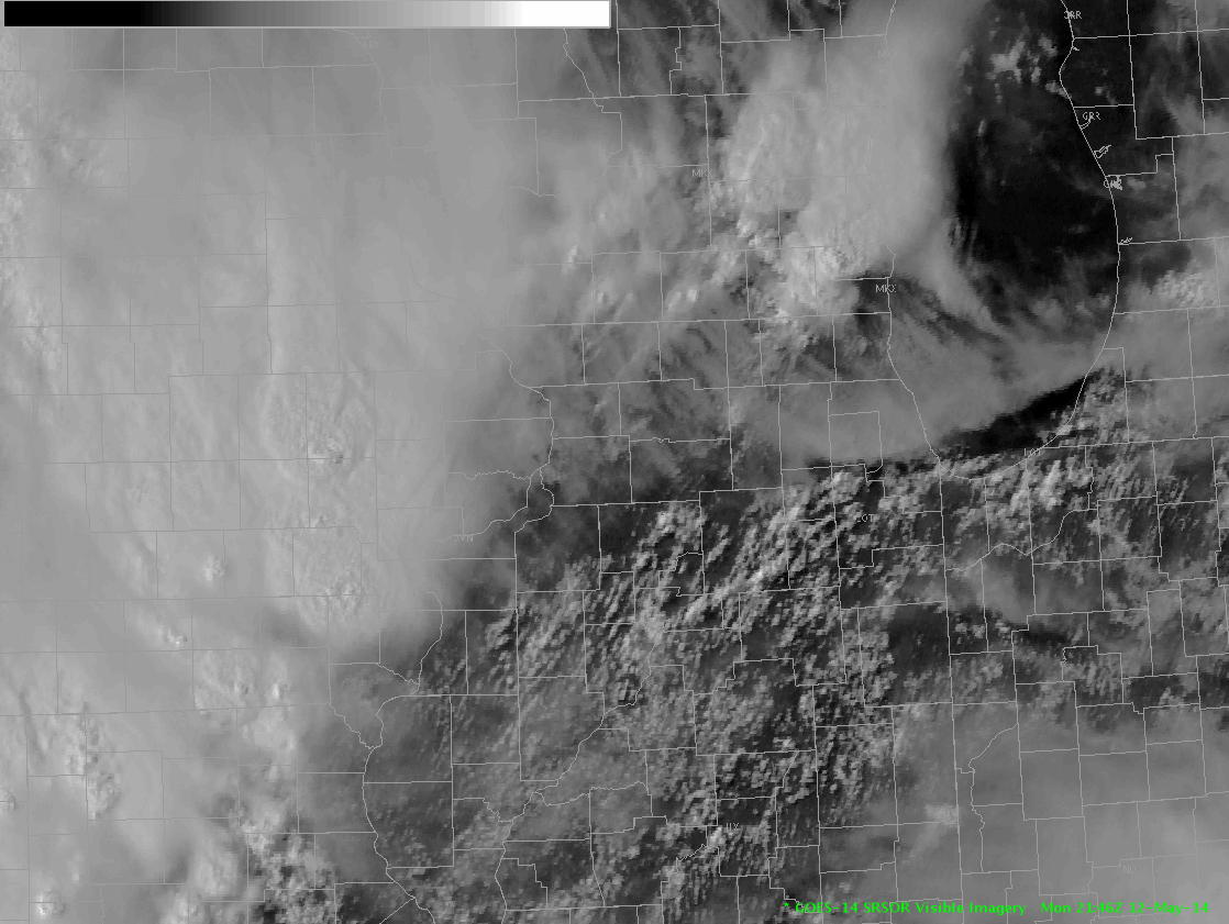
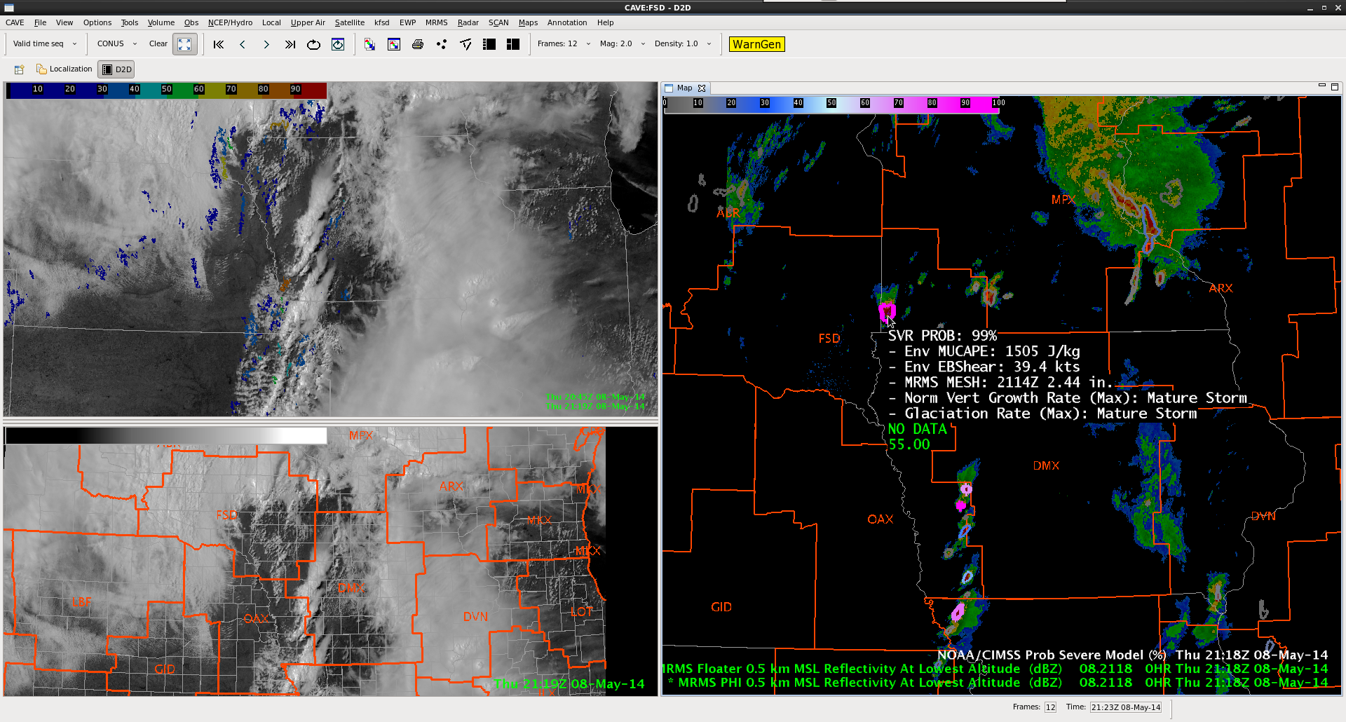
On Tuesday, a much-anticipated mid-level wave will arrive in the Central Plains, creating the potential for a significant severe weather episode.  Seasonally-rich moisture will continue to advect northward in response to deepening low pressure in the lee of the Rockies.  Meanwhile, a strong elevated mixed-layer (EML) will advect over the moist layer, creating the potential for strong instability.  Morning convection over Nebraska and Iowa may delay surface heating somewhat, but it is likely that – at least – strong instability will develop.

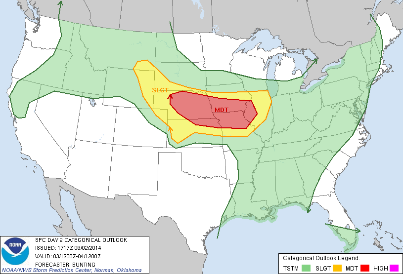
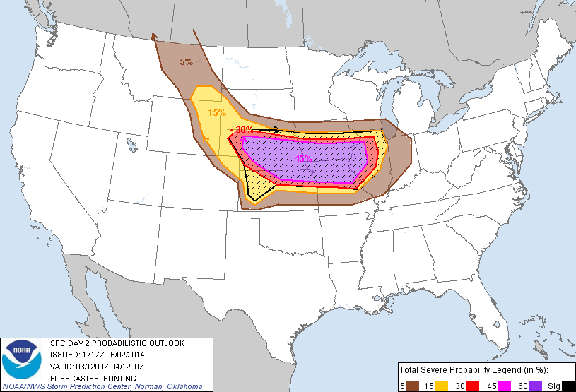
A warm front / outflow boundary looks to be the primary focus for severe weather tomorrow, though storms may fire further south on the dryline.  Given the a) strong to, perhaps, extreme instability, b) strong shear at all levels, and c) deep moisture, the potential exists for high-end severe, including tornadoes.  The greatest threat for tornadoes will likely exist along the warm front in central and eastern Nebraska.  Storm mode will be key, as upscale growth could limit the tornado potential.  Some high-resolution models hint at the development of a strong squall line – perhaps, even a derecho – not long after convective initiation.

In order to capture the initial development, we have elected to start the shift at 1 pm. We will meet in the Hazardous Weather Testbed to listen to the EFP daily briefing.

-G. Garfield
Week 4 Coordinator

Tags: None

EWP Status for Thursday May 22th – 12:00pm to 8:00pm Shift

When in doubt…go to areas where there’s an LMA.

…wait…there’s three (maybe four) regions tomorrow? Okay then…

SPC Day 2 Probabilistic Outlook for May 22, 2014.

Washington D.C. – Weak cold front will continue to push south, shifting flow out of the northwest by the afternoon. Depending on the amount of surface heating available (if the sun can break through this overcast mess), possibly some convection could fire along the front.

Colorado – Copy…paste from today. But expect weaker southerly flow aloft as the low pressure system very slowly continues to propagate eastward tomorrow. Sufficient lift at the front range and lingering PW values from 0.75-1.00″ could cause more thunderstorms tomorrow afternoon and evening. Don’t expect another ‘Denver Metro Supercell’ though (but maybe I’ll be wrong…I hope I’m not)…

West Texas – Incoming trough + low-level moisture surge overnight with forcast MLCAPE values from 1000-2000 J/kg expected over the region. Early to mid afternoon initiation expected ahead of the dry line.

We have options and hopefully more than 1 will pan out. Most model trends are edging towards a rapid destabilization with earlier initiation around 18z.

We will meet in the Dev Lab tomorrow at noon for a debrief before meeting in the HWT by 12:30pm.

-Darrel Kingfield
EWP Week 3 Coordinator

Tags: None

EWP Status for Wednesday May 21th – 12:30pm to 8:30pm Shift

Another split decision day ahead with two areas of favourable convection.

1) NE Colorado area – Deepening low pressure center will push southward, bringing flow out of the south/southwest and pulling moisture into the region. Model soundings show destabilization occurring in NE Colorado between 18-21z with forecast PW values exceeding 1″ over the region by early afternoon. I don’t know how many people were chanting “UPSLOPE! UPSLOPE!” in the HWT today but there were quite a few.21z NAM12 forecast sounding over Adams County, Colorado.

21z NAM12 forecast sounding over Adams County, Colorado.

Ohio Valley/Lower Mid-Atlantic – Forecast surface dewpoints in this area in the upper 60’s/low 70’s with mid-level shear between 40-50 knots over the entire region. EFP forecast probabilities remain low over this region as there is quite a bit of uncertainty of what dominant storm mode will persist overnight. We will see in the morning!

EFP Day 2 Forecast of Hail for May 22, 2014.

We’ll meet in the Dev Lab tomorrow at 12:30pm and debrief our exciting adventures today before heading over to the HWT at 1pm.

-Darrel Kingfield
EWP Week 3 Coordinator

Tags: None

EWP Status for Tuesday May 20th – 1:00pm to 9:00pm Shift

Another somewhat marginal day ahead for Tuesday with a two possible regions of potential convective initiation during the afternoon hours. SPC Provides two regions with a “SEE TEXT” designation.

SPC Day 2 Outlook issued at 1730z.

1) Northern Colorado/SE Wyoming – Upslope flow as the low pressure moves south through Nevada will provide a lifting component but lack of forecast surface moisture provides low confidence in sustained deep convection over the area. Regardless, high-based convective potential will be entertained in this region due to its collocation with the Northern Colorado LMA.

2) Northern Illinois/Southern Wisconsin – A cold front will progress across the upper Midwest through Tuesday, paired with surface moisture feeding into the region from the south. Forecast soundings show a weakening inversion from 21z to 00z where in NW Illinois, SW Wisconsin where the front is forecasted to propagate tomorrow afternoon. This coupled with high unidirectional shear aloft will provide the best change for long-lived convection with wind and hail being the primary threats.

GFS40 00Z forecast sounding in Ogle County, IL
GFS40 00Z forecast sounding in Ogle County, IL.
NAM40 00Z forecast sounding in Ogle County, IL
NAM40 00Z forecast sounding in Ogle County, IL.

EFP Day 2 probabilistic forecasts match this assessment with 5%-10% probabilities of wind/hail in the area.

EFP Day 2 Probability of Hail forecast.

We will meet in the HWT at 1pm to participate in the EFP forecast briefing before having the Monday product debrief in the Dev Lab.

-Darrel Kingfield
EWP Week 3 Coordinator

Tags: None

EWP Status for 15 May 2014: 12:30-8:30 pm Shift

As the Mississippi Valley trough continues to shift eastward, so will the severe weather activity. The most active area for today appears to be from South Carolina into Virginia. One group will be focused in the Sterling, Virginia CWA to hopefully take advantage of the DC LMA. The other group will operate in the Shreveport CWA, where a marginal threat for hail is present. In contrast to the activity on the east coast, this development will be from the clear sky, where most of the GOES-R products have their greatest utility. Additionally, this group will be able to utilize the OUN WRF model.

SPC’s hail outlook highlights the threat in the ARKLATEX region.

day1probotlk_1300_hail

SPC’s tornado outlook highlights that threat along the east coast.

day1probotlk_1300_torn

– Bill Line, SPC/HWT Satellite Liaison and Week 2 EWP coordinator

Tags: None

EWP Status for 14 May 2014: 12:30-8:30 pm Shift

The threat for severe weather looks to be a bit higher today across parts of the Ohio Valley as the same storm system continues to propagate eastward. We have two forecasters operating in the Wilmington, OH CWA, while the other two are operating in the Nashville CWA. We hope that the group in the Nashville CWA will be able to utilize PGLM total lightning  and the Lightning Jump Algorithm from the Huntsville Lightning Mapping Array.

Once again, the outlook from the EFP was helpful in determining where the EWP should operate.

wed_efp_outlookUpdate: the group in Nashville has moved to the Pittsburgh CWA as the severe weather threat and even lightning activity has been very marginal in the area. It looks like Pittsburgh could become quite active in the coming hours.

– Bill Line, SPC/HWT Satellite Liaison and Week 2 EWP coordinator

Tags: None

EWP Status for 13 May 2014: 12:30-8:30 pm Shift

Today, the threat for severe weather appears to be quite marginal, the bulk of which will be forced by the eastward propagating cold front. We have two forecasters operating in the Detroit CWA, and two in the Cleveland CWA. Similar to yesterday, convection was already ongoing this morning when participants began operations. However, there has been some new development out ahead of the front.

Today’s domains were chosen in part based off of input from the EFP. You can see from the image below, the EFP expects the greatest likelihood for severe weather to be in eastern Michigan south into western Ohio.

efp_day2

– Bill Line, SPC/HWT Satellite Liaison and Week 2 EWP coordinator

Tags: None

EWP Status for 12 May 2014: 11:45-7:45 pm Shift

In contrast to last week, the start of this week has come with some very active weather. A fresh batch of forecasters are quickly getting spun up on  all of the experimental products as we look forward to another great week. Today, Shawn Smith (WFO Buffalo) and Michael Scotten (WFO Norman) are forecasting for the Davenport CWA, while Kevin Deitch (WFO Louisville) and Erica Grow (WUSA) are in the St. Louis CWA. Today’s shift will run from 11:45 to 7:45.

day1otlk_2000Forecasters will have access to a sector of GOES-14 1-minute imagery all week providing feedback on the utility of high temporal resolution imagery in a forecast environment.

srsor_20140512_2100– Bill Line, SPC/HWT Satellite Liaison and Week 2 EWP Coordinator

Tags: None

Operations Update: Day 4 @2115 UTC

While ICT still has the possibility of severe convection later this afternoon / evening (a severe thunderstorm watch was recently issued), due to the limited operational time left today that team is moving to the Souix Falls (FSD) CWA which is covered by the tornado watch.  Severe convection is already ongoing in the region (note the 99% probability of severe in the next hour in the ProbWarn Product in the image below).  Meanwhile a line of storms are about to move into the DMX CWA.

Top left: Visible Sat / UAH CI. Bottom Left: Visible Sat / CWA borders. Right: MRMS Reflectivity at lowest altitude and ProbSevere at 2115 UTC.

-K. Calhoun, Week 1 Coordinator


Tags: None

EWP Status for 8 May 2014: 12:30-8:30 pm Shift

EWP Status for 8 May 2014: 12:30-8:30 pm Shift

A second day in a row of significant severe weather is possible for EWP operations tomorrow. A number of possibilities for locations exist extending from Minnesota / Iowa associated with the surface low pressure and cold front to farther south through Missouri and Arkansas in the warm sector.  Severe storms including supercells will be possible during our shift.

Exact timing, nature, and location tomorrow may be somewhat contingent upon convection overnight tonight.

We will begin in the DevLab at 12:30 pm and move to the HWT at 1pm for the map discussion.

-K. Calhoun, Week 1 Coordinator

Tags: None