

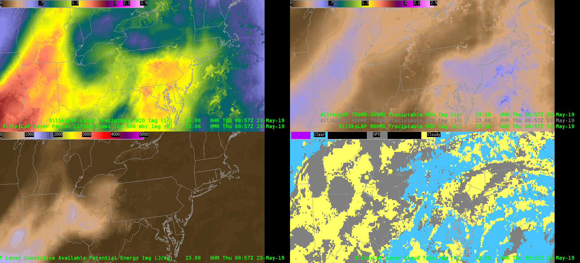
 An eastward moving plume of moisture and instability was clearly depicted in the GOES16-Merged GFS AllSkyLAP products. Estimated MLCAPE in the lower left panel is similar to the SPC mesoanlaysis data. Into central Pennsylvania, values were in the 500-700 J/kg range. So certainly on the low end for severe weather potential in the State College CWA based on instability alone. However, one interesting feature caught my eye in the 700-300mb AllSky PWAT analysis — a west-to-east band of low values advecting through Indiana and Ohio into western PA. This mid-level drying is attendant to the eastern periphery of an EML that originated over the southwest U.S. A plume of warmer 700mb temperatures in the RAP analysis matches up well with this dry band of mid-level air. With the chance for scattered convection later today in central PA, the influx of a dry mid-level layer may aid in the production of strong convective winds/downbursts. -Roy
Category: News
Examining the NUCAPS FCST of CAPE
Below is a loop of the NUCAPS CAPE forecast for the afternoon across the CTP CWA.
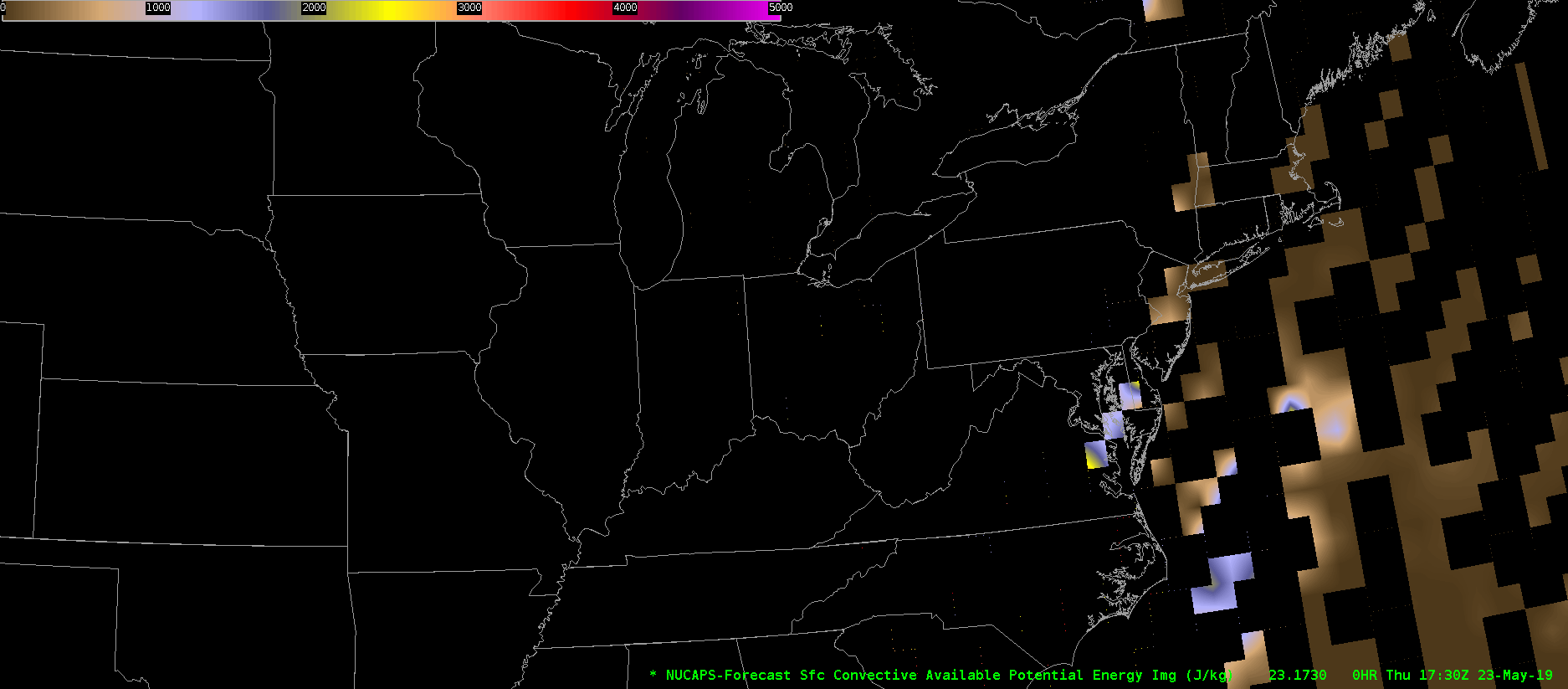
Unfortunately, the product is very blocky, and makes it hard to use, especially since some of the missing data is in the time and place where high impact weather may occur. It’s clear that it is trying to show some elevated CAPE moving across central Pennsylvania, but the values are very suspect to me given the missing chunks of information.
Thorcaster
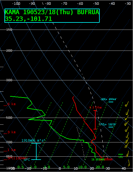
TX Panhandle AllSky CAPE
A moderate risk for severe weather across portions of the Texas Panhandle today. Some convection is already on going along and north of a nearly stationary front stretched from the northern Panhandle into Kansas. Despite the cloud debris, the All Sky layer CAPE product still looks to be doing an acceptable job of analyzing the degree of instability present in the area. 18z values near Amarillo match well with the 18z special sounding at KAMA with values generally between 1600-2000 J/kg. The blotchiness of the all sky product between clear/cloud cover is a bit distracting, but the difference in values is a small enough magnitude that it does not compromise the forecaster’s ability to use the product. 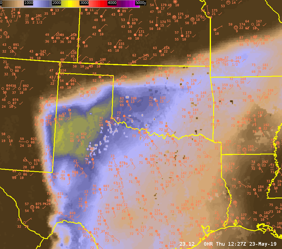
Dave Grohl
Verification of NUCAPS vs. Modified NUCAPS
NUCAPS data points from a polar orbiting NOAA-20 pass matched up with clear skies. The following NUCAPS profiles were from the extreme southwest part of Missouri.
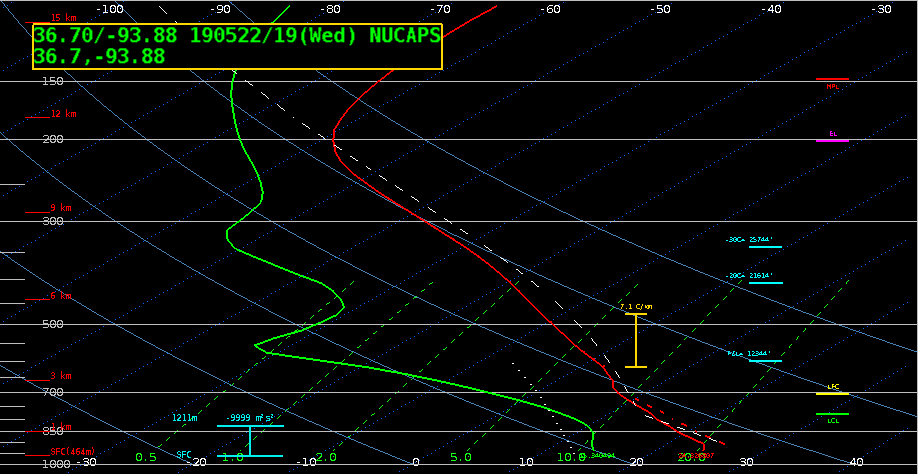
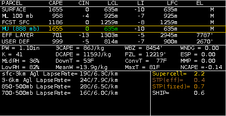
Unmodified NUCAPS profile from southwest Missouri, well south of Springfield. Surface dewpoint was estimated at 57-58 F. MUCAPE only up to 600 J/kg, with MLCAPE of 500 J/kg.
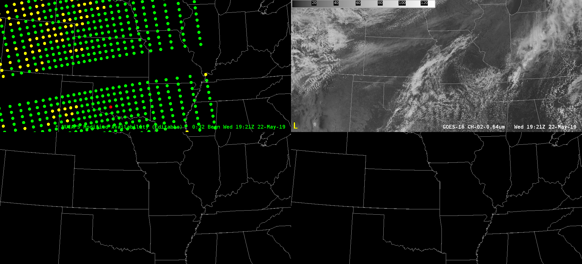
Modified NUCAPS data points from a NOAA-20 pass. Note data void through central Missouri….??? 🙁
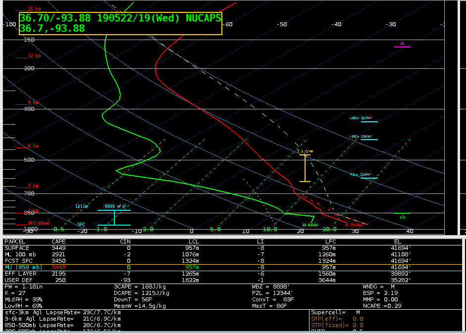
Modified NUCAPS profile in same location as the unmodified sounding. Surface dewpoint was estimated at 67-68 F. High MUCAPE up to 3500 J/kg, with MLCAPE at 2900 J/kg.
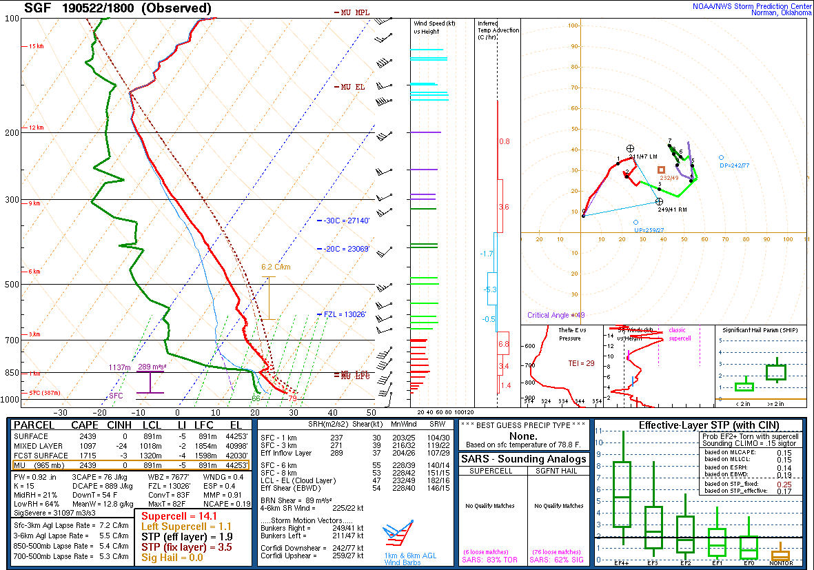
Observed sounding from Springfield, MO at 18Z. MUCAPE is 2500 J/kg, mixed layer down to 1000 J/kg. The surface dewpoint was about the same as that of the modified NUCAPS. But the difference in MU/MLCAPE is significant. I think the modified NUCAPS added value over the unmodified. Unfortunately, it seems a little overdone. With that said, the instability probably increased between the observed sounding time of 18Z and the satellite pass near 1920Z. An MUCAPE closer to 3000 J/kg is probably not too far off — maybe by ~500 J/kg. -Roy
GLM flash rate, size, and RGB with IR
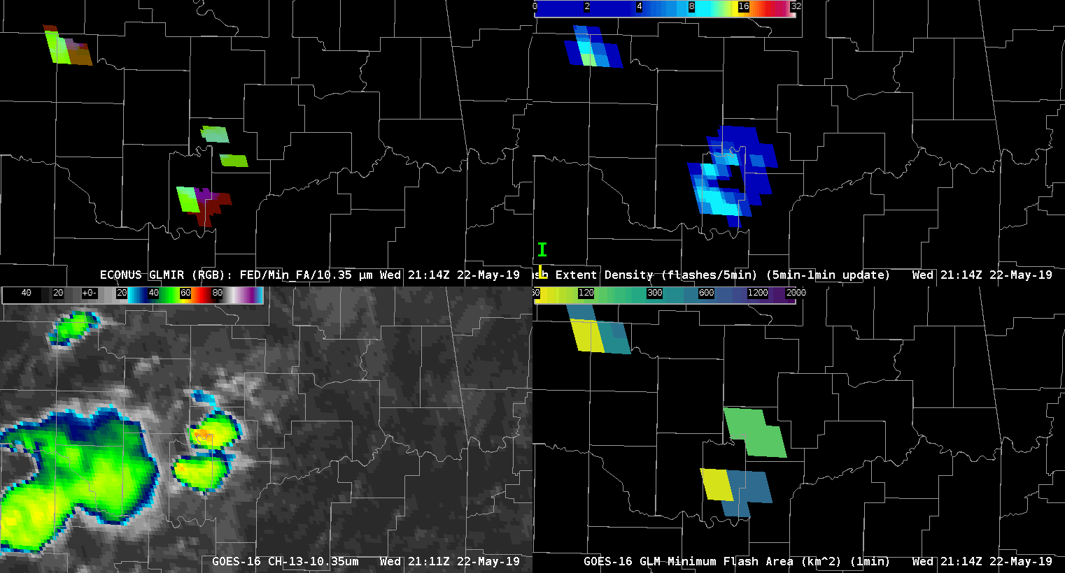
This pair of supercells near Tulsa, OK illustrates how flash rate and flash area information can complement one another. High flash rates and small flashes usually go together in a small updraft. However, at 2145 UTC the flash rate is much higher in the southern storm at the same time its minimum flash size is larger, with the opposite pattern in the northern storm. The northern storm was tornadic at this time. Shortly thereafter, the large flash rates decreased in the southern cell, and the average flash size became smaller, while cloud top brightness temperatures rapidly cooled and the extent of the anvil spread. The southern cell would soon go on to produce its own tornado.
The RGB panel in the top left combines the flash information together with the ABI 10.3 thermal infrared data: the coldest cloud tops and small flashes lead to a bright cyan color, and high flash rates push the colors further toward white. Early on the northern cell exhibits cyan colors while the southern cell is green and burgundy. Later, the southern cell becomes more cyan, while the northern cell takes on a more green hue.
Apparently, the jump in flash rate in the southern cell was an indicator of a strengthening updraft and the development of a mesocyclone. The drop in flash rate and minimum flash size might have been due to (1) a shift to small flashes that didn’t make as much light, (2) extinction of light by an increasingly ice-rich, optically thick cloud, or (3) other instrument artifacts. While the explanation is less than clear-cut, synthesis of multiple sources of information improves the ability to understand the observations.
-deeplycloudy
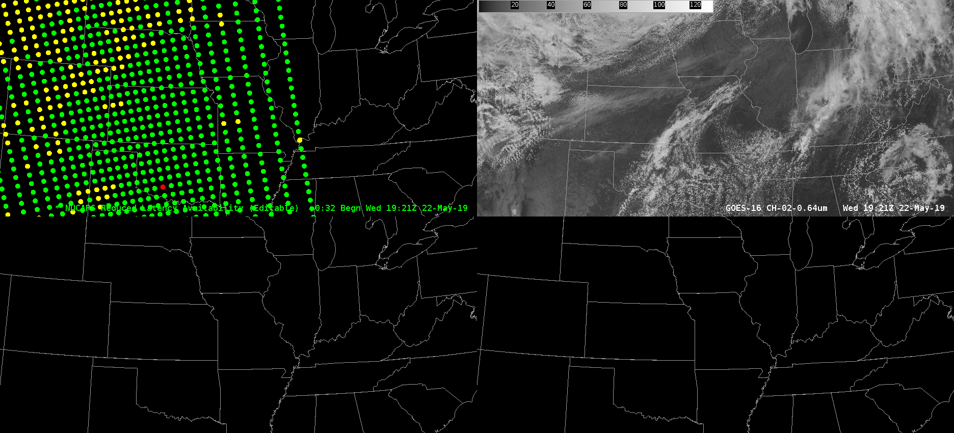
NUCAPS availability maps
Working the SGF CWA this afternoon, I wasn’t able to use the modified NUCAPS soundings, as there was a gap in the availability coverage right over that area. Below are maps of the modified sounding availability vs the reduced latency availability.
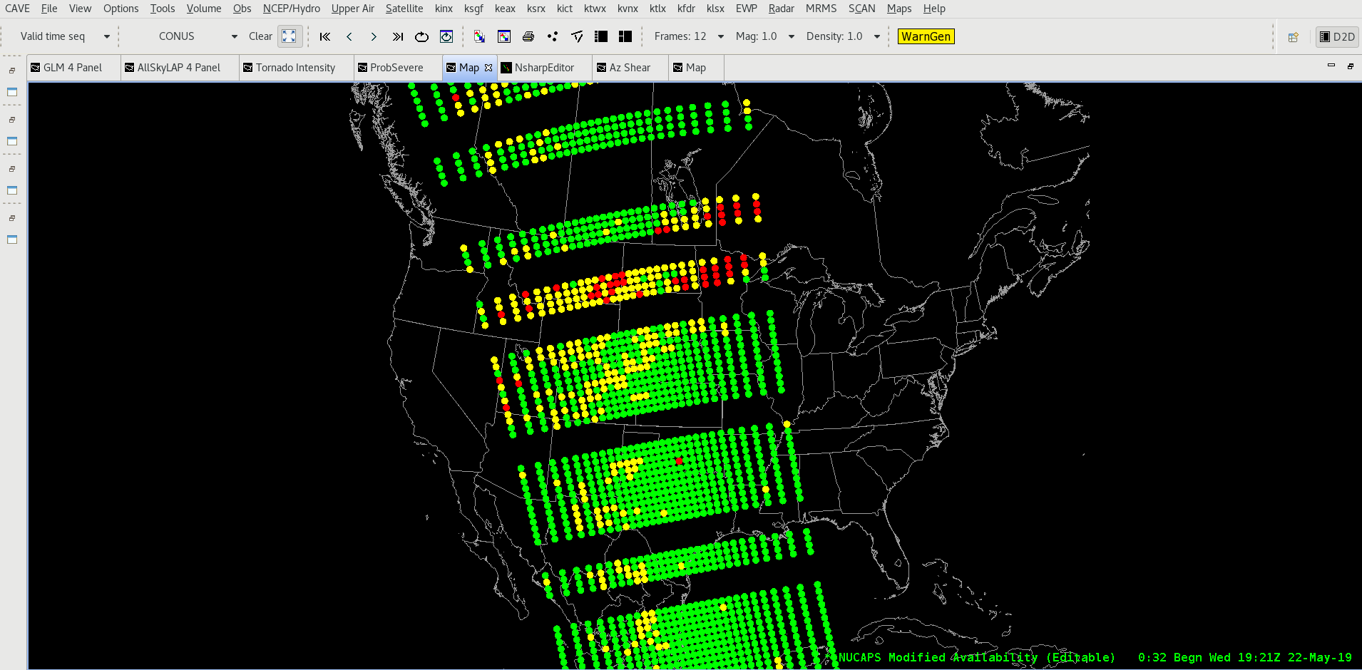
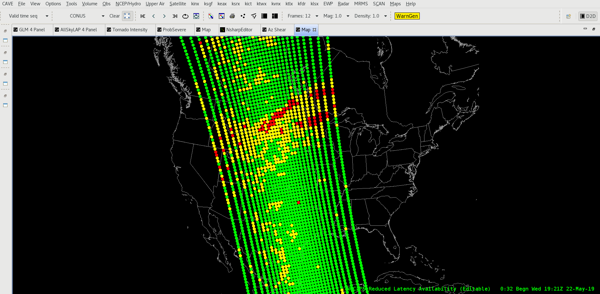
-64BoggsLites
NMDA Struggles to Identify Tight Rotation
The new MDA seems to be missing out an area of obvious rotation in central OK Wednesday afternoon. The new MDA (upper right) has no storm ID on the couplet, but the digital MDA (bottom right) has correctly identified the mesocyclone. The problems may be due to quality control within new MDA, as the rotation is occurring within an area of low reflectivity (upper left) and high spectrum width.

Dave Grohl
AzShear picks up circulation along QLCS
The AzShear product did a nice job of highlighting and pinpointing a developing circulation along the convective line, as shown in the 2 images below from and 2144z and 2146z from kmxx. Zooming out, it’s a great indicator of where to focus on the line for a potential spin-up (bottom image from 2150z)
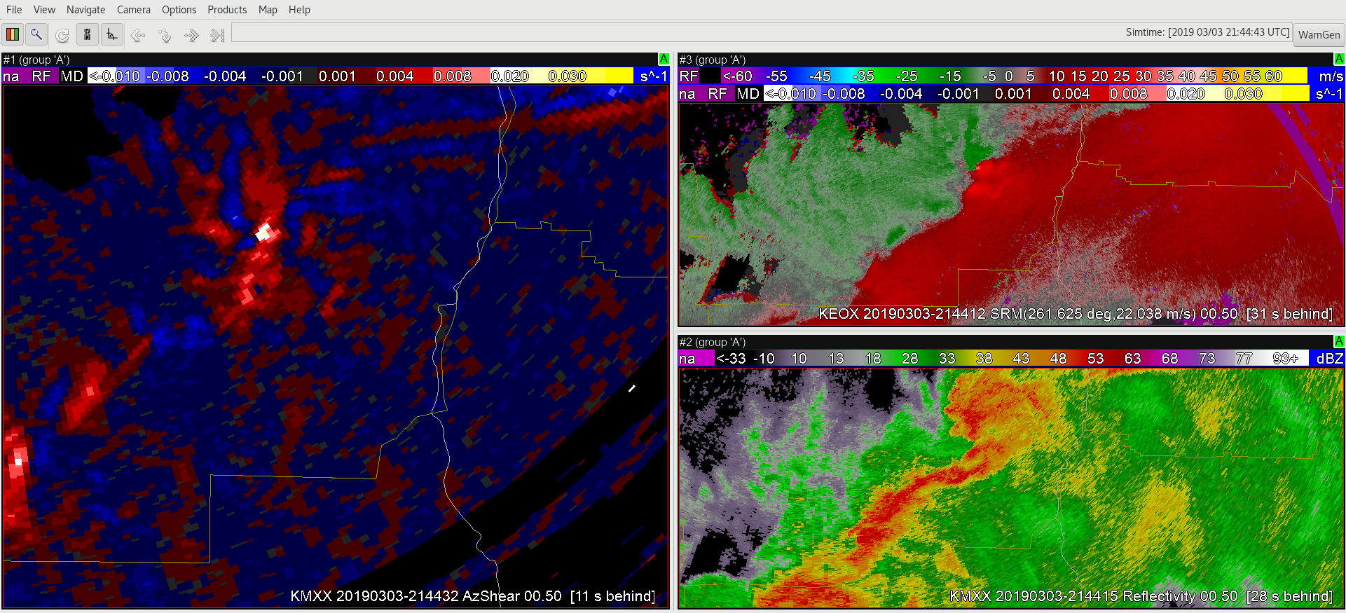
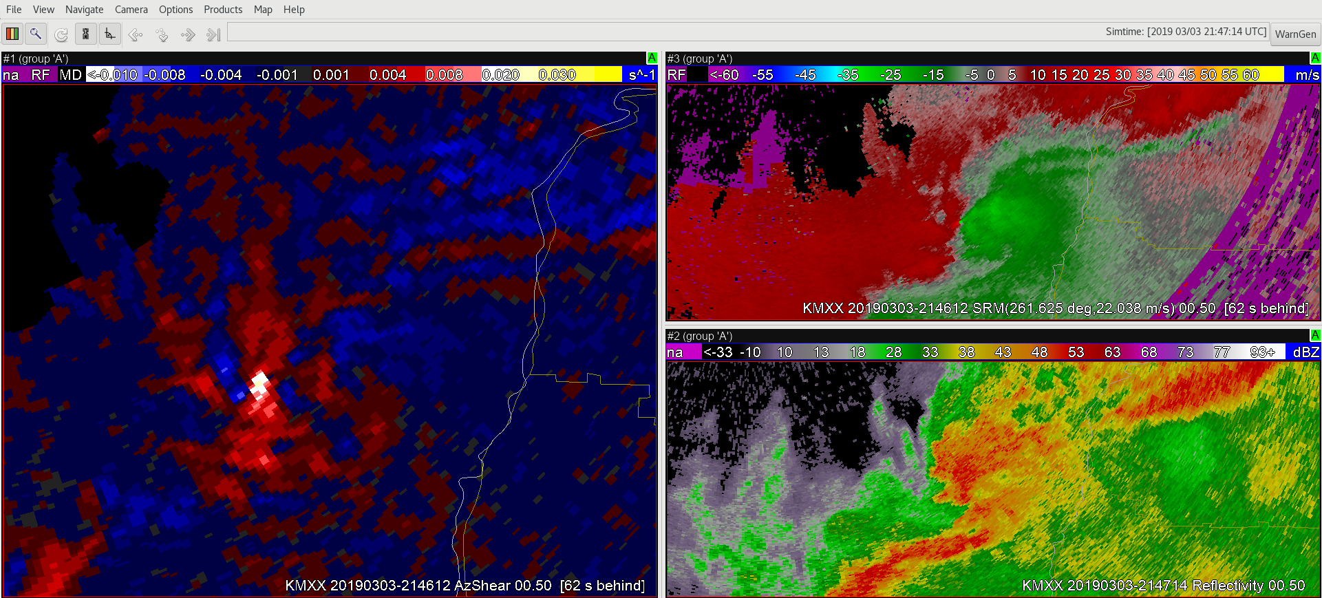
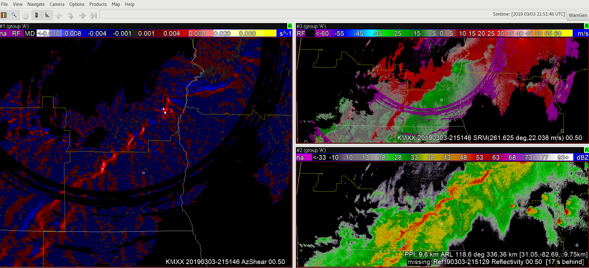
-64BoggsLites
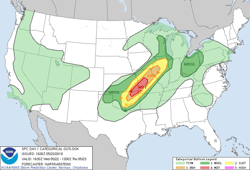
Another Busy Day Ahead
Today looks to be another active day in the HWT, with a moderate risk issued across portions of Oklahoma, Kansas, and Missouri. We will begin operating in the Norman, OK and Tulsa, OK CWAs monitoring for convective initiation with a risk for severe storms with all hazards possible including the risk for some strong tornadoes into the evening hours if storms can form and maintain themselves.
-Michael
Initial impressions of AzShear
Two things jumped out at me right off the bat regarding AzShear. First, the couplet in AzShear really jumps out and your attention becomes focused on this area for further interrogation. It’s a great tool to further investigate the rotation couplet and storm structure in the base data (top picture). Second, The couplet really jumps out in the AzShear product much better when compared to the merged products (bottom figure). Very impressive!
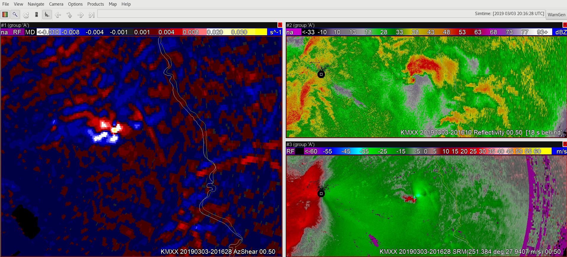
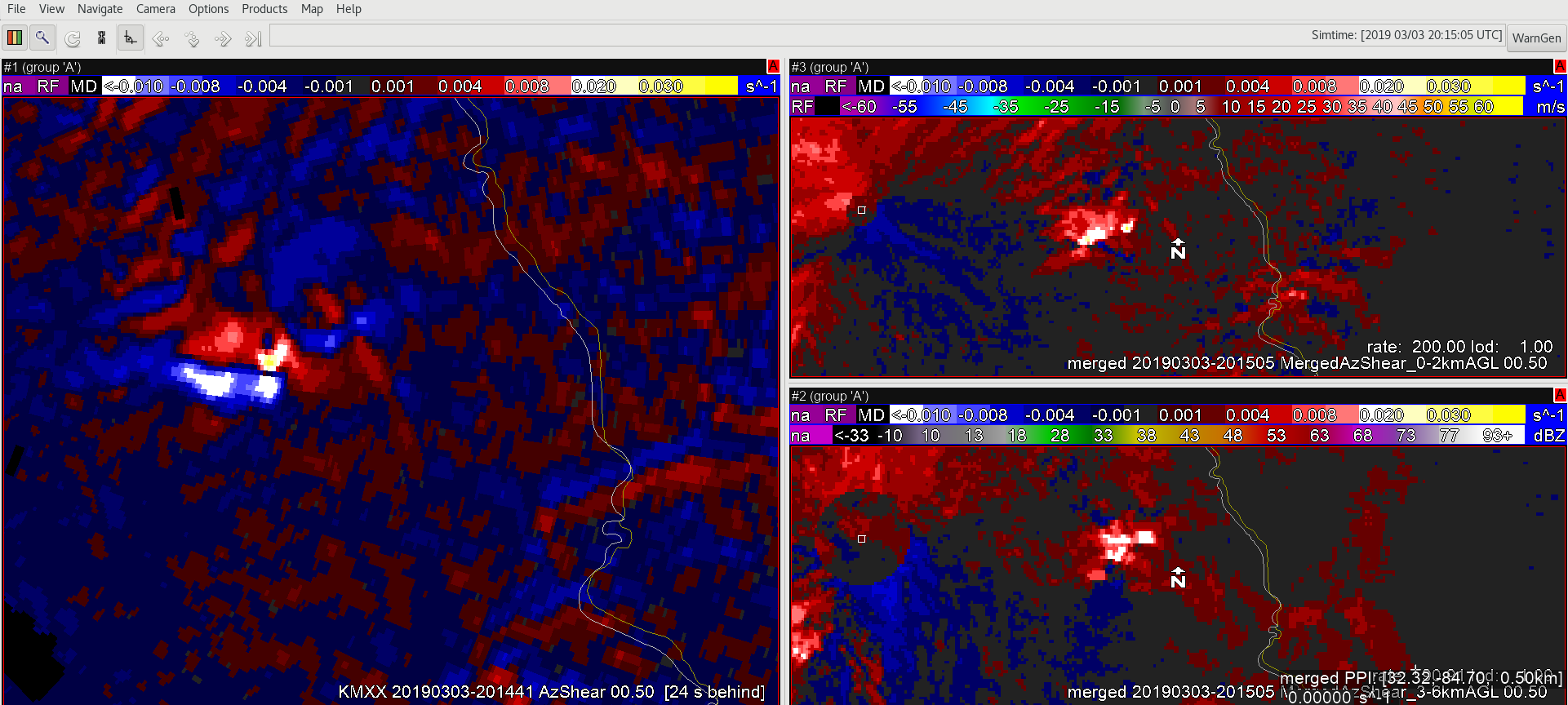 -64BoggsLites