
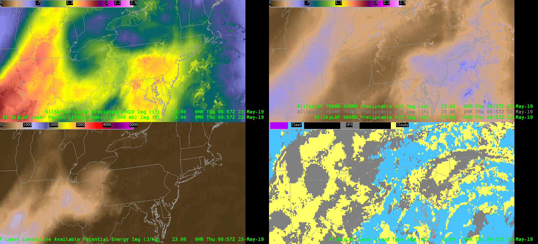
 An eastward moving plume of moisture and instability was clearly depicted in the GOES16-Merged GFS AllSkyLAP products. Estimated MLCAPE in the lower left panel is similar to the SPC mesoanlaysis data. Into central Pennsylvania, values were in the 500-700 J/kg range. So certainly on the low end for severe weather potential in the State College CWA based on instability alone. However, one interesting feature caught my eye in the 700-300mb AllSky PWAT analysis — a west-to-east band of low values advecting through Indiana and Ohio into western PA. This mid-level drying is attendant to the eastern periphery of an EML that originated over the southwest U.S. A plume of warmer 700mb temperatures in the RAP analysis matches up well with this dry band of mid-level air. With the chance for scattered convection later today in central PA, the influx of a dry mid-level layer may aid in the production of strong convective winds/downbursts. -Roy
Official websites use .gov
A
.gov website belongs to an official government
organization in the United States.
Secure .gov websites use HTTPS
A
lock (
) or https:// means you’ve safely connected to
the .gov website. Share sensitive information only on official,
secure websites.
EWP Blog
Spring Experiments & Beyond
