Low Level Rotation in QLCS

Looking at a tornadic QLCS event in eastern Mississippi, low level rotation is clear in both the 0.5 degrees SRM and Single Radar Az Shear. At 0.5 degrees, the radar is looking at approximately 1.94km ARL.

0.5 degree Az Shear, SRM and Reflectivity

At 1.8 degrees, as typical with QLCS tornado events, the rotation is present but not as strong. At 1.8 degrees, the radar is looking at approximately 4.45km ARL. The AZ Shear color curve still does a good job of highlighting the area of concern.

1.8 degree Az Shear, SRM and Reflectivity

Last I looked at the 0-2km merged Az Shear. There is clearly two areas near each other with high Az Shear values, which is clearly an artifact of either merging multiple levels and/or multiple times. As seen above, there is only one area of rotation. For this reason, I might prefer to look at the single radar non-merged Az Shear over the merged Az Shear — but will wait to see additional cases.

Merged 0-2km Az Shear

-Tempest Sooner

ProbSevere Helped to Hold Off On TOR Warning

Here is an example of a long lived supercell where the trends are very important to monitor. Notice the uptick in Prob TOR but then backed off.  AZShear has been impressive for several volume scans.  Prob TOR trends kept me from issuing a TOR warning, and provides some security in not issuing a warning along with other products.  As a side note,  it would be nice to sample some sort of maximum wind gust product, much like we get from MESH with the estimated max hail size.

ZDR_Arcophile

Case Study AzShear

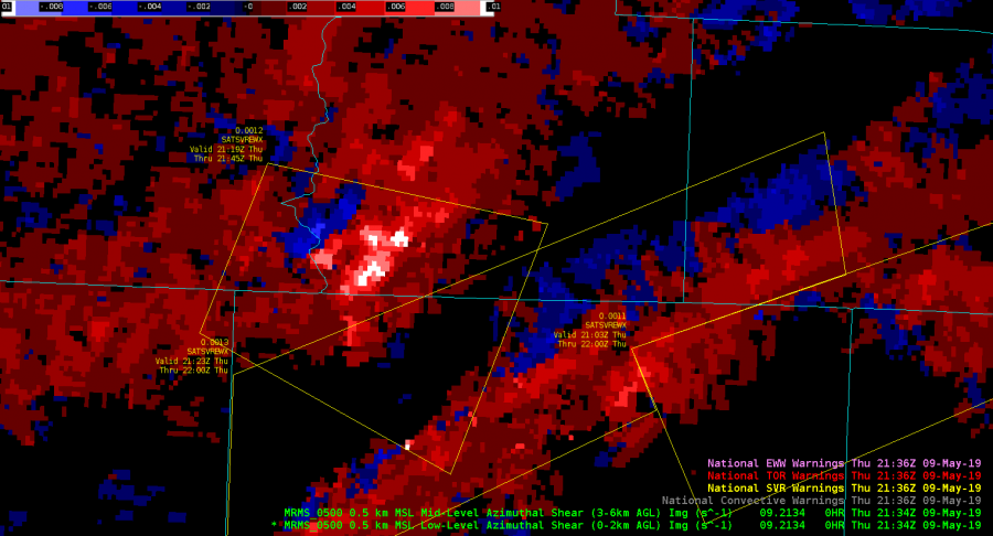
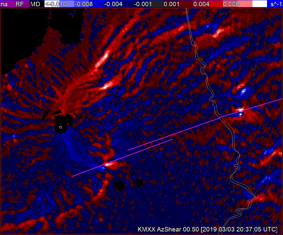
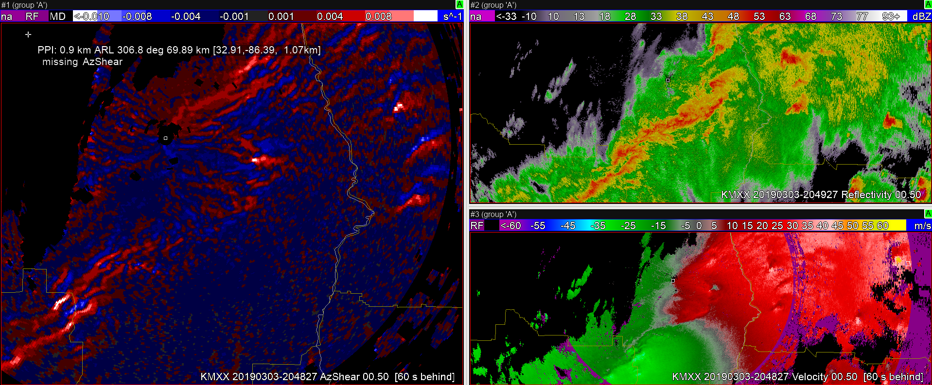
As the case study begins, having had the weather brief of the situation, my initial intention is focused on the supercell east of the surface low ahead of the cold front line. At 2013 I notice in the merged AzShear producing a line of cyclonic vorticty farther west. Looking linear and relatively disorganized on reflectivity and velocity (0.5-1.3) my attention returns to the likely tornadic supercell approaching the GA state line.


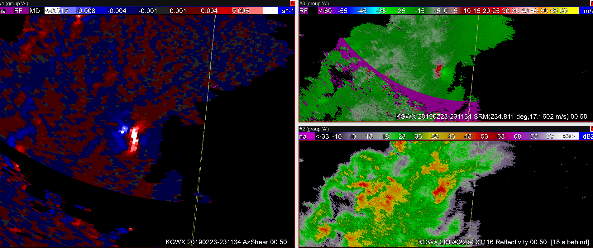
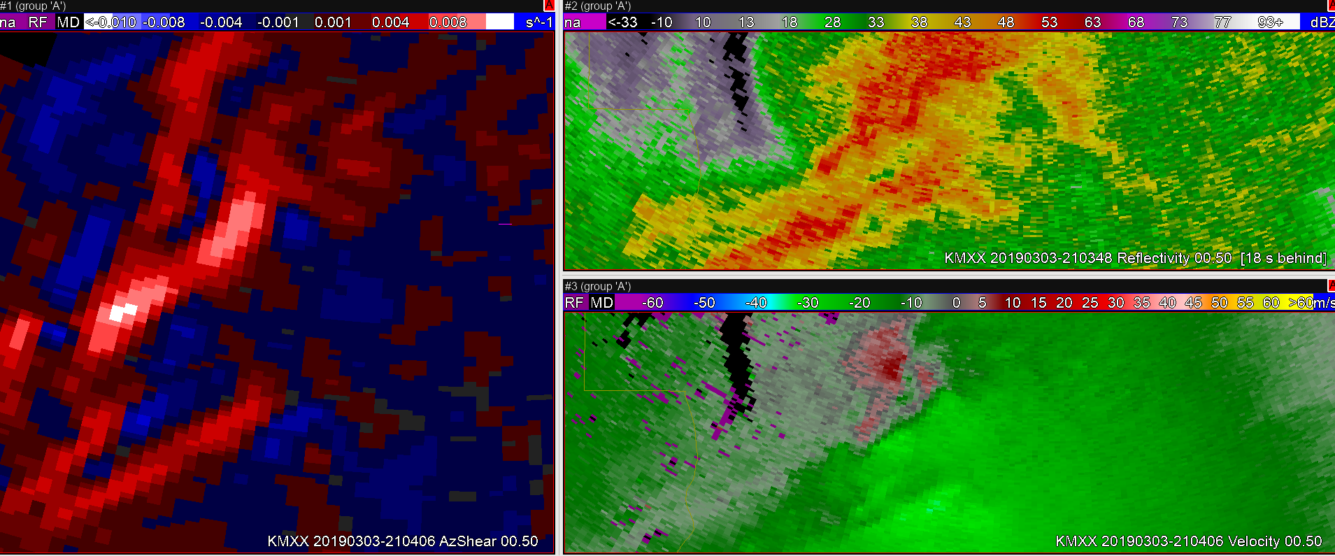
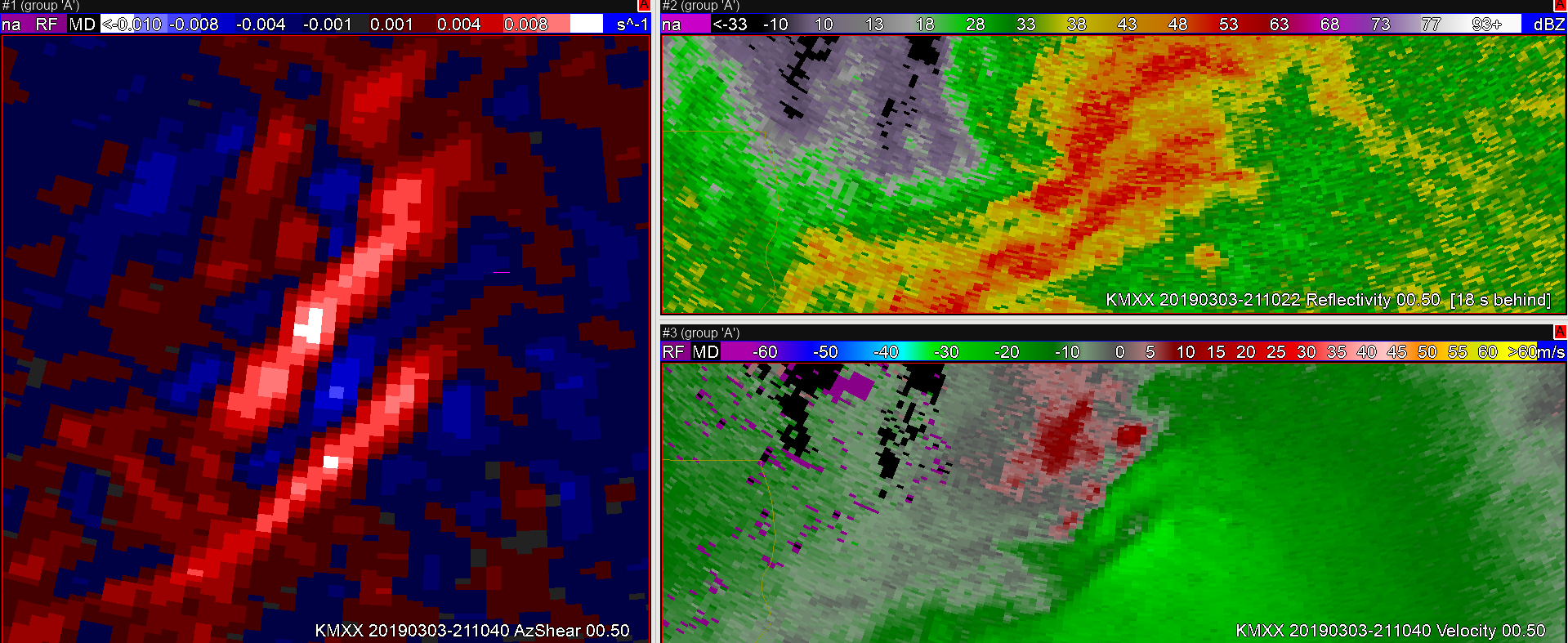
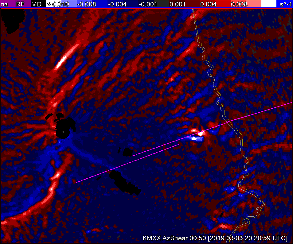
However, in walking back through the data a little, I happened to look at the EOXAzShear product at 2016. This view looks much less linear with the updraft on the northern extent of the lint that stretches along the cold front to the low. If I only had the merged AzShear product with the MXX reflectivity/velocity at the time, I’m not sure I would’ve caught this updraft. By 2019, a velocity couplet is becoming apparent in the .5 degree vel data from MXX with the trailing storm.

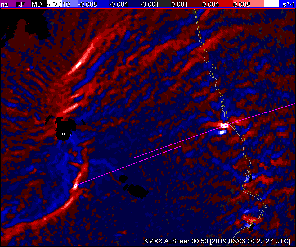
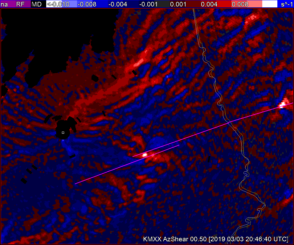
The merged AzShear product does show an increase in cyclonic vorticity with the trailing cell from 2010 to 2019. Also rotation tracks is beginning to track the circulation center in earnest from 2015-2019. The development of this circulation given the storm  position from the radar makes the circulation difficult to detect to the eye, even increasing vertically in the volume scan, so the suite of shear products, particularly the ability to view the storm differently in the single site AzShear products helped me to detect the developingd circulation in the trailing cell on the northern end of the line that I may not have seen in a timely fashion in real time without that data. 

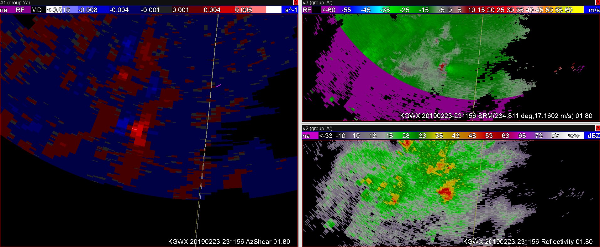
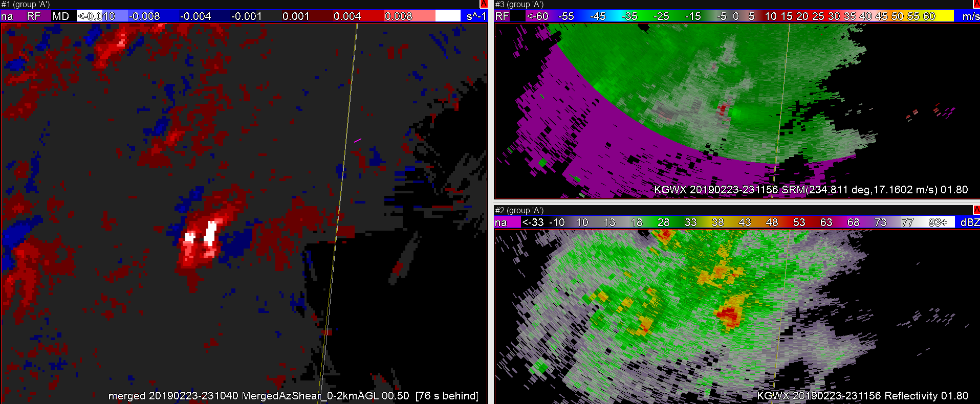
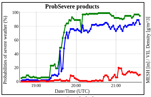
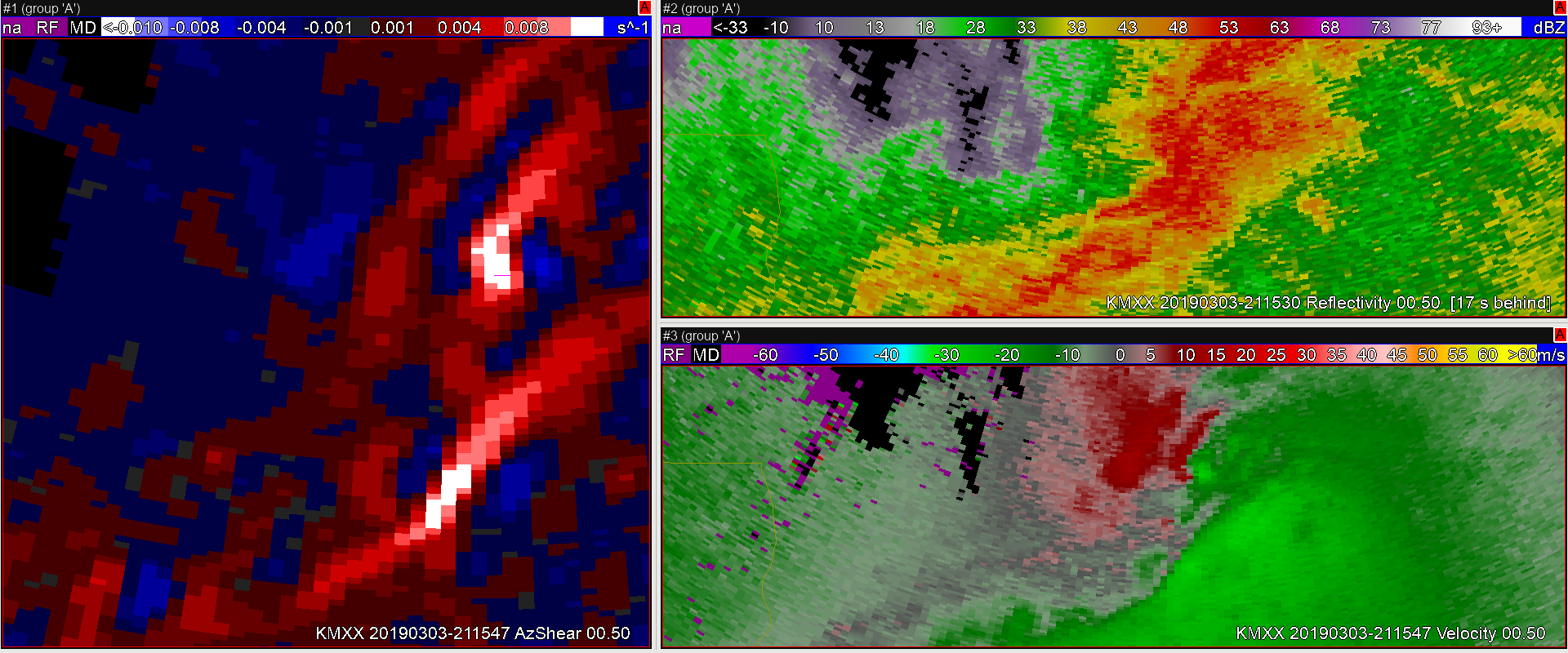
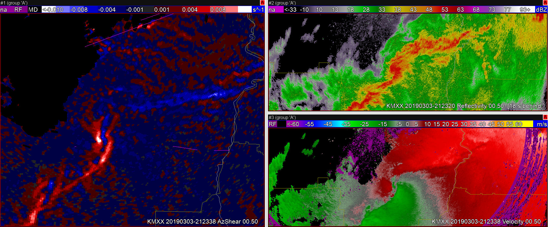
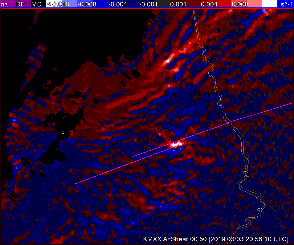
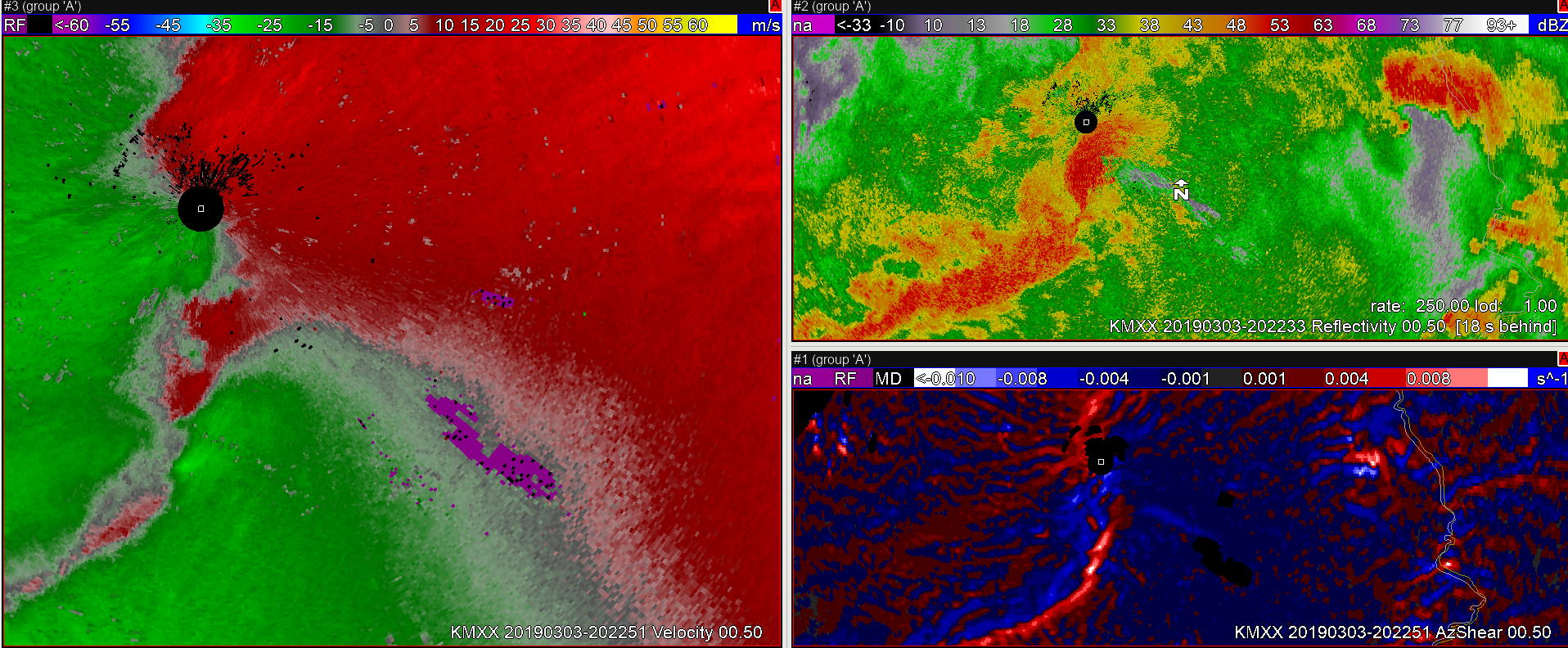
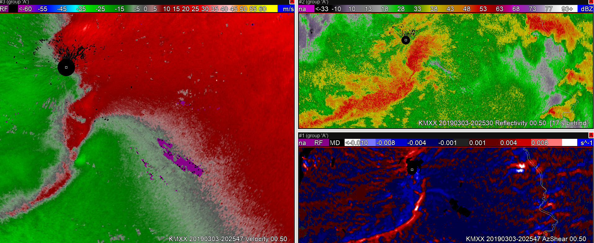
As the first supercell is crossing the state line, both the single site MXX AZShear product and the merged rotational track products both more clearly show the likelyhood of a tornado compared to the MXX vel data, a trend that  continued as the circulation crossed into western GA. Having the single-site AzShear products likely would have been an important additional to tool to the realtime warning forecasters on this day.

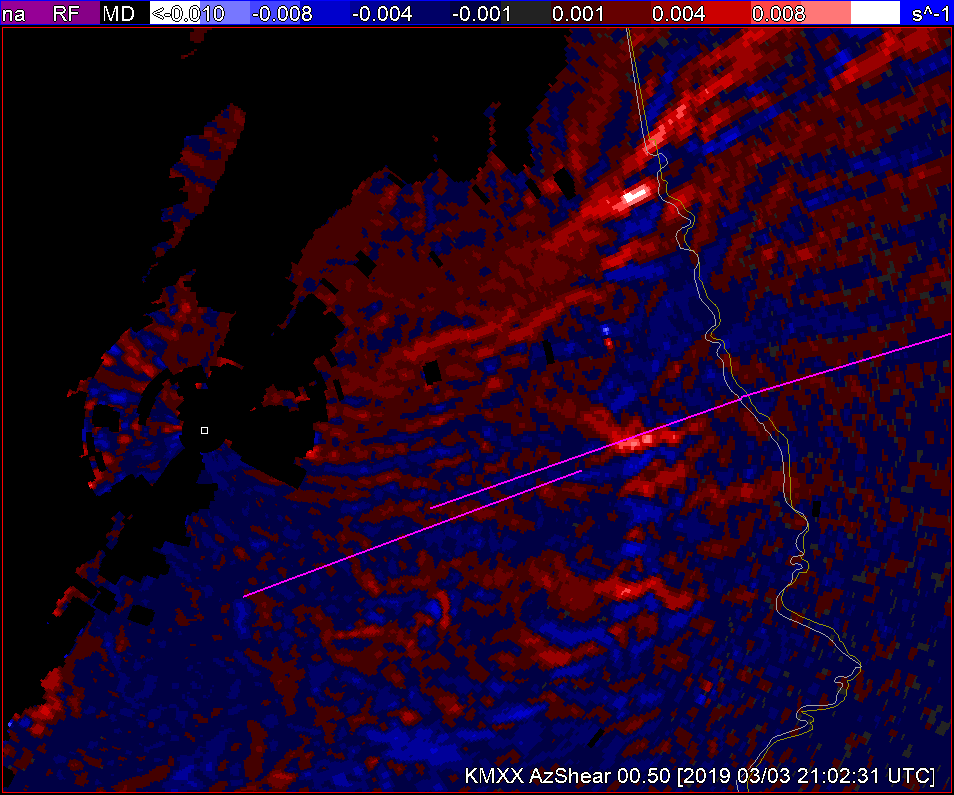
From a situational awareness perspective on the larger view in covering this day, I find for me that the ability to see the single site AzShear products is more effective to me than either the merged AzShear or the rotation tracks to find other circulations of interest that would need at least interrogation from additional warning forecasters in addition to the two main tornadic storms.

-icafunnel


Lead Time Galore w/ AzShear

I continue to be impressed with the POD with AzShear. It’s FAR may be a bitter higher but is probably better than many offices, from what I’ve seen. I think it has a good application for lead time improvement. Take this example of tornadogenesis shown below…

You can track the ‘object’ of the maximum localized AzShear signature from genesis (at 2145 UTC) back around 20-25 minutes! (at 2122 UTC, depending on a subjective start time)…

While I would expect these AzShear Hot Spots (trademarked, but I’ll let you use it) to be perfect, so far in these marginal cases, it seems to perform fairly well.

#ProtectAndDissipate


AzShear shows increasing vorticity along a gust front resulting in a weak, brief tornado

In this case, a weak brief tornado was formed along a QLCS. These are typically the hardest tornadoes to warn upon given their limited impacts, but there are usually storm structures that can be identified within the radial Velocity fields than can give some indication to formation. In this case a convergent vorticity signature can be spotted in the KMXX velocity field, at this time AzShear begins to increase as well.

Later AzShear, continues to show a signature of increased vorticity along the gust front.

Finally, genesis. TaaDaa!

The AzShear threshold, continues to be met well after the tornado dissipates. So it’s not the perfect tornado indicator. However, the velocity field looks as if tornado potential could still be possible, and as a forecaster I would probably hold onto the warning regardless (especially given previous long track tors and guidance).

#ProtectAndDissipate


A Tail of Three AzShear Hot Spots

At 2049Z, AzShear is showing 3 “hot spots”. It still continues to pick out the two tornadoes to the east fairly well, but is also showing an increased signature to the WSW which doesn’t appear to be materializing.

#ProtectAndDissipate

AzShear showing signs of rotation just before TVS appears

No dissipating today! Probably because this case already happened…

Starting out with the AzShear case study, I can already see some of the lead time AzShear can help bring to some of these warnings. On this day, given environmental parameters, it wouldn’t take much to issue a warning with these storms. Even then AzShear help highlight potential areas of rotation where the radar velocity field looked primarily convergent.

2200Z:

2201Z:

2203Z: Now the radar velocity field is showing more signs of a potential TS.

2204Z: Thank goodness for SAILS3! Boom,  AzShear lights up like a Christmas tree with a partial TVS (inbound velocities are a bit wonky)

With the AzShear, lead time may have been increased by about 3-4 minutes if you were waiting for a rotational signature before issuance

#ProtectAndDissipate