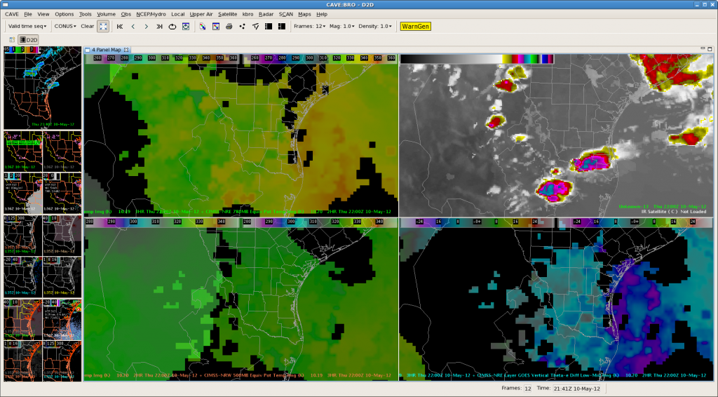
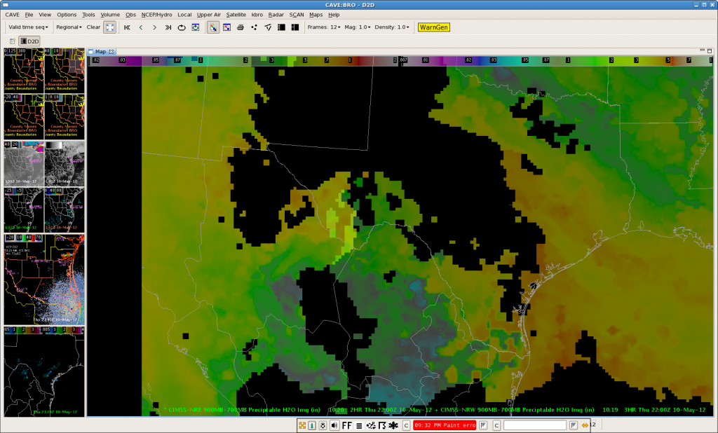
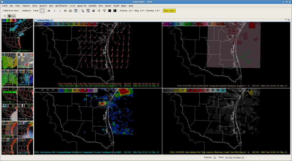
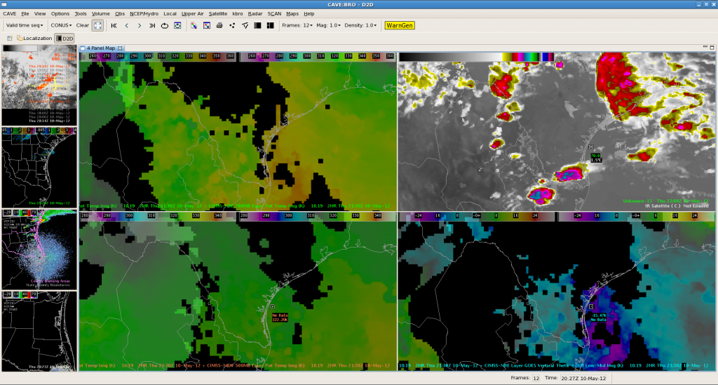
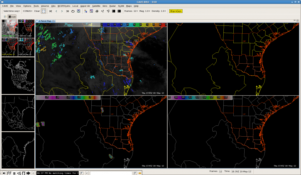
These two nearCast screen captures depict the main axis of theta e/PW that was translating east of the BRO. Ample moisture remains over the eastern and southern parts of the BRO CWA and support thunderstorm development. Sadly, convection continues to be inhibited and is reflected on the 3DVAR sim. comp. reflectivity. RN/AMS
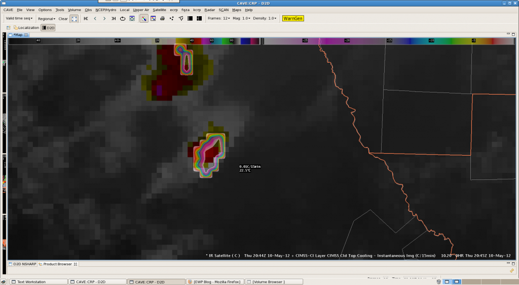
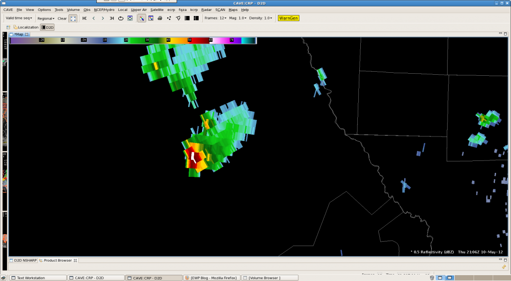
CRP: Mexico! CTC shows a rapidly developing thunderstorm
BRO Meso Analysis with Nearcast/Sythetic WRF at 2030Z
The below image at 22Z depicts nearcast theta-e at 780 mb in the upper left pane, synthetic WRF IR in the upper right, nearcast theta-e at 500 mb in the lower left, and nearcast vertical theta-e difference low-mid in the bottom right.
Looking at the 780 mb theta-e, it shows areas in yellow of best moisture/instability predicted for this afternoon which matches up with storms predict in synthetic IR imagery. Because the 2 products derived off of different model projections are in decent agreement, this lends more confidence to this convective scenario for this afternoon.
AMS/Nunez
3DVAR: Corpus Christi 1940-1950 UTC
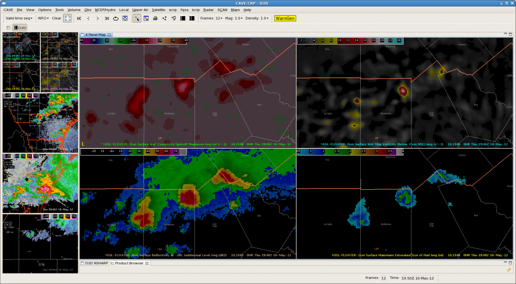
3 training supercells are currently moving across the northern counties of the CRP CWA. Ryan & Jeffrey have issued TOR warnings on all 3 of the storms & have been interrogating a number of 3DVAR products and integrating them with base CRP radar data.
The maximum updraft product has quickly become a go-to for situational awareness and quickly evaluating which storms strengthening/weakening…
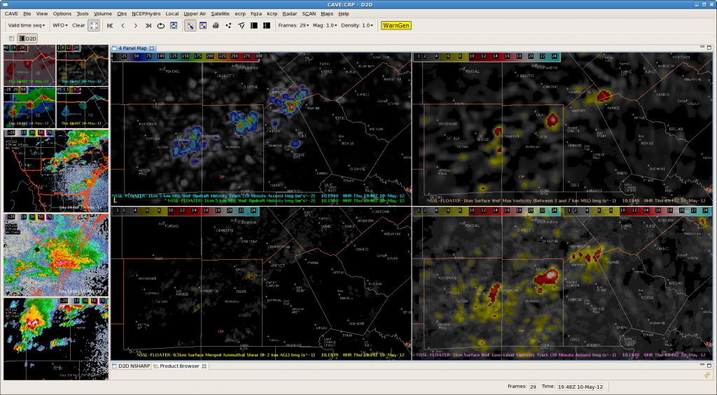
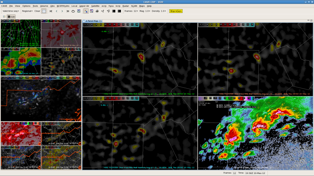
Local storm reports and trained spotters have reported a number of funnel clouds and a couple of tornadoes with the storms over the past hour.
-Kristin C.
BRO MESO Desk @ 20Z
…added Raymondville to the line position…
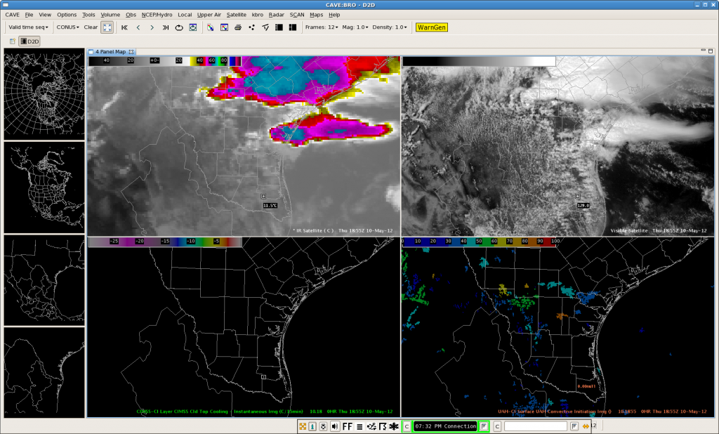
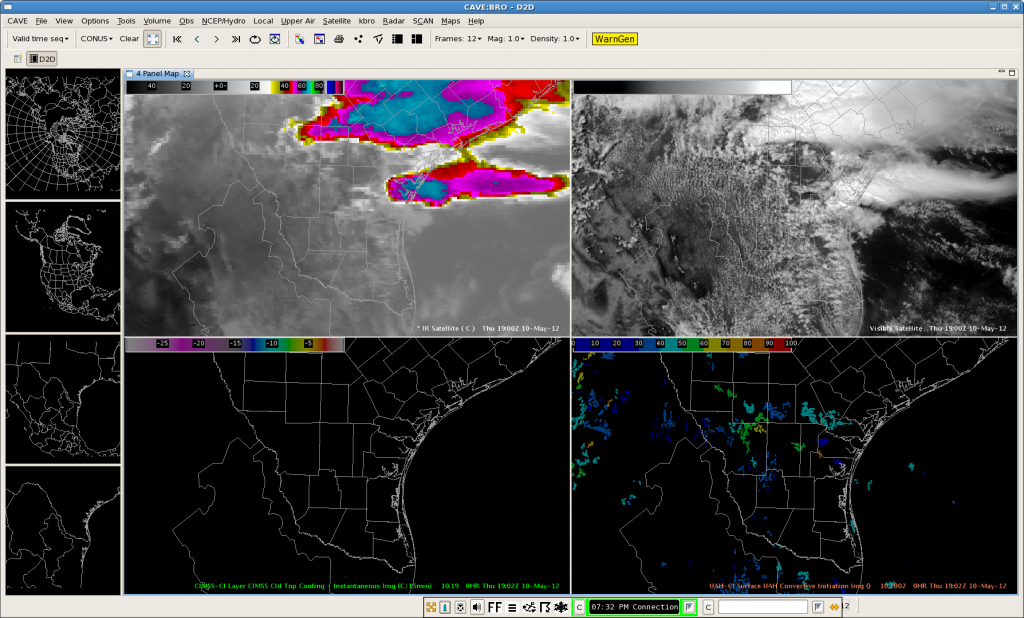
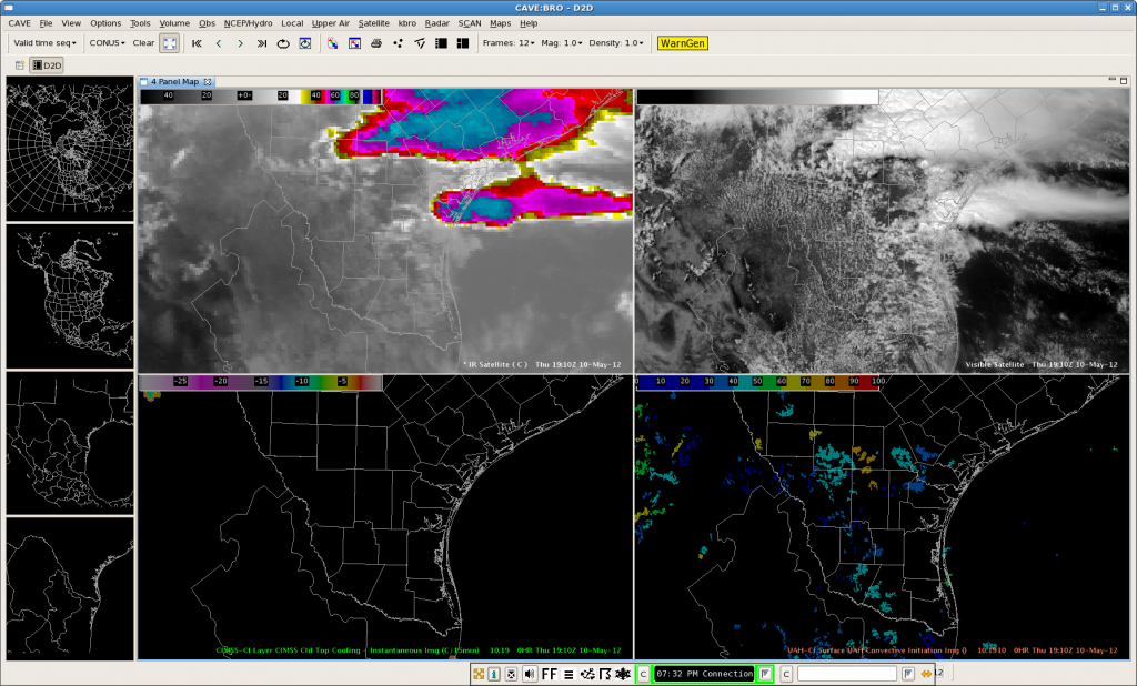
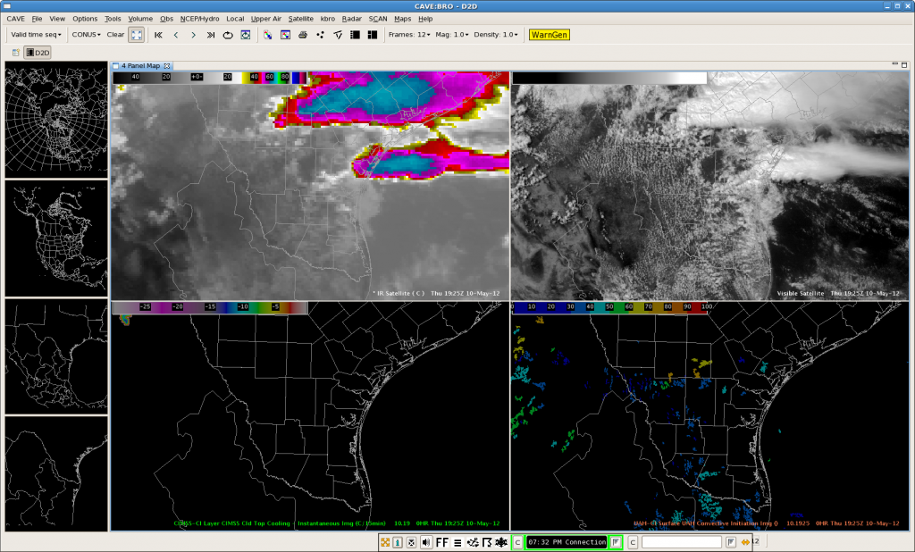
The following four screen captures depict several favored areas of UAH-CI strength of signal along the outflow boundaries that exist immediately north of CWA and north-south along a line from Los Angeles-Realitos-Encino-Raymondville. Knowing were the boundaries were located, UAH strength of signal allowed us to focus on the most favored areas between 20Z-21Z. (Synthetic Sat showed the most likely CI would take place between 20-21Z, particularly with storms along the Rio Grande. It didn’t capture any activity over the northern extent of the outflow boundary.) Nunez
BRO Afternoon Forecast 1920Z
Synthetic WRF imagery was useful in making a convective forecast for Brownsville this afternoon. At 13Z, the synthetic WRF depicted two areas of convection over TX with the south complex near Brownsville being slightly displaced to the south in location. This convection was occurring in an area of high shear ahead of an upper level low progress slowly across the southwest U.S. (seen in synthetic and observed imagery).
13Z Synthetic:
13Z Observed IR/WV (top 2 panes):
At 19Z synthetic and observed IR/WV imagery matched up well with the southern complex, but over did convection to the south of the northern complex in TX. Over Brownsville area, visible satellite imagery depicted a low broken cu field at 1914Z which matches low clouds in the synthetic IR imagery.
19Z Synthetic:
19Z Observed IR/WV (top 2 panes):
1914Z Visible Sat:
Conclusion: The Synthetic WRF model seems to be doing an OK job overall so far today with a few issues. However, it depicts the upper low driving convection today as well as 2 distinct areas of convection over TX.
For Brownsville area for the rest of the afternoon, synthetic images below predict convective initiation around 20Z with convection strengthening through the afternoon hours (22Z image), and then beginning to decrease in strength at 0Z.
20Z Synthetic:
22Z Synthetic:
0Z Synthetic:
AMS/Nunez
CRP Desk-Tornadic Supercells 2:08 PM
Several supercells have developed this afternoon along CRP’s northern CWA, in addition to an isolated tornadic supercell a few miles southwest of Corpus Christi. At least 2 tornadoes have already been reported with the north eastern most storm, and the isolated storm near the coast. The 0.5 degree reflectivity can be seen below on the left. On the right, the top left panel shows the composite updraft maximum, the top right contains the max vorticity through the lowest 3 km, the bottom left is the reflectivity at -20C (very large hail with the one near Corpus Christi), and the bottom right the MESH. The 3DVAR products on the right are about 5 minutes before the radar image.
BRO MESO desk @ 1834Z
Outlook: 10 May 2012
The SW U.S./Mexico cutoff low is now ejecting through SW Texas, with a strong subtropical jet bending under it providing ample deep-layer shear. Very warm and moist onshore flow from the Gulf of Mexico is impact south Texas. At the starting time of operations, severe convection was already on-going. Also expect additional development within the warm sector, perhaps initiating over the higher terrain of NE Mexico before moving across the Rio Grande into the U.S. later this afternoon and evening.
Our teams are operating as Corpus Christie, TX (CRP) and Brownsville, TX (BRO). The CRP team is jumping in on active severe convection. The BRO team is waiting for CI in their CWA and to the west in Mexico.
Here is the SPC Day 1 outlook:
Greg Stumpf, EWP2012 Week #1 Coordinator
Webinar: “Tales From the Testbed” (Week 1)
This Friday, 11 May 2012, WDTB (NWS) and NSSL (OAR) invite you to participate in the 2012 Experimental Warning Program (EWP2012) taking place in the Hazardous Weather Testbed (HWT) in Norman, OK. We will be facilitating a short (22 minute!) webinar providing you assessments by the HWT’s first week’s visiting meteorologists addressing effectiveness of this year’s warning-related research techniques. These research products and techniques cover:
- Prototype satellite applications (GOES-R)
- 3D-VAR and its applications
- OUN WRF (on-station 15-minute-time-resolution model output run every hour)
The goal of these 5 weekly webinars it to provide you insights into the very latest tools and techniques under development and consideration for use in an operational warning environment.
Presenters: This initial week’s webinar presentation will be provided by the following operational meteorologists:
- Andrea Schoettmer – Louisville, KY, WFO (LMK)
- Roland Nunez – Houston, TX, CWSU (ZHU)
- Ryan Barnes – Norman, OK, WFO (OUN)
- Jeffrey Hovis – Charleston, WV, WFO (RLX)
When: May 11, 2012 12:00-1:00 pm CDT/17-18Z
Logistics: To participate in this webinar call WDTB 5-10 minutes prior to the webinar start time of 17Z. Dialing in once the session has begun interrupts the audio.
Use this conference line:
1-877-954-4462 (Pass Code 743889#)
Use this GotoWebinar link:


