EWP2012 PROJECT OVERVIEW:
The National Oceanic and Atmospheric Administration (NOAA) Hazardous Weather Testbed (HWT) in Norman, Oklahoma, is a joint project of the National Weather Service (NWS) and the National Severe Storms Laboratory (NSSL). The HWT provides a conceptual framework and a physical space to foster collaboration between research and operations to test and evaluate emerging technologies and science for NWS operations. The Experimental Warning Program (EWP) at the HWT is hosting the 2012 Spring Program (EWP2012). This is the fifth year for EWP activities in the testbed. EWP2012 takes place across five weeks (Monday – Friday), from 7 May through 15 June. There are no operations during Memorial Day week (28 May – 1 June).
EWP2012 is designed to test and evaluate new applications, techniques, and products to support Weather Forecast Office (WFO) severe convective weather warning operations. There will be three primary projects geared toward WFO applications this spring, 1) evaluation of 3DVAR multi-radar real-time data assimilation fields being developed for the Warn-On-Forecast initiative, 2) evaluation of multiple CONUS GOES-R convective applications, including pseudo-geostationary lightning mapper products when operations are expected within the Lightning Mapping Array domains (OK/west-TX, AL, DC, FL), and 3) evaluation of model performance and forecast utility of the OUN WRF when operations are expected in the Southern Plains.
NEW FOR 2012:
(After this week, this section will not be included in the summaries)
Based on the experience gained from our first five years of operations, the EWP is experimenting with a few changes in our weekly and daily operations for 2012:
1) On-station training shift
Based on feedback from former EWP spring experiment participants, we are providing the training and orientation materials for our spring experiment online. Forecasters will now go through the material in an 8-hour self-paced course to be taken during an on-station supernumerary shift within two weeks prior to their arrival at the Hazardous Weather Testbed in Norman. A WES Virtual Machine archive case DVD was also sent to the participants as part of the training regimen. This freed up our Mondays as a real-time operations day (giving us 4 days for the week, instead of only 3 days).
2) Flex shifts
Again, based on feedback from former EWP spring experiment participants, we developed a new shift schedule that provides for some flexibility to account for variable severe weather event times. Typically, we have operated in the 1-9pm time frame to capture the most likely times for severe weather in which to conduct our experimental warning operations with live data. These shifts sometimes ended prior to the peak of some severe weather events.
We are now running a flexible shift schedule during Tuesday, Wednesday, and Thursday, pre-determined the prior day via a day-2 forecast Typically, the shifts will run from 1-9pm. However, if weather conditions warrant, we may run the shift on either of these alternate times: 12-8pm, 2-10pm, 3-11pm. The Day 2 shift decisions are posted as a shift status message on the EWP Blog and mailed out to the participants at the end of the previous day’s shift. Note that our Monday shifts will always be 1-9pm, and our Friday shifts from 9am-1pm.
3) “Tales from the Testbed” Webinars
With the generous assistance of the NWS Warning Decision Training Branch (WDTB), we are embarking on a new feature of the spring experiment. Each Friday of the experiment (11 May, 18, May, 25 May, 8 June, 15 June), from 12-1pm CDT (1-2pm EDT), we will be conducting forecaster-led Webinars known as “Tales from the Testbed”. The format will be similar to WDTB’s Dual-pol “Storm of the Month” Webinars. At each Webinar, each visiting NWS forecaster will summarize their biggest takeaway from their week of participation in the testbed. After the short presentation, there will be a 30 minute q&a session with the audience. The audience is for anyone with an interest in what we are doing to improve NWS severe weather warnings, including field personnel, regional and national headquarters folks, and our other stakeholders in the NOAA labs, the GOES-R office, the NextGen program, and elsewhere. The Webinars will be posted to the EWP2012 Web page, the EWP Blog, and on the WDTB Web site a few days after they are presented.
WEEK 1 SUMMARY:
Week #1 of EWP2012 wrapped up during the week of 7-11 May. The week was dominated by a split jet stream flow regime, with the best shear associated at the base of a cutoff low over the southwest U.S., affecting southwest and southern Texas and adjacent New Mexico. However, we did get to work one day on the southeast coast as well. During this week, NSSL, the GOES-R program, and the NWS Decision Support Services Pilot Project hosted the following National Weather Service participants: Ryan Barnes (WFO, Norman, OK), Jeffrey Hovis (WFO, Charleston, WV), Roland Nuñez (CWSU, Houston, TX), and Andrea Schoettmer (WFO, Louisville, KY). Other visiting participants this week included Justin Sieglaff (UW-CIMSS), John Walker (UAH), David DeWitt (OAR), and Amanda Terborg (GOES-R AWC liaison, Kansas City, MO).

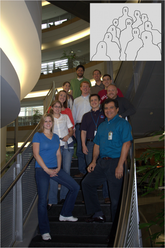
Photo: 1) Andrea Schoettmer (WFO, Louisville, KY), 2) Amanda Terberg (CIMMS/GOES-R – AWC liaison, Kansas City, MO), 3) Madison Miller (CIMMS/NSSL), 4) Kristin Calhoun (CIMMS/NSSL), 5) Gabe Garfield (CIMMS/WFO Norman, OK), 6) Greg Stumpf (CIMMS/NWS-MDL), 7) Darrel Kingfield (CIMMS/NSSL), 8) Chris Siewert (CIMMS/SPC/GOES-R), 9) Roland Nuñez (CWSU, Houston, TX), 10) John Walker (UAH), and 11) Ryan Barnes (WFO, Norman, OK). Photograph by Jim LaDue (NWS/WDTB).
REAL-TIME EVENT OVERVIEW:
7 May: Moderately severe weather and one tornado in Central TX.
8 May: Just a few marginally-severe storms over southern NM; a big hailer in southern TX.
9 May: More marginally-severe storms, this time over coastal SC and GA.
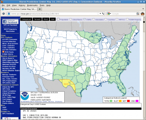
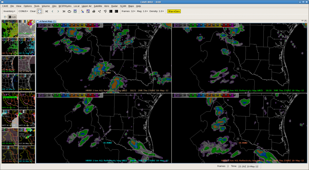
10 May: Supercells with large hail and tornadoes in south TX.
FEEDBACK ON EXPERIMENTAL PRODUCTS:
NSSL 3DVAR DATA ASSIMILATION:
- Useful for determining when winds meet 40 mph CWSU criteria.
- 3DVAR products showed rotation in the storms (based on multi-radar integration) better than the single radar data did. The multiple-radar integration really helped fill in gaps of having to analyze multiple radars separately, especially where storms from one radar were in the “purple haze” of the range-folded obscuration.
- Would be nice to see same products between 3DVAR and the OUN WRF.
- The addition of the 3D wind vectors for AWIPS2 is nice.
- Recommend adding TDWR to the real-time 3DVAR.
- Vorticity products (1km, 4km) helped reinforce where strongest rotation was tracking, whether storms were deviating and right turning to help polygon placement. Updraft pulses also helped determine when the storms were intensifying.
- Depicted a total wind field that simulated the potential of winds descending behind the advancing storm.
- Composite Updraft seems to be relatively helpful in confirming the strength of a storm. However, with some quick pulse storms, the 3DVAR data seemed to lag behind a little.
OUN-WRF:
NOTE: Only the 7 May event (Central TX) was within the OUN WRF domain.
- Nice have 1 hour updates to monitor changes in the environment.
- From the CWSU perspective, we’re constantly looking at the progress of mesoscale forecasts, helps keep track of evolution.
- Subsidence in upper levels for suppression and downdraft velocity could be very useful. It could be used to project time of convective demise.
- It is a great situational awareness tool to help determine location of initiation and storm mode.
- Usually starts out a bit aggressive on convection, but after time it “calms down”. The later runs (closest to CI) seemed to do the best job of capturing coverage.
GOES-R SimuSat:
- Could see the moisture ahead of a shortwave, so it was good for anticipating how the environment was changing.
- This imagery would be very helpful to forecasters in the field because it seems to do a decent job of predicting upper level features, low level clouds, and convection 12-20 hrs in advance.
GOES-R Nearcast:
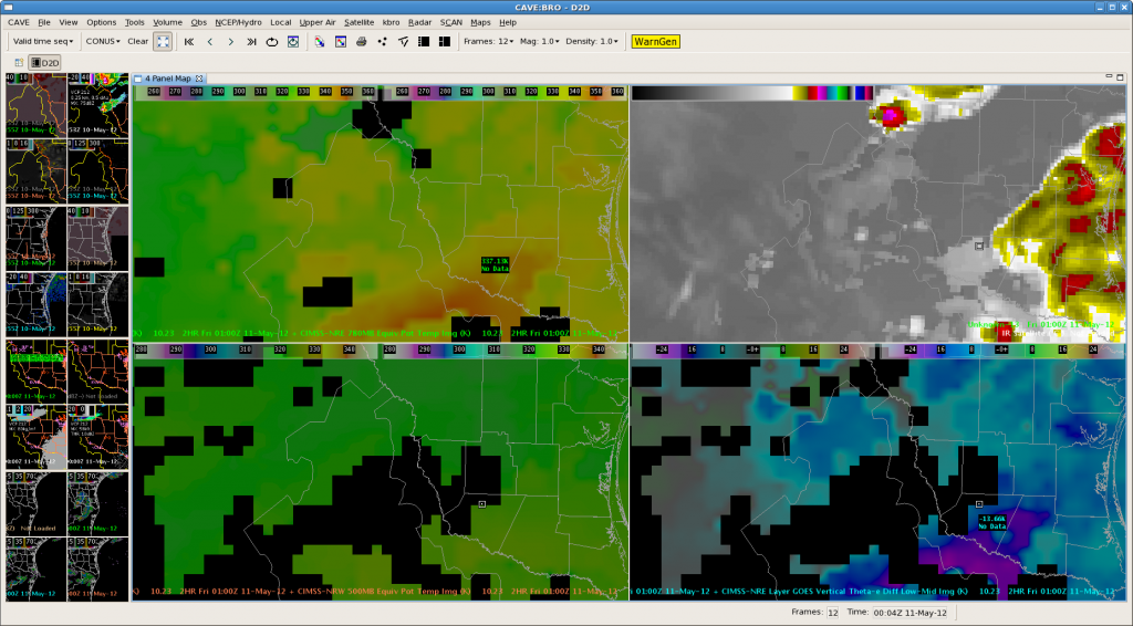
- Was very useful on Thursday storms in south TX. Could see that the storm over the Gulf would continue on a long track based on Nearcast instability forecast.
- Good for isolated storms, to quickly determine if will be long lasting, or it is going to demise.
- Used it to determine the evolution of the cold front and stable air on the South Carolina event.
- Used the theta e difference field when storm first started to intensify and move into more notable area; helped with initial warning.
GOES-R UAH-CI/Satcast:
- Great move to go to strength of signal, to provide a level of confidence. But would also like to see some threshold studies, to determine optimal values to use for decision making.
- Important to to stress to look at environment first, to avoid false alarming.
- It would be nice to see what is happening inside the storms as well, and match with 3DVAR output.
- Only saw one ‘high’ false alarm, over Mexico. Otherwise, when you saw red, you could count on at least 30 DBz storms soon.
- Would like to see model data integration into product (UAH says this is coming next year), but would like to see output from a non-model and model version for comparison.
- Would like access to the intermediate products used to make the final product.
- Helped with boundary identification.
GOES-R UW-CI/CTC:
- Likes how algorithm combines the data automatically to give a quick answer, versus determining this manually from the base products.
- Product was very consistent.
- Output was hard to see, because it was fleeting and small, but accumulating product helps. Or an audible or visual alarm (at -10 or -20) would help.
- Several longer accumulation periods (e.g., 120 min) would be nice.
- CI provides additional lead time. It would be great to put an intermediate product out conveying the possibility of strong storms when we first see these CI signals with an actual warning coming later.
GOES-R PGLM:
None of our events this week impacted the Lightning Mapping Array domains with severe weather. We did briefly operate over central FL, but only one weak storm developed.
There are more GOES-R feedback details on the GOES-R HWT Blog Weekly Summary.
AWIPS2:
- Seems to do better job with high res data.
- Had the “not as bad as you think” impression, but because we are ingesting a lot data, had more memory issues.
- Liked the customization, and the ability to get screen capture and blog to when on same workstation.
OVERALL COMMENTS:
- Having the principle scientists in the room helps improve use of products in decision making, even if they are “hovering” and occasionally asking questions.
- Since we are experimental, it’s nice not to have to worry about lead time, etc. Gives time to interact with the scientists.
- Addition of 6th day for training was huge day was plus. It got everyone in the mindset prior to their visit. Then using Monday to get a good idea of how to start integrating it all within AWIPS2.
- The WES case did a great job of introducing products.
- Many of the products would work really well with a meso forecaster paired up with a warning forecaster.
- Consider more pre-warning products, perhaps akin to what was done during PHI (low-probability warnings).
NOTES FROM THE EWP2012 STAFF:
Several changes to our forecaster schedule will be implemented beginning week 2. After some consideration, we’ve made a two adjustments to the EWP2012 shift schedules, effective Friday 18 May 2012. They are:
Monday: 1pm-9pm (starts 21 May 2012)
Friday: 9am-1pm (starts 18 May 2012)
The Monday change (moving the start and end time an hour later) was done to accommodate activities of the Hazardous Weather Testbed’s forecast exercise with the Storm Prediction Center. The Friday change (addition of one hour at the start) was to accommodate the extra time needed to prepare for the “Tales From the Testbed” Webinar. The shift times on Tuesday, Wednesday, and Thursday will continue to follow the “flex” schedule.
A LOOK AHEAD:
Next week should be very quiet for severe weather. We may have to fill in some down time with an additional archive case on the WES. Near the end of the week, some upper-level flow may begin to impact the western part of the Northern Plains.
CONTRIBUTORS:
Greg Stumpf, EWP2012 Operations Coordinator and Week #1 Weekly Coordinator
EWP2012 PROJECT OVERVIEW:
The National Oceanic and Atmospheric Administration (NOAA) Hazardous Weather Testbed (HWT) in Norman, Oklahoma, is a joint project of the National Weather Service (NWS) and the National Severe Storms Laboratory (NSSL). The HWT provides a conceptual framework and a physical space to foster collaboration between research and operations to test and evaluate emerging technologies and science for NWS operations. The Experimental Warning Program (EWP) at the HWT is hosting the 2012 Spring Program (EWP2012). This is the fifth year for EWP activities in the testbed. EWP2012 takes place across five weeks (Monday – Friday), from 7 May through 15 June. There are no operations during Memorial Day week (28 May – 1 June).
EWP2012 is designed to test and evaluate new applications, techniques, and products to support Weather Forecast Office (WFO) severe convective weather warning operations. There will be three primary projects geared toward WFO applications this spring, 1) evaluation of 3DVAR multi-radar real-time data assimilation fields being developed for the Warn-On-Forecast initiative, 2) evaluation of multiple CONUS GOES-R convective applications, including pseudo-geostationary lightning mapper products when operations are expected within the Lightning Mapping Array domains (OK/west-TX, AL, DC, FL), and 3) evaluation of model performance and forecast utility of the OUN WRF when operations are expected in the Southern Plains.
NEW FOR 2012:
(After this week, this section will not be included in the summaries)
Based on the experience gained from our first five years of operations, the EWP is experimenting with a few changes in our weekly and daily operations for 2012:
1) On-station training shift
Based on feedback from former EWP spring experiment participants, we are providing the training and orientation materials for our spring experiment online. Forecasters will now go through the material in an 8-hour self-paced course to be taken during an on-station supernumerary shift within two weeks prior to their arrival at the Hazardous Weather Testbed in Norman. A WES Virtual Machine archive case DVD was also sent to the participants as part of the training regimen. This freed up our Mondays as a real-time operations day (giving us 4 days for the week, instead of only 3 days).
2) Flex shifts
Again, based on feedback from former EWP spring experiment participants, we developed a new shift schedule that provides for some flexibility to account for variable severe weather event times. Typically, we have operated in the 1-9pm time frame to capture the most likely times for severe weather in which to conduct our experimental warning operations with live data. These shifts sometimes ended prior to the peak of some severe weather events.
We are now running a flexible shift schedule during Tuesday, Wednesday, and Thursday, pre-determined the prior day via a day-2 forecast Typically, the shifts will run from 1-9pm. However, if weather conditions warrant, we may run the shift on either of these alternate times: 12-8pm, 2-10pm, 3-11pm. The Day 2 shift decisions are posted as a shift status message on the EWP Blog and mailed out to the participants at the end of the previous day’s shift. Note that our Monday shifts will always be 1-9pm, and our Friday shifts from 9am-1pm.
3) “Tales from the Testbed” Webinars
With the generous assistance of the NWS Warning Decision Training Branch (WDTB), we are embarking on a new feature of the spring experiment. Each Friday of the experiment (11 May, 18, May, 25 May, 8 June, 15 June), from 12-1pm CDT (1-2pm EDT), we will be conducting forecaster-led Webinars known as “Tales from the Testbed”. The format will be similar to WDTB’s Dual-pol “Storm of the Month” Webinars. At each Webinar, each visiting NWS forecaster will summarize their biggest takeaway from their week of participation in the testbed. After the short presentation, there will be a 30 minute q&a session with the audience. The audience is for anyone with an interest in what we are doing to improve NWS severe weather warnings, including field personnel, regional and national headquarters folks, and our other stakeholders in the NOAA labs, the GOES-R office, the NextGen program, and elsewhere. The Webinars will be posted to the EWP2012 Web page, the EWP Blog, and on the WDTB Web site a few days after they are presented.
WEEK 1 SUMMARY:
Week #1 of EWP2012 wrapped up during the week of 7-11 May. The week was dominated by a split jet stream flow regime, with the best shear associated at the base of a cutoff low over the southwest U.S., affecting southwest and southern Texas and adjacent New Mexico. However, we did get to work one day on the southeast coast as well. During this week, NSSL, the GOES-R program, and the NWS Decision Support Services Pilot Project hosted the following National Weather Service participants: Ryan Barnes (WFO, Norman, OK), Jeffrey Hovis (WFO, Charleston, WV), Roland Nuñez (CWSU, Houston, TX), and Andrea Schoettmer (WFO, Louisville, KY).
Photo: From bottom left, going up stairs clockwise then down stairs: Andrea Schoettmer (WFO Louisville, KY), Amanda Terberg (CIMMS/GOES-R – AWC liaison, Kansas City, MO), Madison Miller (CIMMS/NSSL), Kristin Kuhlman (CIMMS/NSSL), Gabe Garfield (CIMMS/WFO Norman, OK), Greg Stumpf (CIMMS/NWS-MDL), Darrel Kingfield (CIMMS/NSSL), Chris Siewert (CIMMS/SPC/GOES-R), and Roland Nuñez (CWSU, Houston, TX). In the middle, top: John Walker (UAH), bottom: Ryan Barnes (WFO, Norman, OK).
REAL-TIME EVENT OVERVIEW:
7 May: Moderately severe weather and one tornado in Central TX.
8 May: Just a few marginally-severe storms over southern NM; a big hailer in southern TX.
9 May: More marginally-severe storms, this time over coastal SC and GA.
10 May: Supercells with large hail and tornadoes in south TX.
FEEDBACK ON EXPERIMENTAL PRODUCTS:
NSSL 3DVAR DATA ASSIMILATION:
The following feedback was obtained:
· Useful for determining when winds meet 40 mph CWSU criteria.
· 3DVAR products showed rotation in the storms (based on multi-radar integration) better than the single radar data did. The multiple-radar integration really helped fill in gaps of having to analyze multiple radars separately, especially where storms from one radar were in the “purple haze” of the range-folded obscuration.
· Would be nice to see same products between 3DVAR and the OUN WRF.
· The addition of the 3D wind vectors for AWIPS2 is nice.
· Recommend adding TDWR to the real-time 3DVAR.
· Vorticity products (1km, 4km) helped reinforce where strongest rotation was tracking, whether storms were deviating and right turning to help polygon placement. Updraft pulses also helped determine when the storms were intensifying.
· Depicted a total wind field that simulated the potential of winds descending behind the advancing storm.
· Composite Updraft seems to be relatively helpful in confirming the strength of a storm. However, with some quick pulse storms, the 3DVAR data seemed to lag behind a little.
OUN-WRF:
The following feedback was obtained:
NOTE: Only the 7 May event (Central TX) was within the OUN WRF domain.
· Nice have 1 hour updates to monitor changes in the environment
· From the CWSU perspective, we’re constantly looking at the progress of mesoscale forecasts, helps keep track of evolution.
· Subsidence in upper levels for suppression and downdraft velocity could be very useful. It could be used to project time of convective demise.
· It is a great situational awareness tool to help determine location of initiation and storm mode.
· Usually starts out a bit aggressive on convection, but after time it “calms down”. The later runs (closest to CI) seemed to do the best job of capturing coverage.
GOES-R SimuSat:
The following feedback was obtained:
· Could see the moisture ahead of a shortwave, so it was good for anticipating how the environment was changing.
· This imagery would be very helpful to forecasters in the field because it seems to do a decent job of predicting upper level features, low level clouds, and convection 12-20 hrs in advance.
GOES-R Nearcast:
The following feedback was obtained:
· Was very useful on Thursday storms in south TX. Could see that the storm over the Gulf would continue on a long track based on Nearcast instability forecast.
· Good for isolated storms, to quickly determine if will be long lasting, or it is going to demise.
· Used it to determine the evolution of the cold front and stable air on the South Carolina event.
· Used the theta e difference field when storm first started to intensify and move into more notable area; helped with initial warning.
GOES-R UAH-CI/Satcast:
The following feedback was obtained:
· Great move to go to strength of signal, to provide a level of confidence. But would also like to see some threshold studies, to determine optimal values to use for decision making.
· Important to to stress to look at environment first, to avoid false alarming.
· It would be nice to see what is happening inside the storms as well, and match with 3DVAR output.
· Only saw one 'high' false alarm, over Mexico. Otherwise, when you saw red, you could count on at least 30 DBz storms soon.
· Would like to see model data integration into product (UAH says this is coming next year), but would like to see output from a non-model and model version for comparison.
· Would like access to the intermediate products used to make the final product.
· Helped with boundary identification.
GOES-R UW-CI/CTC:
The following feedback was obtained:
· Likes how algorithm combines the data automatically to give a quick answer, versus determining this manually from the base products.
· Product was very consistent.
· Output was hard to see, because it was fleeting and small, but accumulating product helps. Or an audible or visual alarm (at -10 or -20) would help.
· Several longer accumulation periods (e.g., 120 min) would be nice.
· CI provides additional lead time. It would be great to put an intermediate product out conveying the possibility of strong storms when we first see these CI signals with an actual warning coming later.
GOES-R PGLM:
None of our events this week impacted the Lightning Mapping Array domains with severe weather. We did briefly operate over central FL, but only one weak storm developed.
There are more GOES-R feedback details on the GOES-R HWT Blog Weekly Summary.
AWIPS2:
· Seems to do better job with high res data.
· Had the “not as bad as you think” impression, but because we are ingesting a lot data, had more memory issues.
· Liked the customization, and the ability to get screen capture and blog to when on same workstation.
OVERALL COMMENTS:
· Having the principle scientists in the room helps improve use of products in decision making, even if they are “hovering” and occasionally asking questions.
· Since we are experimental, it’s nice not to have to worry about lead time, etc. Gives time to interact with the scientists.
· Addition of 6th day for training was huge day was plus. It got everyone in the mindset prior to their visit. Then using Monday to get a good idea of how to start integrating it all within AWIPS2.
· The WES case did a great job of introducing products.
· Many of the products would work really well with a meso forecaster paired up with a warning forecaster.
· Consider more pre-warning products, perhaps akin to what was done during PHI (low-probability warnings).
NOTES FROM THE EWP2012 STAFF:
Several changes to our forecaster schedule will be implemented beginning week 2. After some consideration, we’ve made a two adjustments to the EWP2012 shift schedules, effective Friday 18 May 2012. They are:
Monday: 1pm-9pm (starts 21 May 2012)
Friday: 9am-1pm (starts 18 May 2012)
The Monday change (moving the start and end time an hour later) was done to accommodate activities of the Hazardous Weather Testbed’s forecast exercise with the Storm Prediction Center. The Friday change (addition of one hour at the start) was to accommodate the extra time needed to prepare for the “Tales From the Testbed” Webinar. The shift times on Tuesday, Wednesday, and Thursday will continue to follow the “flex” schedule.
A LOOK AHEAD:
Next week should be very quiet for severe weather. We may have to fill in some down time with an additional archive case on the WES. Near the end of the week, some upper-level flow may begin to impact the western part of the Northern Plains.
CONTRIBUTORS:
Greg Stumpf, EWP2012 Operations Coordinator and Week #1 Weekly Coordinator


