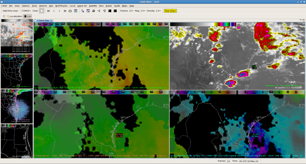
The below image at 22Z depicts nearcast theta-e at 780 mb in the upper left pane, synthetic WRF IR in the upper right, nearcast theta-e at 500 mb in the lower left, and nearcast vertical theta-e difference low-mid in the bottom right.
Looking at the 780 mb theta-e, it shows areas in yellow of best moisture/instability predicted for this afternoon which matches up with storms predict in synthetic IR imagery. Because the 2 products derived off of different model projections are in decent agreement, this lends more confidence to this convective scenario for this afternoon.
AMS/Nunez

