Daily Summary: Week 1, Day 4

Today’s operations were in the Norman, Amarillo and Lubbock CWA’s. Compared to yesterday, it was a much quieter day, and convection took a little longer to get going. This allowed forecasters more opportunity to evaluate environmental analysis tools such as the GOES-R LAP algorithm and JPSS NUCAPS soundings. The GOES-R CI algorithm was also utilized by participants in the pre-convective environment. The Lubbock pair had the opportunity to evaluate the PGLM total lightning, especially late in the day when convective activity amped up in intensity and coverage. With the Frederick, OK radar down for most of the day, the Norman group had increased reliance on the Earth Networks lightning tools.

Tomorrow we will have our weekly debrief, and participants will complete their end of the week surveys and present the Tales from the Testbed webinar.
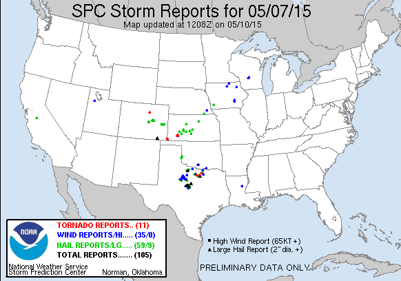
150507_rpts

– Bill Line, SPC/HWT Satellite Liaison and Week 1 EWP Coordinator
Tags: None

Convective Initiation and Radar

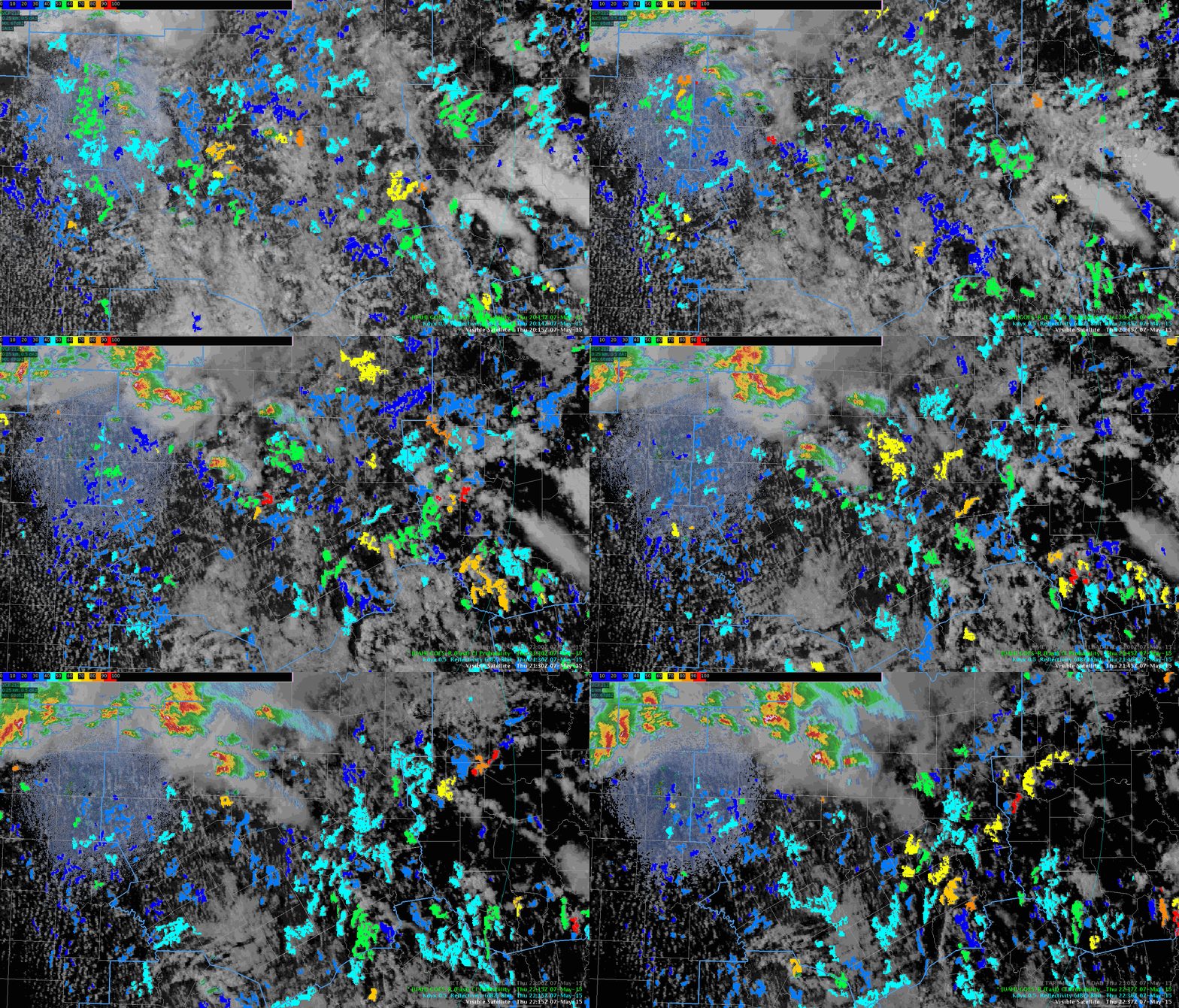
With the OUN cwa quieting down, decided to take a look at how the convective initiation product was working this afternoon. The animated image below (click to view), highlights a couple areas (both in the center and upper left of the image) where the CI algorithm picked up on the development of showers and thunderstorm. Meanwhile, in the upper right hand part of the image, there were several instances where the CI algorithm showed probabilities over 60% and nothing developed as of 2245Z.

20150507_2237Z_CI_Animation_Radar-SRF

Tags: None

Lightning Data Prompts SVS

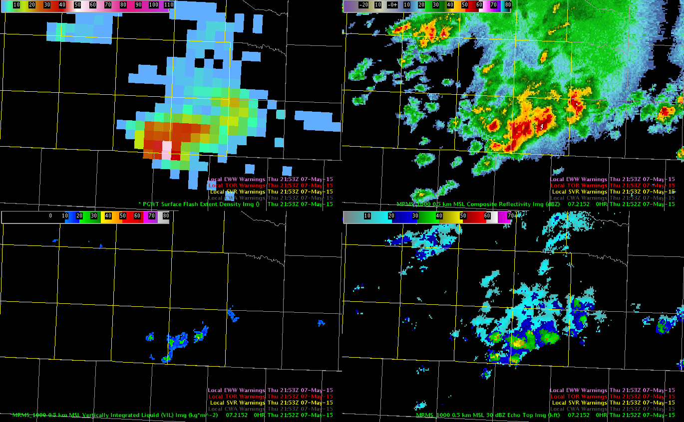
LBB remains a convective mess. Overall storms have been sub-severe. The flash extent density for a cluster of storms in the extreme SE portion of the CWA caught  my eye.

KLBB pGLM 2153ZThe two light pink pixels were around 56-57 (50 being the general minimum for severe storms) at 2153Z.

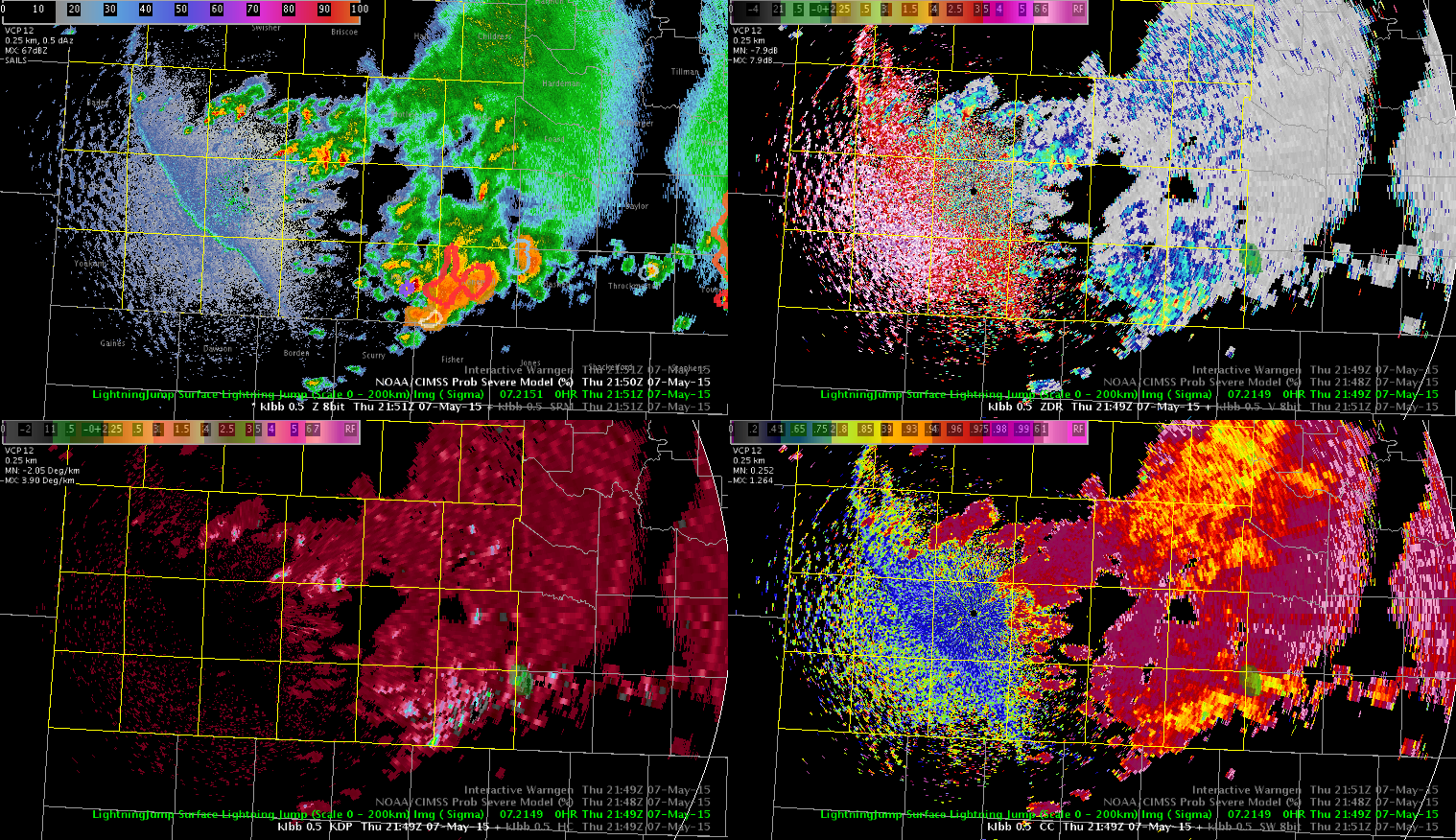
Looking at the other guidance we could use today, there was a 3 sigma lightning jump and a prob severe of 90% at 2149Z.

KLBB prob severe 2149ZI went ahead and issued the warning based on the lightning and prob severe guidance, despite the storms not looking overly impressive on radar. As has been the case the rest of the day across our area, there have been no storm reports.

-V. Darkbloom

Tags: None

ENI Cell Track Information

I haven’t really used the ENI cell track information much today but over the last hour I have started to pay more attention to it and I believe that it may be useful for larger and/or longer lived storms such as supercells.  However, I think it could be more of a problem or less effective in a typical weakly sheared pulse thunderstorm environment which is common in the southeastern US during much of the warm season.  It would be interesting to see how this performs in that type of environment.

CellTrackinfo

Jack Bauer

Tags: None

Comparing storm development with satellite derived CAPE/LI

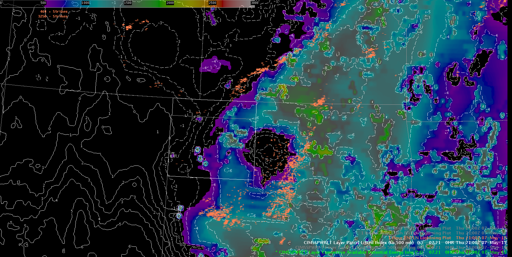
Used satellite LAP algorithm to track the change in the environment over the course of the afternoon. Best instability was in the southeast CWA. Overlayed one hour total lightning with the CAPES and LI to see how the coverage of storms lined up with the best instability. Image shows this overlay at 21z.

Lightning and instability

Ongoing MCS from this morning accounted for the lightning east and south of the forecast area. Narrow strip of lightning west of the better instability was where outflow boundary intersected cold front/dry line. This area had better low level lapse rates and more time to recover after the morning MCS.

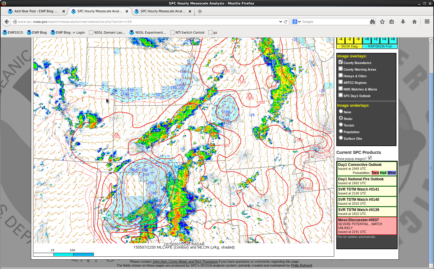
The mesoanalysis from SPC showed much higher CAPS at 21 and 22z than the values from the LAP algorithm. SPC was 1000-1500 J/KG while satellite derived was less than 500 J/KG.

SPC 22z Mesoscale Analysis May 7

Lynford


Tags: None

Custom Dangerous Lightning Alerts

One of the other groups had a good suggestion of raising the Dangerous Lightning Alert custom values to 50/75/100 flashes per minute. That increase was significantly larger than the default values and based off some of the situations we have seen over the SW OUN cwa, that may not have been high enough. This image below (taken around 2143Z) shows just the 75/100 flash alerts and those are too overwhelming with the amount of polygons.

20150507_2140Z_CustomLightningAlert-SRF

Tags: None

ENI Time Series and ProbSevere

New convection has been initiating along the nose of stronger instability feeding northward across north central TX and I have been watching one cell in particular in Young county TX.

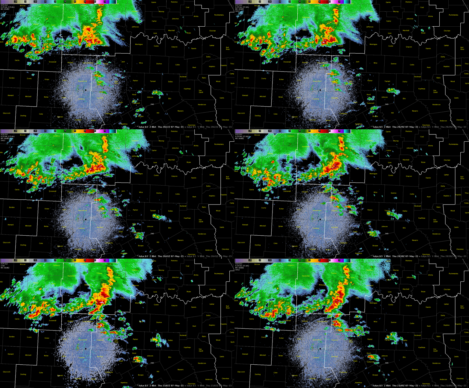
RadarLoop_2109

The ENI time series has provided a nice trend in the strengthening of the storm and showed a large jump in flash rate just before 2050 UTC.  Looking at the base data all tilts at the time of the jump revealed a deep 50 dbz core to almost 40kft and a 70 dbz core to over 21kft.

ENI_Timeseries_YoungTx
ENI Time Series

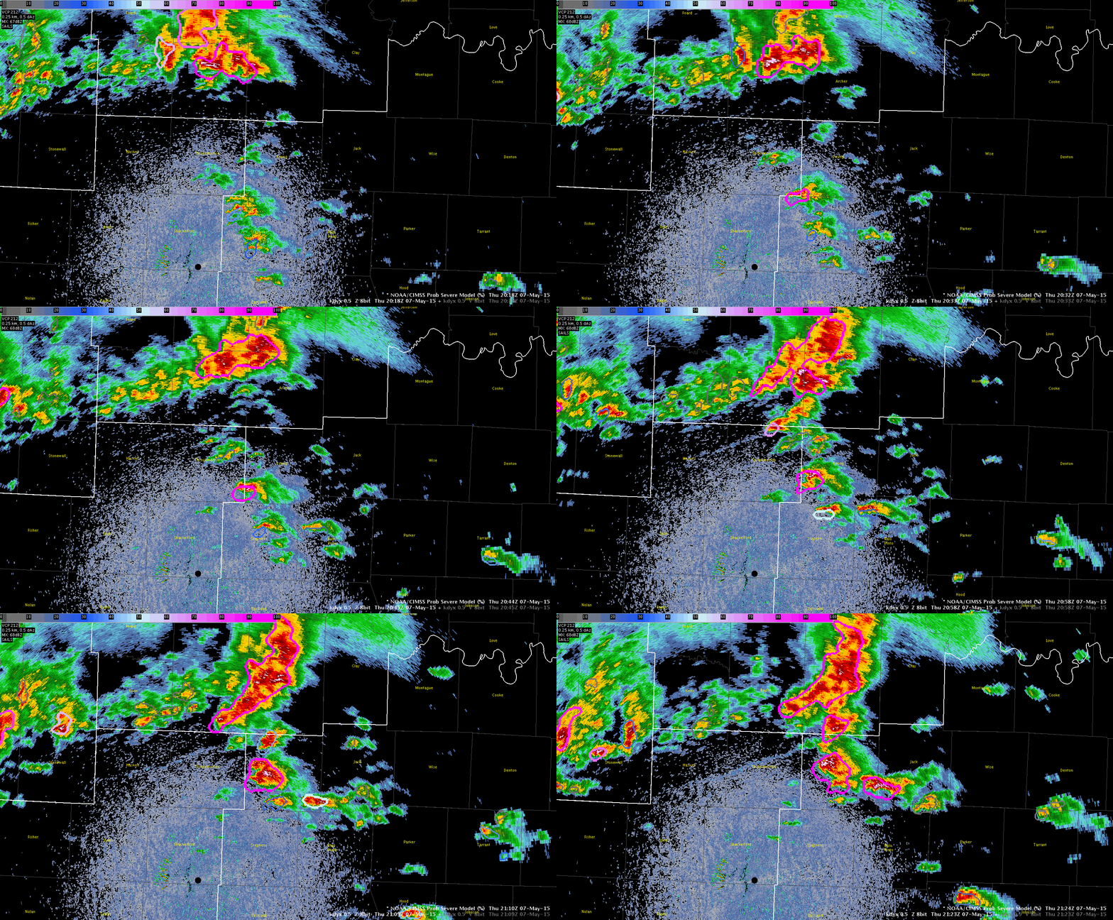
I think this ETN time series data was useful in identifying a rapidly developing updraft. Interesting to note, the ProbSevere model indicated a 74% severe threat at 2024 UTC on this storm which then went to 88% at 2033 UTC and then 98% at 2040 UTC.

ProvSevereLoop
Radar image loop with ProbSevere overlay

The ProbSevere output on the storm when it showed the 74% threat showed a strong glaciation rate and moderate growth rate with MESH of 0.68 inches.

Jack Bauer

Tags: None

Lightning Cell Within Another Cell

Saw this interesting situation today and I’m not sure if it is an issue. There were several instances in a row where lightning cells were within another lightning cells. I have included an animation below (click to view), but I would have thought they should have been combined and lead to a much higher lightning rate and in turn a alert.

20150507_2126Z_LightningCellInside

Tags: None

NUCAPS in Amarillo CWA

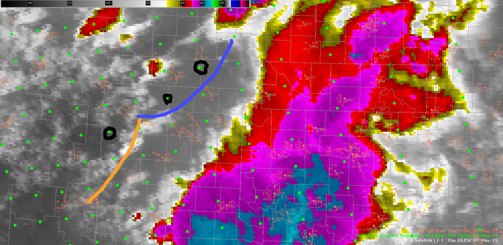
Three NUCAPS soundings were sampled this afternoon around the Amarillo CWA.  Several boundaries are observed in the CWA today…of most interest, a westward propagating outflow boundary from morning MCS and the dryline.  The northern and central soundings were west of the ouflow boundary, but east of the dryline.  Both of these soundings were about 8 degrees too cool (temperature) and 15 degrees too dry (dewpoint) at the surface.  Once the profiles were modified, they yielded 1500 J/kg and 2770 J/kg CAPE, respectively.  The sounding behind the dryline was a close match to observations…and little modification to the sounding was needed.AMANUCAPS

Blue line is westward moving outflow…dryline is marked in yellow.  NUCAPS soundings modified are circled in black.

ALEXANDER’S DARK BAND/LYNFORD

Tags: None

Convective Initiation Miss

At 1930 UTC the Convective Initiation product showed a probability over 60% over Montague/Cooke/Denton counties in TX.

VIS_CI_1930z

However radar imagery over the next hour did not show any development with reflectivities 35 dbz or higher, in fact very little at all was noted.  The image below shows the radar data at 2030 UTC with little if any returns.

Radar_20150507_2030z

Jack Bauer

Tags: None