GFS Difference in Theta-E and NowCast

Today again appears to be a day where the NearCast model is being degraded by a significant amount of cloud cover over the CWA. I have loaded the difference in theta-e fields from the GFS model to fill in some of the gaps in the model. This appears to do well as a proxi for areas of convective instability in the NearCast model. Using the model difference fields in conjunction with the NearCast can help to fill in areas and allow you to get an idea if the model has a good handle on the situation and provides confidence for later in the day.

-JB

theta_e_diff_near_cast

Tags: None

Simulated Satellite Vs. IR Sat

NSSL WRF Simulated Imagery versus IR Sat

I was analyzing the NSSL-WRF simulated satellite versus the actual IR satellite and as you can see it is missing the cirrus cloud deck over the VA peninsula and eastern VA.  It also is missing the cirrus cloud deck over eastern West VA which may hamper or at least slow convection start today.

Simulated Satellite convection south

In one hour it is trying to already form storms over parts that are covered by the cirrus blanket so I wonder if this won’t happen since it hasn’t accounted for it. We shall see. ~ Vollmar

Tags: None

Storm Splitting In OUN WRF

While looking at the 5 KM derived radar reflectivity from the OUN-WRF in order to diagnose strongest cores aloft for the greatest hail potential, I noted a particular item of interest in northern Lincoln County, Colorado.  The reflectivity core clearly splits, which gives us an indication of expected storm tendency.  We can expect that splitting will occur which will place an emphasis on hail with the left moving storm and all modes of severe weather with the right moving storm.  The right moving storm eventually seems to gain a definitive supercell structure in Kit Carson County.  Such a storm would likely be the highest tornado threat in eastern Colorado today. 22May2014-2000Z4HR-OUNWRF5KMRefl

– JRM

Tags: None

Simulated Satellite to Early

Was comparing the simulated satellite to observations to attempt to get a handle on the pre-convective environment. It appears that the simulated satellite today is to quick in developing convection from southern KY into TN. It also is not handling the convection that is developing over eastern KS well. Finally it has convection developing over southwest KS that is not there in reality. This lowers the confidence in the forecast of this model for later in the day.

-JB

early_convection_initiation

Tags: None

EWP Operations Update – Thursday 5/22 – 1:10pm

Our forecasters are set up in Baltimore/Washington D.C. (LWX) to take advantage of the DCLMA as this region currently has relatively few clouds conducive to stronger surface heating than previously anticipated. Adjusted 12z sounding with current surface temperatures show a large region in LWX with minimal CIN to hinder further convective development.

Super-Rapid Scan visible imagery from 1706z-1820z over the East/Central US.

Our second team is currently situated in Nashville, TN (OHX) as we wait for the remaining cap to erode over this area in the next few hours. We only anticipate isolated severe storms in the northern part of the CWA but would like to use this opportunity to really look at some of the GOES-R pre-CI products to see how they fare in a still capped area. On the plus side, if storms do fire here and move to the southeast, we may get some activity in the NALMA. On our final day of Super-Rapid Scan operations, we also wanted to get both of our forecaster teams in domains where they could leverage these data.

12z  ROAB sounding from Nashville, TN.
12z ROAB sounding from Nashville, TN.

We’re watching the WTLMA and COLMA regions closely as well and are ready to jump out west if absolutely necessary.

-Darrel Kingfield
EWP Week 3 Coordinator

Tags: None

EWP Status for Thursday May 22th – 12:00pm to 8:00pm Shift

When in doubt…go to areas where there’s an LMA.

…wait…there’s three (maybe four) regions tomorrow? Okay then…

SPC Day 2 Probabilistic Outlook for May 22, 2014.

Washington D.C. – Weak cold front will continue to push south, shifting flow out of the northwest by the afternoon. Depending on the amount of surface heating available (if the sun can break through this overcast mess), possibly some convection could fire along the front.

Colorado – Copy…paste from today. But expect weaker southerly flow aloft as the low pressure system very slowly continues to propagate eastward tomorrow. Sufficient lift at the front range and lingering PW values from 0.75-1.00″ could cause more thunderstorms tomorrow afternoon and evening. Don’t expect another ‘Denver Metro Supercell’ though (but maybe I’ll be wrong…I hope I’m not)…

West Texas – Incoming trough + low-level moisture surge overnight with forcast MLCAPE values from 1000-2000 J/kg expected over the region. Early to mid afternoon initiation expected ahead of the dry line.

We have options and hopefully more than 1 will pan out. Most model trends are edging towards a rapid destabilization with earlier initiation around 18z.

We will meet in the Dev Lab tomorrow at noon for a debrief before meeting in the HWT by 12:30pm.

-Darrel Kingfield
EWP Week 3 Coordinator

Tags: None

Daily Summary: Week 3, Day 3 (May 21th, 2014)

Another productive day in the HWT! We ended up operating in three domains today, Denver/Boulder, CO (BOU), Indianapolis, IN (IND), and Lubbock, TX (LUB). For most of the day we had two forecasters in the BOU and IND CWAs but moved IND to LUB within the final two hours when most of the severe convection moved out of the CWA. A weak mid-level impulse and steep lapse rates supported initiation along the TX/NM border and provided both teams of forecasters to look at the PGLM products and utilize the tracking meteogram tool with these datasets.

lubbockRadar-20140521PM

Our BOU team remained in their CWA and mainly tracked what will likely be called the “Denver Metro Area Supercell of May 21, 2014” for years to come (this title may need to be shortened…) All GOES-R, several LAPS 3D analysis products (from the 200×200 domain), MR/MS, and Super-Rapid Scan imagery were utilized in performing mesoscale and nowcasting analyses as well as warning issuance. Preliminary reports are coming in on the spatial extent of the main rain-wrapped tornado produced by this storm around 2000z.

0.5 reflectivity from KFTG on May 21, 2014.

Our IND team faced another training sequence of convective cells that came out of the northwest into the CWA. Numerous severe hail and wind reports through the central/southern parts of the CWA. The LAPS 800×800 domain was situated over this area of complex convection, providing 2D analyses and forecasts that our participants compared to MR/MS and other observational products.

may21reports

-Darrel Kingfield
EWP Week 3 Coordinator

Tags: None

Anvil Flashes in PGLM

circle_2148UTC2552_fed_anvil_wnldn

Here are two examples (2148 UTC and 2153 UTC) in northeast CO of how PGLM can be used to detect flashes that propagate long distances into the anvil of storms.  Above is 0.5 km reflectivity, with flash extent density (FED; colored boxes) and NLDN strokes (minus signs).  The highest concentration of flashes is near the updraft core (42 flashes min per pixel), however, note how the flash extent extends well into the anvil region of the storm.  This highlights a region where lightning potential exists.  In the top panel, two NLDN flashes occur in the circled area and in the bottom panel, extensive anvil flashes are noted, but no NLDN information exists in the region where the PGLM shows flash propagation.

Chris S.

Tags: None

ProbSevere vs. LJDA

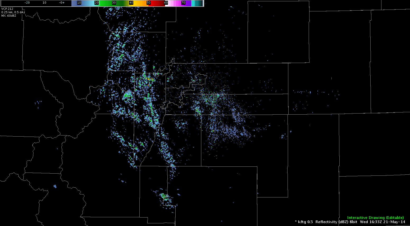
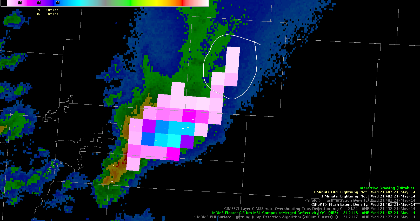
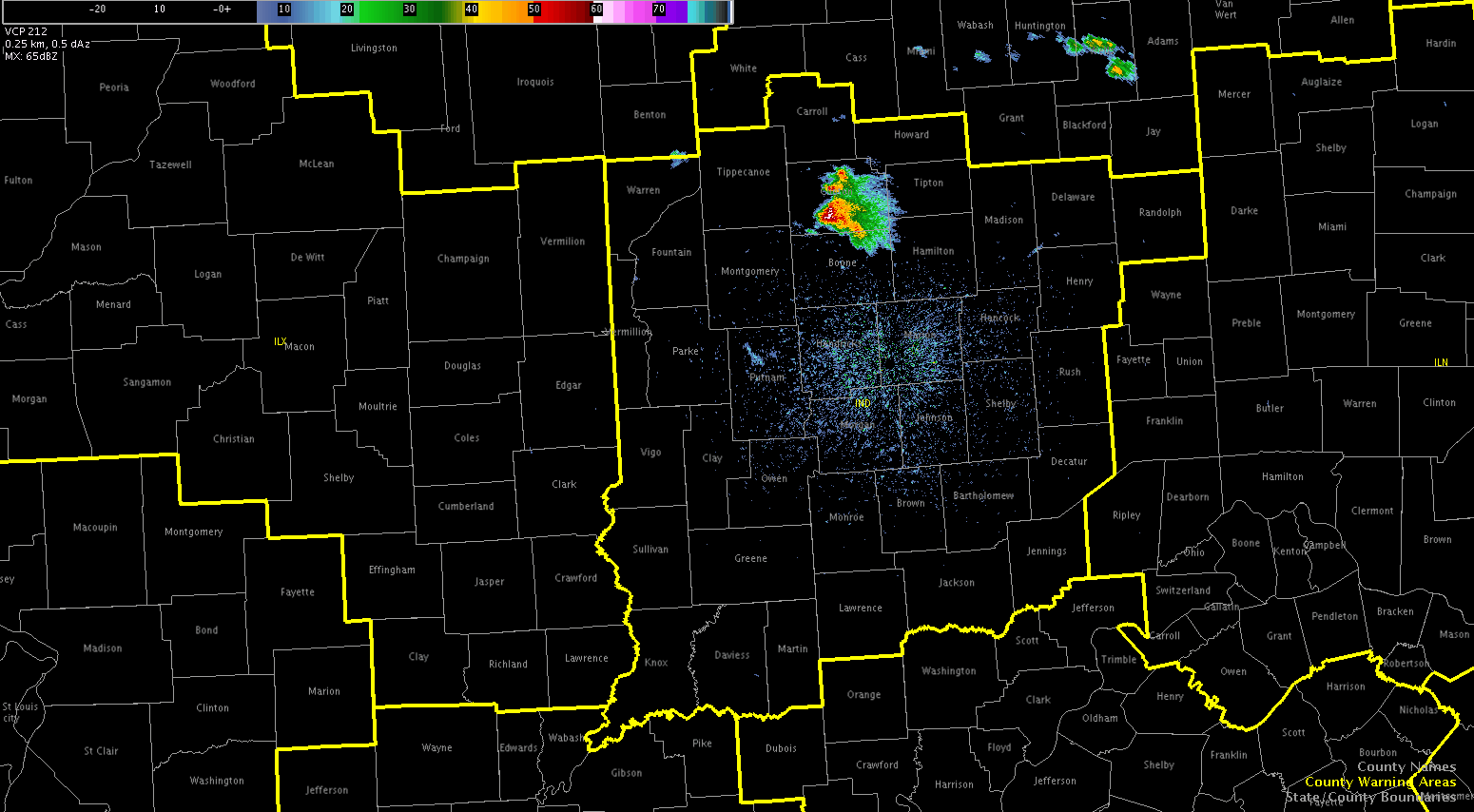
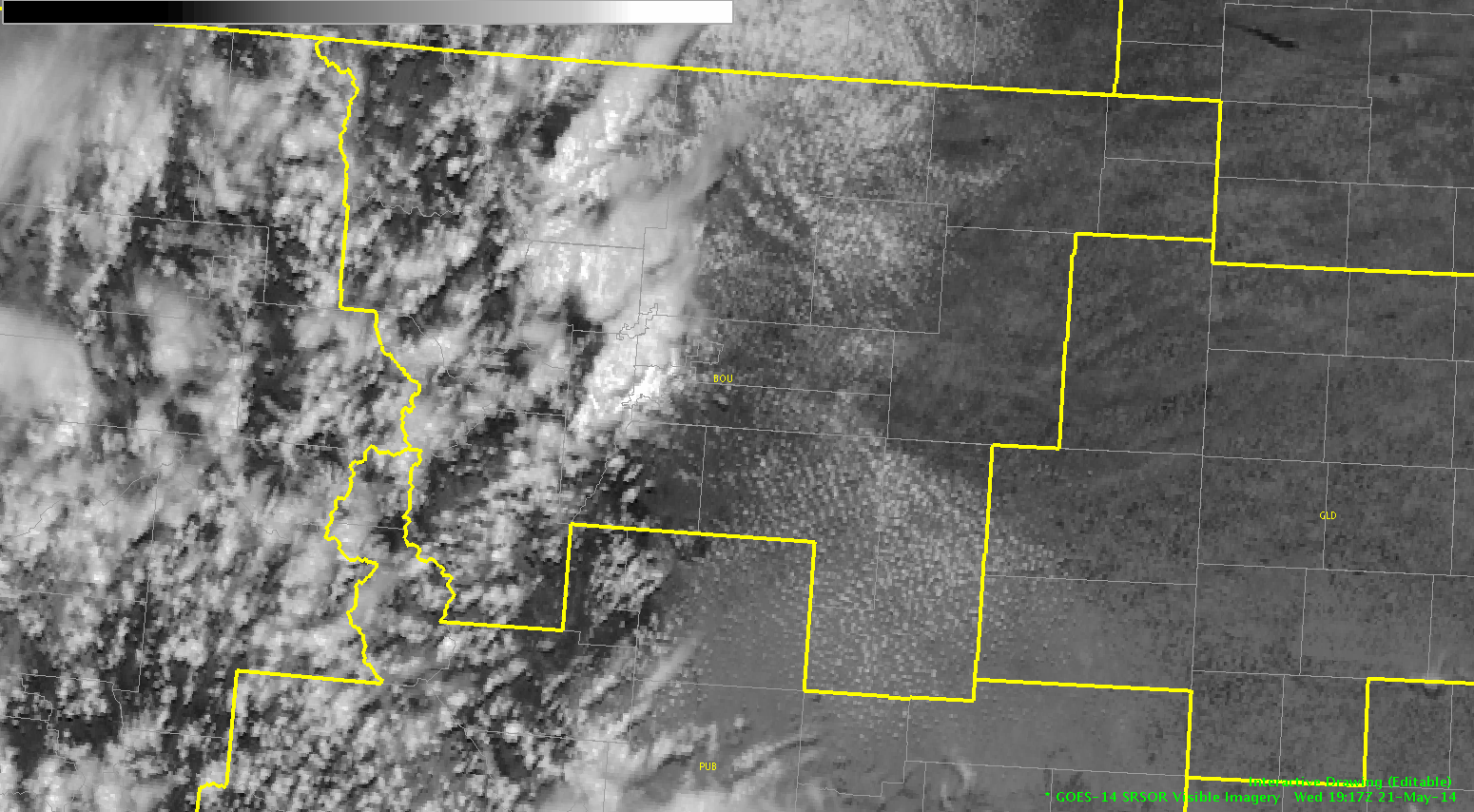
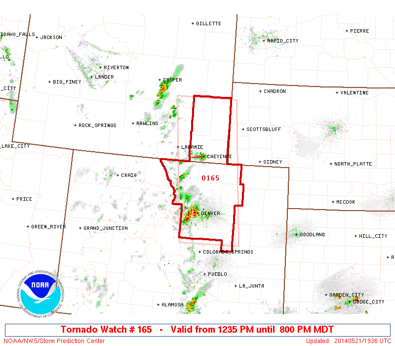
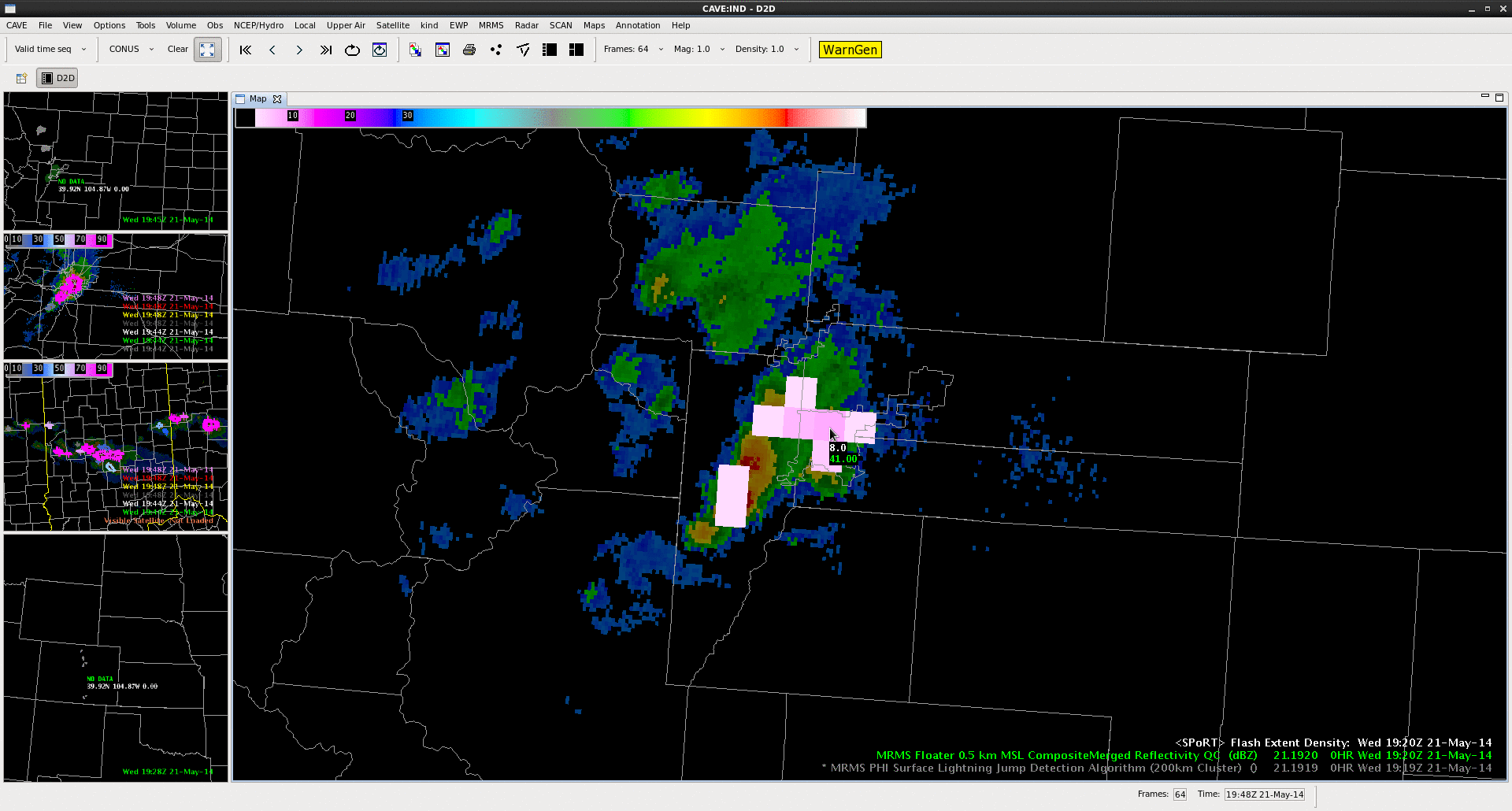
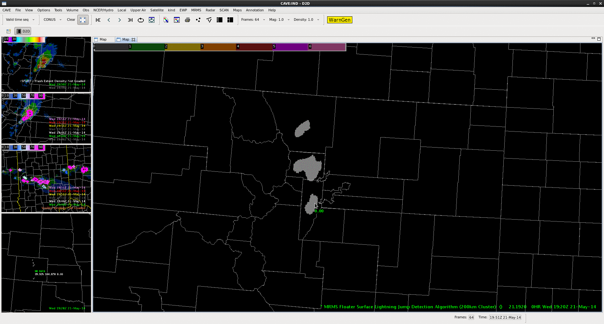
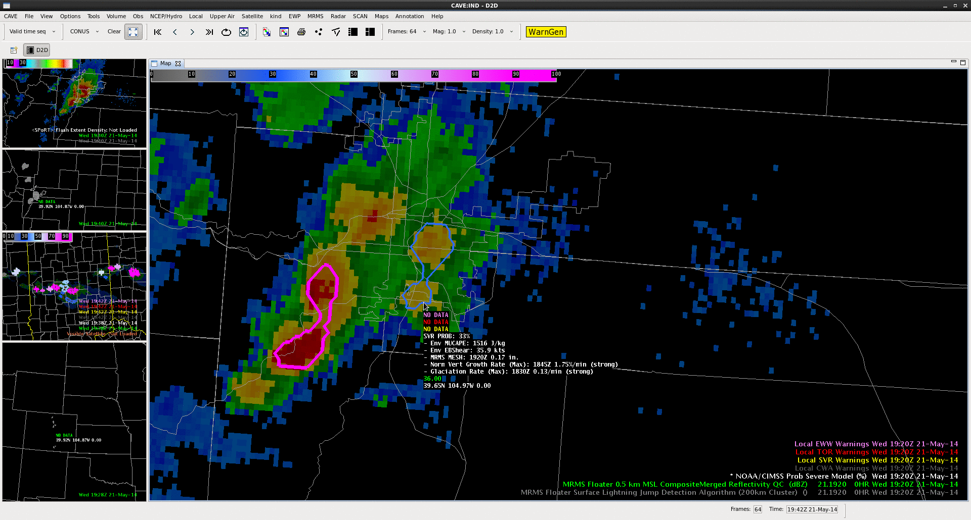
One of our primary goals today was to examine the relationship between the ProbSevere model and the lightning jump detection algorithm. A strong storm fired on the front range of the Rockies, just west of Denver. The ProbSevere model noted strong satellite growth rates in a moderately-sheared environment, with MESH only 0.17″. The probability of severe was 33% at 1920 UTC.  At this time the PGLM indicated a flash rate on the order of 6 flashes per minute.  Two minutes later, at 19:22 UTC, the ProbSevere was 46%, as MESH increased to 0.33″, and the total flash rate at 8 flashes per minute per pixel.   Over the next 4 minutes, two consecutive lightning jumps were indicated in excess of 2 sigma as the total flash rate rose from 8 to 20 flashes/min/pixel (2 sigma jump at 1922 UTC, 4 sigma jump at 1924 UTC).  ProbSevere increased to 66% at 19:24, and 77% at 19:26 (MESH = 0.71″).  This storm intensity information highlighted the rapidly developing updraft within the storm; signalling the potential for severe weather was increasing as the first storm in the area approached the Denver Metro Area.The NWS issued a severe thunderstorm warning at 19:36 UTC. The jump in ProbSevere (46% to 66% from 19:22 to 19:24 UTC) and the 2-sigma and 4-sigma jumps from the LJA (at 19:23 and 19:24 UTC, respectively) may be able to give forecasters enhanced confidence and perhaps more lead time to initial rapid development in the storm, and potential severe hazards. Animated GIFs for Flash Extent Density (top), Lightning Jump Detection Algorithm (middle), and ProbSevere (bottom) from 1920 UTC to 1930 UTC can be seen below.

FED_CO LJA_CO CO

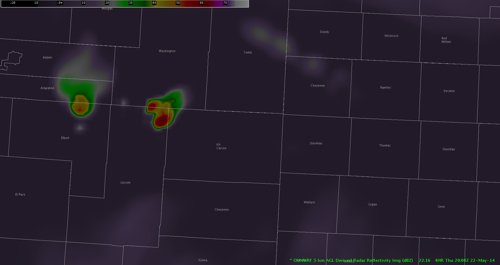
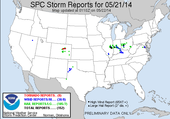
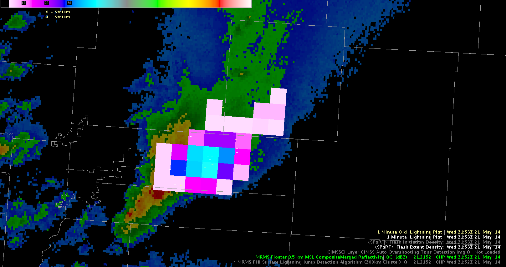
Additional lightning jumps were noted at 1943 UTC (3 sigma) followed by multiple 2 sigma jumps at 2000 UTC, 2001 UTC, and 2004 UTC, and another 3 sigma jump at 2005 UTC.  These additional jumps were additional signals that the updraft in the storm was re-intensifying and continued to have the potential to produce severe weather.  Thus any warning that was issued should remain in effect. During this time period, ProbSevere remained at or above 98%. The first tornado report associated with this storm was at 2005 UTC and hail to the size of golf balls were reported in the Denver Metro.  Also hail depth of at least 5 inches was reported at Denver International.

In this case, ProbSevere and LJDA both displayed the rapid intensification of the updraft, and could be especially useful in identifying the first severe storm of the day, and the maintenance of the ProbSevere and additional lightning jumps continued to highlight the threat of severe weather as the storm continued eastward as the storm propagated eastward.  This information is a high temporal resolution (1-2 minutes) and provides additional data points that can fill gaps between radar volume times.

-JC,CS,BW


3..2..1..INITIATION – EWP Operations Update – Wednesday 5/21 – 2:10pm

We were greeted post-EFP briefing with an explosion of development across across the Ohio Valley and out west in Colorado. Forecasters were quickly allocated to work out of the Indianapolis, IN (IND) to diagnose the rapidly developing cumulus field from Montgomery Country westward.

0.5 deg reflectivity from KIND from 1813z - 1929z on May 21, 2014
0.5 deg reflectivity from KIND from 1813z – 1929z on May 21, 2014

Our second team is working out of the Boulder/Denver, CO (BOU) CWA diagnosing the rapidly developing convection from N/S near the Front Range Mountains.

Super-Rapid Scan visible imagery from 1917z-1929z

With a Severe Thunderstorm Watch issued for the Ohio Valley and a Tornado Watch issued in CO/WY region until 9pm, it looks like a busy afternoon ahead.

WW #164 from the Storm Prediction Center.
WW #165 from the Storm Prediction Center.

-Darrel Kingfield
EWP Week 3 Coordinator

Tags: None