
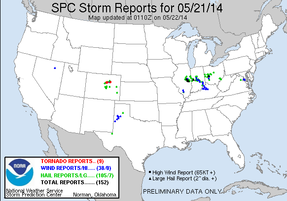
Another productive day in the HWT! We ended up operating in three domains today, Denver/Boulder, CO (BOU), Indianapolis, IN (IND), and Lubbock, TX (LUB). For most of the day we had two forecasters in the BOU and IND CWAs but moved IND to LUB within the final two hours when most of the severe convection moved out of the CWA. A weak mid-level impulse and steep lapse rates supported initiation along the TX/NM border and provided both teams of forecasters to look at the PGLM products and utilize the tracking meteogram tool with these datasets.
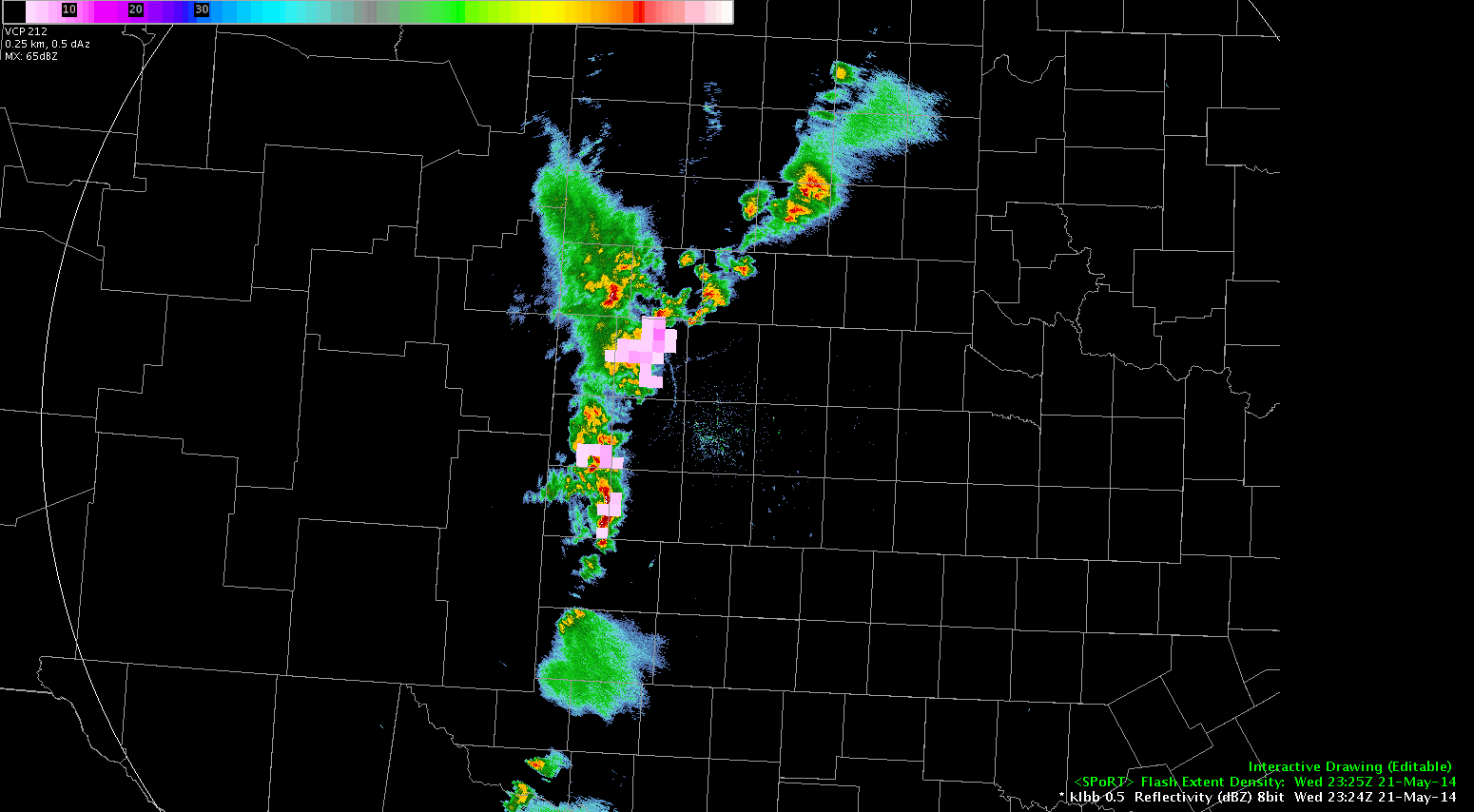
Our BOU team remained in their CWA and mainly tracked what will likely be called the “Denver Metro Area Supercell of May 21, 2014” for years to come (this title may need to be shortened…) All GOES-R, several LAPS 3D analysis products (from the 200×200 domain), MR/MS, and Super-Rapid Scan imagery were utilized in performing mesoscale and nowcasting analyses as well as warning issuance. Preliminary reports are coming in on the spatial extent of the main rain-wrapped tornado produced by this storm around 2000z.
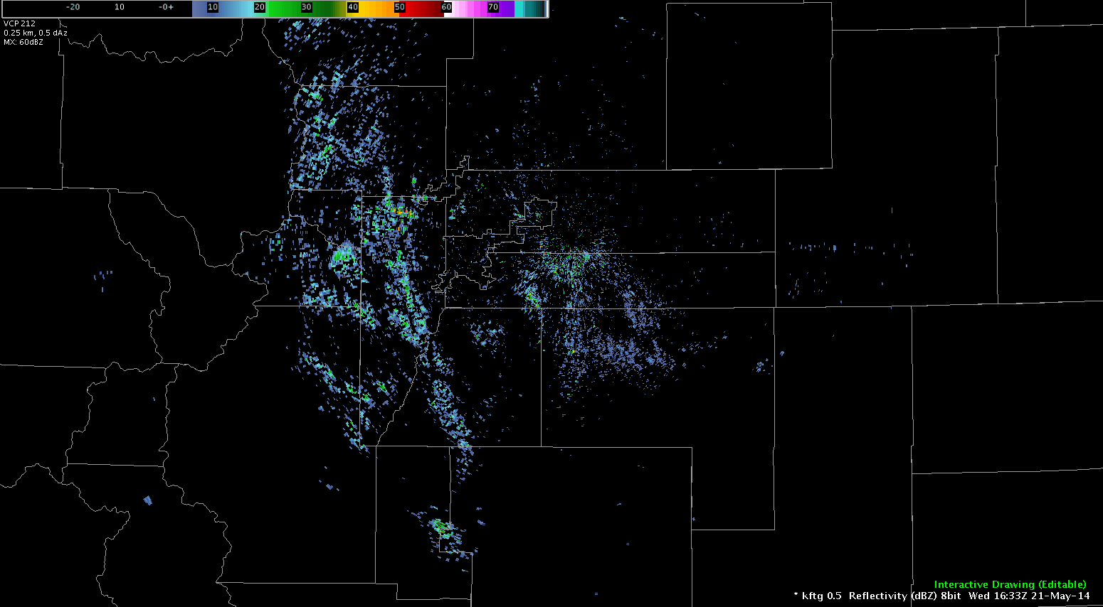
Our IND team faced another training sequence of convective cells that came out of the northwest into the CWA. Numerous severe hail and wind reports through the central/southern parts of the CWA. The LAPS 800×800 domain was situated over this area of complex convection, providing 2D analyses and forecasts that our participants compared to MR/MS and other observational products.
-Darrel Kingfield
EWP Week 3 Coordinator