NearCast ThetaE Diff

Examined the ThetaE difference at 19z.  From a qualitative perspective – the ThetaE difference is greater over PUB than BOU.  Thus – you would expect it is more unstable over the PUB CWA – and thus more vigorous updrafts.  We shall see how this verifies this afternoon.

ThetaE_Diff_Thu

Tags: None

Blog 1 Day 4 5 June Sythetic Sat Comparison

1916sat compsComparing NSSL Wrf Sim 10.4umk IR with 19Z IR and also W Vapor data as well. Very good agreement today between the NSSL WRF and IR/WV at 19Z. MCS over SE MO and Arkansas is in exc. agreement.

In NE NM there is a developing thunderstorm well east of Tucamcari. The NSSL WRF is not picking it up but is showing a cell a bit farther south and is indicating cells firing over the foothills. subjectively i think this is actually not bad- see image. In Colorado (we are working the Pueblo CWA today) there is exc. agreement….impressive actually. Has good aligment on some cirrus streaks as well.

One last note that in SE KS NSSL wrf has very good accuracy on a cell behind the big MCS to the east.

Will be watching an area in southern TX Panhandle where NSSL WRF Imagery shows development. Only the slightest hint of some enhanced cu on IR there. WIll be interesting to see if anything goes there. NSSL WRF thinks it will!

D Satterfield WBOC from KSBY MD.

Tags: None

OUNWRF analysis

Comparing the OUNWRF to the current radar as of 1915Z on Thu shows the model is too slow on initiation since there are already echoes. But, the placement of the echoes as you move ahead in time looks almost spot on. The other issue with the model is that it takes 1.5-2 hrs for radar echoes to develop into a mature supercell. Based on what happened yesterday with a similar environment, it would take no more than an hour for a supercell to evolve.

Tags: None

Simulated Satellite – Thursday

Started off the day by examining the Simulated Satellite products.  Overall – they provided a good starting point over CO.  It showed the stratus burning off in eastern CO in about the right time.  Plus – CI initiates around 18-19z which is evident in the actual satellite obs.  Thus – the NSSL WRF should provide an accurate depiction of overall convective evolution.

18z Top – 19z Bottom

SimSat_Thu_18z SimSat-Thu19z

Tags: None

June 4/5 MCS and Overshooting Tops

An MCS originating in eastern Colorado Wednesday evening (06/04) traversed the southern Plains into the southeast by Thursday (06/05) afternoon. This system had many overshooting tops associated with it, highlighting the locations of the strongest updrafts (and associated hazardous weather) within the massive cloud shield. The overshooting top detection algorithm gives forecasters a tool to easily monitor locations of overshooting tops and trends in detection’s over time. It is an especially beneficial tool to have at night (as with this case) in the absence of visible imagery. Below is a loop of IR satellite imagery with overshooting tops overlaid from 0345 through 1845 UTC on the 5th.

*** Click image to view animation ***

OTD_20140604

SPC storm reports for the 4th and 5th show that the occurrences of severe weather matched up with the locations of the overshooting tops.

yesterday_filtered1 today_filtered2


– Bill Line, SPC/HWT Satellite Liaison

Tags: None

One last satellite comparison and forecast

The first two images showing the simulated satellite imagery (left) and the real-time satellite imagery (right) reflect the overly rambunctious coverage in the simulated imagery earlier in the day (1st image), however the latest images (2nd image) shows the simulated imagery underestimating the intensity with the storm in CO. Looking at the last two images, forecast imagery for 03Z and 06Z, they imply that perhaps the simulation is just lagging behind with generating the intense storms in eastern CO. Based on this simulation, and the fact that it has performed well all day, I would expect additional storms to develop in eastern CO/western KS over the next several hours…moving east thereafter.

060414_2115Z_satCompare 060414_0015Z_satCompare 060414_06Z_satIR_fcst 060414_03Z-satIR_fcst-KP

Tags: None

Daily Summary: Week 4, Day 3 (4 June 2014)

0604_reportsToday, we operated in 4 county warning areas:

Team 1 (Fowle & Anderson)

  • Louisville, KY
  • Springfield, MO
  • Cheyenne, WY

Team 2 (Pelczynski & Satterfield)

  • Boulder, CO

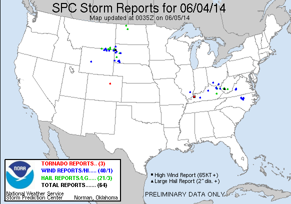
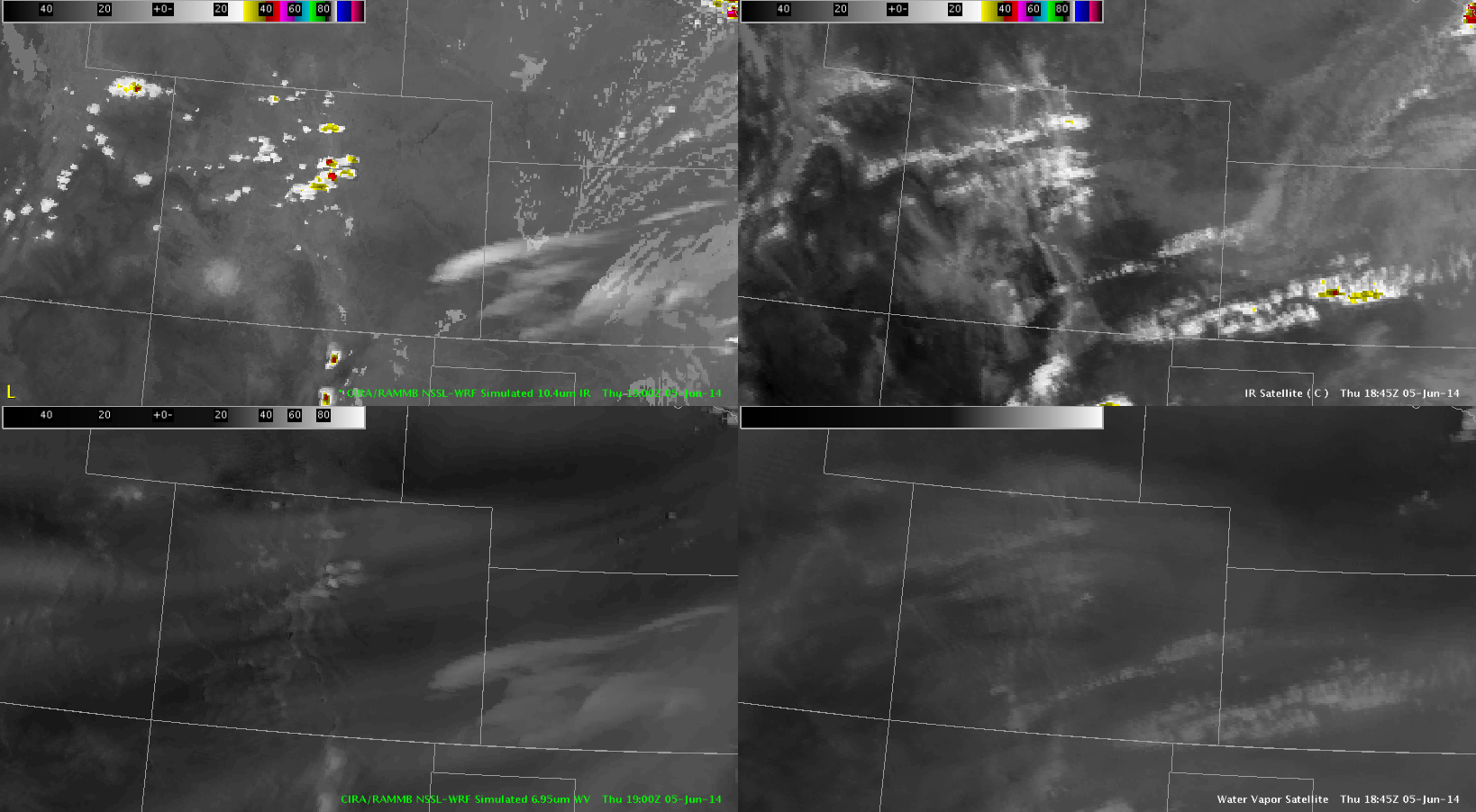
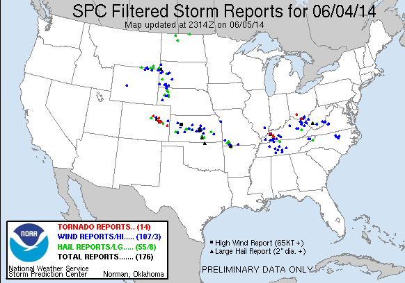
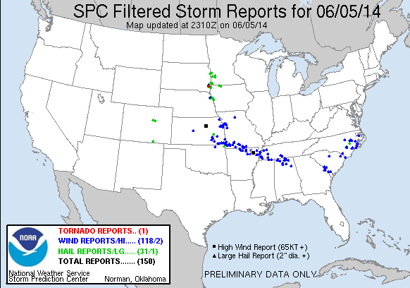
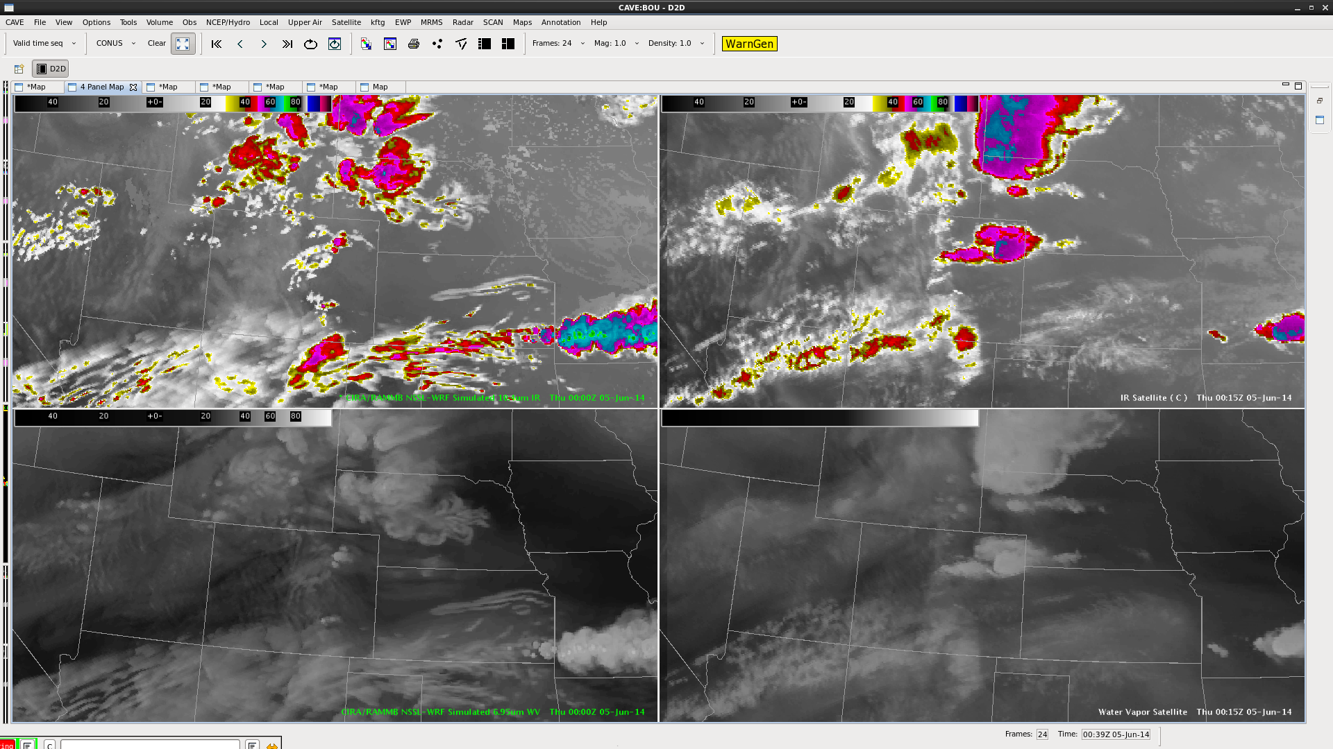
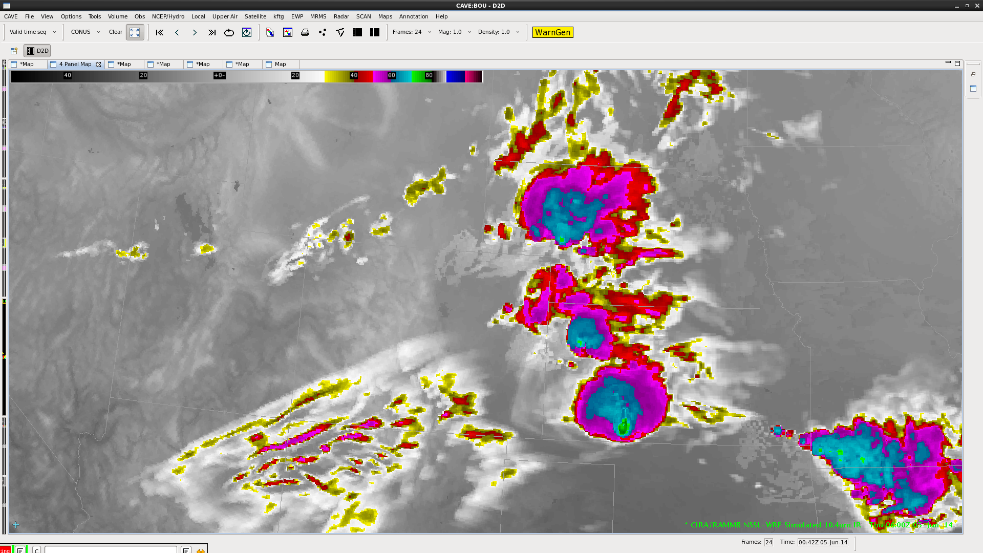
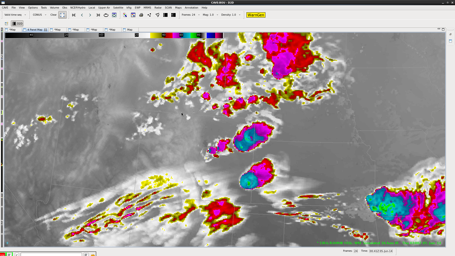
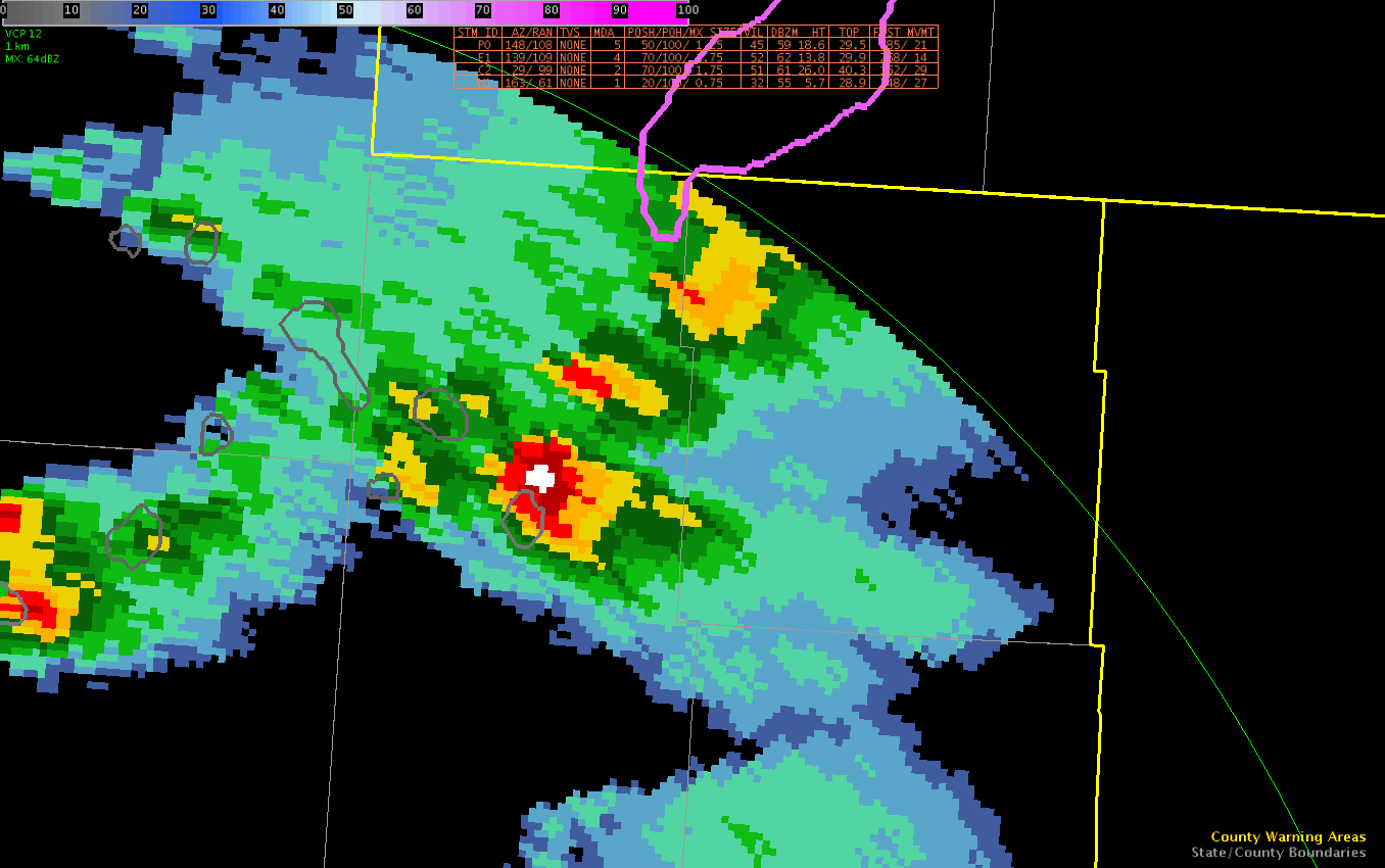
Early in the day, it appeared that the greatest severe threat would exist in the MS/OH valley region.  Additionally, there were enough breaks in the high-level clouds to allow for use of the GOES-R satellite products.  However, as the day progressed, it became apparent that the region would not destabilize as much, so we moved Team 1 to Springfield, MO (based on a favorable mesoscale discussion).  As it turns out, the capping inversion would hold over that area.  Thus, we moved Team 1 to Cheyenne, WY – hoping that we could catch some lightning data from the LMA in Denver.  A few marginally-severe storms did develop.

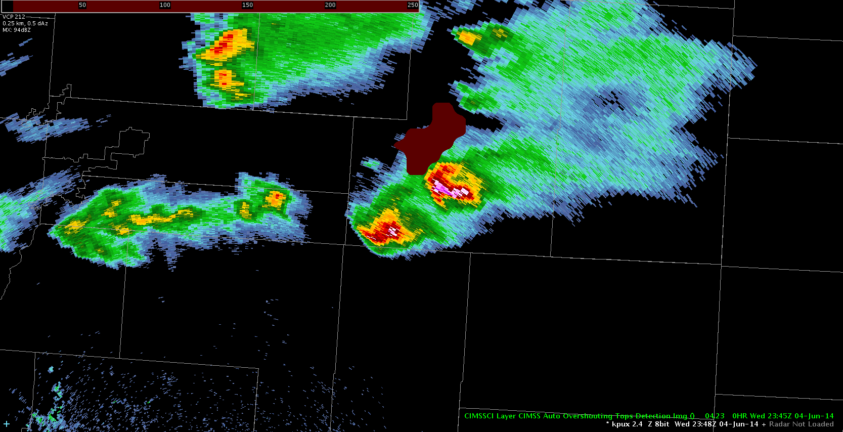
Team 2 remained in Boulder all day.  There, they used the GOES-R products extensively, including the NearCast, UAH CI, Probability of Severe, and lightning data.  Several severe storms developed, though only one severe report was officially logged (for a landspout tornado).

-G. Garfield
Week 4 Coordinator

Tags: None

ProbSevere Loop CYS

Finally had a stronger storm develop in the CYS CWA.  Used ProbSevere to get a general feel on the severity.  As Z in base data increased – ProbSevere quickly increased from 6% to 60% to 91%.

ProbSevereLoopFowle

Tags: None