
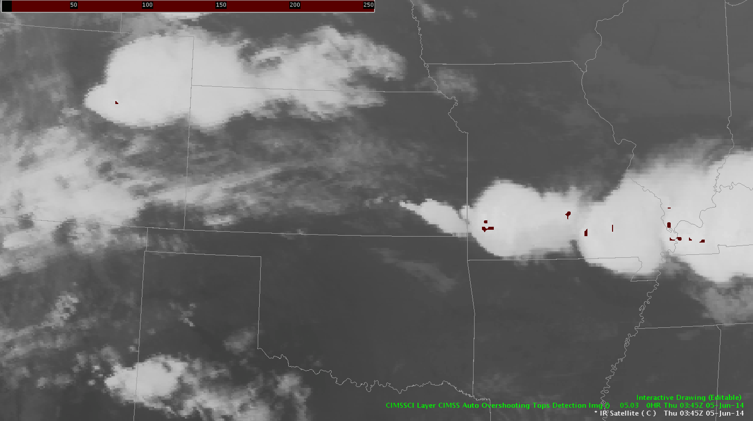
An MCS originating in eastern Colorado Wednesday evening (06/04) traversed the southern Plains into the southeast by Thursday (06/05) afternoon. This system had many overshooting tops associated with it, highlighting the locations of the strongest updrafts (and associated hazardous weather) within the massive cloud shield. The overshooting top detection algorithm gives forecasters a tool to easily monitor locations of overshooting tops and trends in detection’s over time. It is an especially beneficial tool to have at night (as with this case) in the absence of visible imagery. Below is a loop of IR satellite imagery with overshooting tops overlaid from 0345 through 1845 UTC on the 5th.
*** Click image to view animation ***
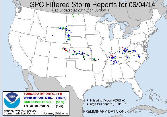
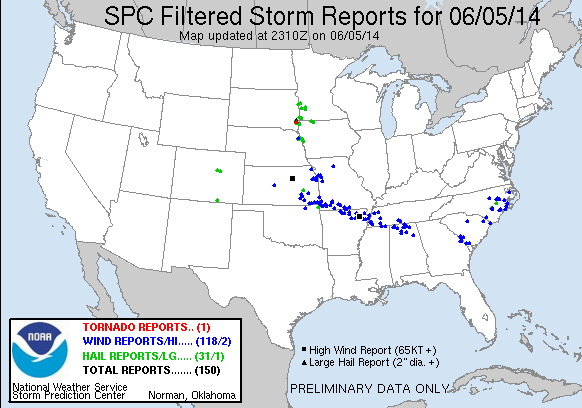
SPC storm reports for the 4th and 5th show that the occurrences of severe weather matched up with the locations of the overshooting tops.
– Bill Line, SPC/HWT Satellite Liaison