Got the chance with CI today. YAY!

May22nd 1910Z

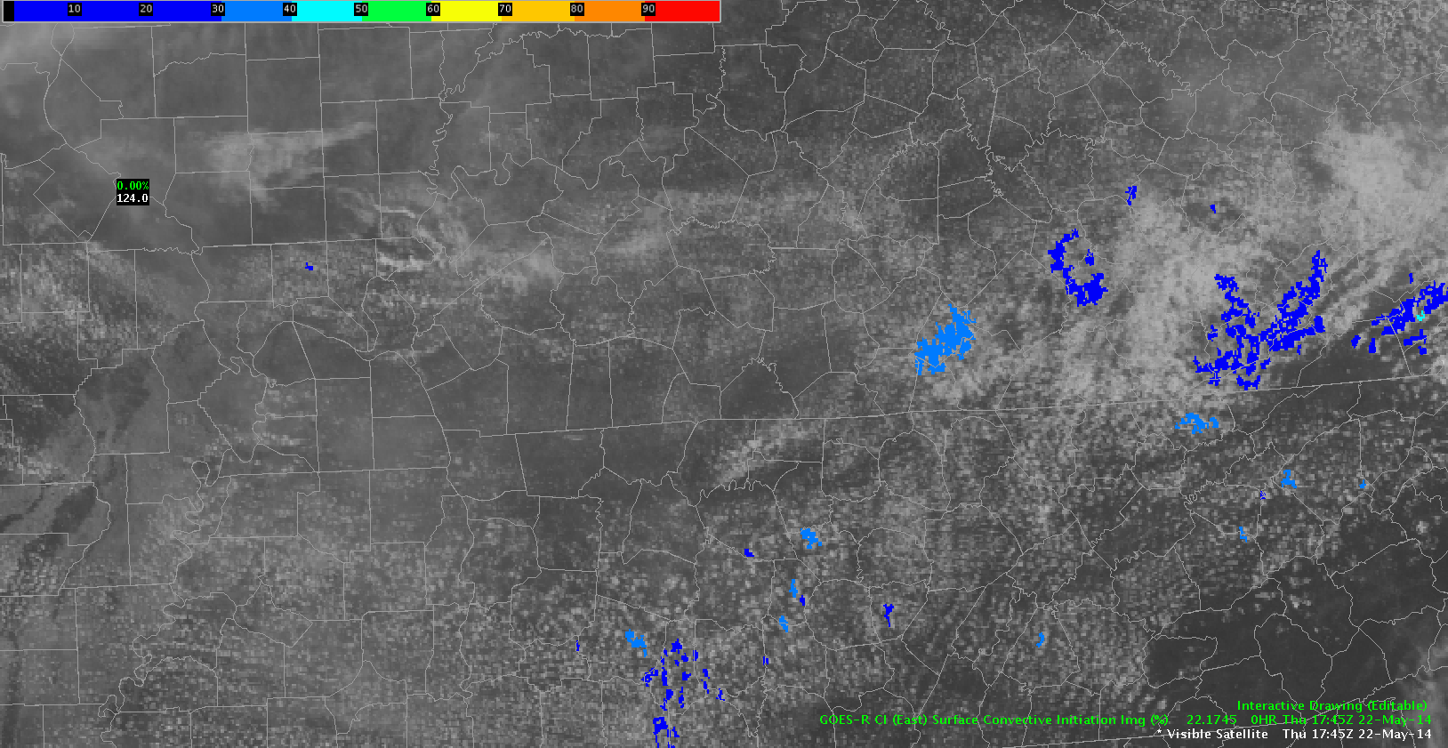
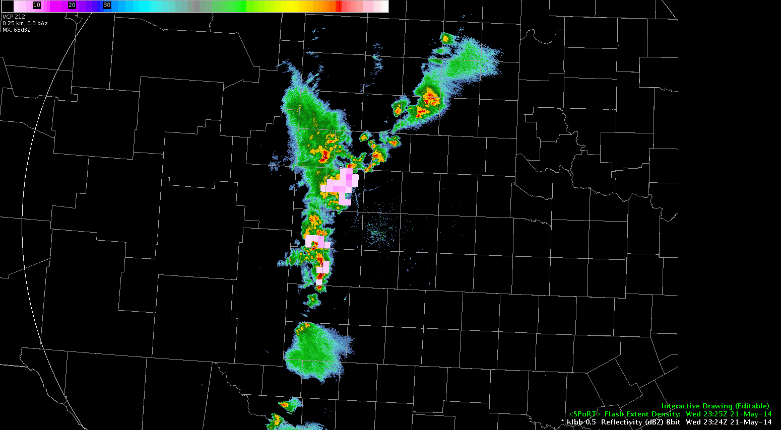
First chance to really play with the CI tool today in a  partially pre-convective environment. Attempted to grab a gif, but it moves a little too fast. I’ll attempt to write through what I’m seeing here anyways.

At the beginning of these frames the CI tool grabs onto a series of storms across far western NY around 15:15Z. These storms fire and immediately move into north central Pennsylvania Probs with these were roughly 86 to 60%. Good job.  Once the storms fire the CI tool lets go of them almost immediately.

focus then shifts south to 1745Z-1815Z where the colors on the CI then begin to resemble a bowl of fruit loops.  We even get a 91% at 1815 over southeastern Pennsylvania that is moving into th New Jersey and the Delmarva.

This tool seems very good for the synoptic level viewing…. but maybe less so on the mesoscale, as there seems to be a lot of noise above  probability of about 40%. The fact that it leaves fired convection behind and moves onto the new area of interest rapidly might make this tool more useful to SPC than to a WFO by redrawing the attention away from the current convection and towards the next problem area. This could help break a natural psychology problem where/when a forecaster would want to obsess over the current convection and may neglect other developing areas for it. .

Also I would like to add that a graduation of the color on the scale may be better than the current discrete 10% breaks built into the color bar.  I noticed that Percent probs were in increments smaller than 10%. This may help to focus the fruit loop bowl effect more. then again it may not but its worth a try.

Grant H.

Tags: None

Low CI (east) With Initial Activity

Looking at the CI product from GOES-E and it appears to have a marginal handle on the CI ongoing over western KY at the moment. In the loop below the values before CI only reached 45% before a 35 dbz echo was detected by radar. In the last frame of the loop there is a 64% noted within the line of CU, though this has not developed on radar. It will be interesting to see if there is soon higher reflectivitiese in this area.

-JB

low_CI

Tags: None

GFS Difference in Theta-E and NowCast

Today again appears to be a day where the NearCast model is being degraded by a significant amount of cloud cover over the CWA. I have loaded the difference in theta-e fields from the GFS model to fill in some of the gaps in the model. This appears to do well as a proxi for areas of convective instability in the NearCast model. Using the model difference fields in conjunction with the NearCast can help to fill in areas and allow you to get an idea if the model has a good handle on the situation and provides confidence for later in the day.

-JB

theta_e_diff_near_cast

Tags: None

Simulated Satellite Vs. IR Sat

NSSL WRF Simulated Imagery versus IR Sat

I was analyzing the NSSL-WRF simulated satellite versus the actual IR satellite and as you can see it is missing the cirrus cloud deck over the VA peninsula and eastern VA.  It also is missing the cirrus cloud deck over eastern West VA which may hamper or at least slow convection start today.

Simulated Satellite convection south

In one hour it is trying to already form storms over parts that are covered by the cirrus blanket so I wonder if this won’t happen since it hasn’t accounted for it. We shall see. ~ Vollmar

Tags: None

Storm Splitting In OUN WRF

While looking at the 5 KM derived radar reflectivity from the OUN-WRF in order to diagnose strongest cores aloft for the greatest hail potential, I noted a particular item of interest in northern Lincoln County, Colorado.  The reflectivity core clearly splits, which gives us an indication of expected storm tendency.  We can expect that splitting will occur which will place an emphasis on hail with the left moving storm and all modes of severe weather with the right moving storm.  The right moving storm eventually seems to gain a definitive supercell structure in Kit Carson County.  Such a storm would likely be the highest tornado threat in eastern Colorado today. 22May2014-2000Z4HR-OUNWRF5KMRefl

– JRM

Tags: None

Simulated Satellite to Early

Was comparing the simulated satellite to observations to attempt to get a handle on the pre-convective environment. It appears that the simulated satellite today is to quick in developing convection from southern KY into TN. It also is not handling the convection that is developing over eastern KS well. Finally it has convection developing over southwest KS that is not there in reality. This lowers the confidence in the forecast of this model for later in the day.

-JB

early_convection_initiation

Tags: None

EWP Operations Update – Thursday 5/22 – 1:10pm

Our forecasters are set up in Baltimore/Washington D.C. (LWX) to take advantage of the DCLMA as this region currently has relatively few clouds conducive to stronger surface heating than previously anticipated. Adjusted 12z sounding with current surface temperatures show a large region in LWX with minimal CIN to hinder further convective development.

Super-Rapid Scan visible imagery from 1706z-1820z over the East/Central US.

Our second team is currently situated in Nashville, TN (OHX) as we wait for the remaining cap to erode over this area in the next few hours. We only anticipate isolated severe storms in the northern part of the CWA but would like to use this opportunity to really look at some of the GOES-R pre-CI products to see how they fare in a still capped area. On the plus side, if storms do fire here and move to the southeast, we may get some activity in the NALMA. On our final day of Super-Rapid Scan operations, we also wanted to get both of our forecaster teams in domains where they could leverage these data.

12z  ROAB sounding from Nashville, TN.
12z ROAB sounding from Nashville, TN.

We’re watching the WTLMA and COLMA regions closely as well and are ready to jump out west if absolutely necessary.

-Darrel Kingfield
EWP Week 3 Coordinator

Tags: None

EWP Status for Thursday May 22th – 12:00pm to 8:00pm Shift

When in doubt…go to areas where there’s an LMA.

…wait…there’s three (maybe four) regions tomorrow? Okay then…

SPC Day 2 Probabilistic Outlook for May 22, 2014.

Washington D.C. – Weak cold front will continue to push south, shifting flow out of the northwest by the afternoon. Depending on the amount of surface heating available (if the sun can break through this overcast mess), possibly some convection could fire along the front.

Colorado – Copy…paste from today. But expect weaker southerly flow aloft as the low pressure system very slowly continues to propagate eastward tomorrow. Sufficient lift at the front range and lingering PW values from 0.75-1.00″ could cause more thunderstorms tomorrow afternoon and evening. Don’t expect another ‘Denver Metro Supercell’ though (but maybe I’ll be wrong…I hope I’m not)…

West Texas – Incoming trough + low-level moisture surge overnight with forcast MLCAPE values from 1000-2000 J/kg expected over the region. Early to mid afternoon initiation expected ahead of the dry line.

We have options and hopefully more than 1 will pan out. Most model trends are edging towards a rapid destabilization with earlier initiation around 18z.

We will meet in the Dev Lab tomorrow at noon for a debrief before meeting in the HWT by 12:30pm.

-Darrel Kingfield
EWP Week 3 Coordinator

Tags: None

Daily Summary: Week 3, Day 3 (May 21th, 2014)

Another productive day in the HWT! We ended up operating in three domains today, Denver/Boulder, CO (BOU), Indianapolis, IN (IND), and Lubbock, TX (LUB). For most of the day we had two forecasters in the BOU and IND CWAs but moved IND to LUB within the final two hours when most of the severe convection moved out of the CWA. A weak mid-level impulse and steep lapse rates supported initiation along the TX/NM border and provided both teams of forecasters to look at the PGLM products and utilize the tracking meteogram tool with these datasets.

lubbockRadar-20140521PM

Our BOU team remained in their CWA and mainly tracked what will likely be called the “Denver Metro Area Supercell of May 21, 2014” for years to come (this title may need to be shortened…) All GOES-R, several LAPS 3D analysis products (from the 200×200 domain), MR/MS, and Super-Rapid Scan imagery were utilized in performing mesoscale and nowcasting analyses as well as warning issuance. Preliminary reports are coming in on the spatial extent of the main rain-wrapped tornado produced by this storm around 2000z.

0.5 reflectivity from KFTG on May 21, 2014.

Our IND team faced another training sequence of convective cells that came out of the northwest into the CWA. Numerous severe hail and wind reports through the central/southern parts of the CWA. The LAPS 800×800 domain was situated over this area of complex convection, providing 2D analyses and forecasts that our participants compared to MR/MS and other observational products.

may21reports

-Darrel Kingfield
EWP Week 3 Coordinator

Tags: None

Switching to West Texas…

Excitingly, we’ve switched over to a region that is covered by GOES-14 SRSOR, so I pulled up the visible imagery and overlaid the overshooting top detection product. Interestingly, we noticed a very slow-moving storm in south-central AMA’s CWA that erupted on vis satellite and consequently, the OTD picked up on it. Additionally, a weak but still present enhanced V was observed with this storm on SRSOR’s IR imagery.

23Z-2357Z_SRSOR&OT

Now to center on LUB, I overlaid SPoRT’s Flash Initiation Density product on KLBB 0.5Z and observed an increase in the initial density as a cell merger occurred in northern Lamb County, TX. This increase was evident for a few minutes and then simmered down. What’s particularly important is that the SPoRT data, since it is coming in every minute, indicated this “jump” before the next volume scan came in on radar.

2324Z-2356Z_init_densityIn the next loop (below), I did a similar setup with 0.5 reflectivity, SPoRT’s Flash Extent Density product, and included a 1-minute CG lightning plot as well. As anticipated, flash density responded similarly to the cell merger by showing an increase. 2324Z-0001Z_extentdens

At around the same time, WFO LUB received wind/wind damage reports in the area.

Having the 1-minute total lightning data was very helpful in being able to see the response of the cell merger and give a couple minutes more lead time to anticipate what was to come. While CGs can provide great information, having total lightning to get a better idea of what is going on is exponentially more valuable.

~Linda

Tags: None