3DVAR Looking Interesting in JAX & MLB Areas

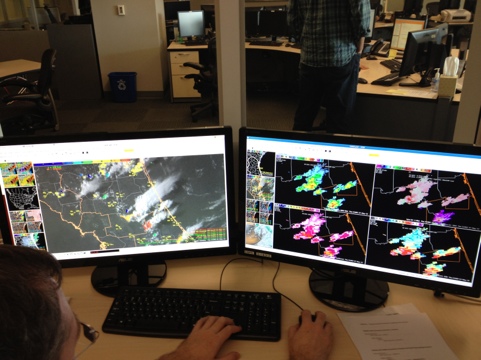
An outflow boundary from earlier coastal convection is intersecting instability in north-central Florida, leading to new development in the far southern portion of the JAX CWA and far northern portion of the MLB CWA. Updraft strength, updraft helicity, and even 10km divergence (not in this image) have all become very interesting across Marion, Lake, and Volusia Counties.

3DVAR Simulated Reflectivity, Composite Updraft Maximum, Updraft Helicity, and 10km Divergence valid 2012-05-17 2210 UTC

These data have prompted the issuance of SVRs for parts of Marion and Volusia county, and special marine warnings have been issued off the coast.  The JAX team has split into half-JAX, half-MLB to address the evolving threats.

Update: 2012-05-17 2230z

Todd and Stephen are going through the 2010-05-19 case in OUN. I decided to let Julia relocalize to MLB as convection is intensifying in the northern CwA. One of the storms west of Daytona beach is sporting a three body scatter spike and 3dVAR updraft of 15m/s

20120517-172733.jpg

Jim LaDue. EWP Week 2 coordinator.

Tags: None

Update: 2011-05-17 11:30z

I ave Todd and Stephen the opportunity to exit MLB and try out a case since convection was appearing to remain weak in their area. They went for it and the case is being set up.

Brian and Julia are still in warning mode in JAX with a southward moving multicell riding an outflow boundary.

Tags: None

CI & CTC May Provide Lead Time on JAX-area Storm

Another severe thunderstorm warning was recently issued (2148 UTC) for a portion of southeastern Georgia (Appling and Jeff Davis Counties), west of Vidalia.  It’s worth noting that both the UAH CI and the UW CTC products flagged this storm quite some time ago.

The first indication on this cell occurred with a 59 strength-of-signal indication from the UAH CI product.

UAH CI and Visible Satellite valid 2012-05-17 1945 UTC

The SOS increased to 68 on the next satellite scan, then 71 on the subsequent scan (2015 UTC).  The UW CTC flagged the storm for the first time at 2045 UTC with CTC rates of -13 to -14 C/15min, and that decreased to -16 C/15 min on the next image.

UW CTC and Visible Satellite valid 2012-05-17 2045 UTC

The visible imagery becomes quite impressive with overshooting tops by 2130 UTC.  The SVR was issued at 2148 UTC, based mostly on distant radars.  The 3DVAR analysis domain was just recently expanded to include this area, and MRMS POSH and MEHS were not particularly impressive.

Visible Satellite valid 2012-05-17 2145 UTC

3DVAR Captures JAX-area Outflow

Another severe thunderstorm warning was issued near the Florida-Georgia border based on strong dual-pol radar and MRMS signatures.  3DVAR hasn’t been as interesting (perhaps the storms are too close to the KJAX radar), but the simulated reflectivity product is picking up on an impressive outflow boundary crossing the state line.

3DVAR Simulated Reflectivity valid 2012-05-17 2110 UTC and KJAX 0.5-Degree Reflectivity valid 2012-05-17 2108 UTC

JAX – ThetaE Gradient

Noticed an interesting diagonal differential heating sort of boundary in across northern Florida where the next round of convection appears to be initiating.  It show up well on the nearcast as s thetaE gradient and is now showing up on Vis and CI products…if this end up being the focus of more critical convection later in the afternoon this could be a really good application the nearcast product.  There was a similar looking (though not sure if it was the same cause) feature when we were MLB two days ago that was where the bigger stuff triggered.  Waiting to see….

JAX – 3D Var vs Dual Pol

Here is an good example of 3d Var picking up on a strengthening storm and some mid level rotation.  The top 4 panel 3 d var from 1905 and the second is radar from 6 minutes later.  The updraft strength, updraft helicity and updraft velocity products show a strong signal while the mid level storm relative velocity images (3 and 4 degree scans especially) have good rotation developing.  Not much at low levels (images not shown) but nice example of 3-d Var pick up and highlighting mid level rotation.  One additional feature that would be very good to have in the 3d var data is something that shows the height of max updraft helicity.  Built a 4 panel to compare all tilts radar (top two panels) to 3-d var updraft helicity and storm top (10 km) divergence as they seem to be good parameters to for finding rapidly intensifying/severe storms and will have to see how it works for the next storm.  Below is an example of the procedure with interesting gravity wave like features from the previously dissipating storm but nothing much firing yet to see how it works.


Interestingly there is a red (94%) and a few other CI detections in the vicinity of the ‘gravity wave’ looking things.  Curious to see how they build…

GOES sounder nearcasting CAPE

We’ve been keeping an eye on the relationship between the GOES nearcasting CAPE field and the coverage of the developing convection over Florida today.  The synthetic satellite imagery has also done a good job on delineating the areal coverage of developing convection.  The four-panel image has actual Infrared imagery on the upper left, synthetic satellite imagery on the upper right, visible satellite and lightning data on the lower left and a layered CAPE field derived from GOES-13 sounder nearcasting data.  The highest CAPE values, around 1200 joules/kg, are located just to the northwest of Lake Okeechobee, with an axis of lower CAPEs further to the north.  There is also a subtle increase in CAPE values over northern Florida, where additional convection is developing.  The region with the lower CAPEs has weaker convection at this point.  The synthetic satellite imagery is a 12 hour forecast using the 06z run of the WRF model, valid at 18z.  It also does a nice job depicting less convection in the region of lesser instability.

Dankers/Kearney

Outlook: 2012 May 18

Today’s situational environment remains little changed from our expectations yesterday.  An upper-level low has moved in from the Gulf yesterday to South Carolina today.  Deep, moist convection (DMC) has already erupted around the perimeter of the upper low.  To the south, unusually strong mid-level flow continues along the central Gulf to the FL peninsula.  With plenty of moisture resident over FL, and southwesterly low-level flow, it appears we have a good juxtaposition of shear and CAPE in a climatologically unusual location.  Supercells are likely, especially where the shear is strongest from St. Augustine and south.  However the question of the day is expected coverage of DMC.  The coolest air aloft resides close to the upper low meaning that northern FL would see the steepest lapse rates and least inhibition.  Early DMC in southeast GA helps confirm this thinking.  Further south, the air aloft is warmer and coverage is expected to be less.  We’ll also have to rely on the initiation of the west coast seabreeze to help provide the strongest low-level forcing to overcome the greater inhibition to the south.  The eastern seabreeze may help to provide enhanced low-level shear but the poor boundary-relative convective steering layer flow will limit residence time of any incipient DMC in its lifting zone.  While some time may lapse before we get mature storms in the central FL peninsula, whatever storms that form could turn into supercells, especially if they latch onto the enhance shear along the eastern seabreeze. Damaging winds and large hail are possible with these storms though an unusual intersection between outflows and seabreeze interaction may enhance low-level vertical or horizontal vorticity enough for a tornado.

At this time, Todd and Stephen have localized to MLB while Brian and Julia are covering JAX.

Jim LaDue: EWP week 2 coordinator

Tags: None

First Warning of the Day for JAX

The first severe thunderstorm warning for the day for WFO JAX comes along the JAX-CHS CWA line in Glynn County, GA.  The 3DVAR analysis indicates some of the strongest indicators seen this week.

3DVAR Analysis of Simulated Reflectivity and 1km U/V Wind, Updraft Composite, Updraft Helicity, and 10km Divergence valid 2012-05-17 1905 UTC

The 1-km U/V winds indicate 30-40 knot winds (perhaps a rear-inflow jet) nearing the coast, 19 m/s composite updraft strength, 159 m/s^2, and 10km divergence of 10.72 s^1.  These values (particularly the updraft) are among the stronger storms we’ve seen this week.  After some AWIPS 2 problems, a severe thunderstorm warning was issued after confirming these data with the KJAX radar.