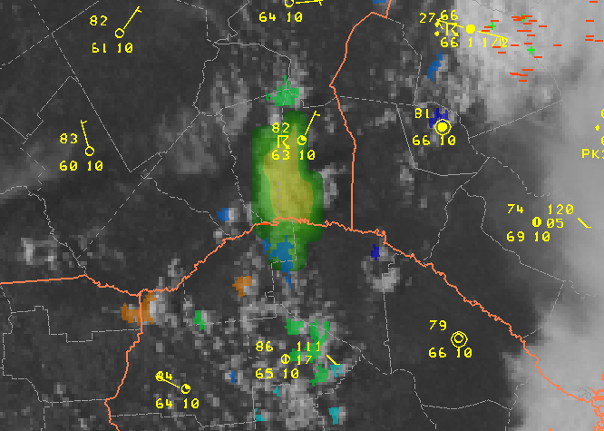
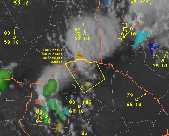
Another severe thunderstorm warning was recently issued (2148 UTC) for a portion of southeastern Georgia (Appling and Jeff Davis Counties), west of Vidalia. It’s worth noting that both the UAH CI and the UW CTC products flagged this storm quite some time ago.
The first indication on this cell occurred with a 59 strength-of-signal indication from the UAH CI product.

The SOS increased to 68 on the next satellite scan, then 71 on the subsequent scan (2015 UTC). The UW CTC flagged the storm for the first time at 2045 UTC with CTC rates of -13 to -14 C/15min, and that decreased to -16 C/15 min on the next image.

The visible imagery becomes quite impressive with overshooting tops by 2130 UTC. The SVR was issued at 2148 UTC, based mostly on distant radars. The 3DVAR analysis domain was just recently expanded to include this area, and MRMS POSH and MEHS were not particularly impressive.


