Evolution of ProbSevere

I am finding the all hazards version of ProbSevere to be extremely useful as a situational awareness and decision making tool. Here is a short animation of the evolution of ProbSevere thresholds for a storm near Kermit, TX.

Below is a timeseries for the same storm…

A loop of the ProbSevere thresholds provides a quick look at the potential hazards, but it becomes even more powerful when you combine it with the timeseries.

GOES GLM products offset

Always important to keep in mind that the locations on all GOES Products are offset based on the tilt of both GOES satellites relative to the CONUS. Good Example of the offset of GLM with ENTLN lightning data displacement shown here.

Would something like this be problematic when calculated into the ProbSevere model?

#ProtectAndDissipate

Good non-severe storm with agreement from radar/satellite products

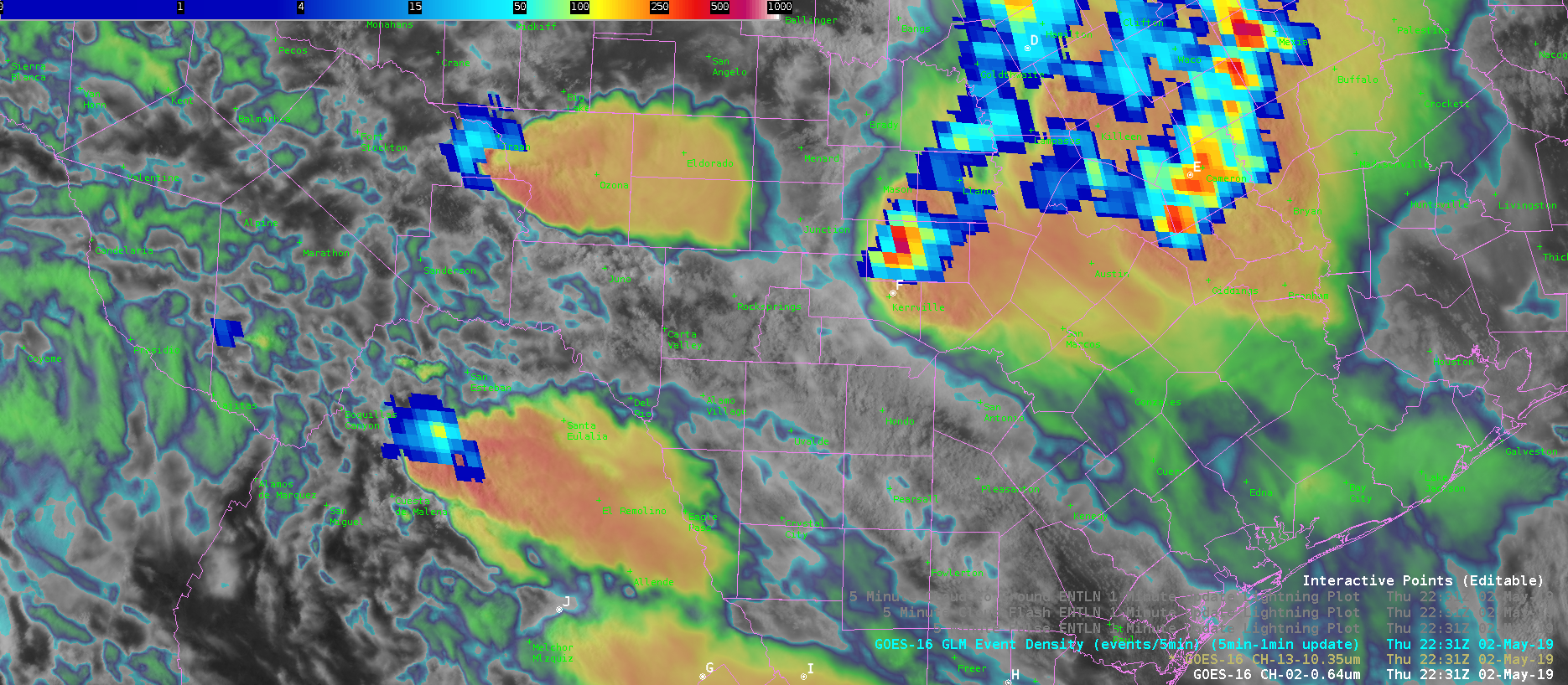
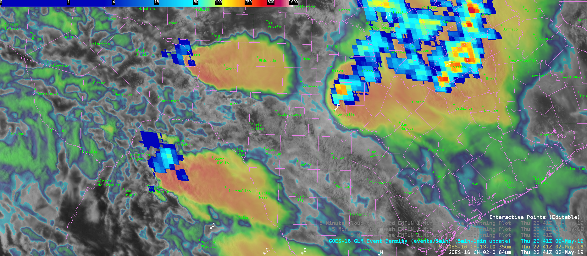
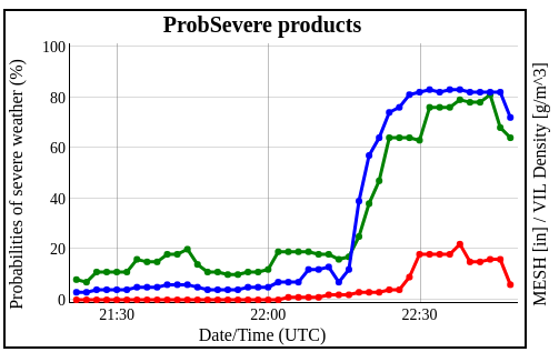
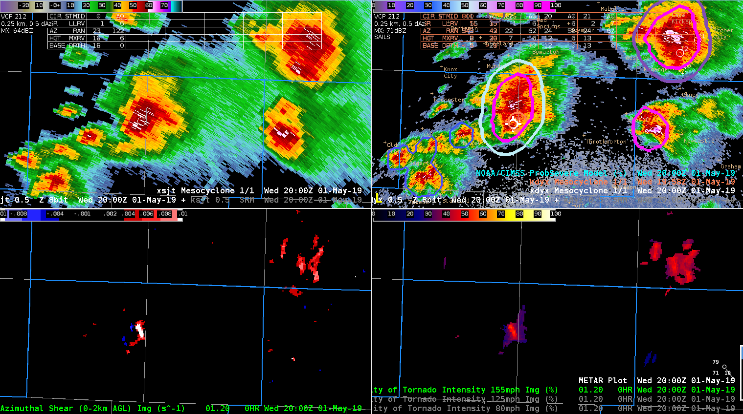
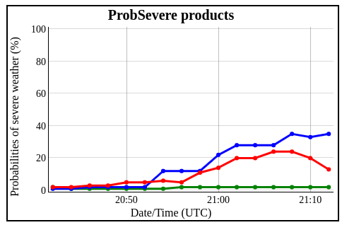
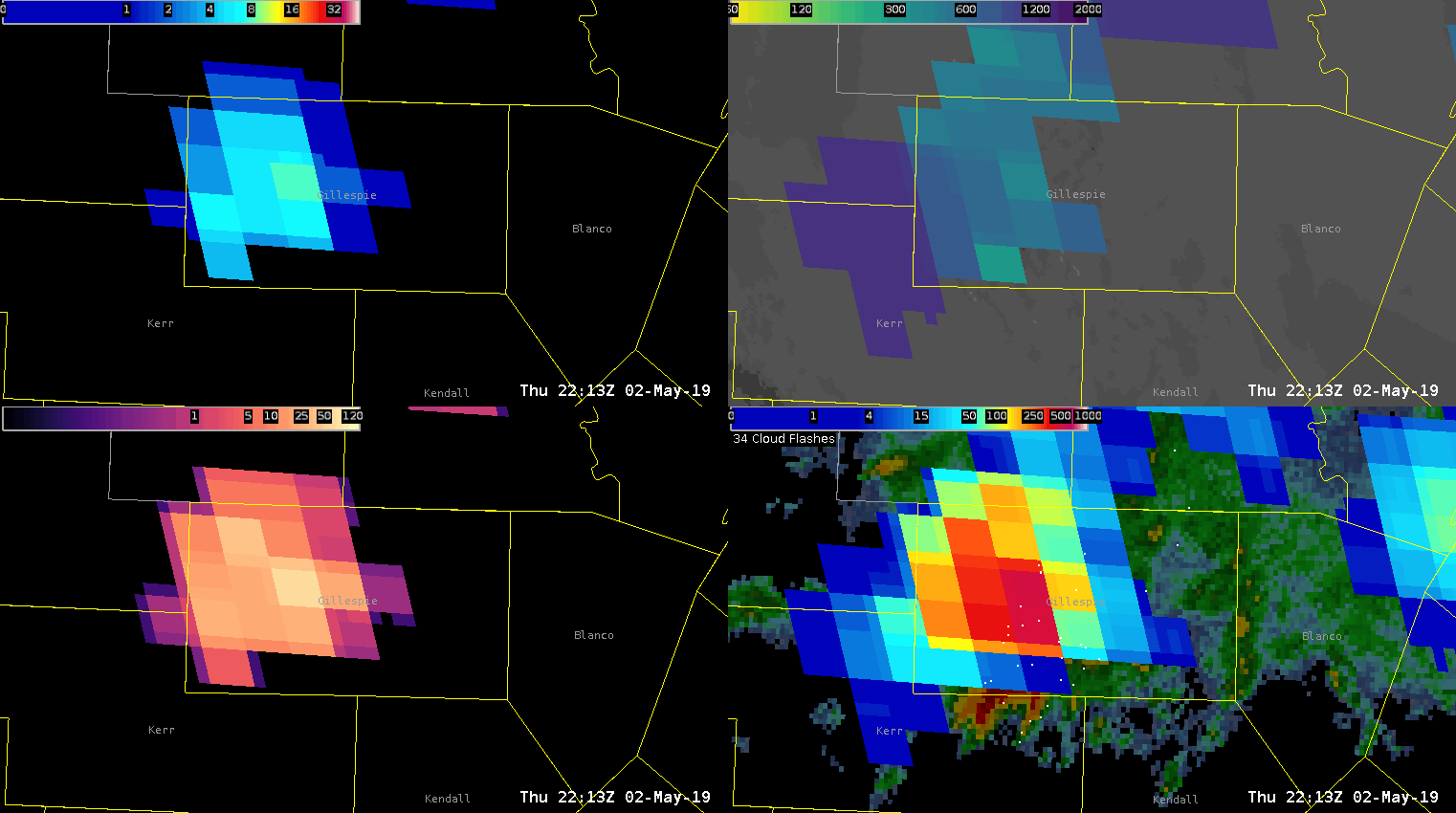
One storm became near severe around 545 pm in EWX CWA. All parameters; lightning, ProbSevere and Dual-pol radar agreed on the evolution of the storm and expected impacts. Radar data suggested there to be equal wind and hail threat based on high ZDR and KDP within the core suggesting sub-severe hail. There was some notching in the back side of the storm’s reflectivity as the front end of the storm surged eastward suggesting some wind threat. Lightning over this time had increase from 10 fl/min to 20 fl/min about 15-20 minutes prior to the development of some weak mid level rotation. As the storm cycled and weakened, so did the lightning and ProbSevere values. An uptick in GLM event density was followed by a slight increase in ProbSevere values toward the end of the loop.

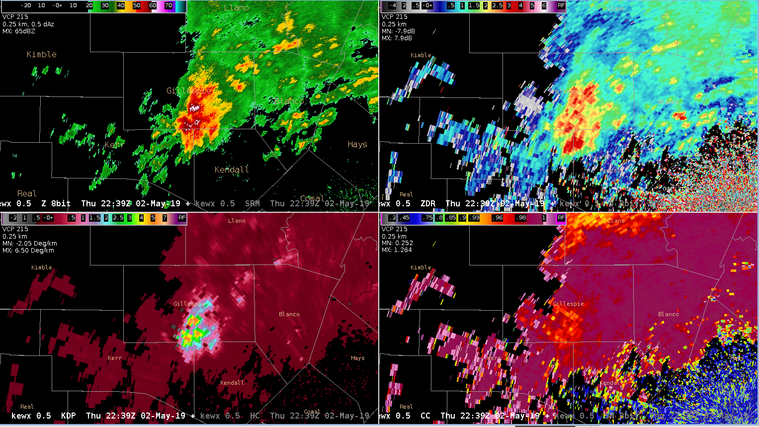
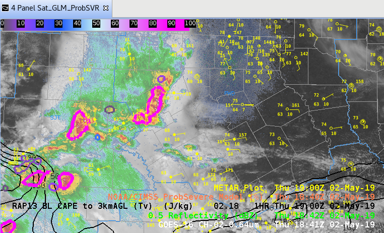
KEWX 4-panel – Refl (UL), ZDR (UR), KDP (LL), CC (LR)

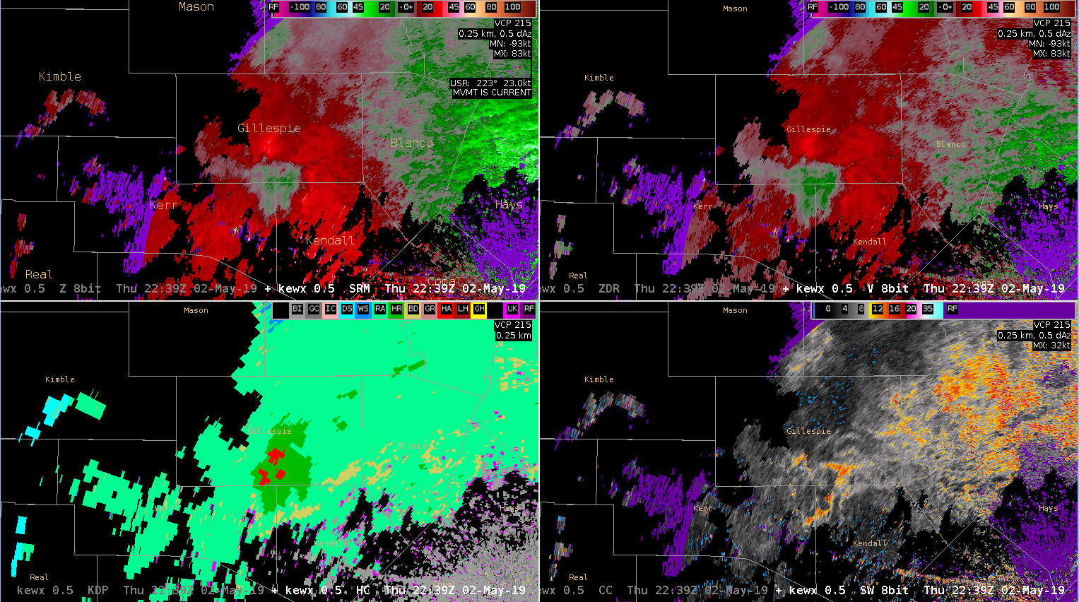
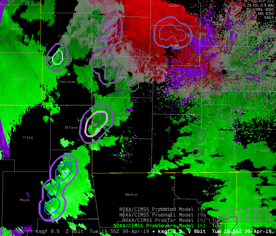
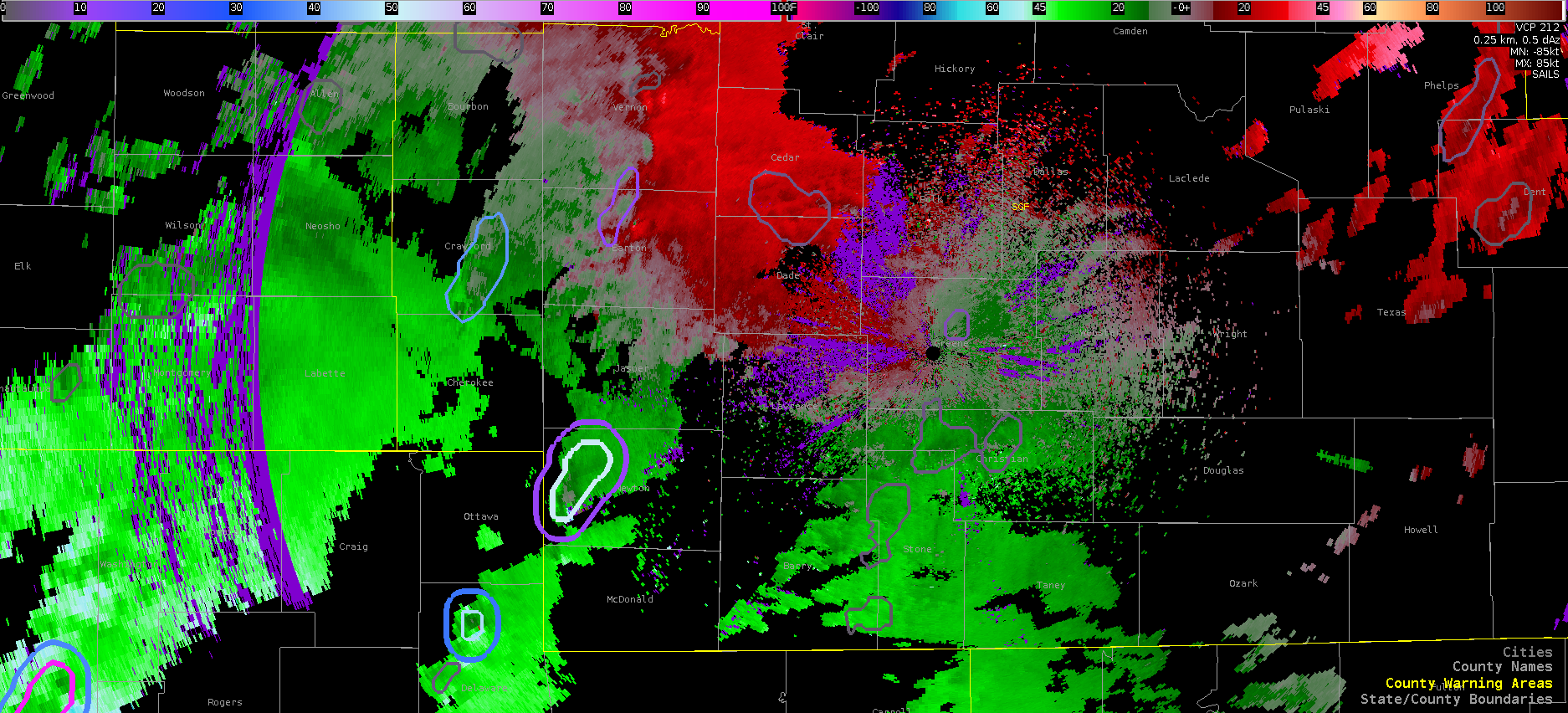
KEWX 4-panel – SRM (UL), V (UR), HC (LL), SW (LR)

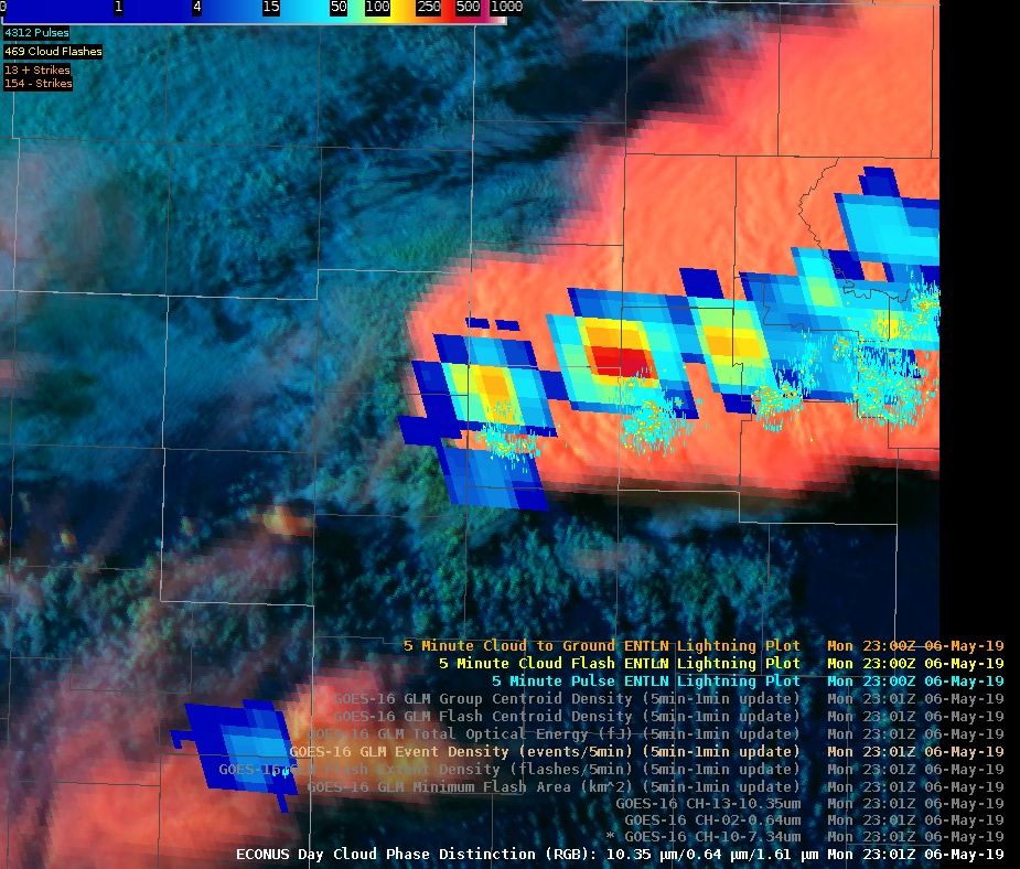
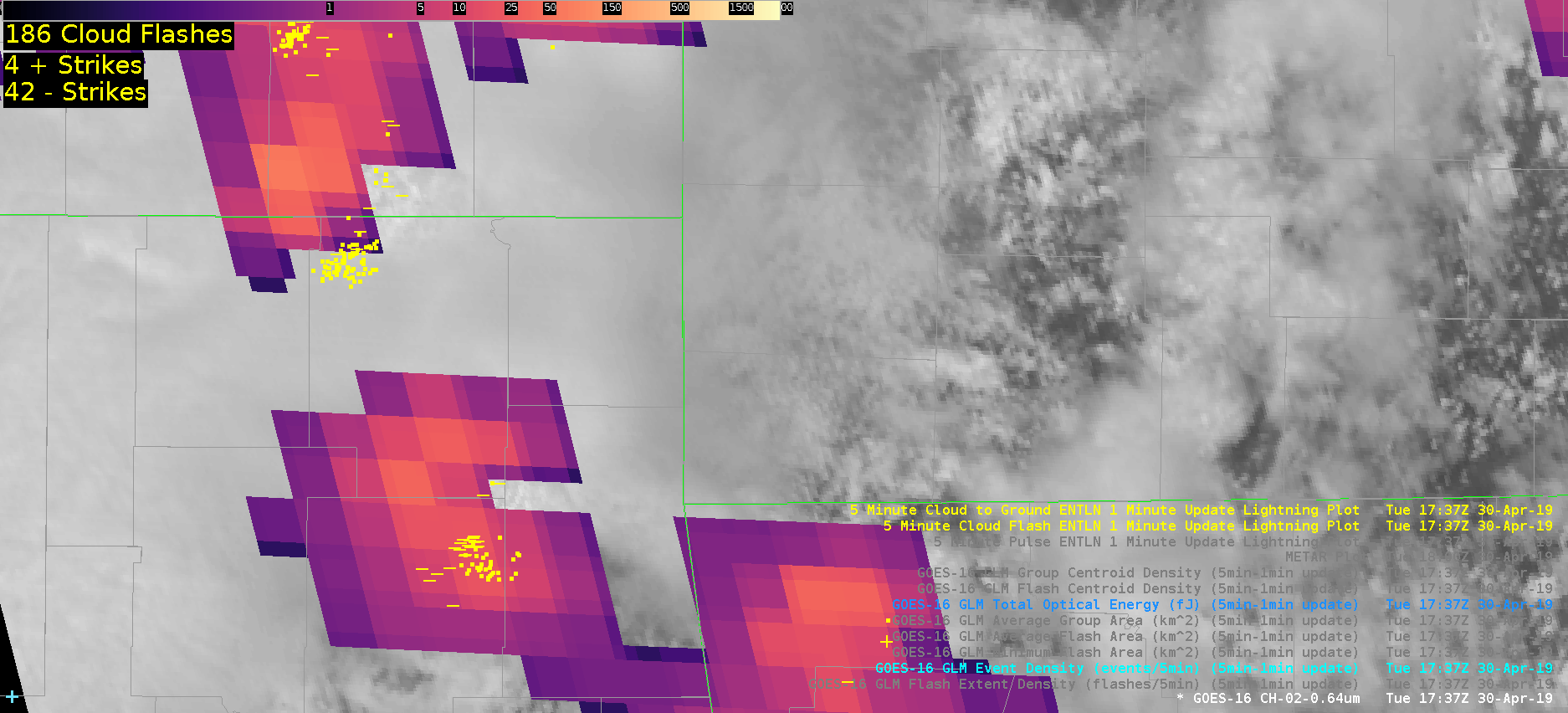
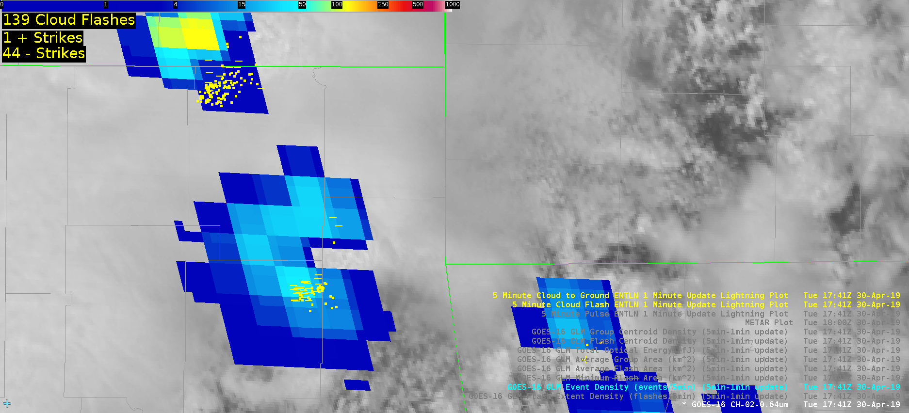
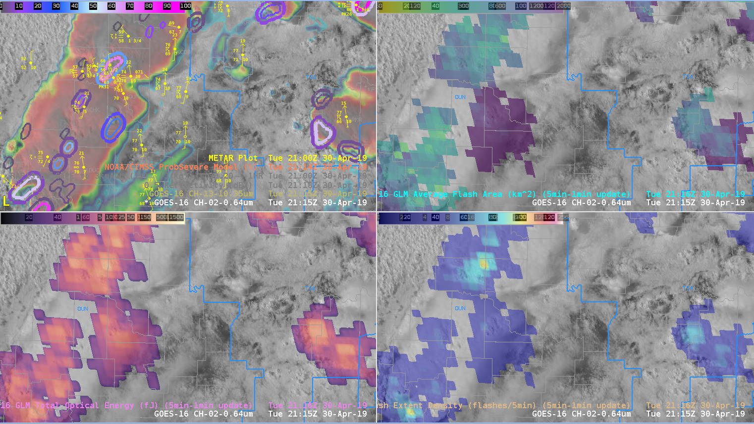
GLM sequence of Gillespie County storm – 1-min(FED)(UL),AFA(UR),TOE(LL),EventDensity(LR)

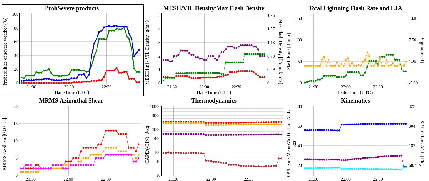
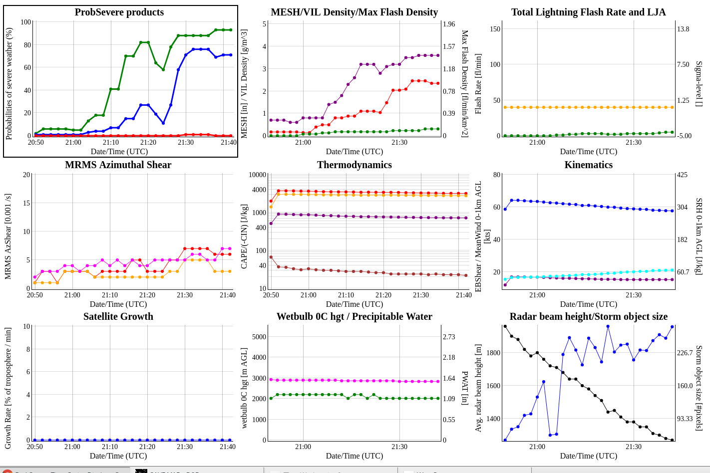
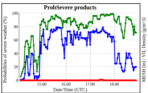
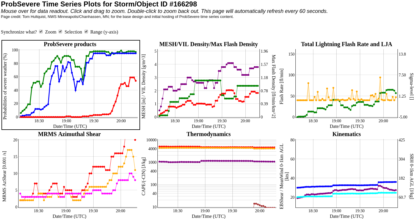
ProbSevere time trends from http://cimss.ssec.wisc.edu/severe_conv/plots/PSplots.php?ID=176047

— SCoulomb

Lightning Event Density As A Proxy For Storm Intensity

Lightning Event Density was mirroring the storm near point F for a fair amount of time. Notice how the prob severe graph almost directly correlates to the product. When Flash Event Density decreased, the Prob Severe decreased as well. Greater Flash Event Density seems to correlate to storm intensity.

Lightning Event Density Before Storm Weakens (Point F)
Lightning Event Density After Storm Weakens (Point F)
Trend-line for the storm…notice the drop-off that occurs when the flash event density decreases.

South Beach

HWT Day 2 case blog: Start until 19:10

This rapidly developing supercell displayed a GLM lightning decrease as it intensified. This was a good example of optical attenuation due to an updraft core. ENTLN network is displayed, showing that there was a tremendous of CG and IC flashes despite low GLM values. Shown is the TOE product.

The same storm and lightning minimum shown in Event Density.


ProbTor was occasionally too aggressive. Only one of these storms was really concerning at this time given the environment and radar tilts further up in the volume. On a day like this, it would likely be prudent to increase the probtor threshold above 3%

Prob Tor contours showing  a new probtor threshold of 10% instead of 3%. This was edited on the fly in the localization file of the procedure itself. This view shows a less cluttered display given the amount of rotating storms this day.


Comparison of MDA products over a weak low topped supercell, as well as showing the probsevere contours. ProbTor was at 47% at the time, prompting the issuance of a Tor Warning.


ProbSVR

ProbSVR time series graphs with the online version continues to be one of my favorite for tracking trends.  Uncertain how to display this cleanly in AWIPS II?   – Jake Johnson

SC Entering Washington County

This storm has had consistent Azhear max for past several volume scans, but again does not seem to match low-level SRM scans very well. Prob Tor has increased and remained steady at about 75 to 77 % CPTI has remained slightly over 50%. Upgraded SVR to Tor possible. Reflectivity structure suggests increasing organization with well organized ZDR arc arc suggesting increasing SRH. May upgrade to tor shortly given better storm structure in base data. Quick Twip