Outlook – 17 June 2010

The last operations day for EWP2010 finds us operating in the Northern Plains/Midwest for the first time this spring.

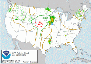
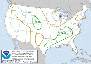
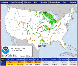
The SPC has issued a MODT Risk for the Minnesota area in response to a strong negatively tilted trough and deep surface circulation moving through the area.  Attendant to the system will be a very unstable warm sector, warm front and occlusion with a trailing dryline/cold front.  Forecast soundings from the 17 UTC RUC valid for 00 UTC show very deep instability (3000-4000 J/kg).  Deep layer shear exceeds 50 kts, especially in the north part of the state.  Low-level shear also is very high, exceeding 30-40 kts in places.  Hodographs, especially over MPX’s northern half and DLH’s area are very favorable, with a hint of a Dan Miller sickle on some.

For today, we are going to start two forecasters right away on nowcast and warning operations for the Minneapolis MN (MPX) WFO.  Tornado Watches are already out for the area.

The two other forecasters who hadn’t yet done the 5/24/08 LMA archive case are doing so this afternoon.

Greg Stumpf (EWP Weekly Coordinator, 14-18 June 2010)

Tags: None

Outlook – 16 June 2010

A severe weather episode is expected over our Washington DC Lightning Mapping Array (LMA) domain, so we will be operating in that area.  An upper level trough and associated surface cold front over the central Appalachians, along with a tongue of very moist unstable air to the lee of the mountains are the primary ingredients for severe weather today.  0-6 km shear will exceed 30 kts over the domain, and increase to above 40 kts over central and northern Pennsylvania.  0-1 km shear will be adequate (20 kts), and CAPE will be in the 1000-2000 J/kg range.  A lee trough has set up, and the first wave of severe thunderstorms is expected to affect our CWAs (Sterling VA – LWX, and State College PA – CTP) around 20 UTC, and should be through around 23-00 UTC.  Unless severe weather is ongoing in two CWAs after dinner, we will break off two of the forecasters to do the 5/24/08 archive case, while the other two will remain issuing warnings and watching the GOES-R products.  Otherwise, we will conduct the archive event on Thursday in an afternoon shift with two forecasters, and an evening shift with the other two forecasters.

Greg Stumpf (EWP Weekly Coordinator, 14-18 June 2010)

Tags: None

Outlook – 15 June 2010

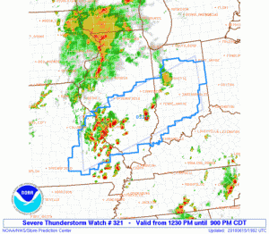
We are planning to work the event that is highlighted with an SPC Moderate Risk in Central Indiana south through central Kentucky and there already as a Severe Thunderstorm Watch in effect.  There is sufficient deep layer shear, as well as some decent low-level shear for rotating storms, but the main threat today appears to be high wind.  This will be a good example of how we might be able to use some of the MRMS products for wind warnings, which we haven’t had much experience with yet this spring.  So we will start with localizations for Indianapolis IN (IND) and Louisville KY (LMK).

In addition, the GOES-R convective initiation products should get a good work out today, as the area covered by both CWAs is essentially cirrus free at the moment!

Greg Stumpf (EWP Weekly Coordinator, 14-18 June 2010)

Tags: None

Outlook – 14 June 2010

Today we start week 9 of the 2010 EWP.  Our visitors are Angela Lese (WFO Louisville, KY), Melissa Kreller (Southern Region HQ, Fort Worth, TX), Marcus Austin (WFO Tallahassee, FL), and Dave Sharp (Melbourne, FL).

A long stationary front is draped across the southern plains, with a late season strong 500 mb jet max overhead.  This will provide severe weather and flash flooding opportunities from a broad region from the south Texas plains through central Oklahoma.  SPC highlights the area with a Slight Risk, and best chances of supercells over the Texas portion of the risk area where the deep layer shear is more adequate.

Because central Oklahoma is under the convective gun today, we opted to operate within the Lightning Mapping Array (LMA) network there.  Unfortunately, the morning flash flood over OKC (10″+) have caused some outages in the LMA netork, and thus it is unavailable.

Therefore, we are going to complete training through 530pm, break for dinner, and then do a short IOP focused on the 5% SPC tornado risk in Texas.  Most likley, we will act as WFOs Lubbock, Midland, San Angelo, or Norman (the latter, for the NW TX counties).

Greg Stumpf (EWP Weekly Coordinator, 14-18 June 2010)

Tags: None

Outlook – 10 June 2010

Today we again started our debrief with looking at the previous day’s CI products.  In this case, we reviewed areas that were outside of where we operated since yesterday’s domain was dominated by thick cirrus/ice.

We then switched to a discussion of the pGLM products.  A comment was made that suggested that the pGLM added some advance dense CG areas and potentially helping to more early identify (or at least add confidence to) new and healthy updrafts.

We wrapped up the discussion with quickly reviewing some MRMS data.  We focused on the Rotationtracks product as a potential aid in areas where swatchs of strong winds may be occurring or have occurred.

As for today’s activities, since there appears to be no chance for severe weather in any of the LMA domains, we will focus on the SPC MDT Risk in NE CO/SE WY/W NE.  The cirrus appears to be cooperating and today will hopefully be a good day to examine the GOES-R products.

We are anticipating a longer shift possible and we are starting with Andy working on the archive case while Dan D / Dan N are monitoring convective initiation in the BOU CWA.  Frank and Pat are doing likewise in the CYS CWA.  We have localized LBF and GLD CWAs in anticipation for later this evening if needed.

Kevin Manross (EWP Weekly Coordinator, 7-11 June 2010)

Tags: None

Outlook – 9 June 2010

We had a good discussion regarding last night’s events.  We started off with reviewing the GOES-R verification from CIMSS, actually for operations on the 7th and then the 8th.  We then moved to the MRMS review which prompted a good discussion on the use of divergence fields – particularly storm top divergence.  Chris showed a satellite div/vort field that is being jointly developed by CIMSS and NSSL via Bob Rabin.

As for today’s operations: We had hoped that we could perform realtime pGLM analyses using the NAL domain.  Early convection had suppressed that hope (excuse the pun) momentarily, but as the day continues, new/re development appears to be likely in the OHX/HUN areas which is advantageous to pGLM ops.

Kevin Manross (EWP Weekly Coordinator, 7-11 June 2010)

Tags: None

Outlook – 8 June 2010

We begin our first full day with a debrief/discussion from last night’s activities.  Dan D., Frank A., Pat S. Andy T. and Dan N. led off with a good discussion focusing on some of the merged grids as well as some discussion on polygon orientation.  The participants provided several good suggestions for products and product improvement.

We followed up with a discussion on today’s activities.  SPC has outlined a focused area in E KS, and we will plan out operations there.  We were hoping to get a good look at the GOES-R products, but there is considerable cirrus limiting the usability of that product in that area.  We have cheated out floater domain to provide some overlap to the W where the cirrus are less, and as I type, the UWCI product is lighting up over the TX PH. Also, a TOR watch has been issued for E KS.

Frank and Pat are running through an archive case for GOES-R / pGLM / LMA, while Dan, Dan and Andy are taking a look at the realtime GOES-R products.

We may take a 30 minute dinner break -or- start into MRMS/GOES-R ops (and do dinner in shifts) immediately after the archive case since we are expecting early initiation.

Kevin Manross (EWP Weekly Coordinator, 7-11 June 2010)

Tags: None

Outlook – 7 June 2010

Today we start week 8 of the 2010 EWP.  Our visitors are Frank Alsheimer (WFO Charleston, SC), Dan Darbe (WFO Atlanta/Peachtree City, GA), Daniel Nietfeld (WFO Omaha, NE), Pat Spoden (WFO Paducah, KY), and Andy Taylor (Norman, OK).

We will start with training the forecasters on the new products they will see.  Training will start with GOES-R products (CI & Overshooting Tops-Thermal Couplet), followed immediately by LMA/GLM training.  We will take a break an then do MRMS training likely followed by observing realtime products to get the forecasters used to looking at the data.

Regarding today’s outlook.  There is a large slight risk area across the Central & High Plains stretching west across the WY/CO border and terminating in the northern half of Utah.

There is not strong confidence in getting much in the way of SVR in the OK domain today (the best chance of SVR among all the possible domains).  We will likely run our Introductory IOP in our Floater Domain and likely set that near NE CO/SW NE / SE WY where there is currently an MD as this entry is being typed.

Kevin Manross (EWP Weekly Coordinator, 7-11 June 2010)

Tags: None

Outlook – 27 May 2010

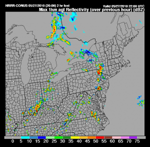
Focus for operations today is the mid-Atlantic through northeast US.  Moderate instability combined with weak shear has allowed for multi-cell storms to develop across the region.  Forecasters have been separated into three different CWAs: State College, PA; Philadelphia, PA; Sterling, VA.  In addition to the MRMS and GOES-R products the forecasters are able evaluate the GLM product as derived from the DCLMA.  Before operations began a SVR watch was issued for the intended operational area.

As opposed to earlier this week, the models (HRRR and NSSL-WRF) seem to have a decent handle on the situation and were evaluated in the daily wx briefing.

HRRR_1kmREF

Kristin Kuhlman (EWP Weekly Coordinator, 24-28 May 2010)

Tags: None

Outlook – 26 May 2010

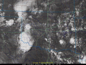
Following review of previous day activities, forecasters were split into a two groups for an archive case and real-time operations in Oklahoma (OUN CWA).    A moist boundary layer combined with CAPE values around 1500-2000 J/Kg and outflow boundaries from overnight convection have spurred storms in the OK region.

Kristin Kuhlman (EWP Weekly Coordinator, 24-28 May 2010)

Tags: None