Today we again started our debrief with looking at the previous day’s CI products. In this case, we reviewed areas that were outside of where we operated since yesterday’s domain was dominated by thick cirrus/ice.
We then switched to a discussion of the pGLM products. A comment was made that suggested that the pGLM added some advance dense CG areas and potentially helping to more early identify (or at least add confidence to) new and healthy updrafts.
We wrapped up the discussion with quickly reviewing some MRMS data. We focused on the Rotationtracks product as a potential aid in areas where swatchs of strong winds may be occurring or have occurred.
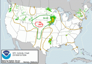
As for today’s activities, since there appears to be no chance for severe weather in any of the LMA domains, we will focus on the SPC MDT Risk in NE CO/SE WY/W NE. The cirrus appears to be cooperating and today will hopefully be a good day to examine the GOES-R products.
We are anticipating a longer shift possible and we are starting with Andy working on the archive case while Dan D / Dan N are monitoring convective initiation in the BOU CWA. Frank and Pat are doing likewise in the CYS CWA. We have localized LBF and GLD CWAs in anticipation for later this evening if needed.
Kevin Manross (EWP Weekly Coordinator, 7-11 June 2010)

