Sampling of Sub-Severe Convection Across the Southeast

Modified NUCAPS sounding appeared to have a better handle on the environment compared to baseline NUCAPS sounding. However, it also appears it might not be totally representative of the atmosphere given the partly cloudy conditions at the time RTMA data was pulled in. The SPC mesoanalysis page suggested MLCAPE upwards of 2500 J/kg in an uncapped environment.  Using the gridded mid level lapse rate product from NUCAPS we found the data to be representative. It verified well with what was shown in the NUCAPS soundings and matched with the values suggested by the SPC Meso Analysis page.

MODIFIED SOUNDING 1927UTC – WEST HINDS COUNTY, MS
1927UTC BASELINE SOUNDING – WEST HINDS COUNTY, MS
21UTC 700-500MB LAPSE RATES

The NUCAPS mid-level lapse rates were fairly representative when compared to the SPC mesoanalysis page. This was further evidence that large hail was probably not going to be in the cards for the Jackson area today, but marginally severe wind gusts would be something to watch.

16 UTC 700-500MB NUCAPS GRIDDED LAPSE RATES, SAMPLE NEAR THE SOUNDING DATA POINT

Prob Severe version 2 vs version 3, particularly in prob severe wind:

In this event, the prob severe there was a sig wx statement and severe thunderstorm warning put out by the Huntsville office. Around that time, the prob severe was increased specifically for the prob severe wind component. The version 2 had a prob severe value of 3% while the version 3 had a 53%.  Version 3 better captured the significance of the storm with a 40 mph gust reported around the same time.  This is significant since we were also discussing how filtering lower prob severe thresholds would be useful in decluttering the operational screen. We could have missed this event if that was the case (with version 2).

Based on this experience, we can see the vast improvement in the wind component of prob severe version 3.

21:16 UTC ProbSevere Sample (note V2 versus V3 differences in sample).
Local Storm Report of a measured 41mph wind gust in Colbert County AL, just north of the contoured ProbSevere storm.
1 Minute FED overlaid with ENTLN 5 minute (1 minute update) and GM Flash Point

GLM Observation:

Saw a steady lightning jump depicted in the GLM FED correlated with a storm that NWS Huntsville issued a Severe Thunderstorm Warning on. Several mPING reports of wind damage (assuming sub-severe with no LSRs issued as of this time) which raises confidence that storms are intensifying. Perhaps the most interesting thing about this screenshot is seeing the parallax-correction in action when looking at the Flash Points.

Optical Wind:  

Still difficult to tell where you are geographically.  Suggestions to perhaps swap the lime green grid with the state outline colors.

Additionally, the time stamp gets cut off if you zoom in on the product and occasionally gets covered by the wind barbs themselves. Perhaps a floating time stamp would be better for this instance.

Time stamp for the image above.

A note about the timestamps:

The time stamps attached to the wind barbs appear to be formatted incorrectly, showing times like 21.97Z, note the actual time correctly formatted shown in the image below was actually 21:58Z.

– Groot and Dwight Schrute

Tags: None

NOAA-20 Pass Ahead of Severe Convection

The San Angelo CWA was expecting severe convection in the afternoon.  There was a NOAA-20 pass over their CWA at 1927Z.  A NUCAPS Sounding in the clear air ahead of ongoing convection was chosen.  The approximate point of this sounding is shown by the white circle in the left image.  The sounding in the right image showed an environment very favorable for severe convection, including hail.  Since ongoing severe storms were heading in this direction (left image), the storms could be expected to maintain their intensity or possibly strengthen.

– Champion

Tags: None

GLM Flash Point Product

The GLM Flash Point is a unique addition to the GLM suite of products.  It’s parallax corrected, which is nice.  But the points seem to tell you less data per minute than the FED.  In this example there are eight points for the Sterling/Irion County storm.  However, you need to mouse over each point to get more data (flash duration and area).  By comparison, the FED quickly tells you this is an electrically active storm.  In a warning environment, with limited screen space, and where every second counts, the FED tells you a lot more very quickly than the Flash Points.

– Champion

Tags: None

New Mexico Severe Storm

Radar imagery showed a storm form and rapidly strengthen over Guadalupe County, NM.  ProbSevere matched this intensity increase well.  The storm looked like it was going to become severe.  ProbSevere jumped to 60% at 2226Z, which was about a 40% increase in about 5 minutes.  Surprisingly, the 60% value was the same for ProbSevere Versions 2 and 3.  The modelers mentioned that Version 3 has lower values than what forecasters are used to seeing in Version 2.  Therefore, a 60% value for Version 3 is probably a higher threat than an identical value for Version 2.  That gave me more confidence considering this storm severe.

– Champion

Tags: None

Mesoanalysis summary for E CO

Looking at a surface map there looks to be a boundary, possibly a weak warm front, over E CO that storms are firing off of.  A similar feature can also be seen in the satellite data taken at the same time.

Lightning:

The FED did not give as much information about the growth stage of the updrafts as the flash minimum area did.  Also noticed the VII trend resembled a similar trend as the flash minimum area did.

The flash minimum area is also a good way to help catch the eye of what updrafts are strengthening, especially if the trend of low flash minimums persists.  Great tool to use at first glance of which storms need to be watched and which don’t.

-Dwight Schrute and Accas

Saw several examples of the flash density for lightning either muting out or not showing the trend the flash minimum area was showing.  In the past I have been using the flash minimum area to help me see trends in the lightning, but am now seeing that I should be using the flash minimum area instead if I want to see trends in lightning activity.  I use the lightning trends to help me know if the storm is rapidly intensifying or suddenly weakening and possibly about to generate a severe downdraft.  Being able to see these sorts of trends better can also help communicate a potential threat for storm intensification or severe wind development to those in the path of the storm.

-Accas

Area of coverage greater for the  minimum flash vs extent density.

MRMS and Satellite indicating glaciation (the small updraft in the center of the satellite picture). Lightning expected, but only seen potentially with the minimum flash area product and not with the flash extent density product. Until one scan later (shown below).

Next time stamp, we can see increased minimum flash area lightning over the new updraft and a pixel from the flash extent density. So the minimum flash area would likely be the best bet for using the tool with decision support services in mind due to its higher sensitivity.

-Dwight Schrute

This was a scenario where we were baffled by how little lightning was being shown from both the minimum flash area and flash extent density products. We asked why so little lightning compared to how much ice is in the storm, combined with MESH indicating a 2” hail stone.  The lightning with this maturing storm was not being sampled well.

-Dwight Schrute

Tags: None

NMDA detected over a weak TOR without NTDA detection

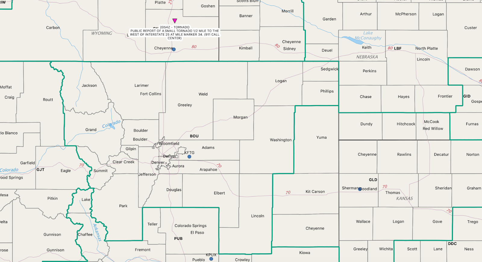
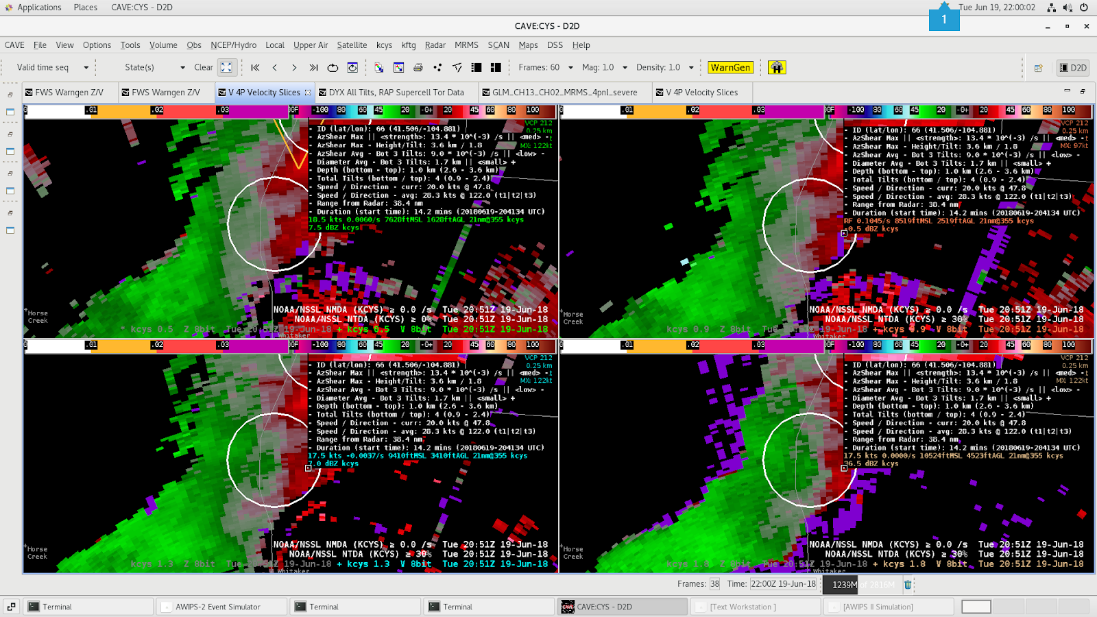
There was a public report of a small tornado just east of I-25 in CYS’s forecast area at 20:54Z. Base velocity data from the KCYS radar was pretty unimpressed showing some weak rotation at 20:51Z. The NTDA didn’t have a detection with it but the NMDA was detecting a meso with a medium azShear Max and low azShear Average. The stronger rotation was above the 0.5° with the NMDA triggering on the 0.9 to 2.4° tilts. I’m unsure that would have provided enough confidence to issue a tornado warning. But the NMDA could’ve given some clue to the potential for a tornado. There was no SAILS data for this event, so maybe if we had additional 0.5° scans then we would have seen a stronger rotation signal in the base velocity.

PUBLIC REPORT OF A SMALL TORNADO 1/2 MILE TO THE EAST OF INTERSTATE 25 AT MILE MARKER 34 | Laramie County | 25 miles N of Cheyenne
0.5, 0.9, 1.3 and 1.8° tilts from the KCYS radar at 20:51Z.

– Gerry Bertier

Tornado Warnings – Tulsa/Norman Event

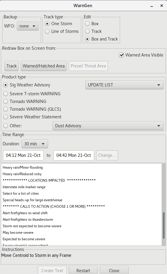
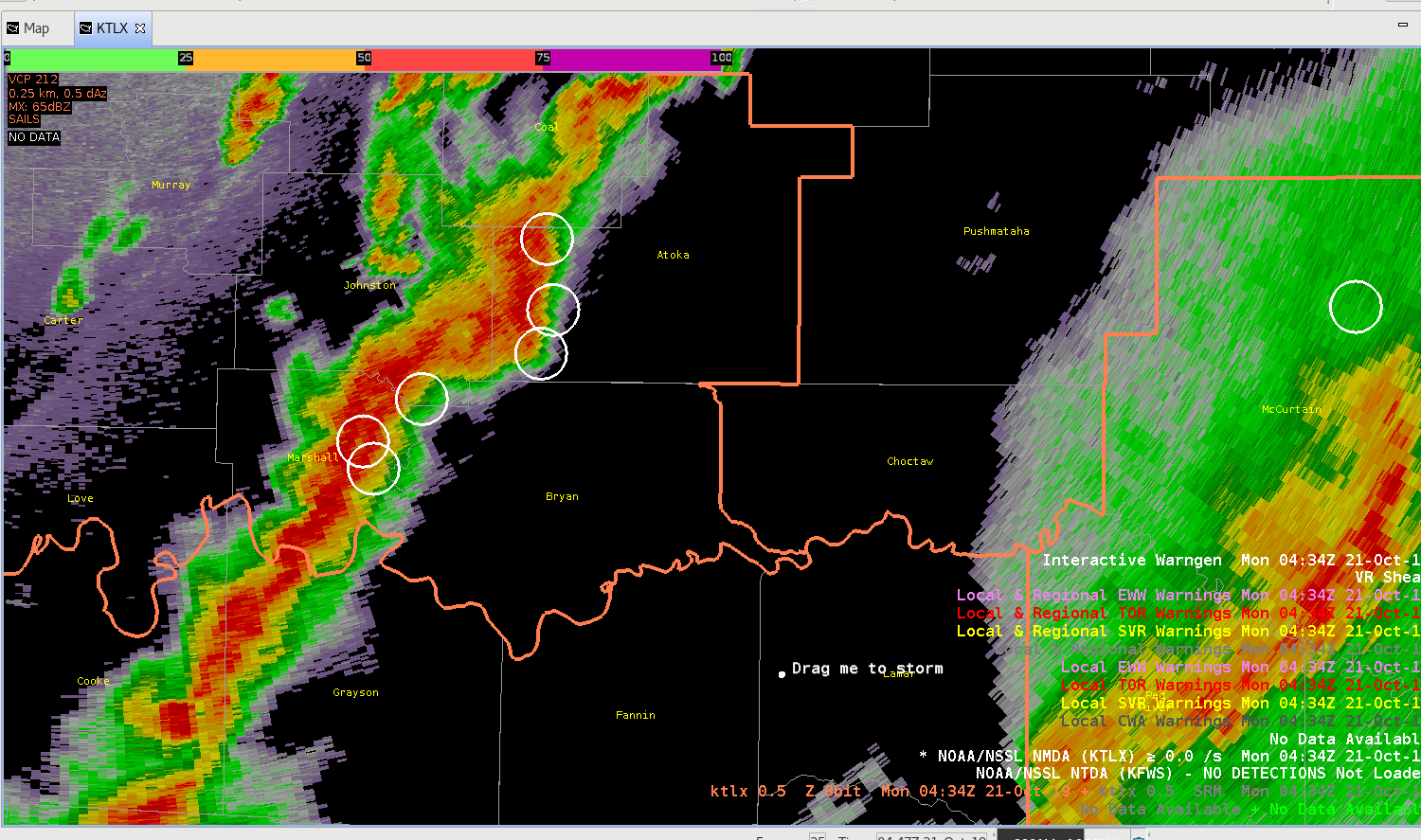
I became bogged down with WarnGen and the GUI with this event and it took away from some of my situational awareness.  I issued a few Tornado Warnings with the KOUN WarnGen GUI but it was customized differently from the previous several cases and real time events. I liked the Tornado Warning (QLCS) option, but the re-arrangement of the product types and the attributes threw me off.  I did toggle on the TLX or Tulsa option in the WFO knob to get back to reality a bit (Fig. 1).  I also had issues with the Track and Box.  I got a speed of 605 mph.  A new record.  I did not issue a warning until I got the speed back to 35-50 mph.

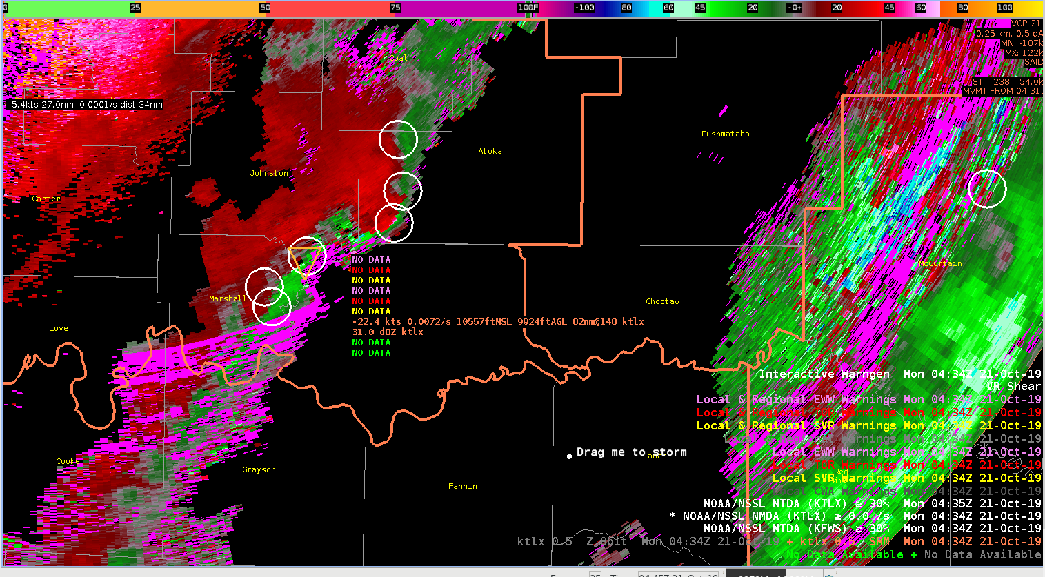
I switched primarily to SVR mode with TOR tags after I issued a few TORs as the warnings were not verifying.  I lowered the NTDA probs down to 20% thinking more TORs may be needed with maybe 40-60% probs.  I forecasted incorrectly with this.  I likely should have decreased the NMDA to the bottom threshold to reduce the numbers of MESOs detected. See the bottom two figures (Fig. 2 and Fig. 3) .  I likely should have issued a few TORs here late in the event for the south side of the line.  This would have been between 0430-0500 UTC.

Fig. 1: KOUN WarnGen GUI
Figure 2: 0434 UTC 21 OCT 2019 KTLX 0.5 DEG SRM, NMDA, NTDA, and Warnings.
Figure 3: 0434 UTC 21 OCT 2019 KTLX 0.5 DEG REF, NMDA, NTDA, and Warnings.

– Yoda777

Great Performance by NDTA and NMDA in OK QLCS Tornado

KINX

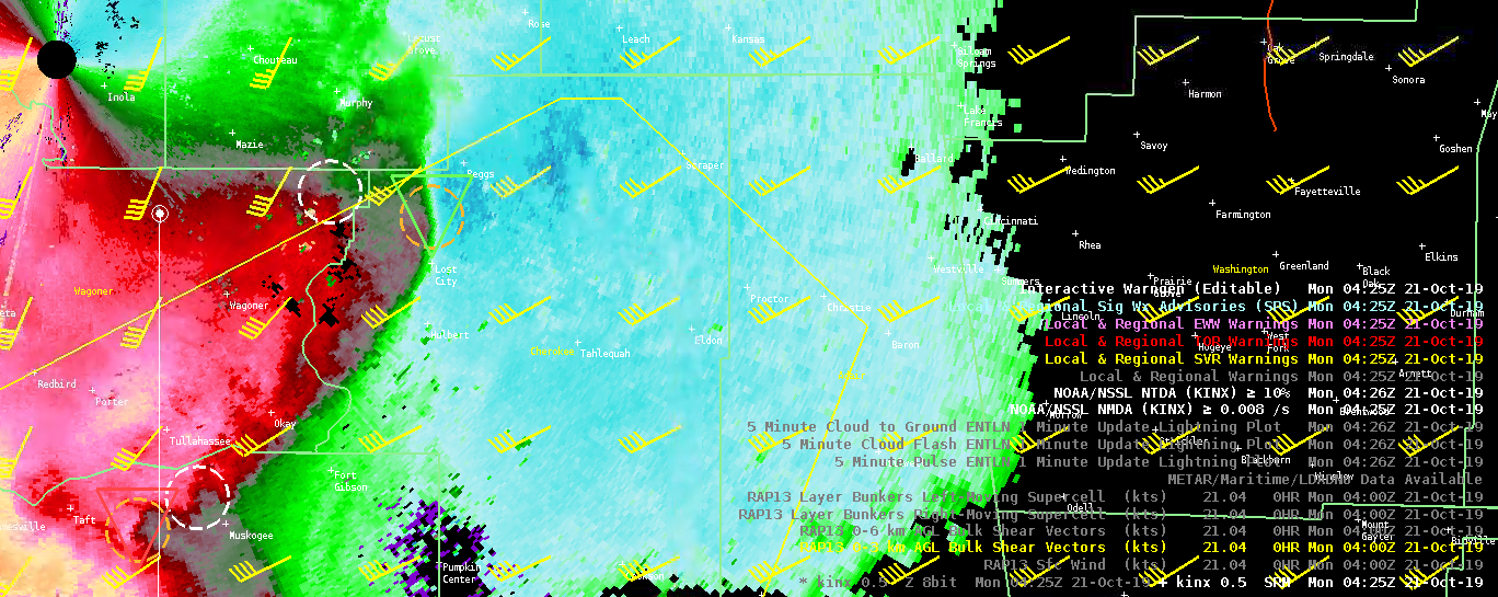
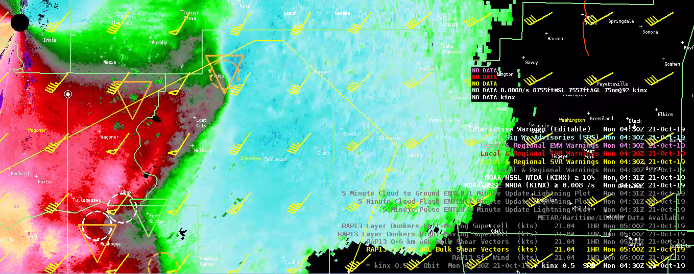
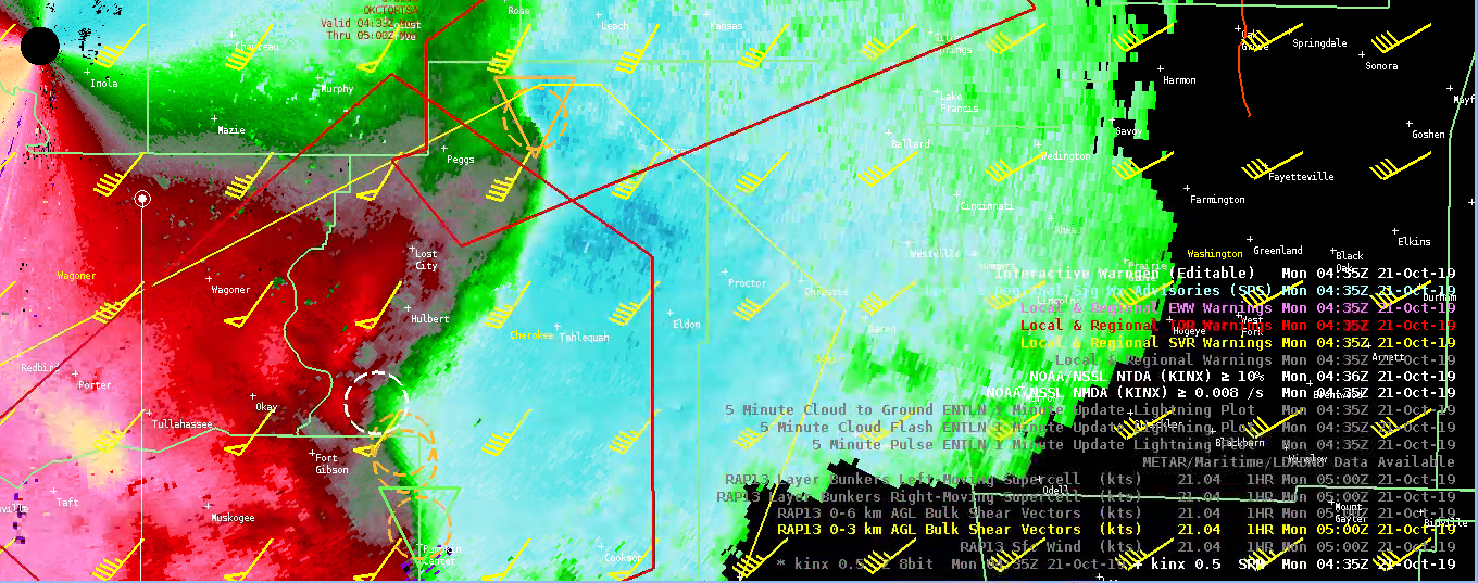
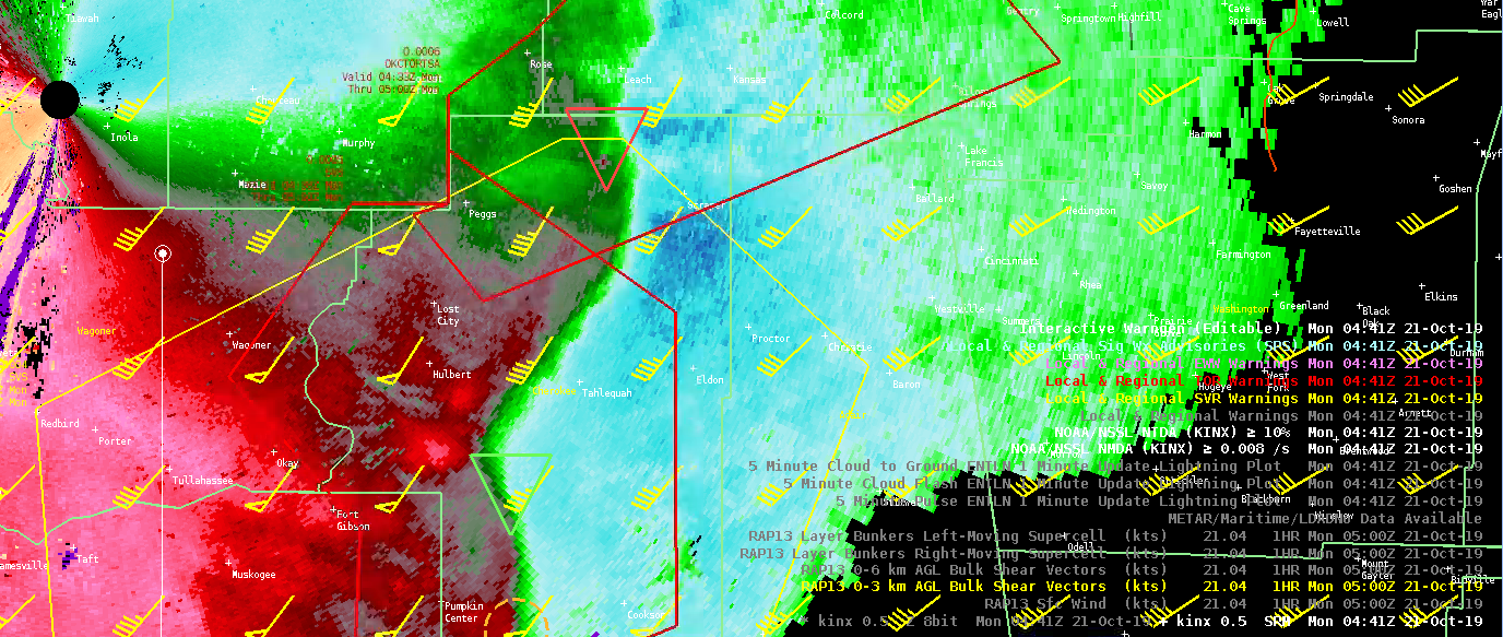
A QLCS system developed across Tulsa CWA and moved ENE to NE. Using the three ingredients method, along with the two algorithms, allowed me to get about 10 min lead time on a QLCS tornado in northern Cherokee Co.

KINX 0425 – Around the time both algorithms picked up on rotation. NDTA 21%, NMDA – mod (3 tilts)
KINX 0430 – Both algorithms showing increasing trend. Tracked object really well. NDTA 28%, NMDA – mod (10 tilts)

Tornado warning was issued at 0432Z.

KINX 0435 – NDTA 36%. NMDA still showing moderate rotation (5 tilts)
KINX 0441Z Around the time of the tornado – NDTA 52%. NMDA still showing moderate rotation (frame before) (10 tilts)

Over the course of the week, I’ve found that co-located detections (NMDA and NTDA) along with steady or increasing intensity trends in both, have given me increased confidence to issue or continue downstream warnings. While the NTDA probabilities can be somewhat low, at times (esp. QLCS systems), the monitoring the trends in the intensity output has been very valuable to me. Some sort of visualization of the trends (similar to ProbSevere) would be extremely helpful.

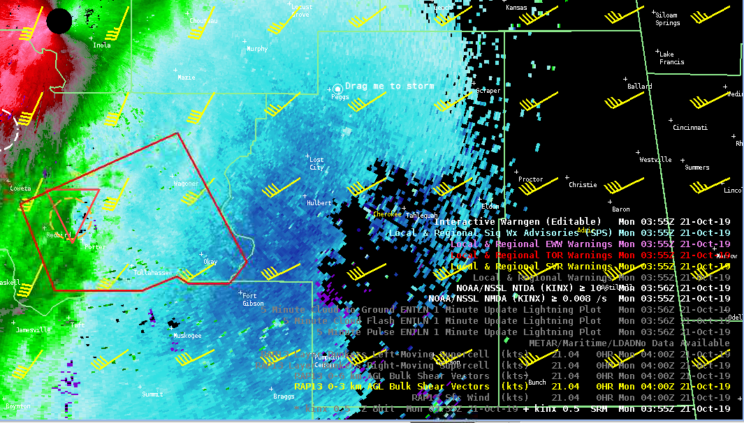
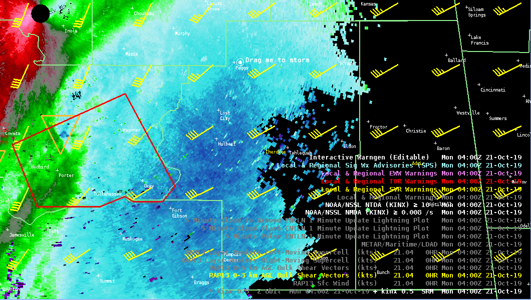
Earlier, the combination of the NMDA, NTDA, and three ingredients method gave me confidence to continue a tornado warning downstream of a current warning.

KINX 0355 – NDTA 51%. NMDA still showing moderate rotation (3 tilts)
KINX 0400 – NDTA 29%

New Tornado Warning was issued between 0400Z to 0405Z and there was a tornado LSR

There was another QLCS tornado earlier in the event in which the NTDA showed quick and substantial increase in probabilities – 39% @ 410Z, 43% @ 412Z, 67% @ 413Z, 59% @ 415Z. This didn’t really provide much lead time as I was a little late on the Tornado Warning, but the probabilities behaved as they should have.

– Beltzer

A Little Confidence Goes a Long Way – NTDA/NMDA Warning Decision Nudger

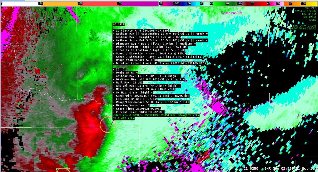
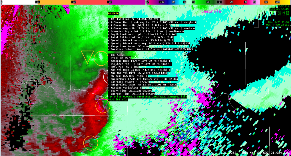
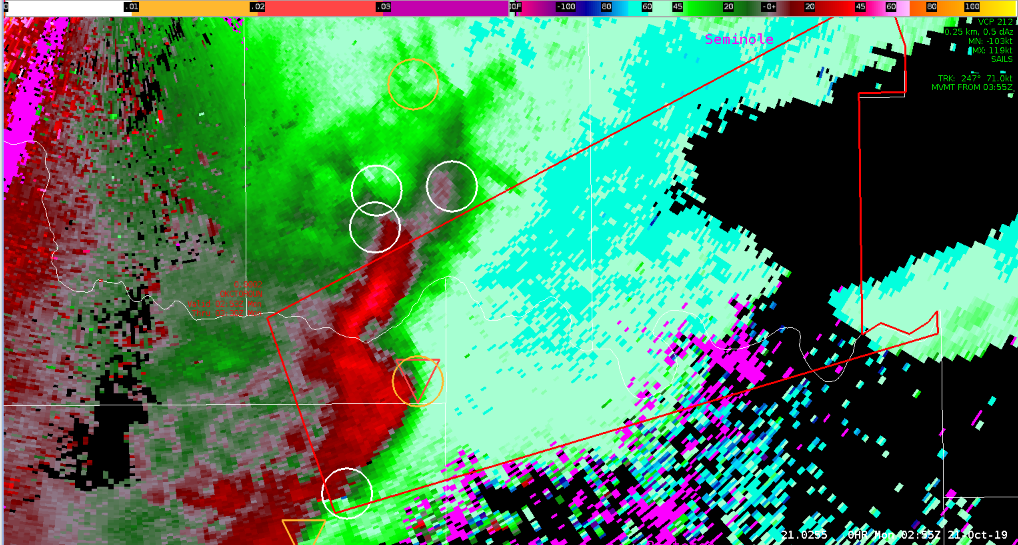
This was a great example where both the NTDA and NMDA algorithms acted as a confidence nudger for a warning decision – ultimately resulting in positive warning lead time ahead of a tornado. Interrogating a local surge in a line of severe thunderstorms southeast of TLX at 0250Z, this area was a prime focus for potential tornadogenesis given line-normal 0-3km Bulk Shear of ~40kts according to RAP13KM data (using the Three Ingredients Method). Scanning aloft quickly, a tightening mesocyclone was in progress which led to a tornado warning decision. By this time, I did notice quickly increasing trends in NTDA probabilities (83.59% at 0250Z, 86.36% at 0252Z) which by this time, I was already beginning to draw the TOR in Warngen. Seeing this display update while drawing the warning gave enough confidence to not second doubt anything, and to “pull the trigger”.

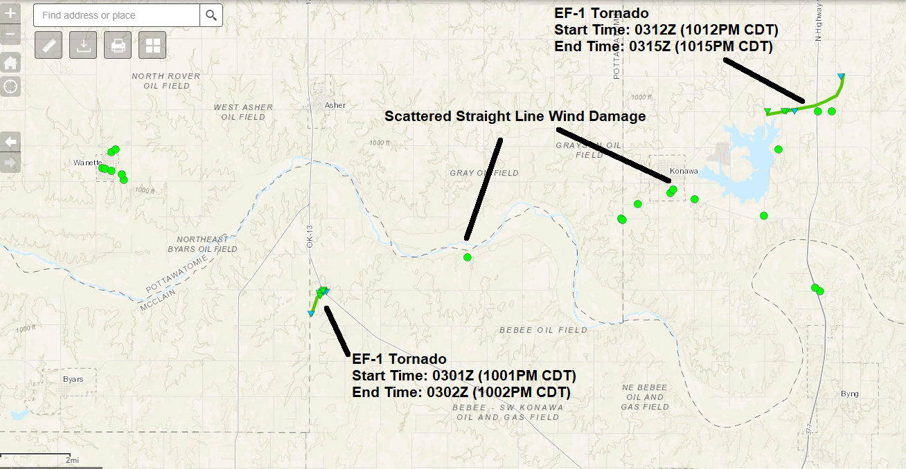
The warning came across at 0253Z, providing a 8 minute lead time to the first tornado (past survey analysis performed looking at the Data Assessment Toolkit shows a small EF-1 tornado touched down at 0301Z).

0250Z (0950PM 10/20/19) KTLX 0.5ºSRM plotting NTDA and NMDA.
0253Z (0953PM 10/20/19) 10/21/19 KTLX 0.5ºSRM plotting NTDA and NMDA.
0255Z (0955PM 10/20/19) KTLX 0.5ºSRM plotting NTDA and NMDA.
Tornado tracks and wind damage reports from the Damage Assessment Toolkit (DAT) showing two small tornadoes, and scattered wind damage from the local line surge/area of rotation.

Did the NTDA/NMDA algorithms make my decision? No, and honestly I am not sure when or where it would. What this does show is how these tools provided the confidence needed to make the decision, which in a stressful situation is vital. Confidence is hard to come by when making warning decisions, as there are so many tools (sometimes too many). I would safely say the NTDA/NMDA algorithms provided extra confidence to my warning decision which ultimately led to a positive lead time from my tornado warning. Great tool!

– Dusty Davis

Some issues with the algorithms in the TSA/OUN case

The TSA/OUN case was a mixed bag of supercell structures and QLCS storm types. Overall the performance of both the NMDA and NTDA did well. They showed higher values where you would expect to see stronger rotation. I thought both did particularly well with identifying areas along the QLCS where you would expect tornadic development based on the 3 ingredients method. Most of the detections, especially moderate or strong detections, were in favorable regions.

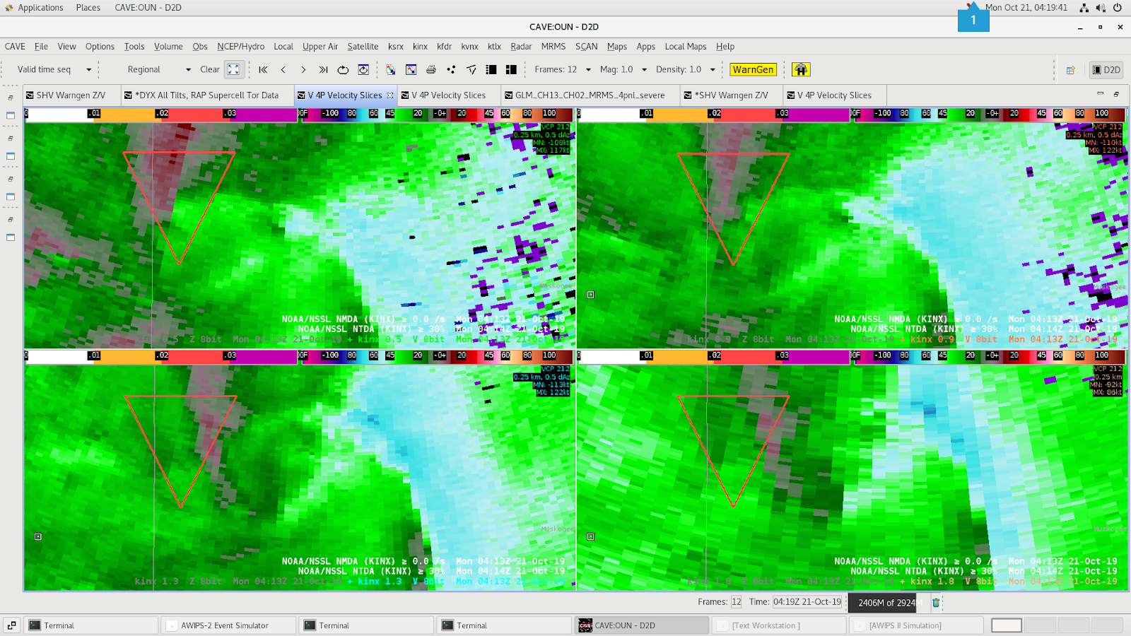
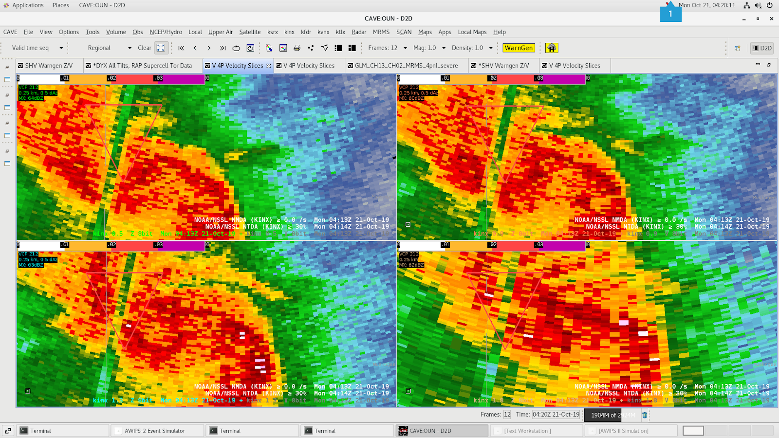
There were two very noticeable issues during the event. The first was caused by a bad radial close to the northern bookend vorticy of the QLCS. The NTDA picked up on the shear near the bad radial and identified it with a higher prob value. But it failed to identify a real couplet slightly further east. This may have been due to the distance requirement between two detections. The NTDA may have filtered out the nearby real detection favoring the artificially higher shear a bit further west. The NMDA didn’t detect either area.

0.5, 0.9, 1.3 and 1.8 Velocity data from KINX. Beam blockage caused an artistically high azShear value. Which may have prevented the NTDA from picking up on a real couplet.
0.5, 0.9, 1.3 and 1.8 Reflectivity data from KINX. Beam blockage caused an artistically high azShear value. Which may have prevented the NTDA from picking up on a real couplet.

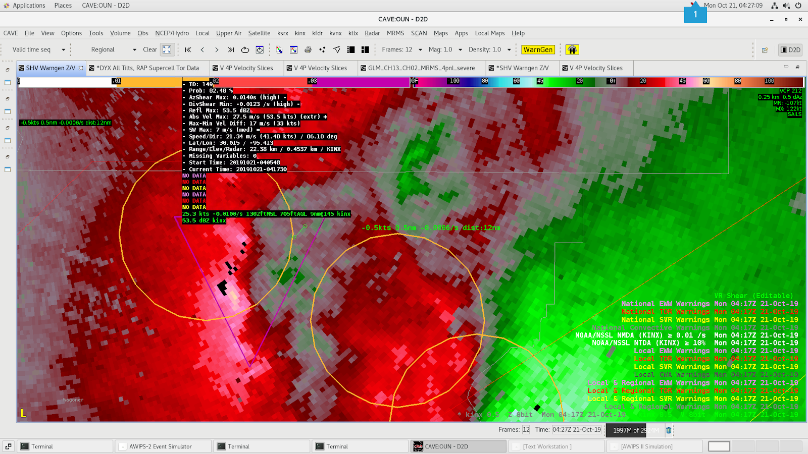
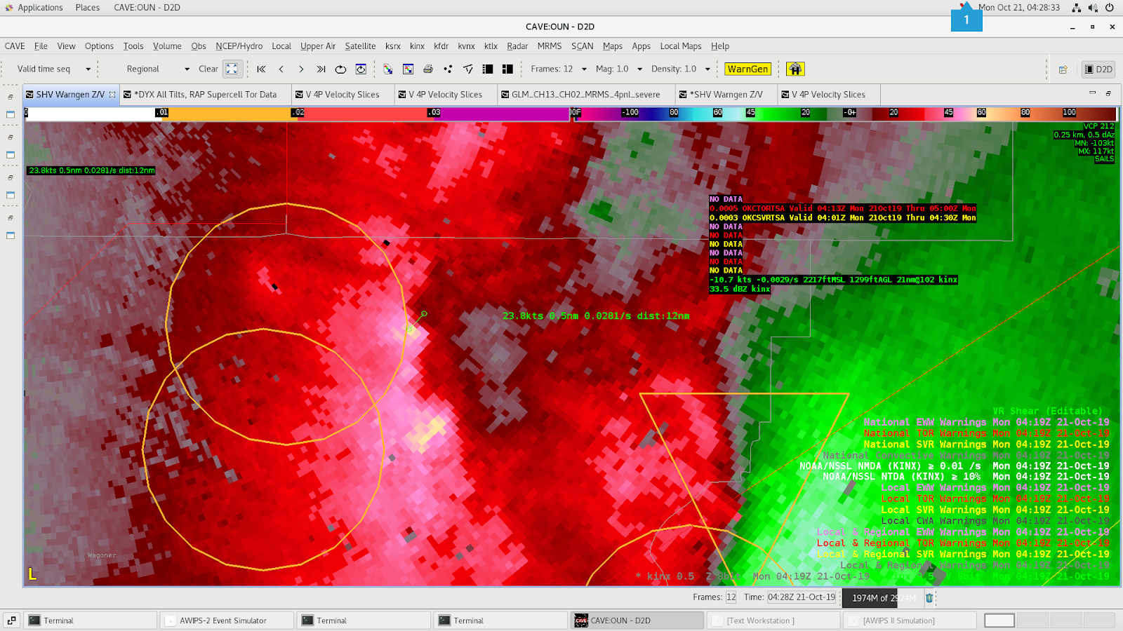
Later on in the event, the NTDA and NMDA detected an area of rotation closer to the KINX radar. The NTDA had a prob of 82% at 04:17Z but then at the next scan (04:19Z) was no longer detecting the circulation, even though it looked tighter than the previous scan. The threshold was set to >= 10% for the NTDA in the image below but I believe even adjusting it to 0% showed no detection. Looking at the velocity data it definitely seemed like there should be some detection on it. The MDA was problematic too. It seemed to detect the two areas of rotation at 04:19Z but they were located well left of the couplet. This could have been because of the known issue with having 3 sails scans in place.

Base velocity data from KINX at 04:17Z. NTDA Prob was at 82.48%.
Base velocity data from KINX at 04:19Z. No NTDA detection was made despite a tighter couplet.

– Gerry Bertier