
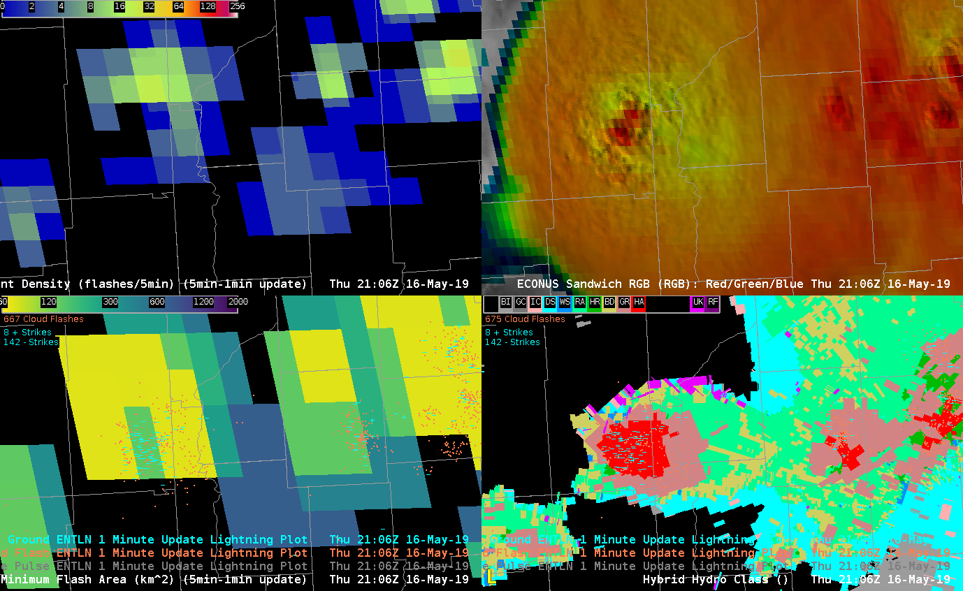
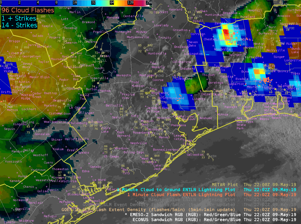
Over Indiana, there is a concentration of negative flashes where Minimum Flash Area is slightly larger. This is colocated with a hail core shown in the Radar Hybrid Hydro Class.
-Jonathan Wynn Smith (ESSIC/UMD)
Official websites use .gov
A
.gov website belongs to an official government
organization in the United States.
Secure .gov websites use HTTPS
A
lock (
) or https:// means you’ve safely connected to
the .gov website. Share sensitive information only on official,
secure websites.

Over Indiana, there is a concentration of negative flashes where Minimum Flash Area is slightly larger. This is colocated with a hail core shown in the Radar Hybrid Hydro Class.
-Jonathan Wynn Smith (ESSIC/UMD)
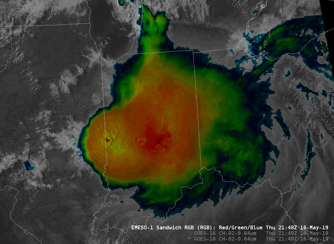
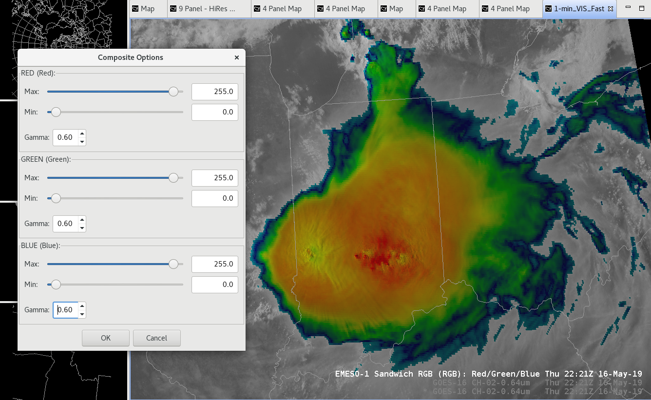
VisIR sandwich product has been a very useful way to combine the high res visible imagery with the cloud top temperatures. However late in the day as the sun angle gets lower, the image gets darker. One way to remedy this is to adjust the composite options (right click on legend), and equally lowering the Gamma setting. This will brighten up the image and allow better utility into the low sun angle hours before sunset.
Default:
After: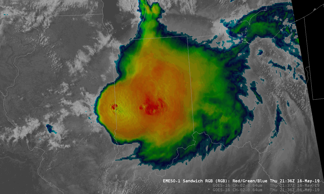
How to adjust settings:
— warmbias —
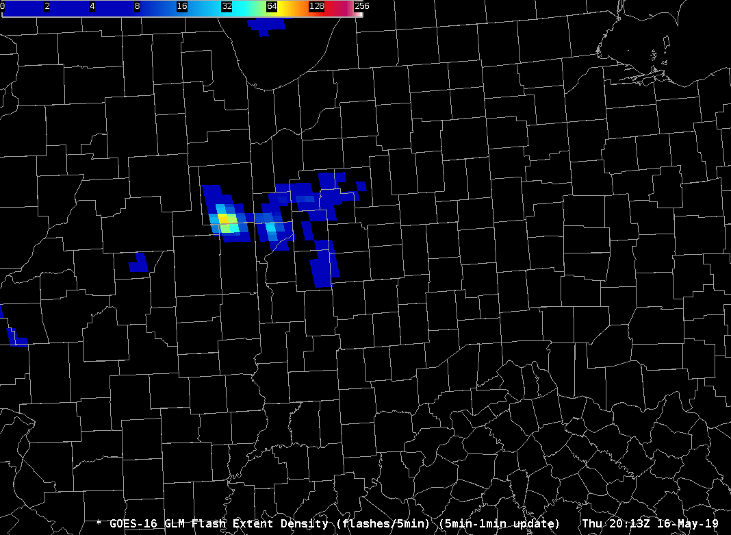
Testing a new colormap for FED using the Rainbow colormap in Python. The first image depicts the modified 5-min FED with the modified colormap. There is more variation on the lower end of the 5-min FED. Will this colormap depict the variation in the more intense convection. The second image is the original 5-min FED colormap. – Jonathan Wynn Smith (ESSIC/UMD)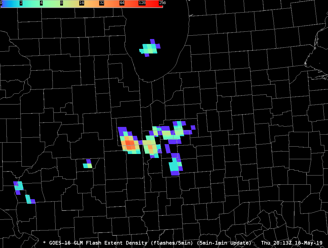
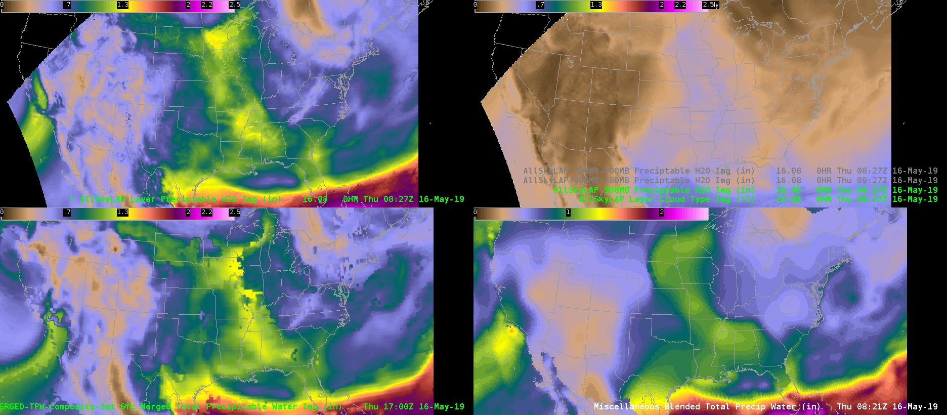
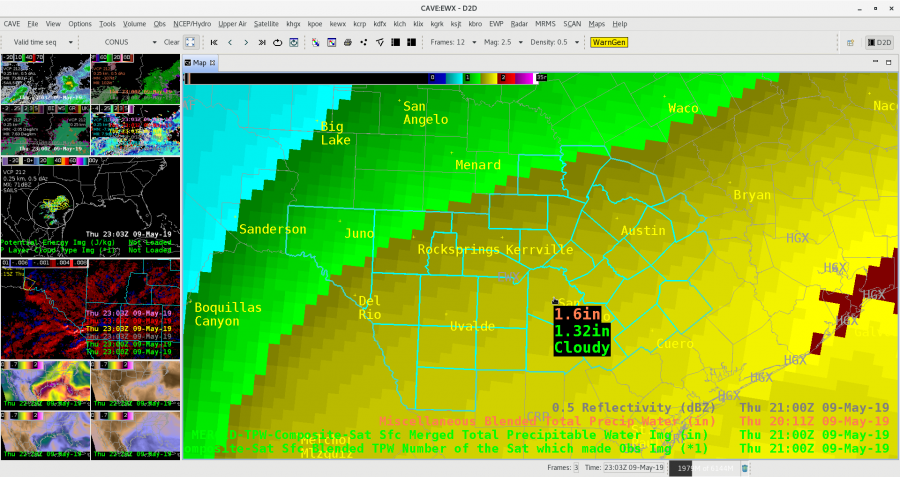
Here’s just a quick example of today’s TPW over the Midwest where a complex MCS and discrete supercell are located. The blended TPW is very low-resolution and therefore you miss the enhanced values that might be located over IL compared to the rest of the upper Midwest and southeast U.S. The AllSky products in IL are mostly using GFS, which may or may not be reliable, but at least it gives a better emphasis and resolution in where to focus your attention….as well as data underneath the severe storm complex. Over central IL, the TPW values are around 1.5 inch vs. the 0.9 inch for the blended TPW.
Animation below shows: Upper Left AllSky All Layer TPW, Upper Right AllSky sfc-900mb TPW, Lower Left Merged TPW, Lower Right Blended TPW
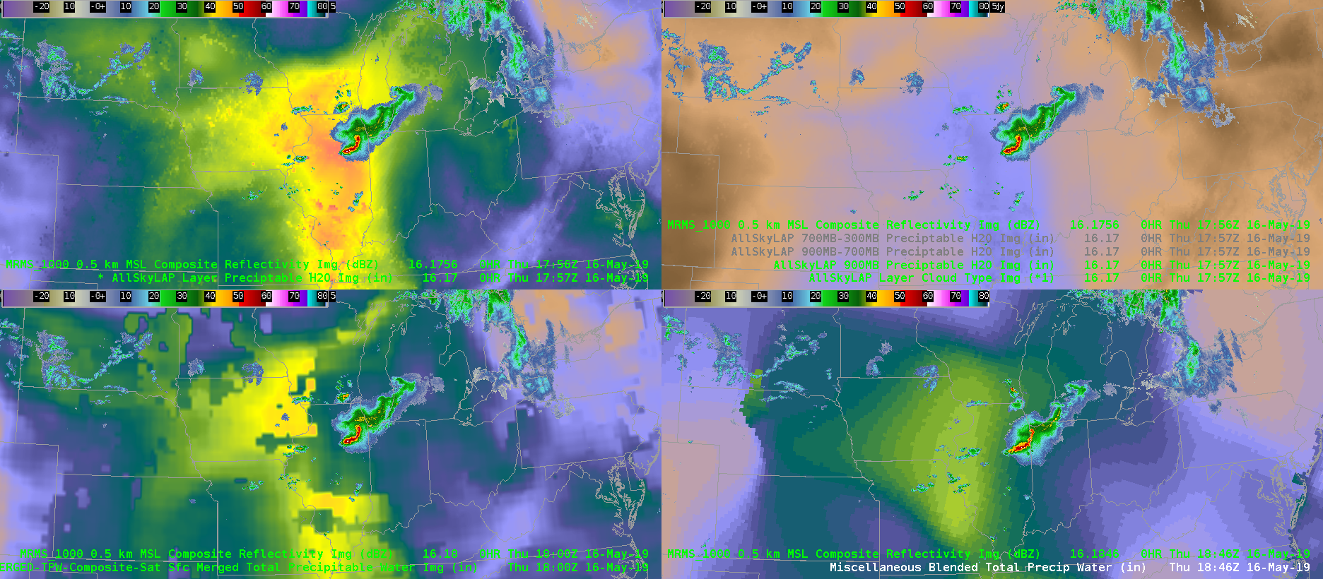
Below is a screen shot of the MRMS loaded at a similar time over the TPWs to see the impact of the cloud cover.
ProbSevere gives every indication of a severe storm over Morton County, ND (see ProbSevere read out below). The Earth Networks lightning suggests there of 52 fl/min but GLM FED gives 0 fl, TOE 0 fJ, and AFA 0 km^2. The two depictions below show those three GLM fields with the MRMS 1 km reflectivity. Perhaps there is an issue with viewing angle at this northern latitude. – Jonathan Wynn Smith (ESSIC/UMD)
ProbHail: 93%; ProbWind: 95%; ProbTor: 5%
– MESH: 1.83 in.
– VIL Density: 3.20 g/m^3
– ENI Flash Rate: 52 fl/min
– ENI Flash Density (max in last 30 min): 0.89 fl/min/km^2
– Max LLAzShear: 0.007 /s
– 98% LLAzShear: 0.006 /s
– 98% MLAzShear: 0.008 /s
– Norm. vert. growth rate: 2101Z 1.3%/min (weak)
– EBShear: 38.0 kts; SRH 0-1km AGL: 155 m^2/s^2
– MUCAPE: 2925 J/kg; MLCAPE: 1657 J/kg; MLCIN: -36 J/kg
– MeanWind 1-3kmAGL: 26.4 kts
– Wetbulb 0C hgt: 9.0 kft AGL
– CAPE -10C to -30C: 546 J/kg; PWAT: 1.3 in.
GLM: max FED: 0 fl; sum FCD: 0 fl/5-min
GLM: max TOE: 0 fJ; avg AFA: 0 km^2
Avg. beam height (ARL): 1.28 kft / 0.39 km
Object ID: 273531
PS: 98
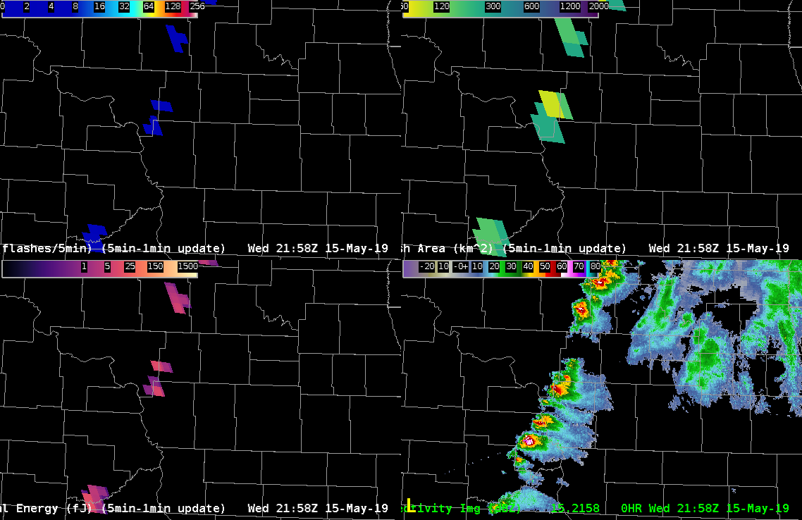
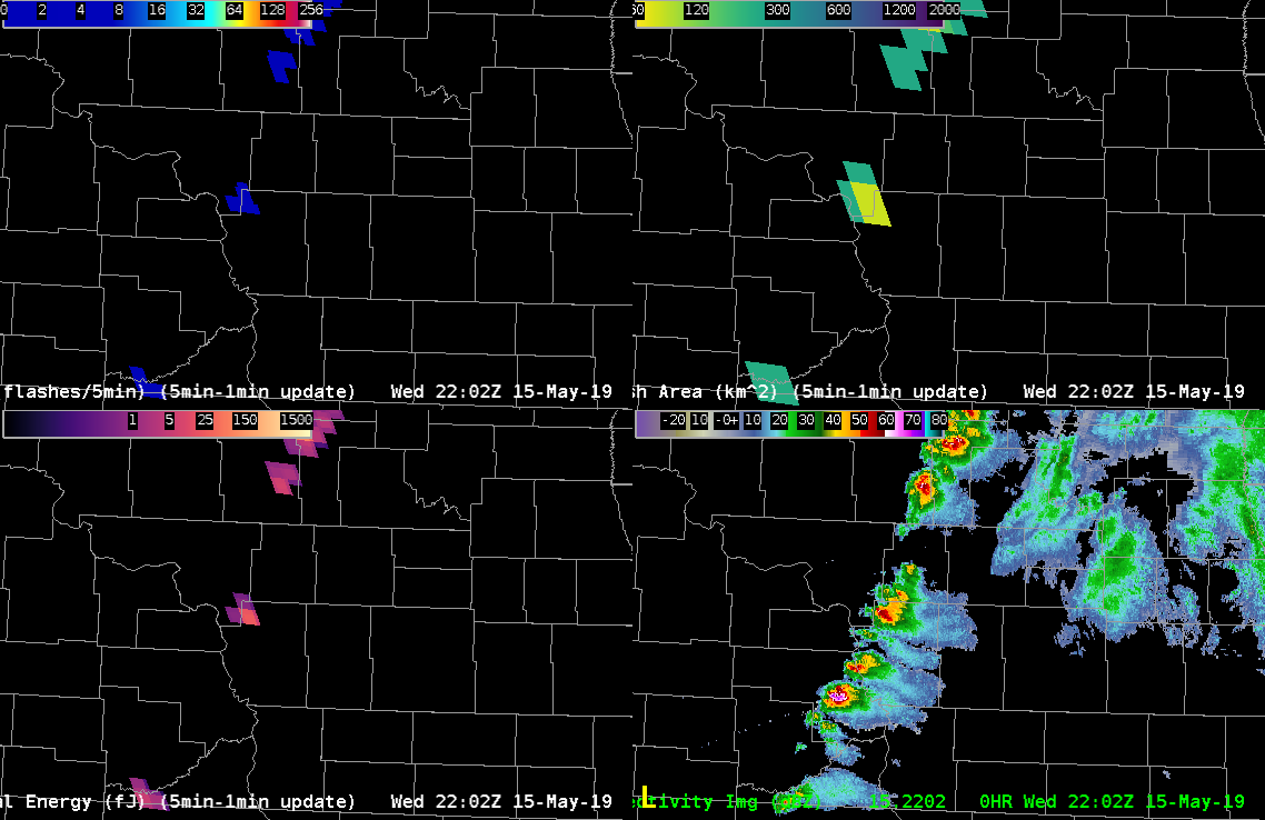
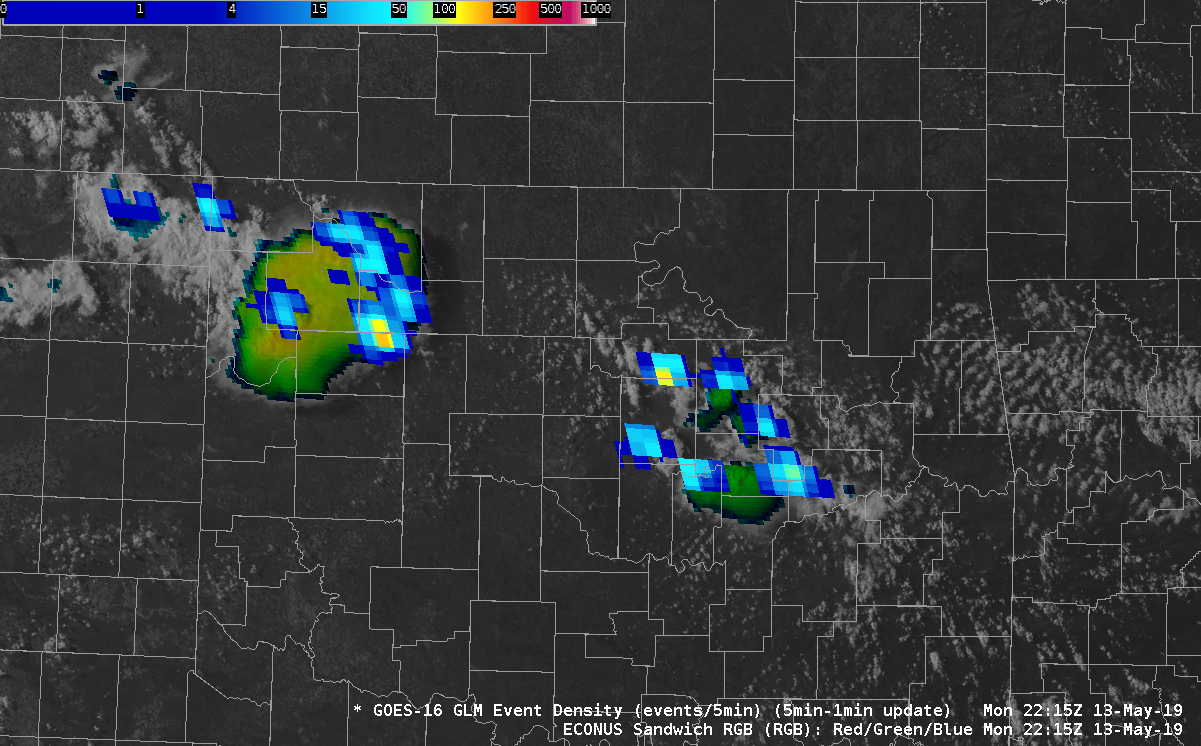
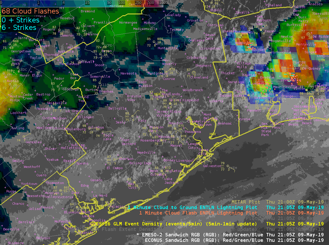
Image 1 shows the GOES16 RGB Composite VIS/IR Sandwich. This product displays the texture of the convective cloud tops and the temperature of those cloud tops. The texture and temperature of the clouds provides information about the updraft. The 2nd image shows the most intense GOESR GLM event densities and how they correspond with the taller clouds and strong updrafts. – Jonathan W. Smith (ESSIC/UMD)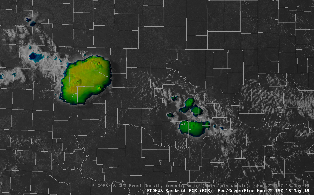
 .
.
Ok, last post….honesty time.
I didn’t make this a secret in my application that I had been out of meteorology for about 4 years between 2014-2018. During that time, GOES-16 launched. As I returned to broadcasting, I didn’t adequately spin-up on the new capabilities of this new generation of satellites. I was aware of the spatial and temporal resolution improvements of course – what meteorologist – currently working in or out of the field, didn’t get excited about 1 minute imagery?
 However, I wasn’t aware of some of the RGB combinations that I’ve been exposed to here at the HWT. The features that can be picked out by applying coordinating colortables to multiple channel views is simply astounding. I’ve used the simple water vapor, day cloud phase distinction, day convection, differential water vapor RGBs this week….I’ll be making a phone call to my broadcast weather vendor. I know I’ll need to get some other broadcasters on board with me to lead a charge, but count me in. Until then, I’ll be livin on the CIRA RMMB Slider site!
Color (RGB) Me A Fan!
-icafunnel
A quick comparison at 21Z reveals that Merged TPW Composite is running about .3 inches lower than Blended Total PW.
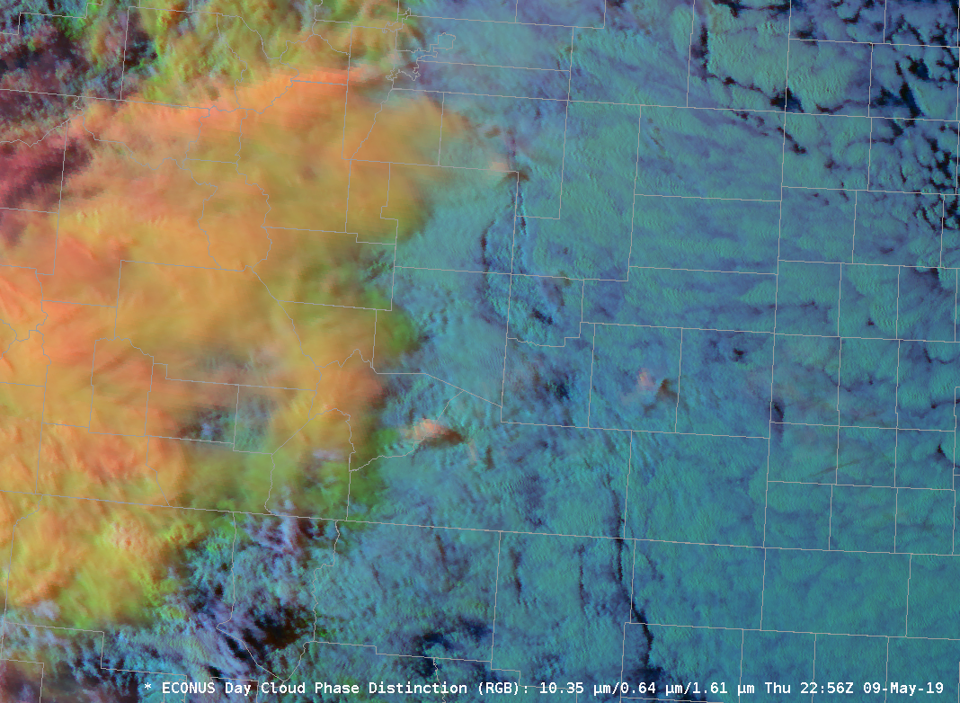
Since things were kinda boring over HGX today I had to look for things to blog about. Here is something interesting that I noticed with the Vis/IR Sandwich RGB. At the beginning of the loop the RGB didn’t show any IR brightness temperatures. As the TCU continued to develop we saw pixels of IR brightness temperatures starting to show up indicating cold cloud tops and the potential for glaciation to start. Low and behold, if we continue to watch the loop, more pixels start showing up…and a few minutes later both GLM and ground based networks picked up on a couple of CGs. As the thunderstorm developed, cloud tops cooled and more pixels started getting displayed we began to see more lightning. This was something that I didn’t expect the RGB to pick up on and potentially helpful for situational awareness and IDSS in the west where most lightning tends to come from single cell thunderstorms. If you are able to pick up on these ahead of time you may be able to some lead time before lightning occurs.
Update…it happened again, pixels starting being displayed and then lightning occurred within a couple of minutes. If this generally hold true for single cell thunderstorms this would be awesome for outdoor IDSS.
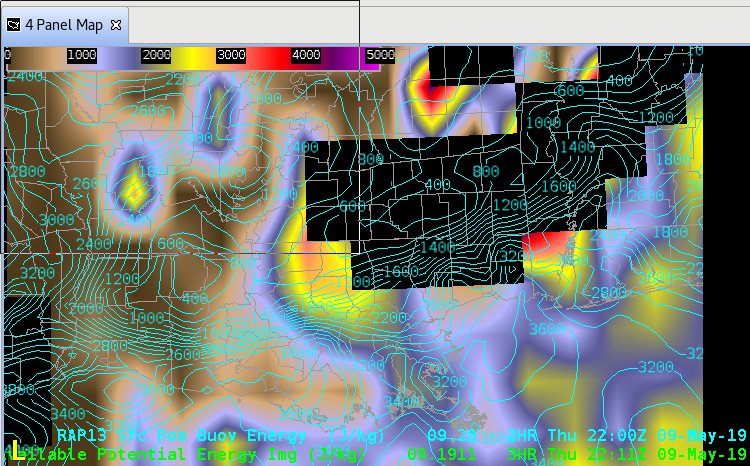
Knowing that the NUCAPS FCAST information was in today for the first time this week, I decided to do some analysis of the fields. Initial thoughts are that the missing blocks of data (not sure if that is typical – more visible in the CAPE field in top image – similar data holes observed in LCL, LFC and EL) make it hard to have confidence in it at first glance.
CAPE (Top Image)
NUCAPS FCAST CAPE data isn’t good in the pre-storm environment along the LA coast. RAP13 initialization is overlayed for comparison. RAP13 values are 2500-3500+ and much more representating thatn the NUCAPS values that in some cases are less than 500 ahead of the line.
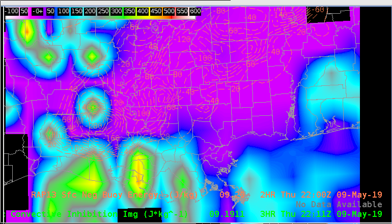
CINH (Lower Image)
While these values appear to be more closely representative compared to the RAP13, the inability of the product to adequately represent the boundary layer at times during the week don’t provide me much confidence for these surface based stability parameters.
-icafunnel