Tuesday, April 26 EWP shift: 1 pm – 9pm
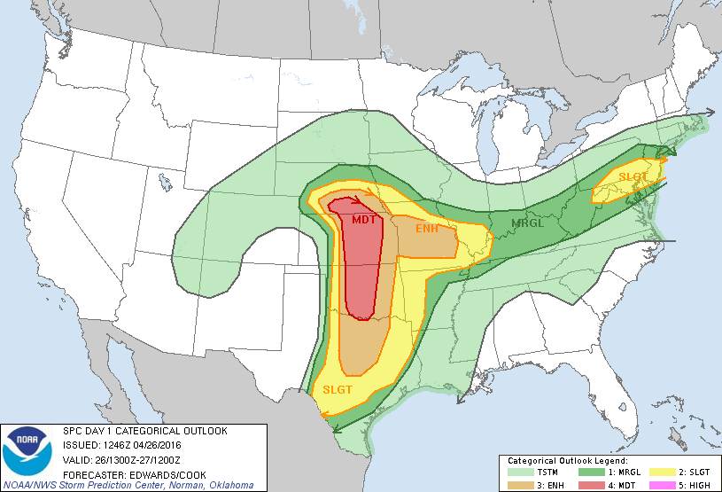
SPC 13z Day 1 Convective Outlook:
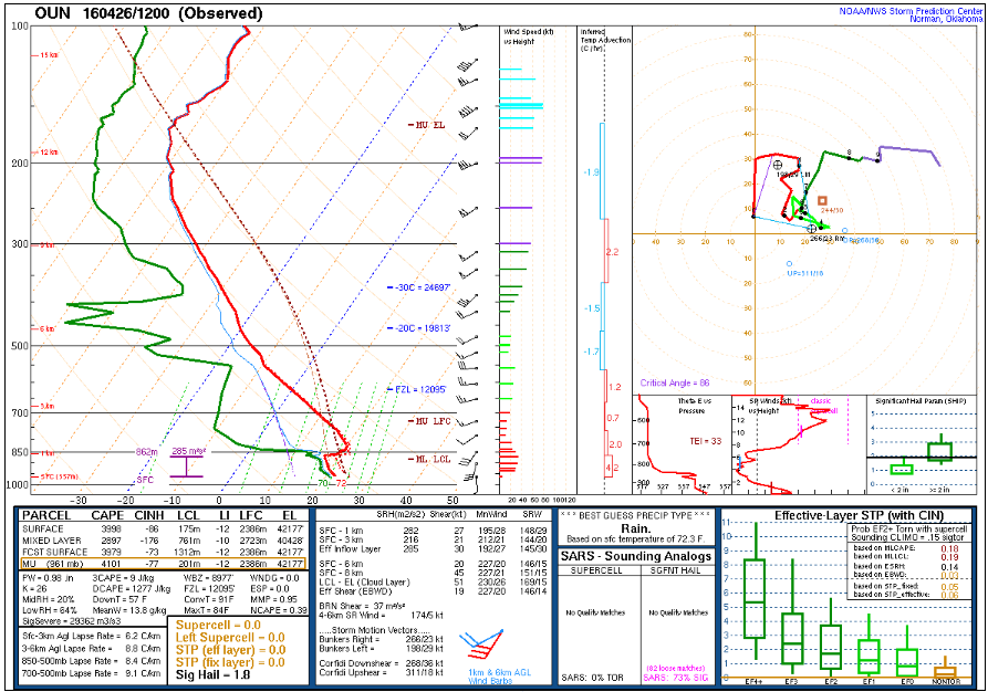
OUN 12Z RAOB
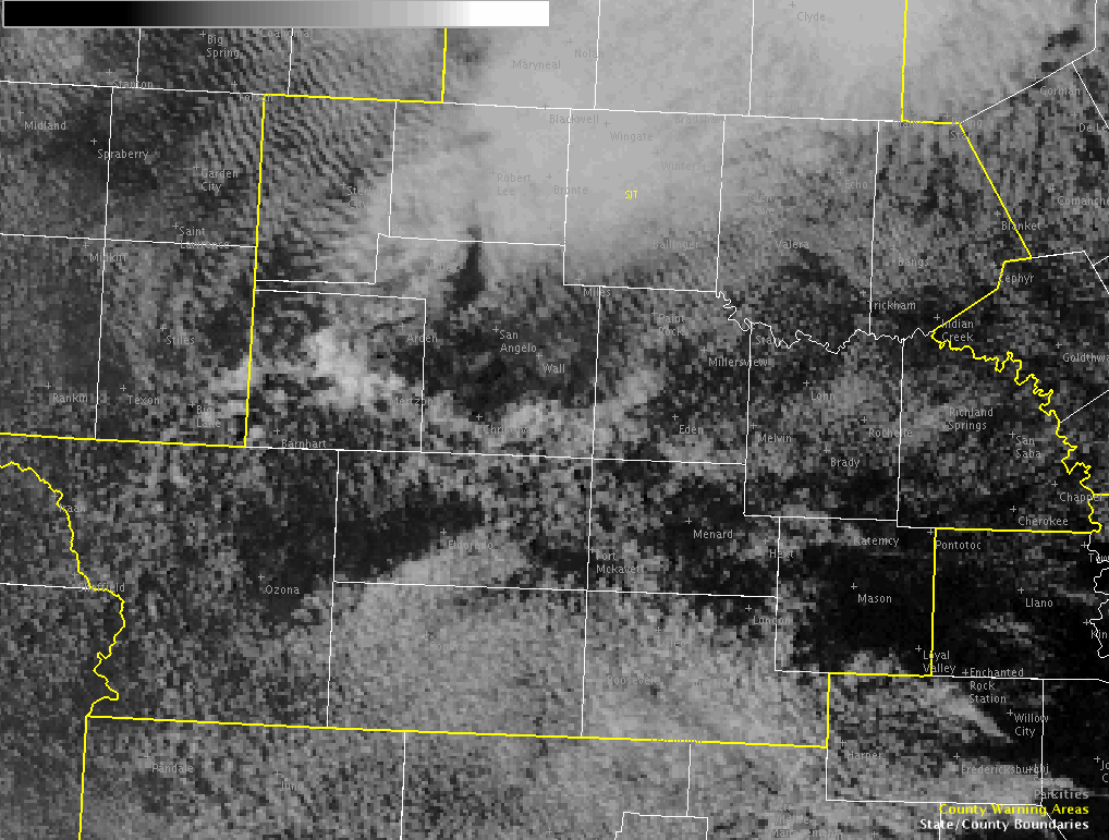
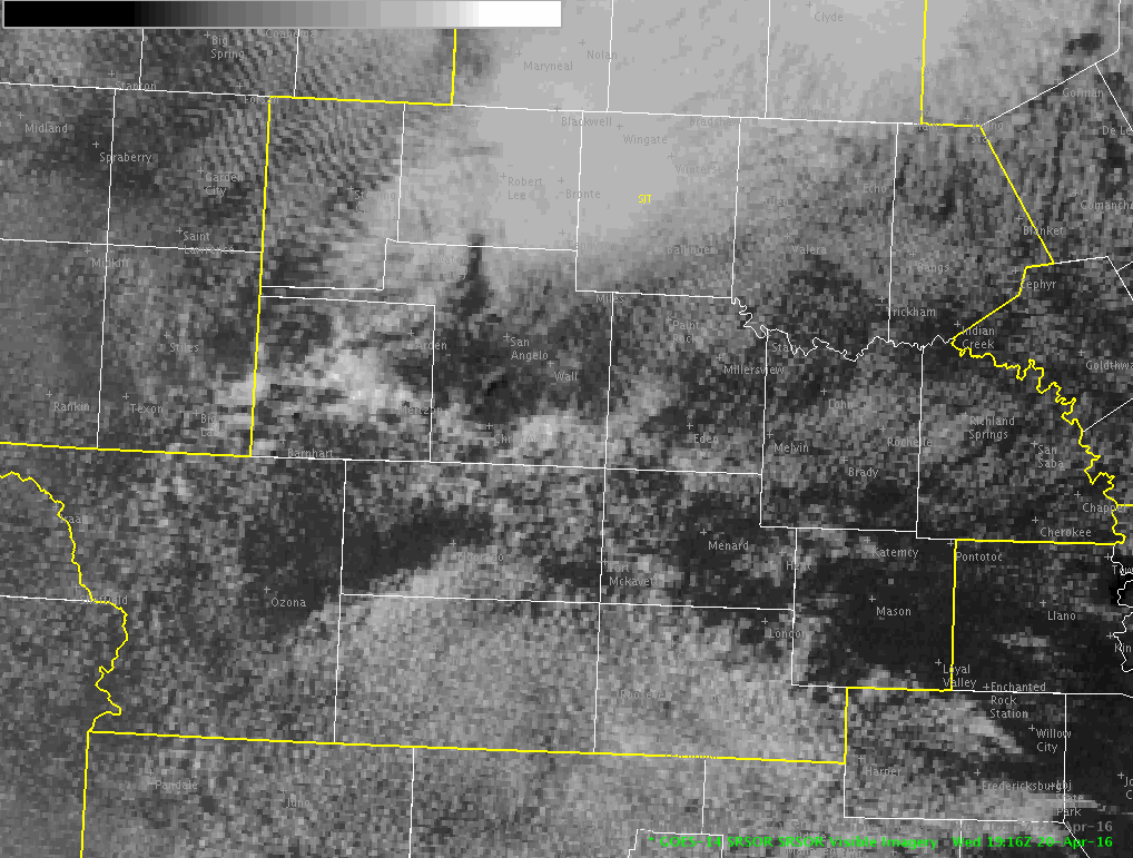
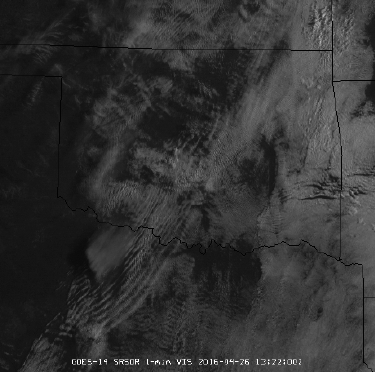
Morning SRSOR 1-min visible imagery over OK and N TX shows low clouds in place and gravity waves traversing the region.
Bill Line
Official websites use .gov
A
.gov website belongs to an official government
organization in the United States.
Secure .gov websites use HTTPS
A
lock (
) or https:// means you’ve safely connected to
the .gov website. Share sensitive information only on official,
secure websites.

WWUS83 KMKX 252034
SPSMKX
SPECIAL WEATHER STATEMENT
NATIONAL WEATHER SERVICE MILWAUKEE-SULLIVAN WI
333 PM CDT MON APR 25 2016
WIZ060-065-066-252115-
OZAUKEE WI-WAUKESHA WI-MILWAUKEE WI-
333 PM CDT MON APR 25 2016
…SIGNIFICANT WEATHER ADVISORY FOR SOUTH CENTRAL OZAUKEE…
NORTHWESTERN MILWAUKEE AND NORTHEASTERN WAUKESHA COUNTIES UNTIL 415 PM CDT…
AT 333 PM CDT…DOPPLER RADAR WAS TRACKING A STRONG THUNDERSTORM OVER NORTHERN MILWAUKEE…MOVING NORTHEAST AT 30 MPH.
HALF INCH HAIL AND WINDS IN EXCESS OF 40 MPH WILL BE POSSIBLE WITH THIS STORM.
LOCATIONS IMPACTED INCLUDE…NORTHERN MILWAUKEE…MENOMONEE FALLS…MEQUON…WHITEFISH BAY…BROWN DEER…FOX POINT…BAYSIDE…RIVER HILLS AND GLENDALE.
PRECAUTIONARY/PREPAREDNESS ACTIONS…
TORRENTIAL RAINFALL IS ALSO OCCURRING WITH THIS STORM…AND MAY LEAD TO LOCALIZED FLOODING. DO NOT DRIVE YOUR VEHICLE THROUGH FLOODED ROADWAYS.
&&
LAT…LON 4314 8790 4312 8790 4309 8799 4318 8808
4326 8791 4324 8791 4321 8790 4320 8790
4316 8788
TIME…MOT…LOC 2033Z 238DEG 25KT 4318 8800
$$
BMS
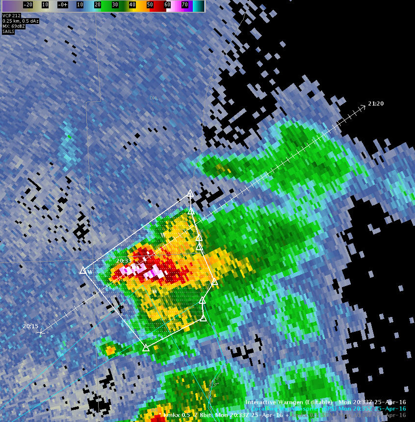
Second Significant Weather Advisory issues for thunderstorm to the north of first Significant Weather Advisory. MESH is now over 0.50″ with Prob Severe at 35%. Went for half inch sized hail and winds in excess of 40 MPH with these. Lightning being presented at 2.0 Sigma for these thunderstorms as they are heading off shore.
Forecaster: Schuerman
Week 2 of the HWT 2016 GOES-R/JPSS Spring Experiment is well underway. This looks to be quite an active weather week, with an SPC Moderate risk for severe out for Tuesday across the central plains. Today, participants are working in the Milwaukee and Chicago CWA’s.
Bill Line, SPC/HWT Satellite Liaison
J-Money:
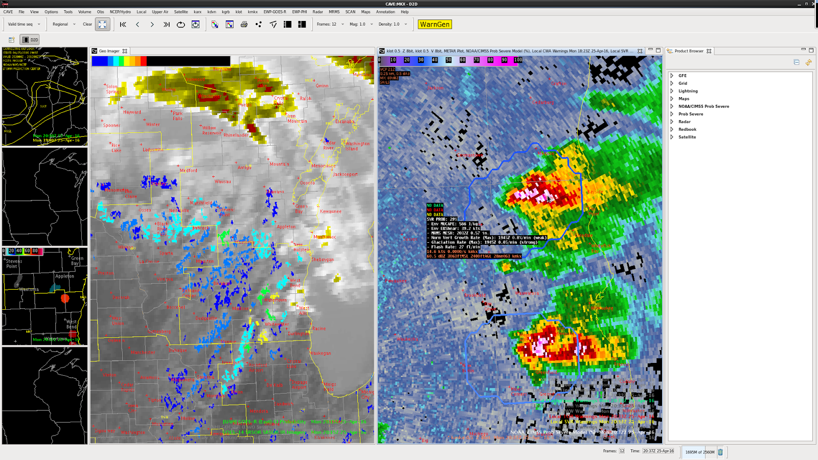
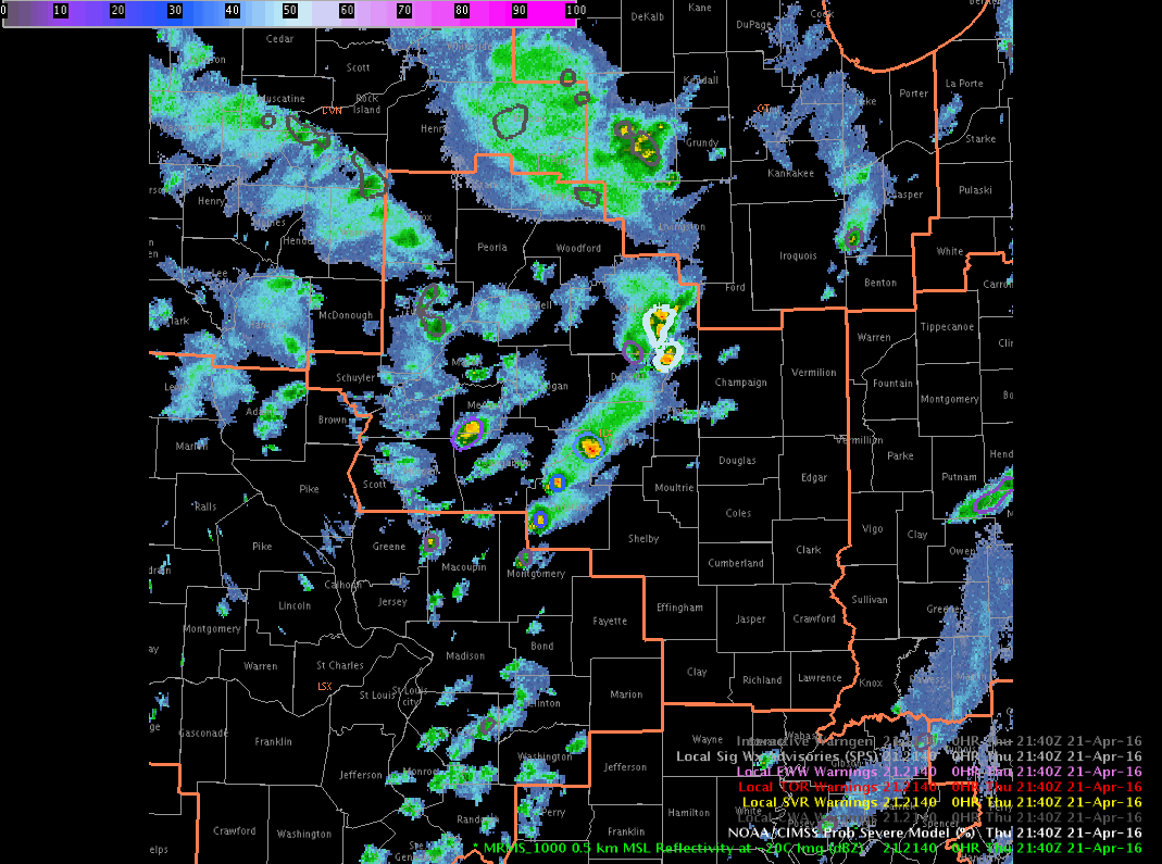
For much of the afternoon, so far, scattered to numerous storms in central/southern IL have been non-severe in nature, with occasional small hail. Prob Severe values have been correspondingly low, with meager flash rates, and poor growth rates.
However, just before 22z, a storm intensified in the far northeast part of the ILX CWA. Prob Severe values rose quickly into the 70s and 80s, as flash rates and MESH values increased. A warning was issued, based on the environment of cold air aloft, and seemingly more favorable storm-scale parameters for hail, as shown by Prob Severe.
A loop of refectivity at the -20C level, with Prob Severe overlayed, is shown here. It well correlates with the above descriptions.
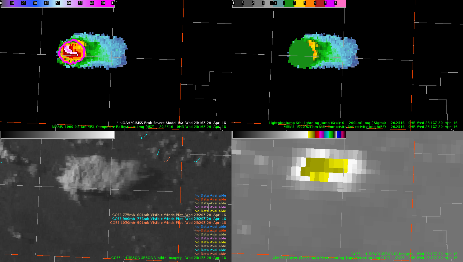
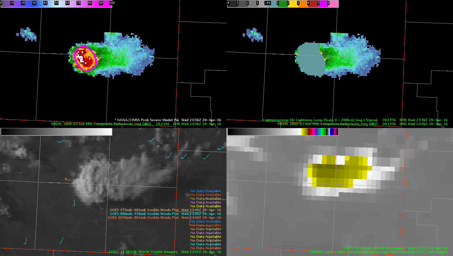
Looking at the use of prob severe in providing lead time. At 23:36z a report of ping pong ball size hail.
Analysis of prob severe and lightning jump 20 minutes before at 23:16z , shows the probSvr displaying 91% chance of severe, 46kts shear, MU cape 947, Mesh 1.07″, Growth rate strong: glaciation: strong, flash rate 28/min and 1 signa jump.
20 minutes later at 23:36z: 90% chance of severe, 49 kts shear, Mu cape 1157, Mesh 1.93″, Growth rate:strong, Glaciation: strong, 0 signa. ( however, jump did stay at 1 during 20 min duration.)
One report of ping pong ball size hail at that point.
Prob severe may be a good factor in issuing an early warning for a severe storm.
-thunder
This storm east of Amarillo produced quarter size hail at 6:25 PM, approximately 11 minutes before severe prob increased above 80%. There was a steady increase in values over the 30 minute before the severe hail report, from 20% at 6:02 PM, to 25% at 6:08 PM, to 62% at 6:12 PM. Correlated with the time of the severe hail report, severe prob values were 90%. Glaciation rates went from weak to strong ~20 minutes before the severe hail reports. Flash rates steadily increased leading up to the severe hail report but peaked ~30 minutes after the report.
-dryadiabat
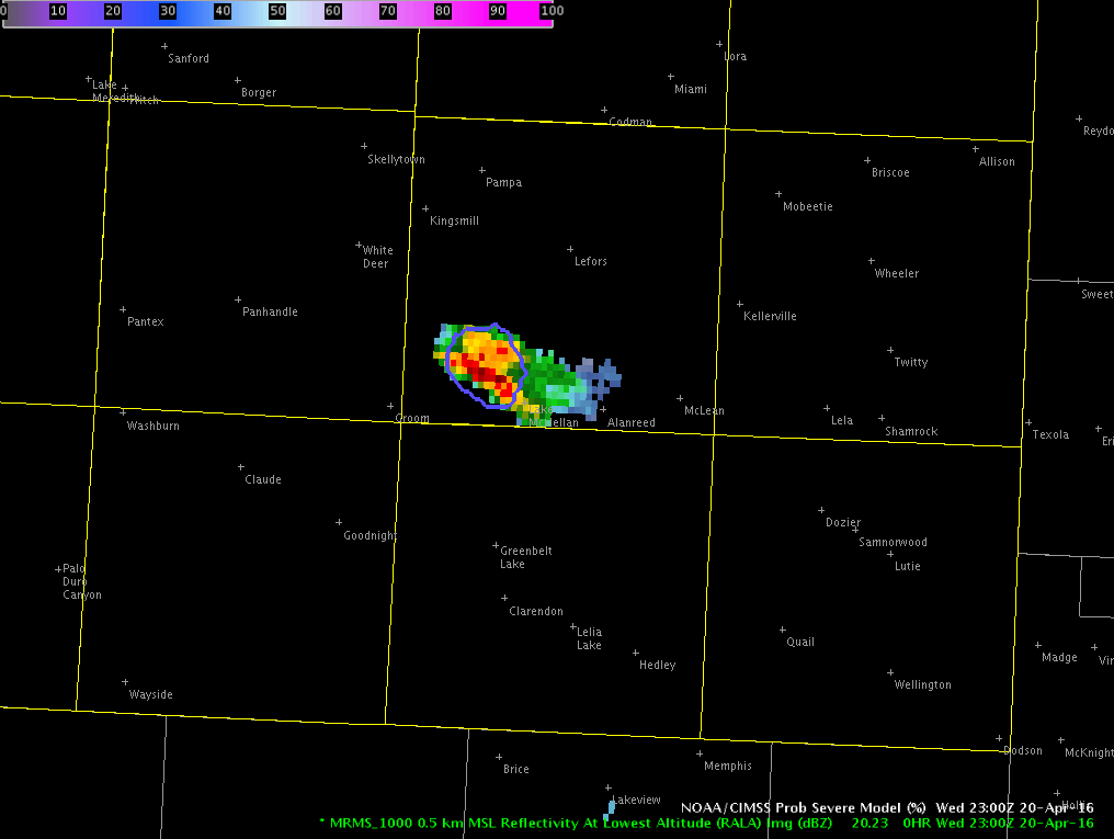
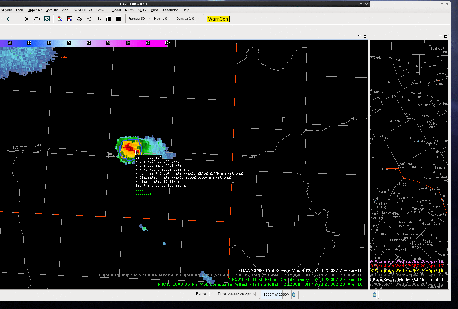
While we are watching storms in the Lubbock CWA, I kept an eye on a storm over the eastern portion of Amarillo CWA, near I-40. The ProbSevere was 25% at 2308 UTC and jumped to 84% by 2314 UTC as MRMS MESH and total lightning flash rates jumped significantly (also the effective bulk shear was rather high in the mid/upper 40 knots). The ProbSevere values continued to increase into the 90% range. A 1.00″ hail report was received at Interstate 40 at 2325 UTC and after the report was received, a severe thunderstorm warning issued. The good lead-time for this storm can be attributed to all predictors of ProbSevere–strong satellite growth rates, strong satellite growth rates, increasing lightning in a highly sheared environment and MRMS MESH over 1.00″.
-Sieglaff
Storm development has occurred southeast of the Lubbock, TX RDA in the Texas Panhandle. While initially the all-tilts reflectivity looked promising, PROBSvr continued to indicate marginal severe potential. Combine this with no significant lightning jump and low flash density on the PGLM array, the decision was made to hold off on a warning for now.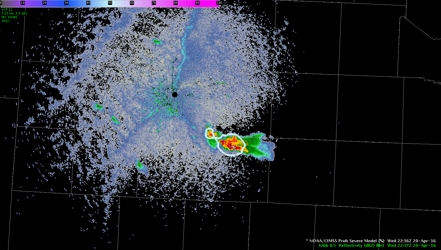
Take a look at the evolution of the storm southwest of San Angelo in one minute visible satellite data compared to 15 minute data. The difference in the evolution is amazing.