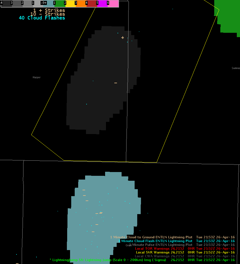
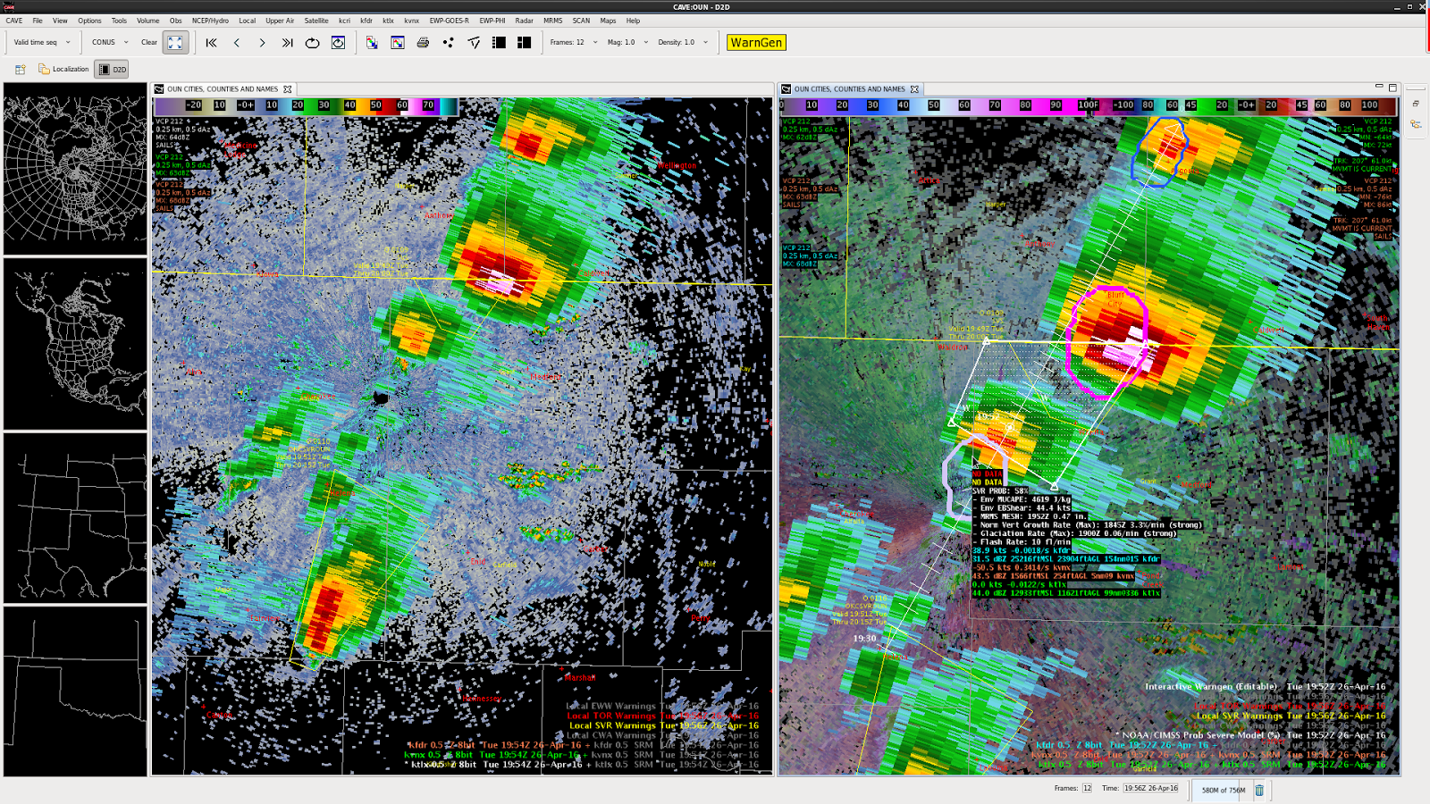
KICT was down for us, but we relayed with OUN on warning (also pulled up the Topeka radar to help).
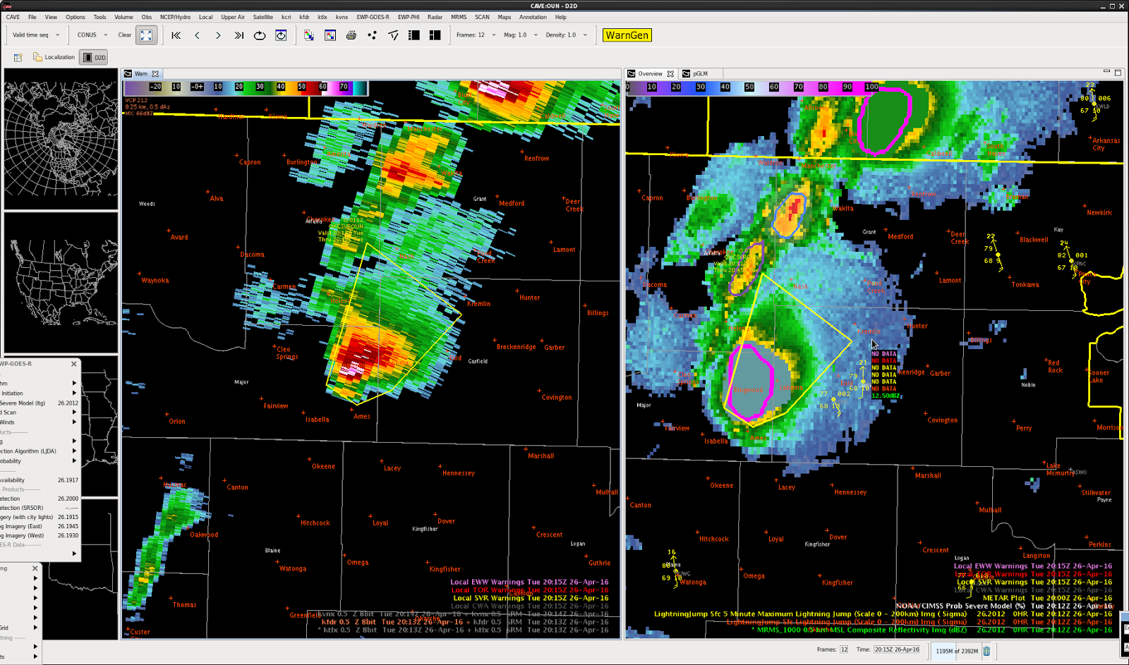
BULLETIN – IMMEDIATE BROADCAST REQUESTED
SEVERE THUNDERSTORM WARNING
NATIONAL WEATHER SERVICE WICHITA KS
233 PM CDT TUE APR 26 2016
THE NATIONAL WEATHER SERVICE IN WICHITA HAS ISSUED A
* SEVERE THUNDERSTORM WARNING FOR…
SOUTHEASTERN HARPER COUNTY IN SOUTH CENTRAL KANSAS…
SOUTHWESTERN SUMNER COUNTY IN SOUTH CENTRAL KANSAS…
* UNTIL 315 PM CDT
* AT 233 PM CDT…DOPPLER RADAR INDICATED A SEVERE THUNDERSTORM
CAPABLE OF PRODUCING LARGE DAMAGING HAIL UP TO GOLF BALL SIZE AND
DAMAGING WINDS IN EXCESS OF 60 MPH. THIS STORM WAS LOCATED NEAR
WAKITA…OR 14 MILES NORTHWEST OF MEDFORD…AND MOVING NORTHEAST AT
25 MPH.
* LOCATIONS IMPACTED INCLUDE…
ARGONIA…BLUFF CITY AND FREEPORT.
PRECAUTIONARY/PREPAREDNESS ACTIONS…
IF YOU ARE IN THE PATH OF THIS STORM…PREPARE IMMEDIATELY FOR LARGE
HAIL AND DEADLY CLOUD TO GROUND LIGHTNING. PEOPLE OUTSIDE SHOULD MOVE
TO A SHELTER…PREFERABLY INSIDE A STRONG BUILDING AND AWAY FROM
WINDOWS.
&&
LAT…LON 3732 9779 3716 9752 3699 9775 3700 9799
TIME…MOT…LOC 1933Z 216DEG 24KT 3693 9795
$$
BAJ
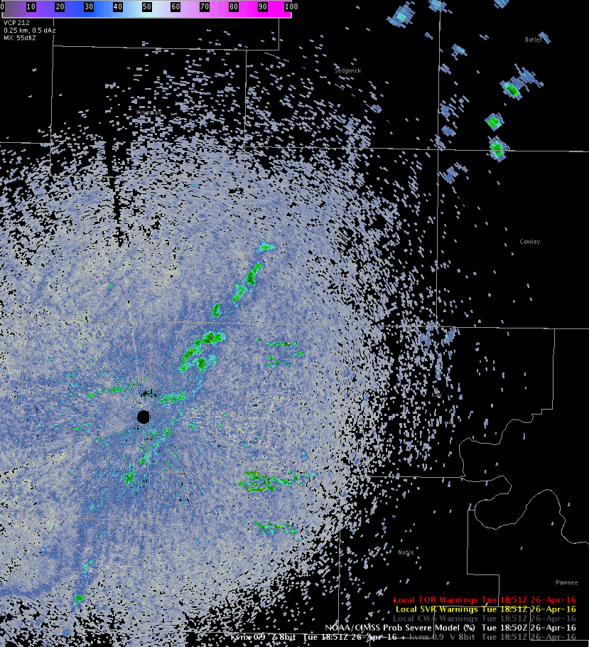
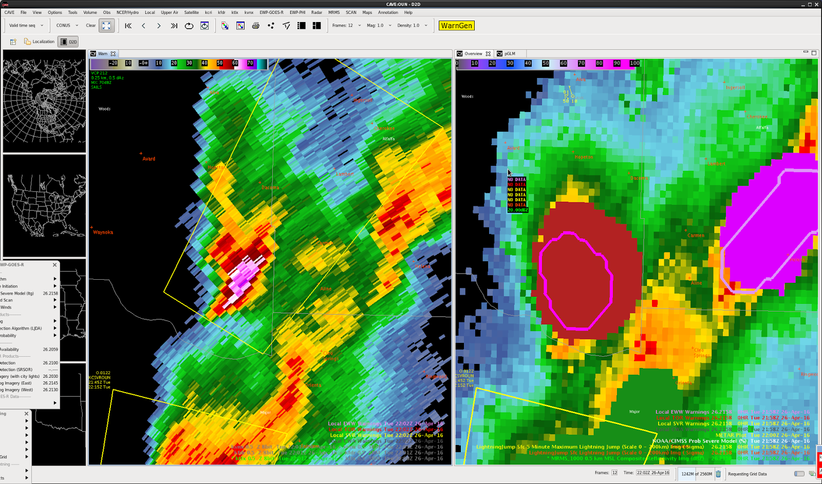
The ProbSevere went from zero to 97% in less than 40 minutes.


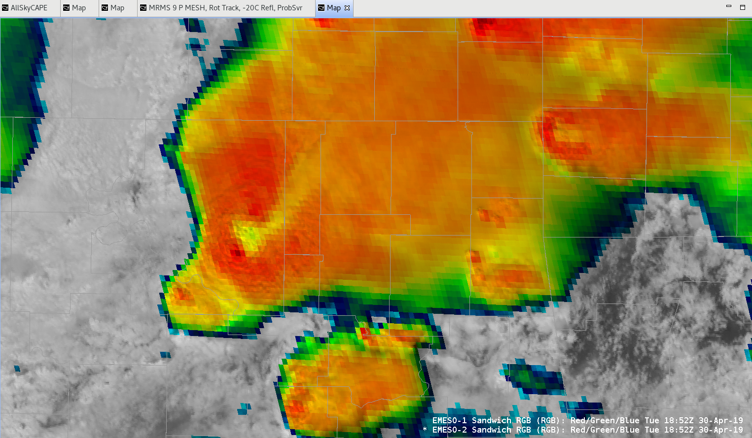
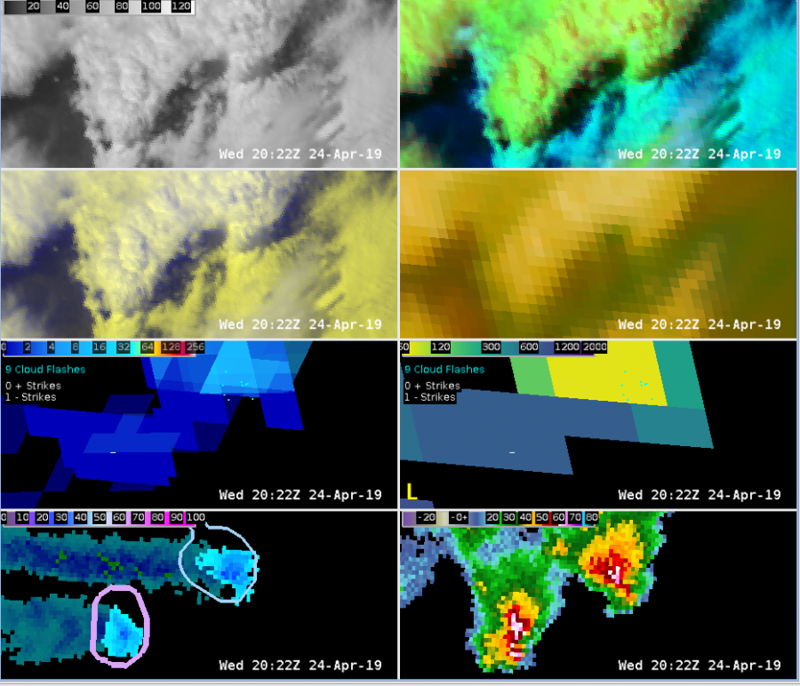
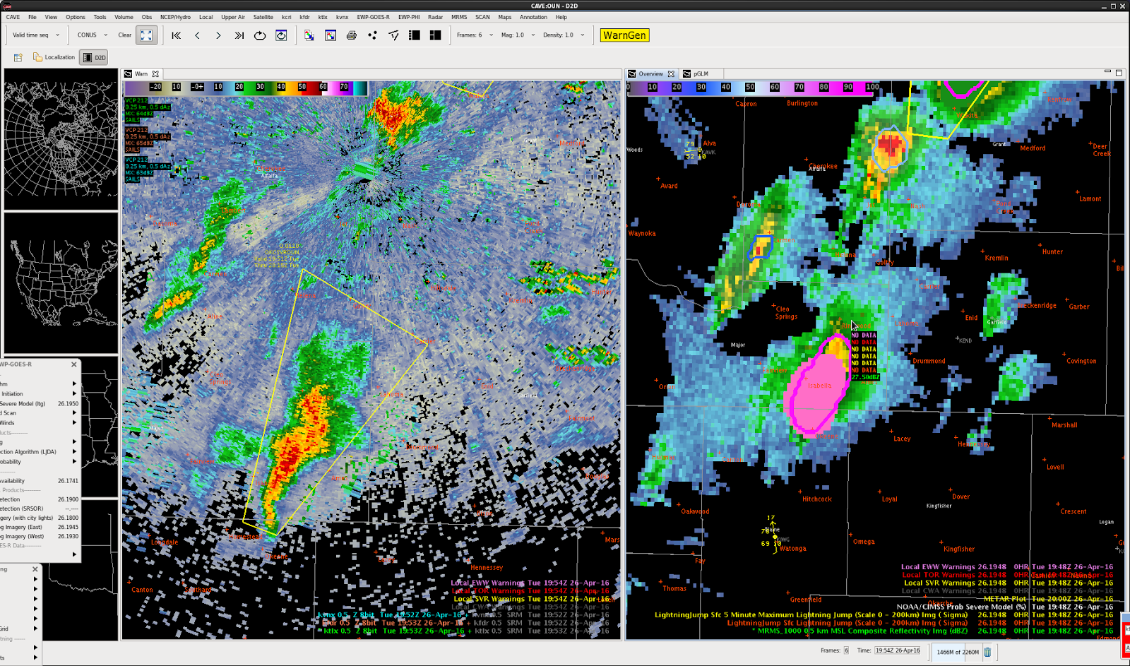
 Minimum Flash Area showed some utility in boosting lead time for storm re-generation. The storm in the center of the first image had started to weaken a bit after moving off of the outflow boundary that initiated it.
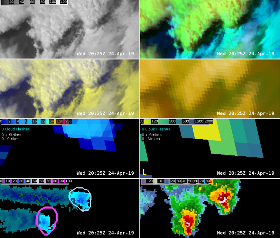