
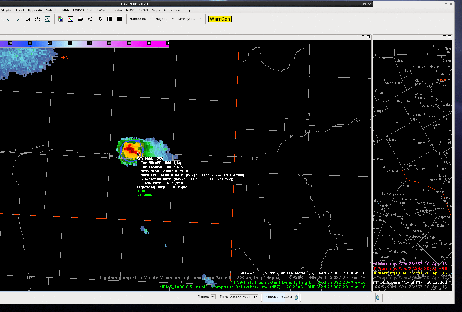
While we are watching storms in the Lubbock CWA, I kept an eye on a storm over the eastern portion of Amarillo CWA, near I-40. The ProbSevere was 25% at 2308 UTC and jumped to 84% by 2314 UTC as MRMS MESH and total lightning flash rates jumped significantly (also the effective bulk shear was rather high in the mid/upper 40 knots). The ProbSevere values continued to increase into the 90% range. A 1.00″ hail report was received at Interstate 40 at 2325 UTC and after the report was received, a severe thunderstorm warning issued. The good lead-time for this storm can be attributed to all predictors of ProbSevere–strong satellite growth rates, strong satellite growth rates, increasing lightning in a highly sheared environment and MRMS MESH over 1.00″.
-Sieglaff