ProbSevere Running Hot in SGF CWA

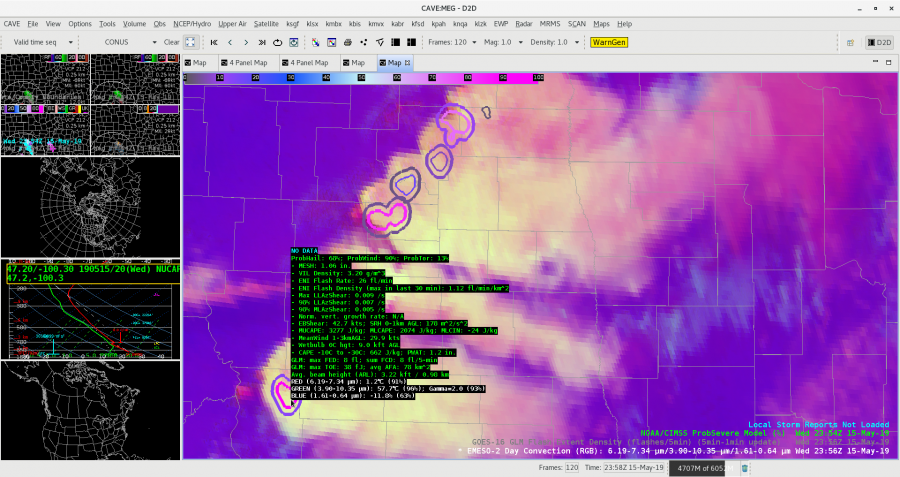
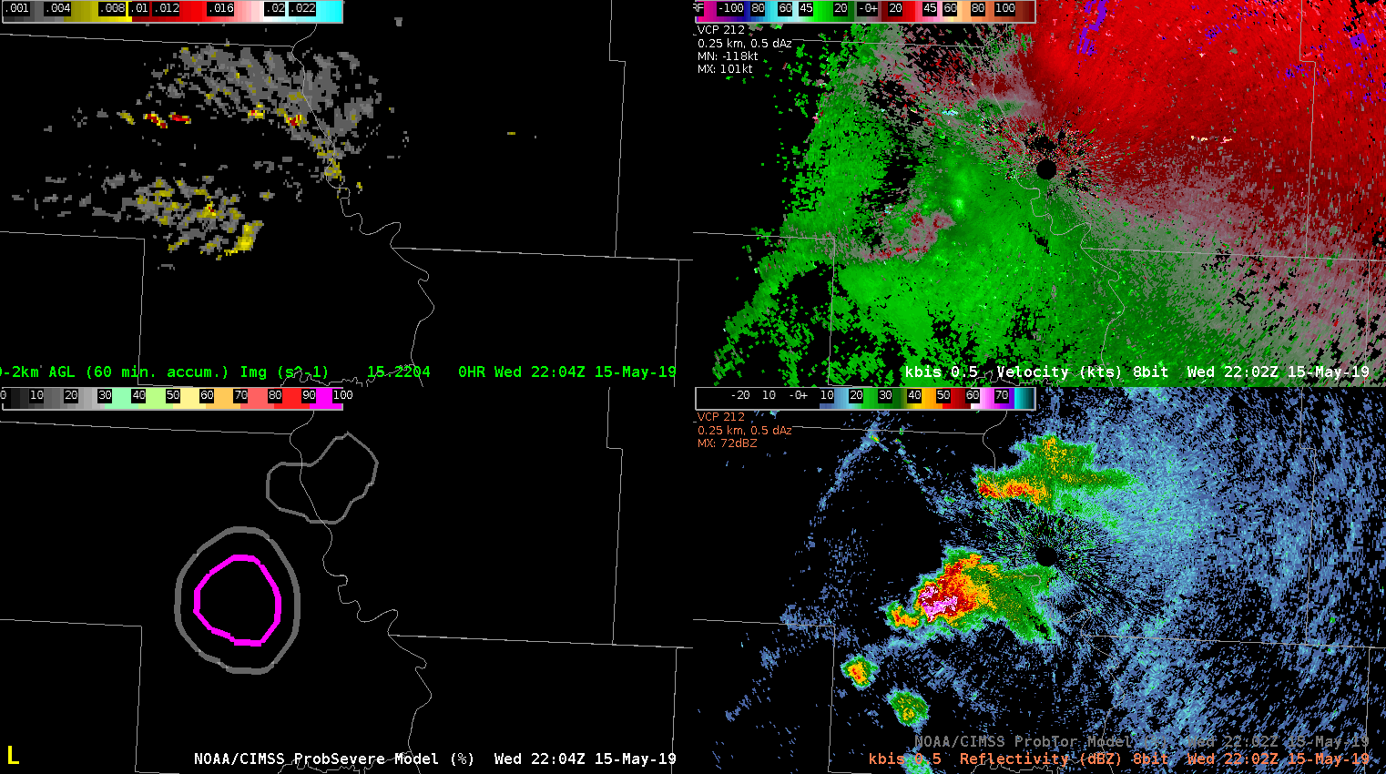
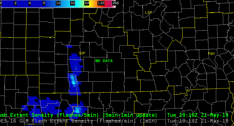
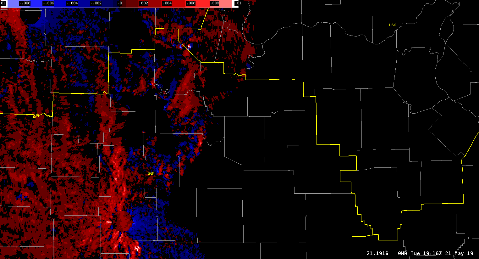
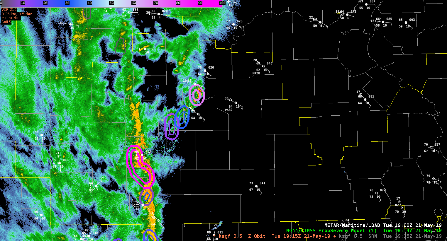
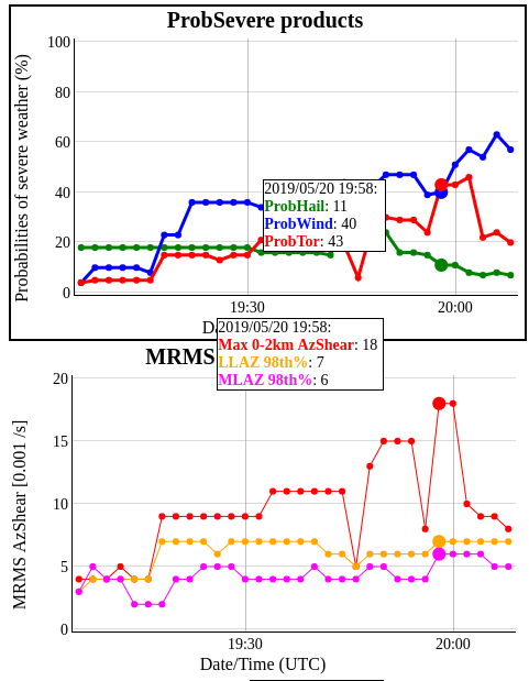
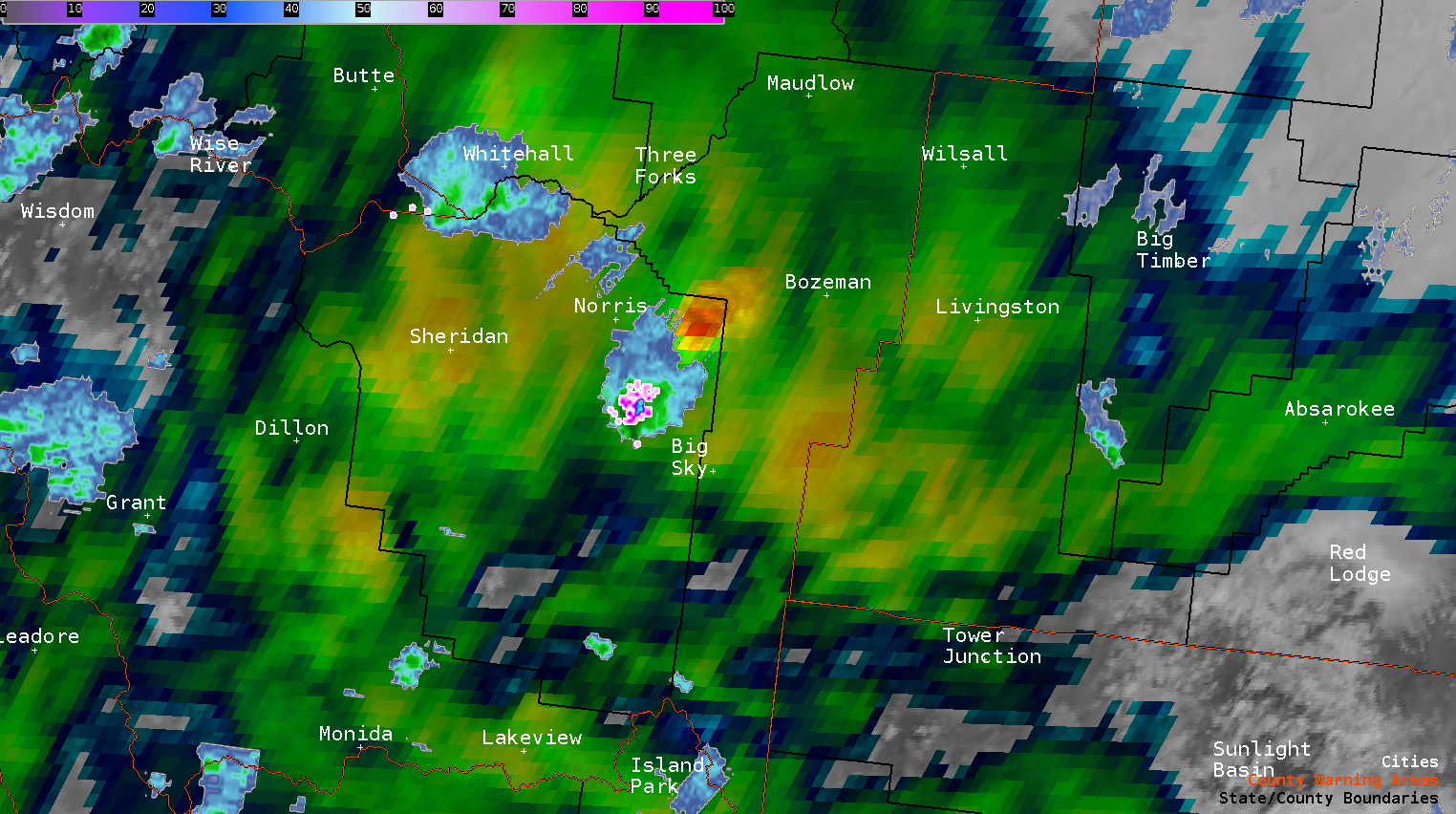
Looking at convection developing upstream across southern MO, I noticed prob severe had an object advertising 71% for TOR in the northern portion of the SGF  CWA (about a county and a half south of the CWA bondary. This particular cell does not show any rotation in the SGX base data, the Azimuthal shear doesn’t show much, and GLM lightning shows no electrical activity with this cell. I’m assuming the algorithm is keying more on environmental factors than anything else in coming up with this probability?

-64BoggsLites

The good and bad of Prob Tor/AzShear/Meso Detection Algorithms

The image below looks at 2 cells in central Oklahoma. The northern cell has a prob tor of 77%, but is falsely lightning up a shear zone with little chance of a tornado. The southern cell shows all the characteristics of a tornadic supercell, but has a prob tor of 37%. However, the southern cell is closer to producing a tornado (via live media).

Here’s another image using KVNX instead of KTLX, and shows only the prob tor.

The two cells to the north have 90 and 91 percent, respectively, while the southern supercell has only 33 percent.

Not to pick on the prob severe product, the meso detection algorithms a similarly struggling. Below is a 4-panel showing the legacy mesocyclone alogrithm (upper left), the digital mesocylone algorithm (upper right), the low level AzShear (lower left), and the experimental meso algorithm (lower right).

All three detection algorithms are flagging the circulations as equally important, but an examination of the base data shows otherwise.

Thorcaster

First simulated TOR warning

Trying to get set up in a hurry with all the experimental products. First simulated TOR of the day for OUN based on a combination of base radar, jump in TOR probability, and a noticeable increase in the AzShear. Below is shown the trend of the prob tor and MRMS AzShear products.

Notice the jump in both just prior to 20Z. Not show is the base reflectivity with the expected pendant on the inflow side of the cell.

Thorcaster


IND TVS

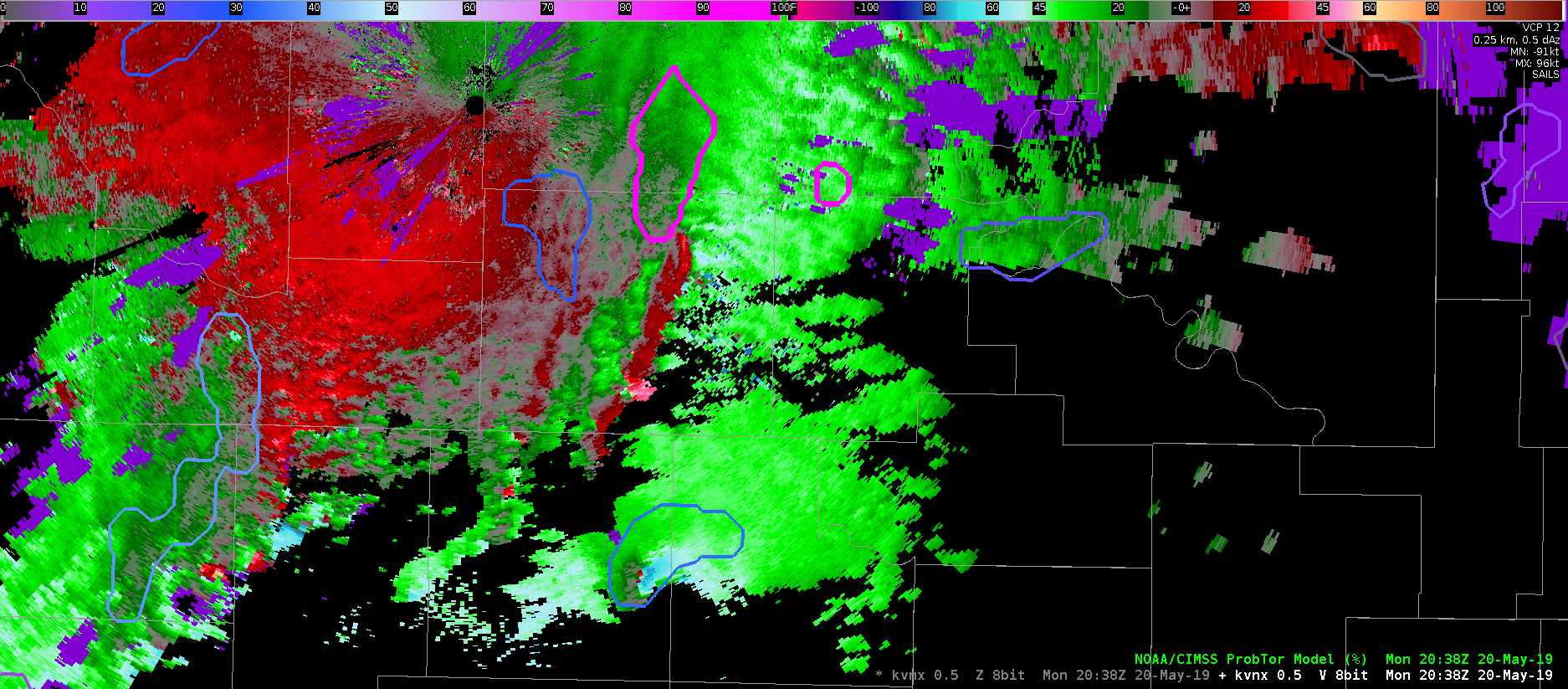
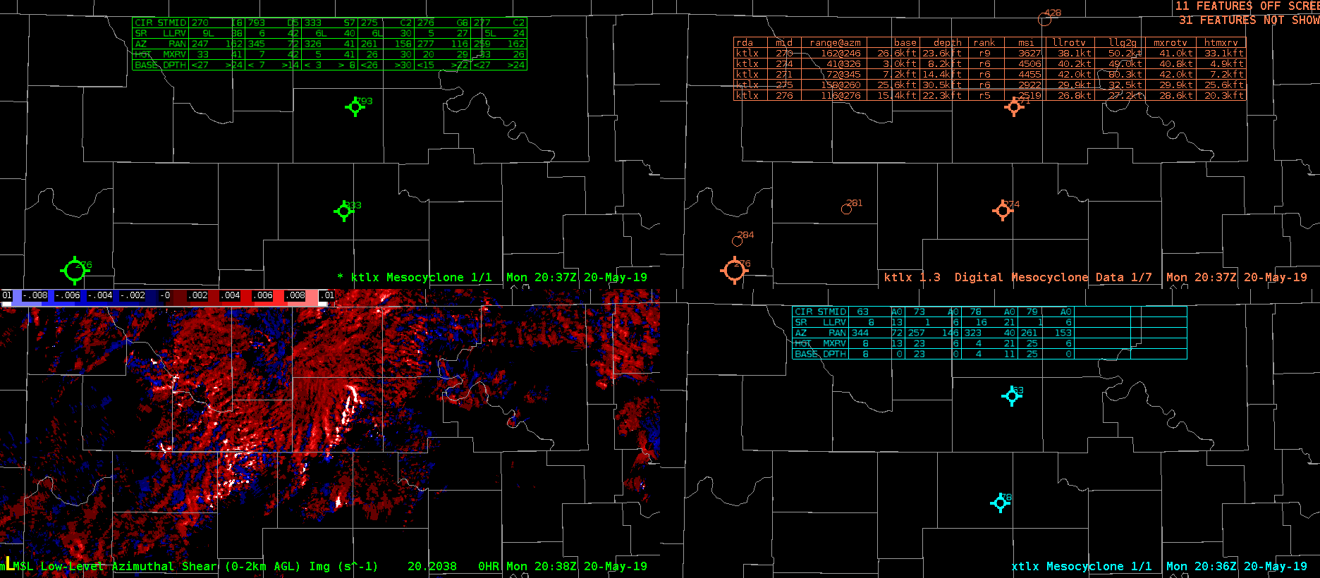
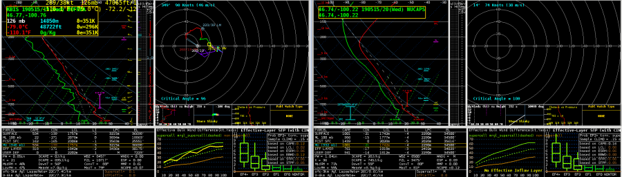
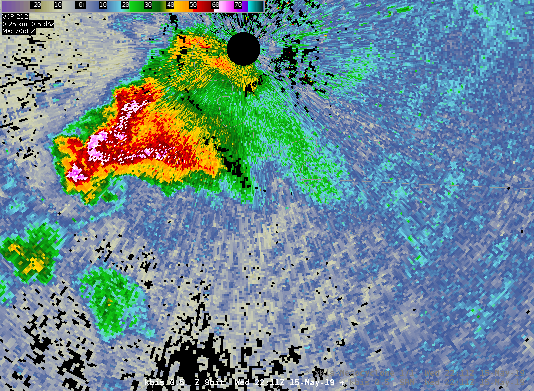
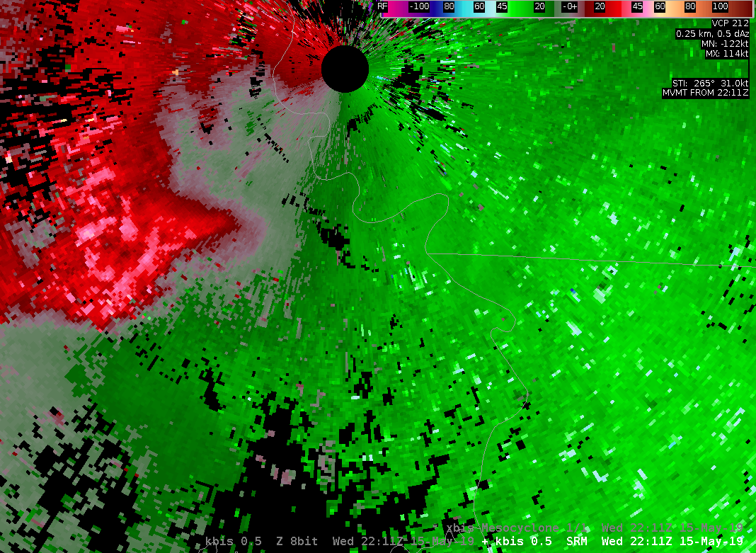
15 min prior to 1.75″ hail and 20 min prior to baseball-size hail, a supercell tracked NNW-SSE through Vermillion Co, IL …the Probsvr nailed the values for ProbHail at 96%, VILD 4.3, and a well defined TVS (100kt G-G) and strong MESO on NEXRAD ~ 7k’
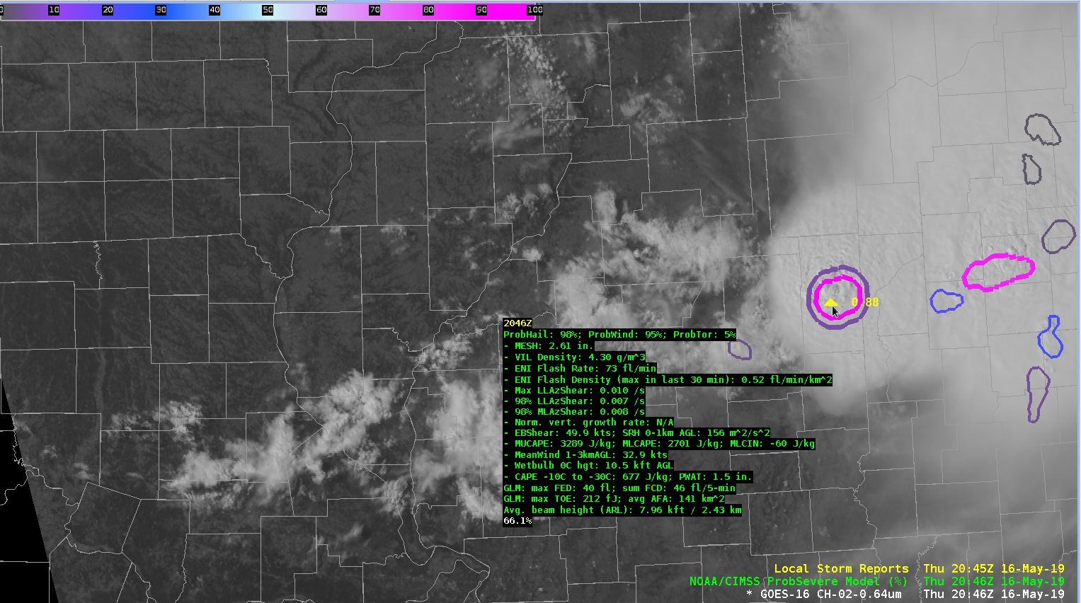
NUCAPS SVR TS values kinda nailed it in Ern IL :

East Central IL  (green dot) MU and FCST SFC CAPE were > 4000, LIs were > 12, DCAPE > 1000 (~50KT Gusts), SHIP > 1 and LR H8 – H5 ~8SRM showed Storm Top Div > 130kt 12 min prior to the Baseball Sized hail
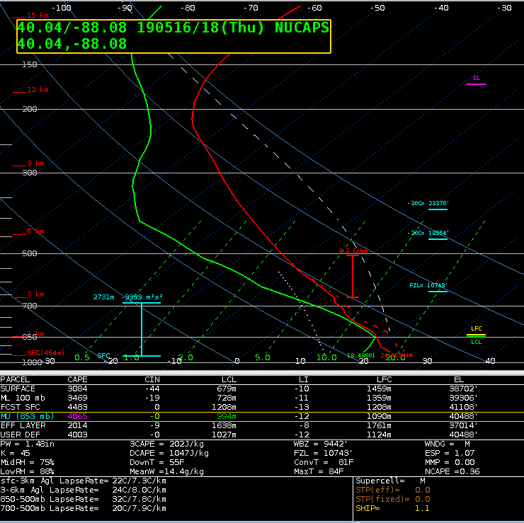
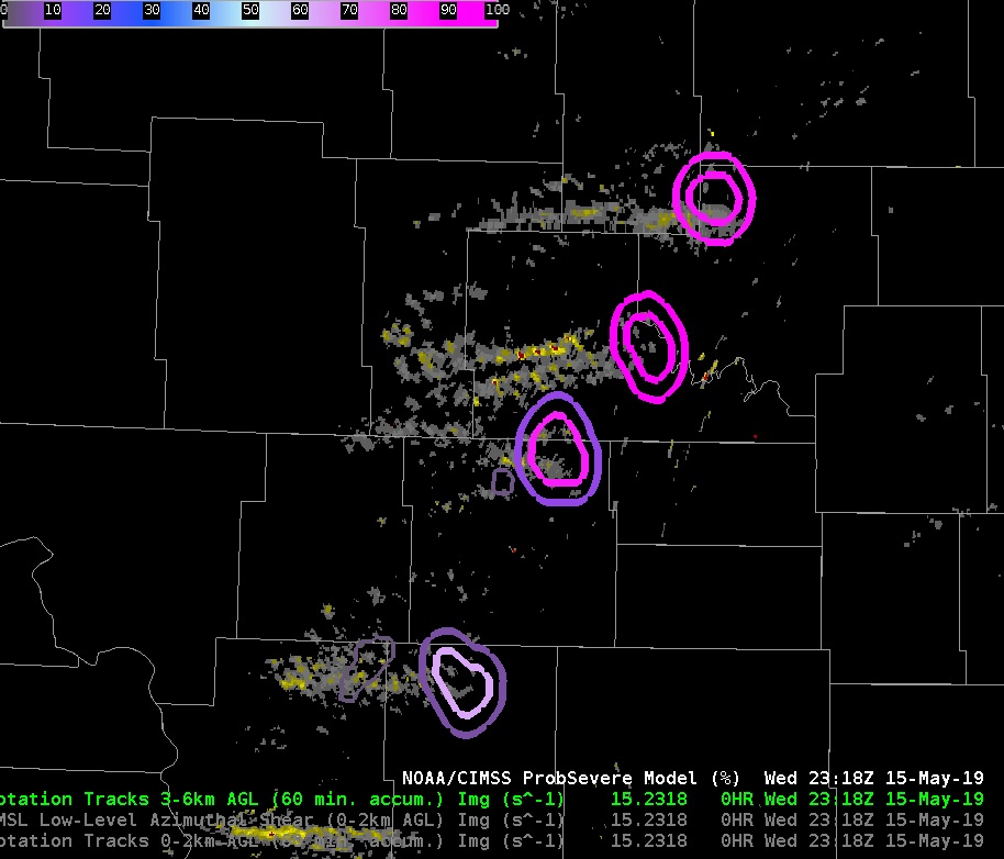
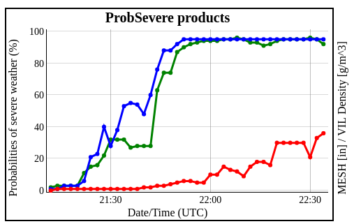
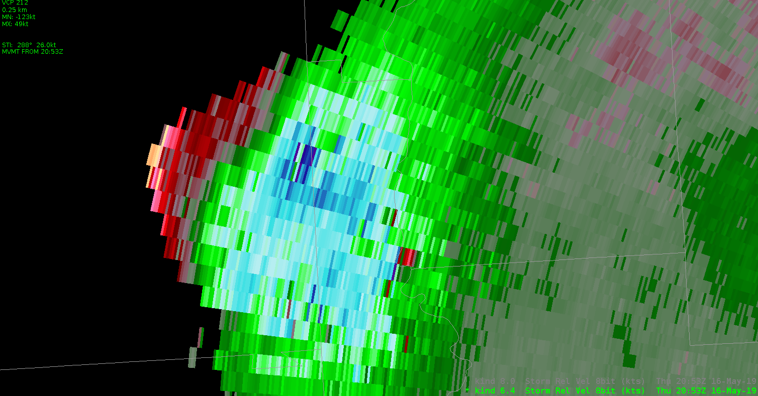
This storm is not diminishing, with Storm Top DIV remaining well over 100kt
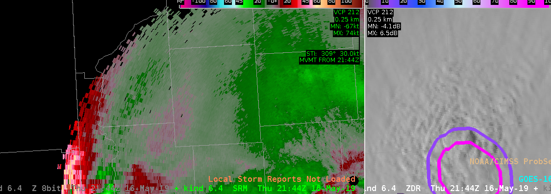
Eastern end of MCS continues to chug thru central IN (2130-2300z), 
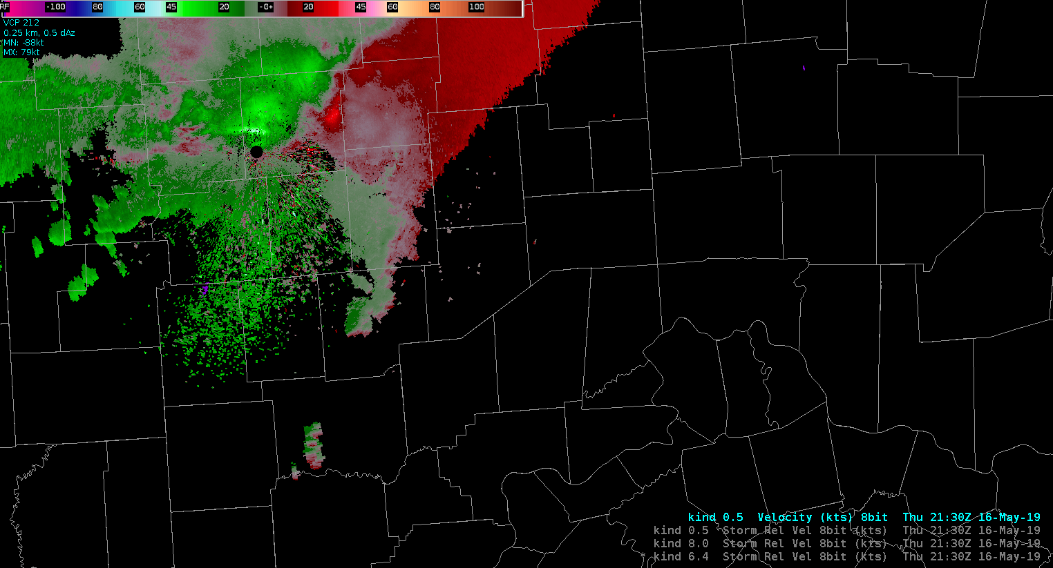
ProbSVR ~ 23z looking good, more warnings on the way

ProbSevere in MCS

Watching the MCS evolve over Indiana, ProbSevere became increasingly hard to use. The object continued to change in size and in number, so it was hard to trust the probabilistic values. Ideally, I would have liked to see one on the eastern flank where the strongest velocities were, another on the western flank where the reflectivity is higher, and perhaps one or two more in between.  However, since the orientation of the MCS continues to change, I’m not sure if that would continue to be the preferred object count and location.  Bottom line is to use ProbSevere with caution with lines, bows, MCS’s or anything with ill-identifiable cells.

-Tempest Sooner

Prob Severe Object Identification

Prob Severe failed to identify a strong storm developing in radar sparse coverage area near Bozeman, MT. The storm did show up on MRMS composite reflectivity, ENTLN, GLM Lighting and had rapidly cooling cloud tops, so not sure what was missing to have the storm identified by Prob Severe.

–warmbias–

Pinwheel Fronts In The Dakotas

Mid afternoon into early evening saw a bretty good bloom of supercells along a SSW-NNE Cold Fronf in North Dakota…

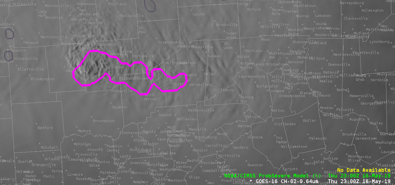
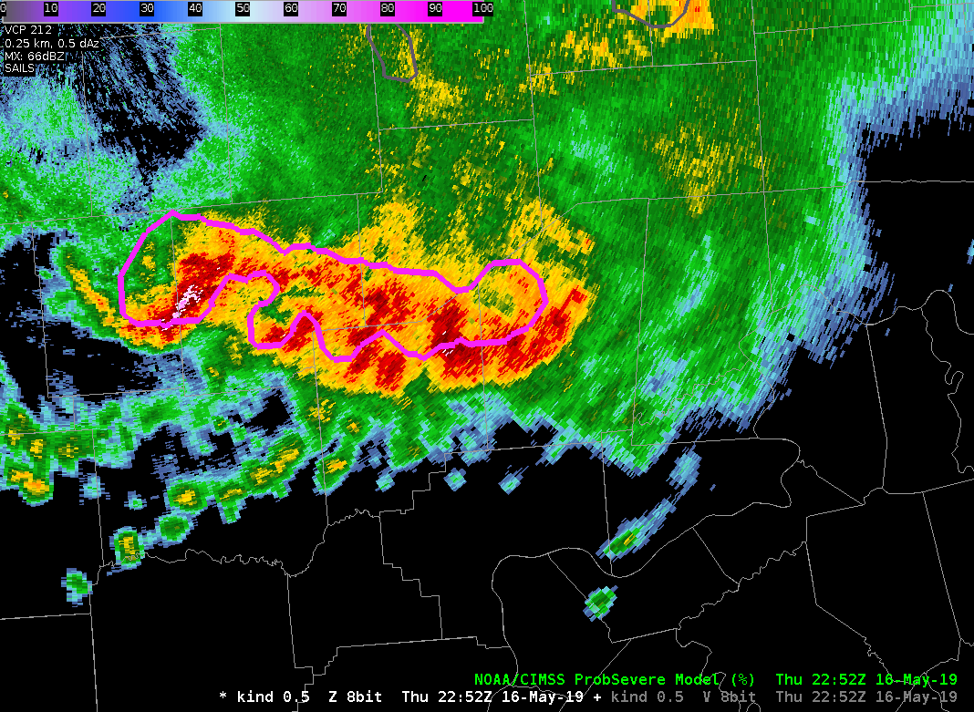
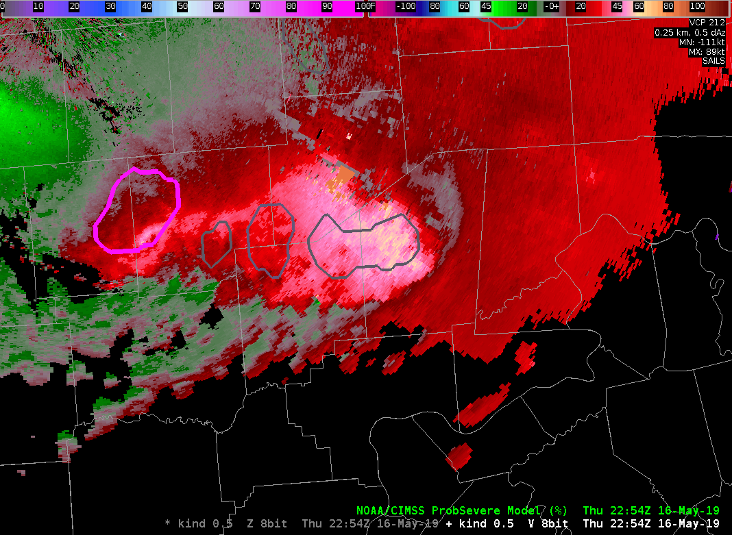
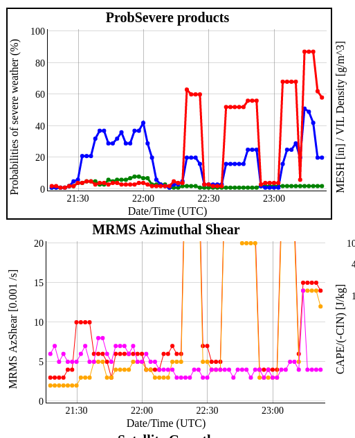
Thru the period the SVRProb and SVRtor seemed to regularly over warn during this outbreak, BUT SVRHail was spot on, a little False Alarm-y, but it sure didn’t miss the Large Hail reports, with %s >90 both instances.  The RGB Day Convection GOES product seemed to respond pretty well with the hail instances as well.

Afternoon NUCAPS over forecast the CAPEs by ~ 500, PW by 0.2″, did well with the Downrush temp and DCAPE tho.

Prob Severe – Unrealistically High ProbTor

ProbTor started giving unrealistically high values in northern ND, noting very high Az Shear Values. This appears to be a problem with data QC in the operational MRMS data, as it does not appear in the Testbed data.


Looking at the time series for one of these anomalous Prob Tor values, its clear the bad Az Shear data is contributing to the jump in Prob Tor:

ProbTor Gets Schooled Again

We continue to see significant issues with ProbTor that seems directly related to inflated Low Level AzShear values. This is likely due to an outflow boundary that is extremely well sampled by the KBIS radar.  As this outflow boundary races ahead of convection, the actual tornado threat, which was never high to begin with, continues to drop even more.

ProbTor, on the other hand, places a tremendous amount of weight on LL AzShear,  resulting in a persistently high ProbTor values.


#MarfaFront

ProbTor Too High

Watching a supercell near Bismarck…

It was clear from the hail core aloft that this was severe. However, it was obvious around 2152Z that the RFD gusted out as was seen on reflectivity initially, and then later on the velocity images as the winds became less perpendicular to the beam. However, ProbTor continued to carry high probabilities, and even increased when it was clear on the velocity images there was no tornado threat.  ProbTor was only keying on the outflow boundary.  MRMS Rotation Tracks were also showing a swath of higher values along the outflow boundary.

Reflectivity Loop
SRM Loop
ProbSevere Time Series

-Tempest Sooner