 15 min prior to 1.75″ hail and 20 min prior to baseball-size hail, a supercell tracked NNW-SSE through Vermillion Co, IL …the Probsvr nailed the values for ProbHail at 96%, VILD 4.3, and a well defined TVS (100kt G-G) and strong MESO on NEXRAD ~ 7k’
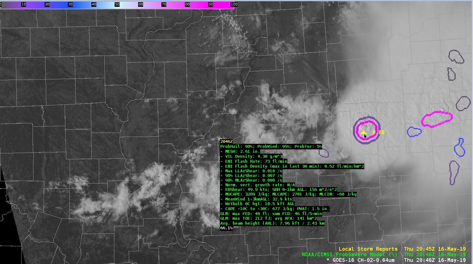 NUCAPS SVR TS values kinda nailed it in Ern IL :
East Central IL (green dot) MU and FCST SFC CAPE were > 4000, LIs were > 12, DCAPE > 1000 (~50KT Gusts), SHIP > 1 and LR H8 – H5 ~8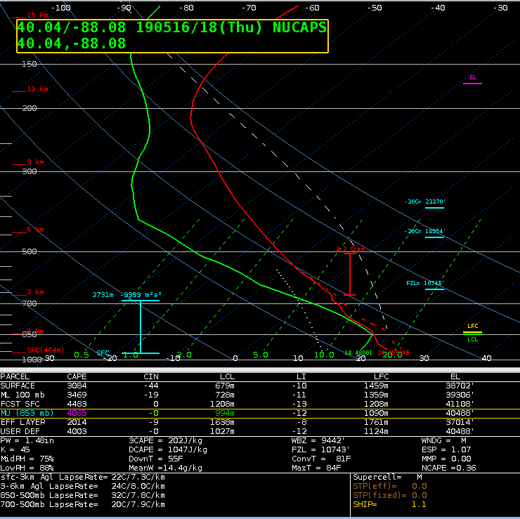 SRM showed Storm Top Div > 130kt 12 min prior to the Baseball Sized hail
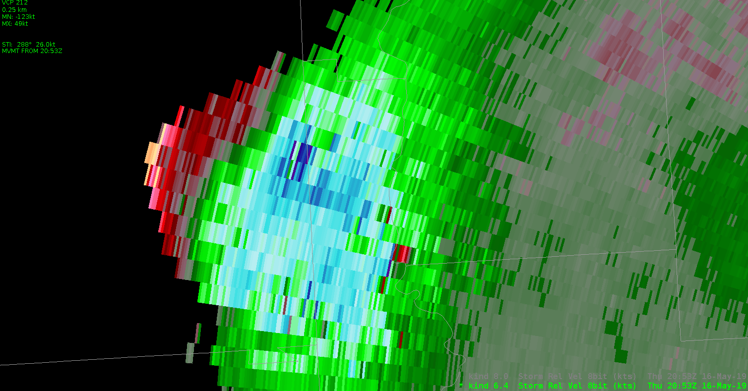 This storm is not diminishing, with Storm Top DIV remaining well over 100kt
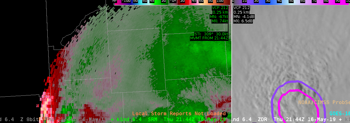 Eastern end of MCS continues to chug thru central IN (2130-2300z),
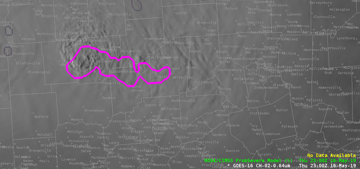
 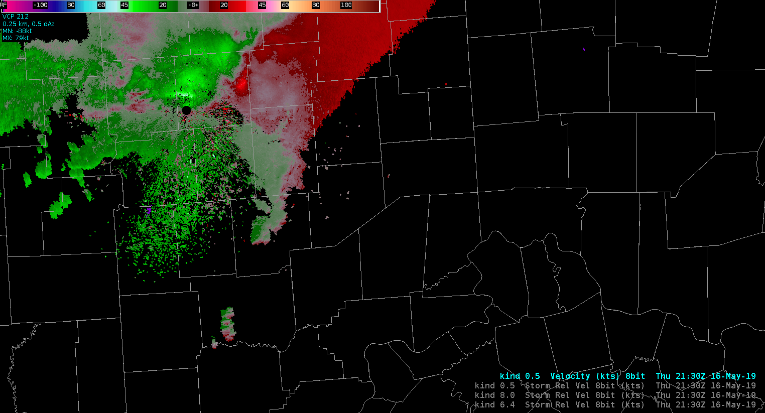 ProbSVR ~ 23z looking good, more warnings on the way