
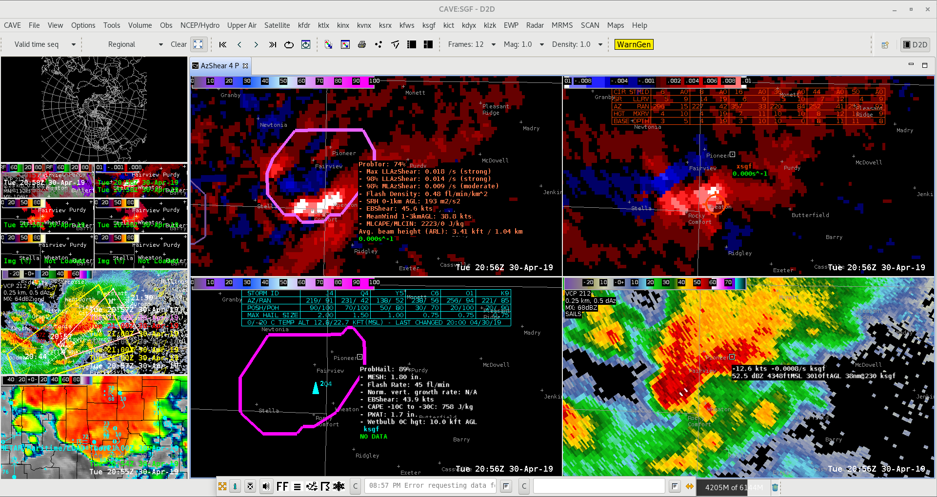
ProbTor jumped from 37% to 74% over an 8 min period with the circulation over SW MO as a TDS became evident and a tornado was reported.
–SCoulomb
Official websites use .gov
A
.gov website belongs to an official government
organization in the United States.
Secure .gov websites use HTTPS
A
lock (
) or https:// means you’ve safely connected to
the .gov website. Share sensitive information only on official,
secure websites.

ProbTor jumped from 37% to 74% over an 8 min period with the circulation over SW MO as a TDS became evident and a tornado was reported.
–SCoulomb
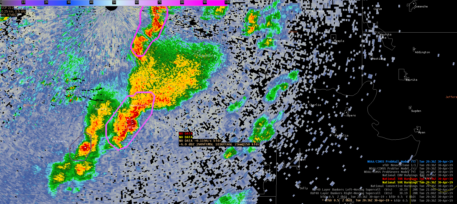
At 336pm CDT, a supercell storm near Electra, TX produced golf ball sized hail despite MRMS MESH showing sub-severe hail (~0.85″). Despite the low MESH, ProbSevere hail was progged at 75%. KFDR data had 50+ dBZ above 34K feet MSL and the storm was highly tilted downshear (a known limitation of MESH – underestimates in this case). This storm highlights the need to couple MESH/ProbSevere products with a thorough analysis of the base radar data and a fundamental understanding of strengths and limitations of supplementary datasets.
–Stanley Cupp
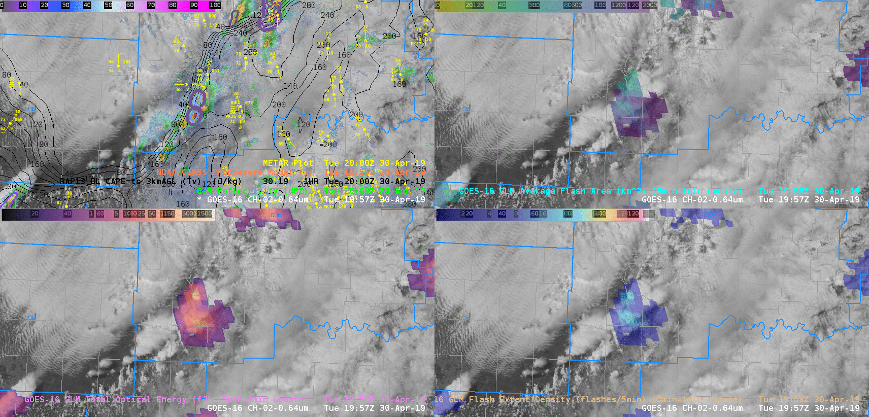
Two supercells developed in far southwest Oklahoma along 0-3km CAPE gradient. At 1957Z ProbSVR Hail 10% Wind 39% Tor 3%, then 6 minutes later at 2003Z ProbSRV Hail 63% Wind 75% Tor 5% on the southern storm. GLM Total Optical Energy in lower left image performed well with the increase in lightning activity for both supercells. -Jake Johnson
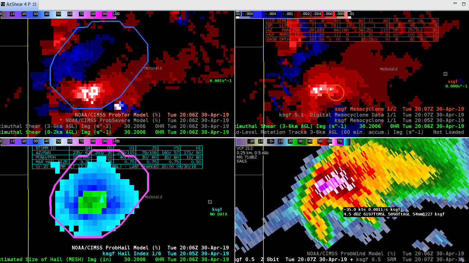
ProbHail on the storm in southwest MO seemed to be too low based on other derived parameters (MESH/Hail Index) and storm structure. ProbHail was consistently 70-75%. It was explained that the hail cape (~750 J/kg), the EBShear (47kt) and lightning (29 flash/min) were relatively lower than one would expect given the environment. Justin showed the parameter space for each of the ingredients and how they were weighting down the overall ProbHail due to the ratios being <1.
— SCoulomb
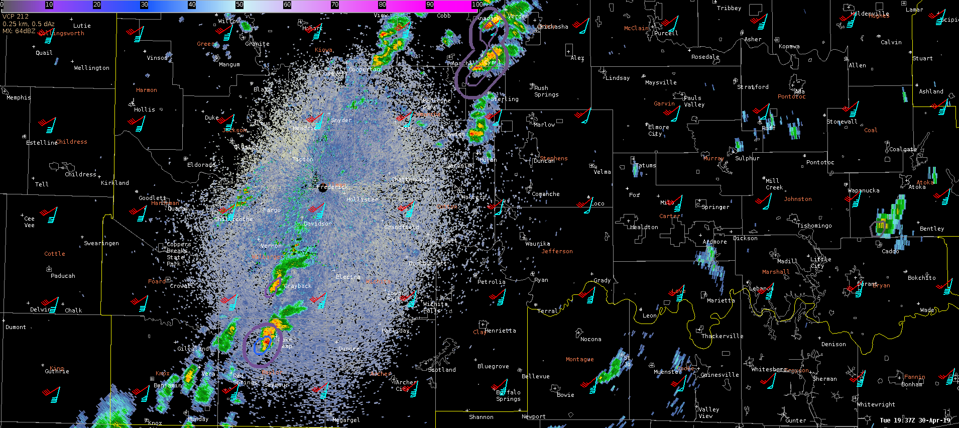
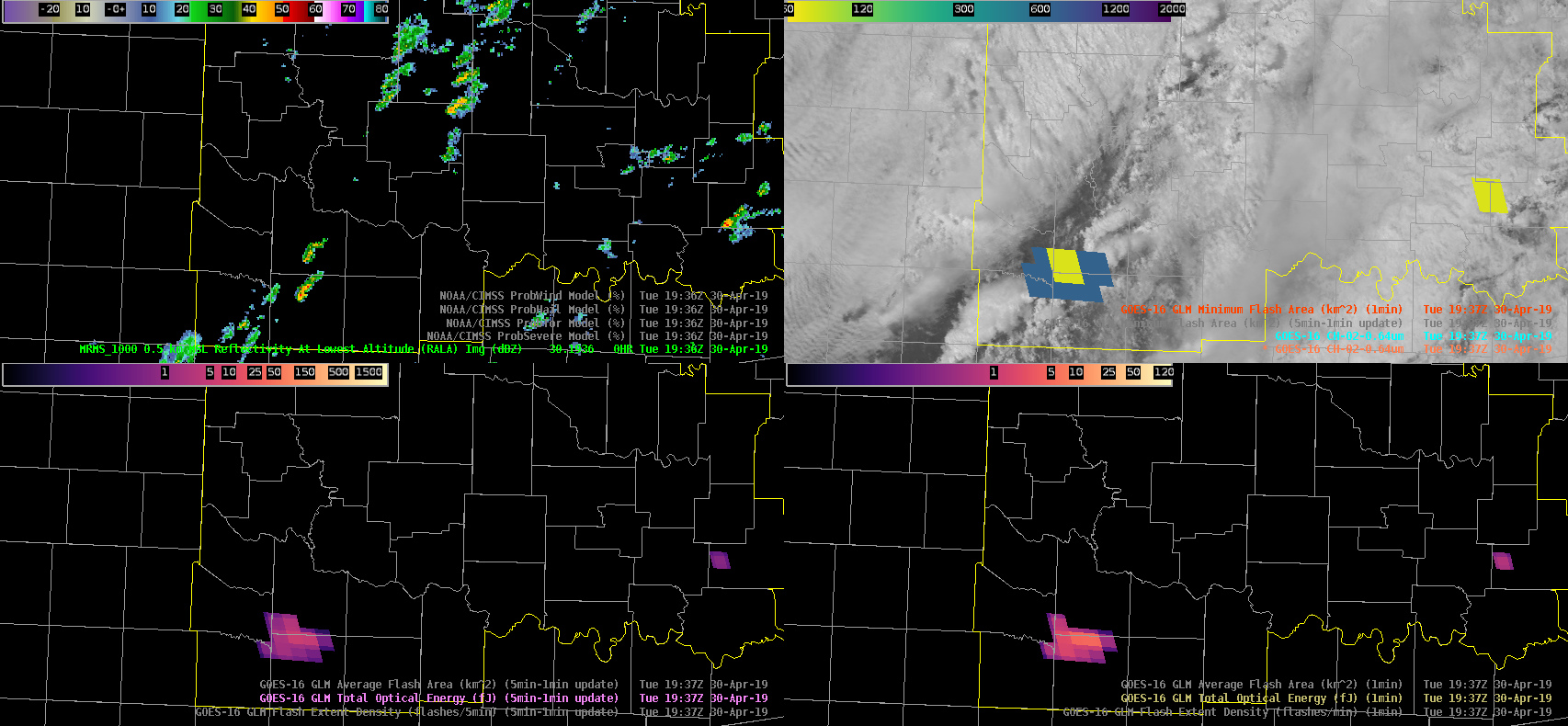
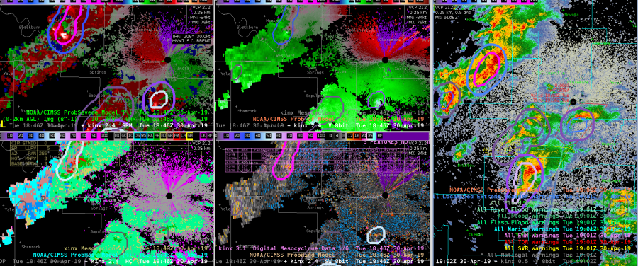
Beginning to see CI in the southwest portion of OUN’s CWA. ProbSevere has progged a 3-4% tornado probability for two areas: the SW storm and a few weaker/young storms in the central CWA. GLM minimum flash area along with total optical energy clearly indicate that the SW storm is the most promising of the two with more persistent updraft(s). Subsequently, 0-2km merged AzShear has perked up with the storm in the southwestern portion of the CWA. Given the storm’s favorable environment (ample 0-3km CAPE, bulk shear, and SRH), this storm warrants watching. Based upon the combination of GLM data, ProbSevere/AzShear, and 1 minute satellite imagery, a forecaster can quickly hone in on the most pressing storms at the moment.
–Stanley Cupp
1937z KFDR base reflectivity with ProbSevere overlays (double contour –> tornado prob progged)
Top left: MRMS RALA; Top right: visibile sat plus 1 minute minimum flash area; Bottom left: 5 minute total optical energy w/ 1 minute updates; Bottom right: 1 minute total optical energy
0-2km merged AzShear
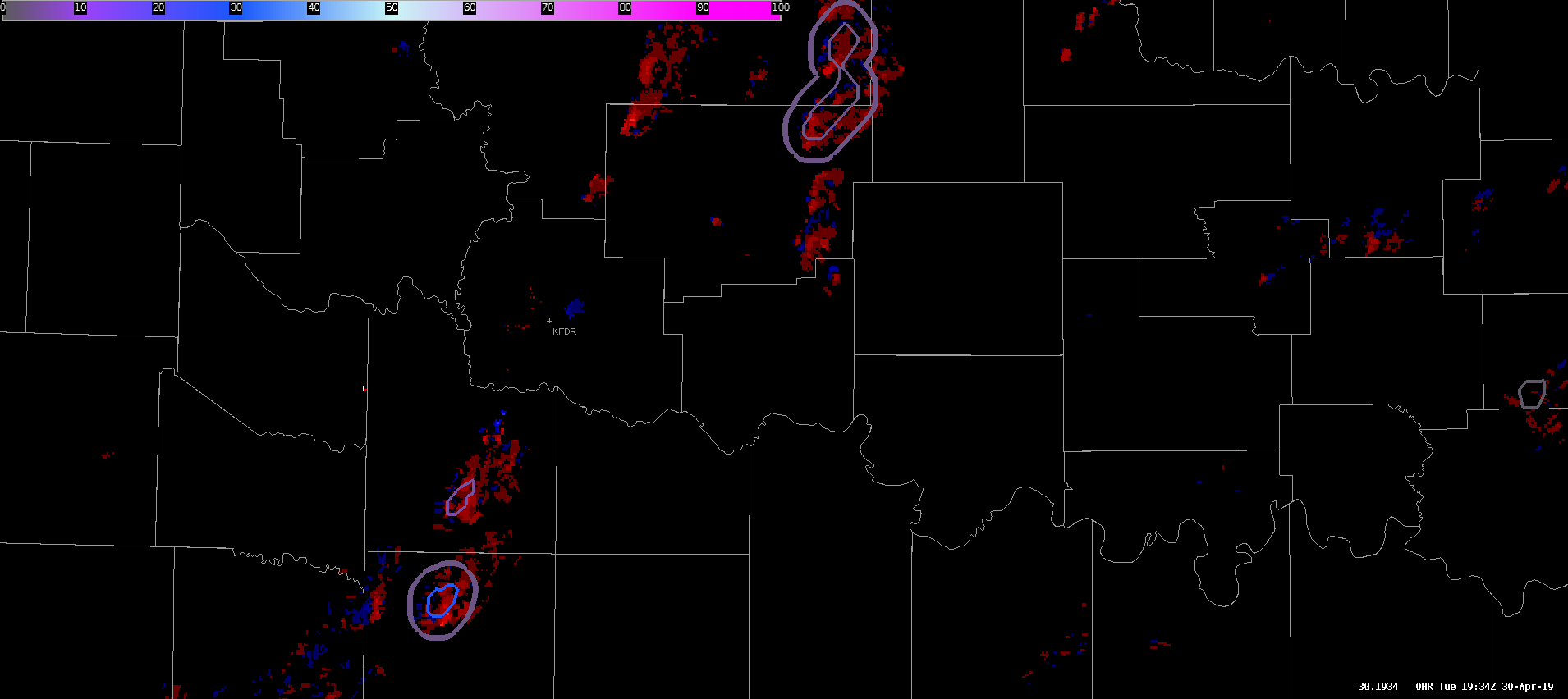
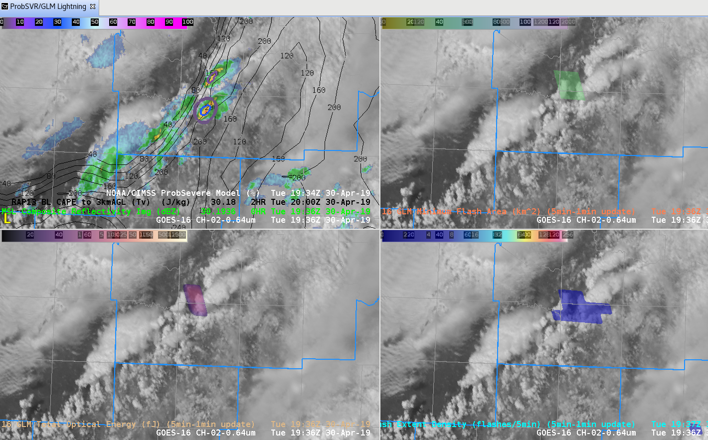
Figure 1936Z
Thunderstorm developing in southwest Oklahoma along 0-3km CAPE boundary with GLM showing first signs of lightning. If this storm remains attached to this boundary the environment supports possible tornadic development. ProbTOR is showing 3% with this early development Figure 1936Z. -Jake Johnson
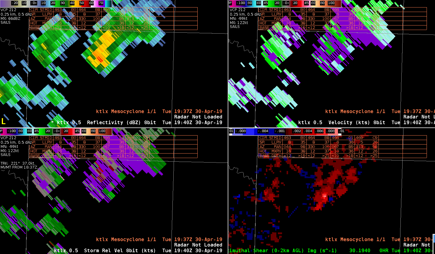
A positive for AZ-Shear product it does not show range folding like base velocity/SRM products. Might be useful tip. -Jake Johnson
Prob Tor up to 88% with 63% CPTI 80 mph winds. AZShear has been very persistent last several Volume scans and Z/SRM suggested tornado . WARNGEN would not issue TOR got error but tornado warning out! Quik TWIP
This storm has had consistent Azhear max for past several volume scans, but again does not seem to match low-level SRM scans very well. Prob Tor has increased and remained steady at about 75 to 77 % CPTI has remained slightly over 50%. Upgraded SVR to Tor possible. Reflectivity structure suggests increasing organization with well organized ZDR arc arc suggesting increasing SRH. May upgrade to tor shortly given better storm structure in base data. Quick Twip
Favorite part of the Azimuthal shear product so far is it can highlight some areas of the storm that need to be investigating…if you are watching a different storm and want to do a quick look at your CWA this can grab you attention to a storm that needs to be looked at next.
South Beach
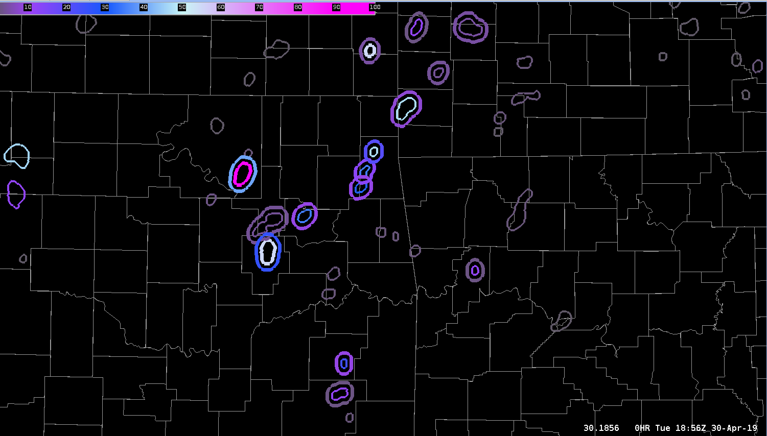
ProbSevere double contours were plentiful at this time showing the utility that certain “big” days may need to be modified to increase the threshold for the second contour. This was the default 3%. Only a couple of the circulations were worth investigating in reality.
— S Coulomb