ProbSevere on BLX storm

d2_probsvr_1920

The ProbSevere algorithm had a notable jump on the convection NW of BLX, despite it moving into an area that may not be as hospitable for severe weather. There were two ProbSevere clusters at 1920z; the northern one had a value of 23% and the southern at 73%.


d2_probsvr_1926

At 1926z, the two were combined into one with a ProbSevere of 66%. Since it was maturing, ProbSevere may have moved past its prime usefulness.

Jason Williams

Tags: None

individual cells merge into linear system near Billings

byz2_Capture

Discrete cells which showed modest growth west of Billings merged into a linear complex very close to Billings.  CIMSS prob severe model shows high degree of confidence of embedded severe potential within the line as it sweeps over the radar site. Dime size hail was reported near Billings as of 1945Z.

John Pendergrast

Tags: None

Bismarck, ND Discussion

Synoptic Discussion

Little synoptic change over 24 hours.  Main upper level trough remains over the PacNW with broad SW flow aloft over the BIS CWA.  Fig 1 in the top right panel shows an associated surface low slowly progressing east. This is producing  south low-level flow ahead of the low that is producing moisture advection primarily over the eastern CWA. Currently surface dewpoints are in the mid 60 east of Bismarck so cloud breaks are allowing for instability to develop. Moisture and instability are in place and trigger mechanism looks to be associated with diabatic surface heating and eroding the low-level CAP.  Surface convergence will also come in play in the surface trough areas associated with the sfc low. These are located through the central Dakotas and extending into Montana and Wyoming. By 00z Wed a secondary forcing provide by a weak vorticity center may allow for already developed convection to rapidly develop. The HRRR (fig 2)also seems to initiate convection with the small perturbation around 20Z.  Overall will focus on eastern CWA for most potent and organized convection. –Cattywampus

screenCapture

Fig 1:

screenCapture

Fig 2:


Mesoscale Discussion

The CIMSS Layer CAPE and LI products show that instability has increased over the last few hours. CAPE and LIs are highest in the south central portion of the FA with values up to 1900 J/kg and -7 respectively. The CIMSS Layer PWAT is most favorable across the eastern half of the FA with values up to 1.35 inches. The SPC mesoscale analysis shows wind shear values up to 35kts in the south central portion of the FA, so believe convection will be organized. Large hail and locally damaging winds appear to be the main threats. CIMSS

-Helen Hunt

Tags: None

SRSO data vs. RAP


Convection was ongoing across the area today in CYS.  This lead to a quick assessment of the weather.  Wanting to use the new data, I asked to use the 1 min srso wind data as well.  This shows that there is a weak 50kt + jetlet moving across the cwa.  This suggests that deep layer shear is larger than previous suggested by the RAP.  As storms move to the east across the cwa, I’m expecting the storms to become more organized.  With dewpoints in the 60s across this area, would not be surprised if we start getting some severe weather soon.

Screenshot-CAVE:CYS - D2D

Screenshot-My Animation - Mozilla Firefox

MacGyver

Tags: None

LAPS and Montana convection

d2_1800_instability

GOES-derived LAP products indicate a swath of higher instability across the southwestern part of the BYZ CWA. A storm cluster is moving northeast out of this zone of higher instability. Per the LAP products, I would expect the storms to diminish in intensity. Will provide an update on whether or not that occurs.

d2_1920_radar

Jason Williams

Tags: None

Environmental setup for eastern Montana this afternoon

A review of the Sounding from GGW shows an elevated unstable layer with sufficient moisture for ongoing storms through the afternoon.  It looks like the primary threat from convection will be the possibility of some coin size hail and high convective wind gusts in the strong or severe cells which develop.  Current radar shows scattered multi-cellular storms west of Billings will be moving through the region with a general increase in coverage expected through mid-afternoon.

Pendergrast/Jason Williams

Tags: None

Daily Summary: Week 4, Day 1

After a week off, the EWP Spring Warning Project resumed in the Hazardous Weather Testbed. With much of the first 3 weeks of activities taking place in Texas, it is refreshing to have a change in the weather pattern, taking us north this week. Today, we had our 3 pairs of forecasters operate in the Bismarck, Pocatello, and Pendleton CWA’s. It is beneficial to have the algorithms evaluated in a variety geographic regions, so today’s northwest convection was welcomed. With a slow start to convection, participants had ample opportunity to become familiar with all of the GOES-R and ENTL products under evaluation. By the end of the day, as convective activity amped up, participants were comfortable using the products to issue short-term forecasts and warnings.

Tomorrow’s activities will begin at 1 pm, and will likely make a slight shift eastward with the most active convective weather.

– Bill Line, SPC/HWT Satellite Liaison and Week 4 EWP Coordinator

Tags: None

6/1/15: First Cell, Bismarck CWA.

First meaningful cell developed in the area that showed the most promising CAPE values shown on the CIMSS satellite CAPE analysis.  The cell did develop but was of the pulse variety. ProbSevere only showed about a 35% SVR Prob (fig 1) which seemed reasonable with only a narrow 50dBz core only reaching a little above 27kft MSL.  The core quickly collapsed and only showed a ProbSevere of ~11% (Fig 2).

2110Z

Fig 1: 2010z, ProbSevere ~35%.

With our modified NUCAPS souding showing ~2300 J/kg, expecting to see some stronger development but it didn’t happen. The morning 12z sounding did show a pretty substatinal stable layer/cap so could be it hasn’t completely mixed out yet or our modified sounding using the KISN site may have been too aggressive. Additonal cells continue to form, will see if they can develop deep if the cap is continuing to erode.

2122Z

Fig 2: 2021Z, ProbSevere, ~11%.

Forecasters: Cattywampus/CoonieCatEye

Tags: None

ENI compared to LJ

I’ve noticed a few cases today where the Lightning Jump Algorithm and ENI polygons and time series data do not line up as I might have imagined. Lightning jump is based on radar data whereas the ENI polygons and time series data use the Earth Network lightning data. Beam blockage due to the terrain in the Pocatello CWA may have affected the radar data going into the lightning jump which may account for some of the differences.

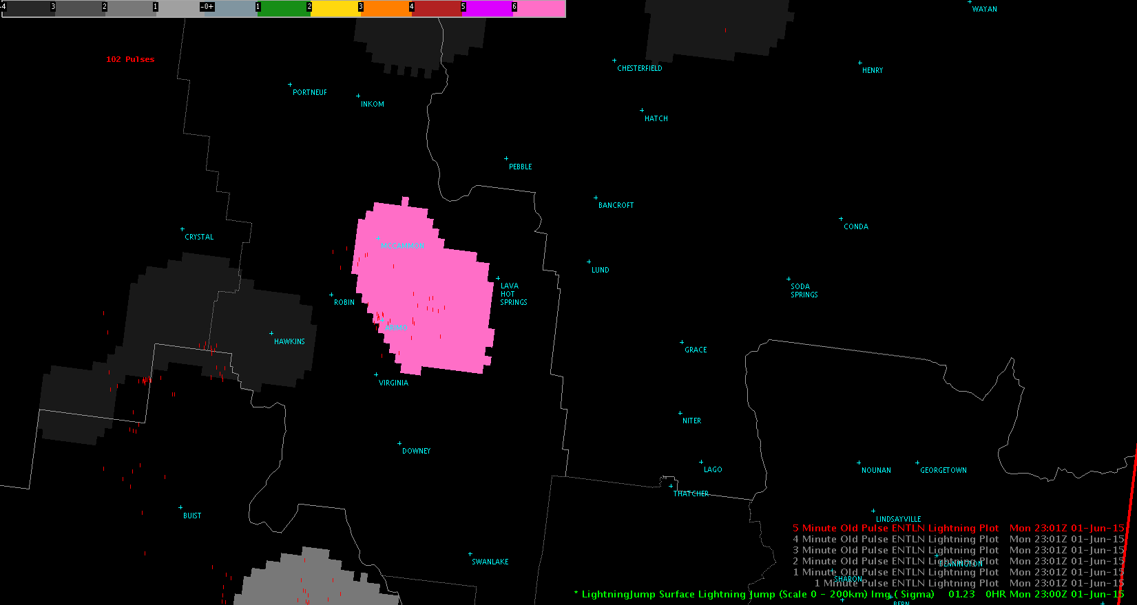
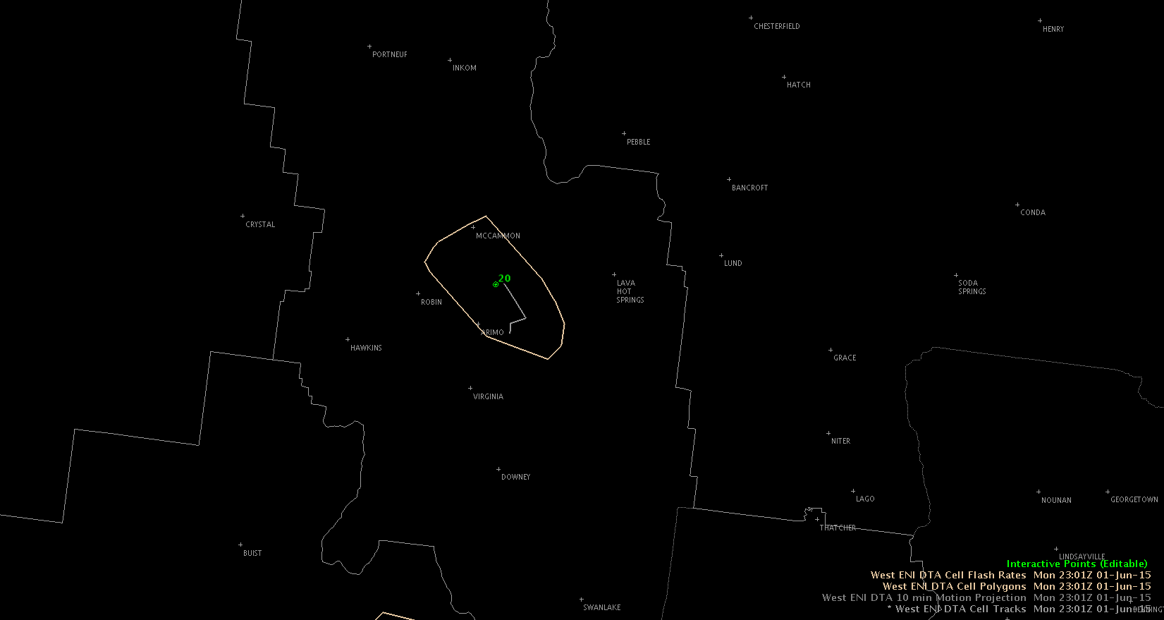
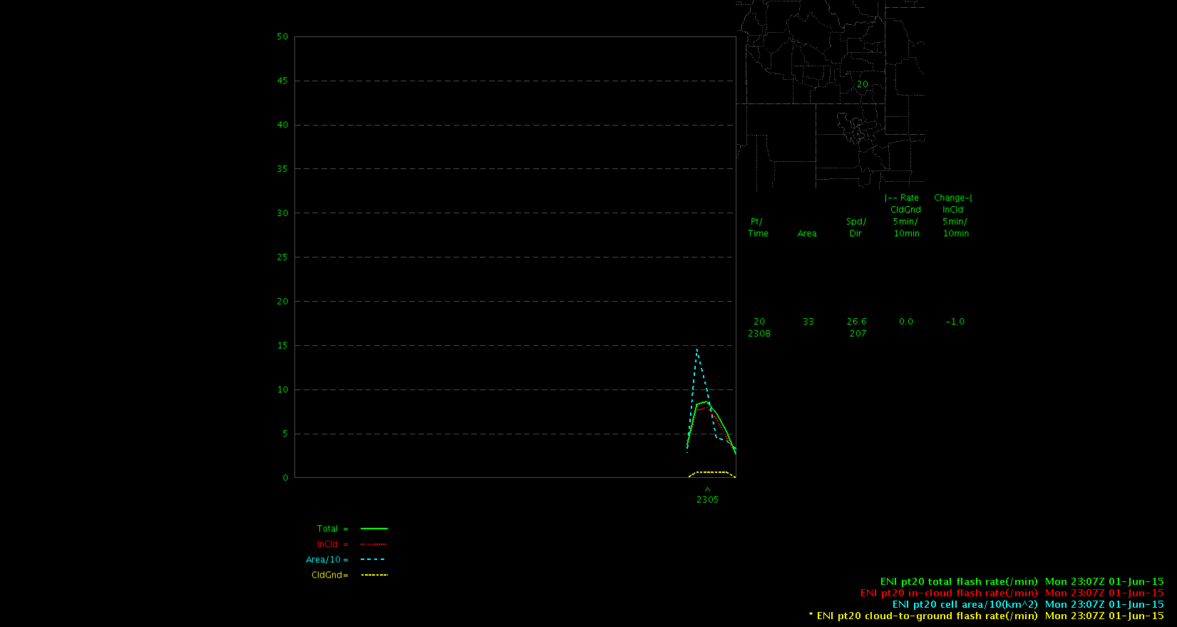
In the example below, the lightning jump algorithm shows a value of 6 sigma at 2301Z whereas the ENI time series shows only a relatively small increase in lightning activity at this time.

LJumpENIflashENItimeseries-Helen Hunt

Tags: None