ENI Efficiency Problem

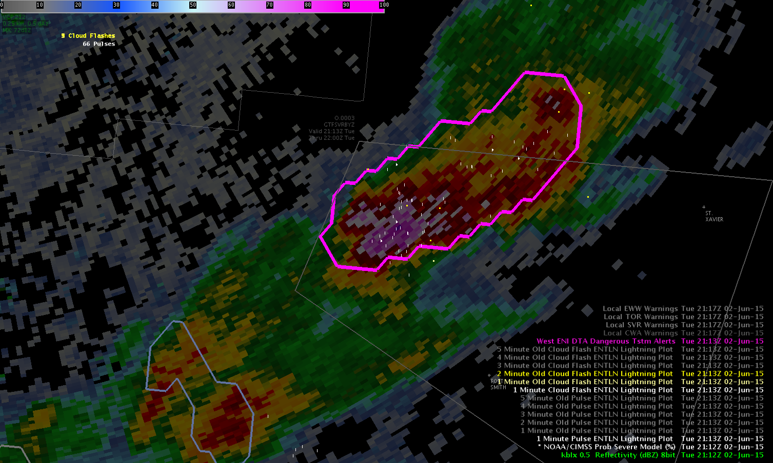
I was surprised when I did not see an ENI DTA cell polygon around the storm in southern Mountrail County. The two strong storms further south both had polygons, but this one did not. I noticed this storm was also strong with high reflectivity values aloft and some rotation. The 1 min cloud flash ENTLN lightning plot only showed one flash associated with this storm. The total lightning detection efficiency is only around 40% in this area which may explain why there was very little lightning associated with it. Since there wasn’t an ENI DTA cell polygon, I couldn’t look at the time series. This example showed me that it’s important not to rely on this data. It would be nice if the lightning detection efficiency were higher in this part of the country or equal across the entire country.  ENI

-Helen Hunt

Tags: None

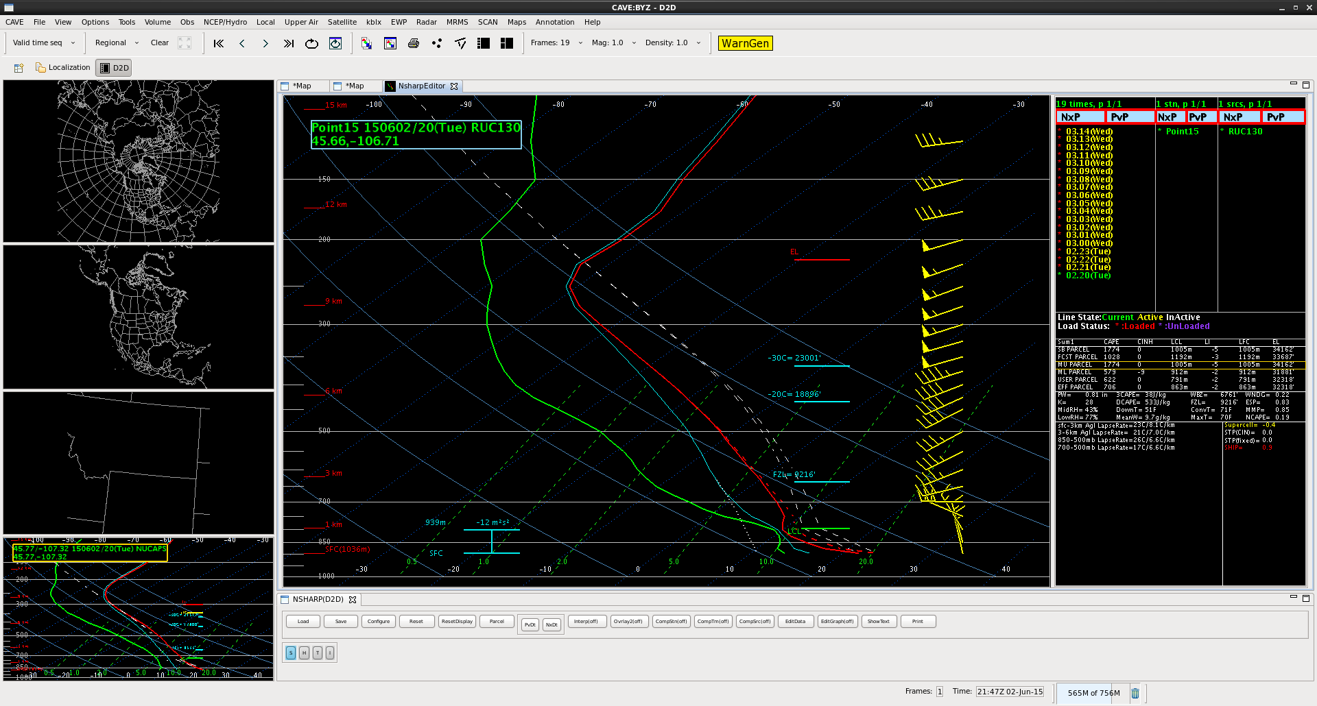
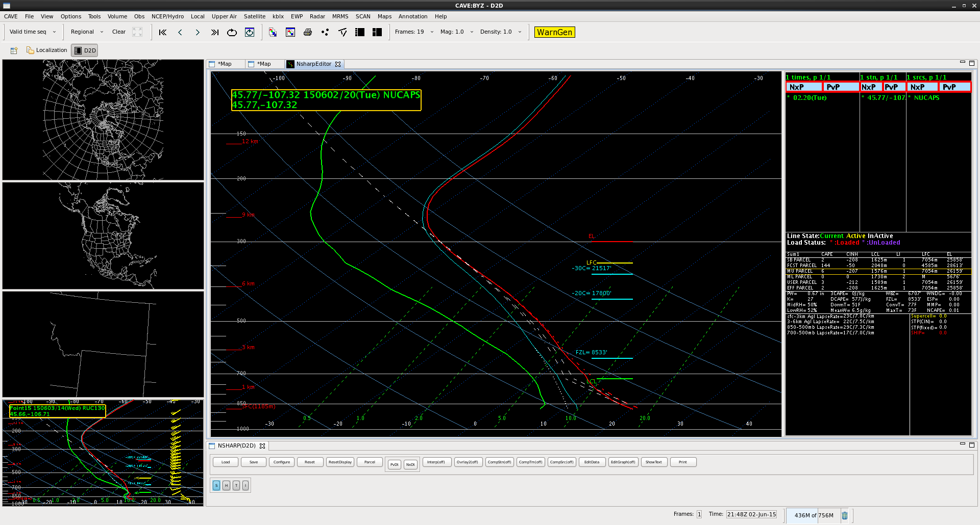
RUC – vs – NUCAPS soundings over SE Montana

Screenshot-ruc0602nucaps0602

Comparison of relatively uncontaminated areas from RUC and recently available NUCAPS ahead of encroaching cloud cover show temperature and moisture profiles similar with slightly higher PWAT on the RUC due to low level moisture contribution. NUCAPS indicated 500 MB temperatures around 2C warmer than the RUC likely leading to more convective inhibition than the RUC was showing.

John Pendergrast

Tags: None

June 2 — Rapid growth of 2 supercells across northern CYS CWA

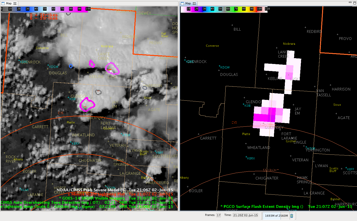
We have been seeing amazingly rapid supercell growth of two cells, one just north of Guernsey and a second near Lusk since 2045Z.  Both cells have also shown rapidly increasing severe probabilities.  The Overshooting Tops algorithm was also indicated with the Lusk cell.

Supercells_2107Z_2June15


The 1-minute GOES-14 visible satellite is showing both supercells very well (L).  The two pink overlays indicate the increasing severe probabilities.  The southern cell north of Guernsey was up to 90 percent, while the cell near Lusk was at 76 percent.  Since 2107Z, the Lusk cell severe probabilities increased to 89 percent at 2110Z. along with several CG lightning strokes.  The 2107Z Flash Density (R) was up to 17/minute with the Gurensey cell, and 10/minute with the Lusk cell.

CoonieCatEye/MacGyver


Tags: None

More thoughts on LAP CAPE in Montana

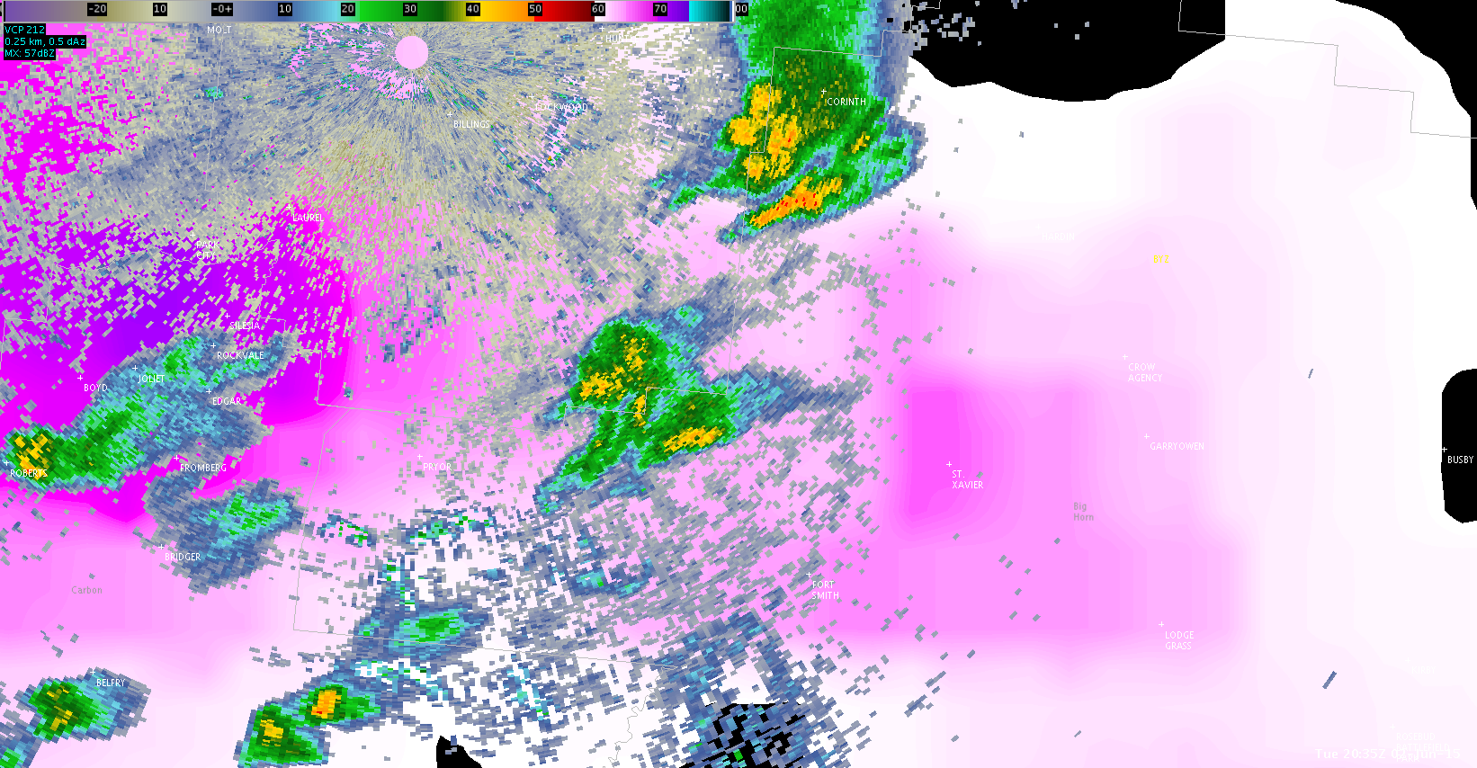
radar_LAPS_2035z radar_LAPS_2119z

Above are radar images from BYZ at 2035z and 2119z, on top of LAP-derived CAPE (valid at 2000z). Convection that began to develop in a local min of CAPE quickly intensified as it moved into a local max. Again, the LAP-derived CAPE seems to be doing very well in assisting with short-term trends.

Jason Williams & John Pendergrast

Tags: None

Lone cell southeast of Billings garners a pseudo warning

severe_rural0602

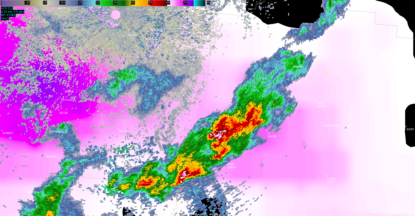
A lone cell over rural areas southeast of Billings developed into a persistent severe cell on the CIMSS Model (above 90 percent) for several consecutive radar scans along with significant to dangerous category total lightning values.  The cell centroid moved to the right of environmental flow on both radar and projected ENI motions.

John Pendergrast/Jason Williams


Tags: None

June 2 — Lightning Jump coincides with Large Flash Density (CYS)

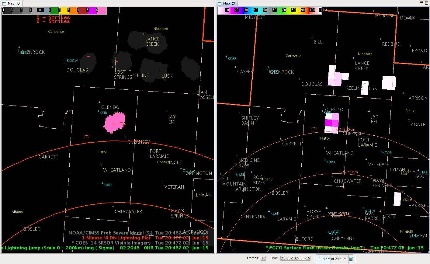
Just a few minutes after my previous post on distant flash density, we got a lightning jump along with several CG lightning strokes AND a large flash density.  The lightning jump was up to 6 sigma!

CGLrng_FlashDensity_2June15_2047Z

Note the 6 sigma lightning jump on the left screen along with 4 CG lightning strokes, while the flash density was up to 16 per minute!

This cell persisted with its density rate as the severe probability quickly increased to 90 percent by 256 PM.  The overshootimg top algorithm also turned on with another supercell that developed near Lusk, WY.

CoonieCatEye

Tags: None

BIS CWA: Using NUCAPS and CIMSS to anticipate new convective development

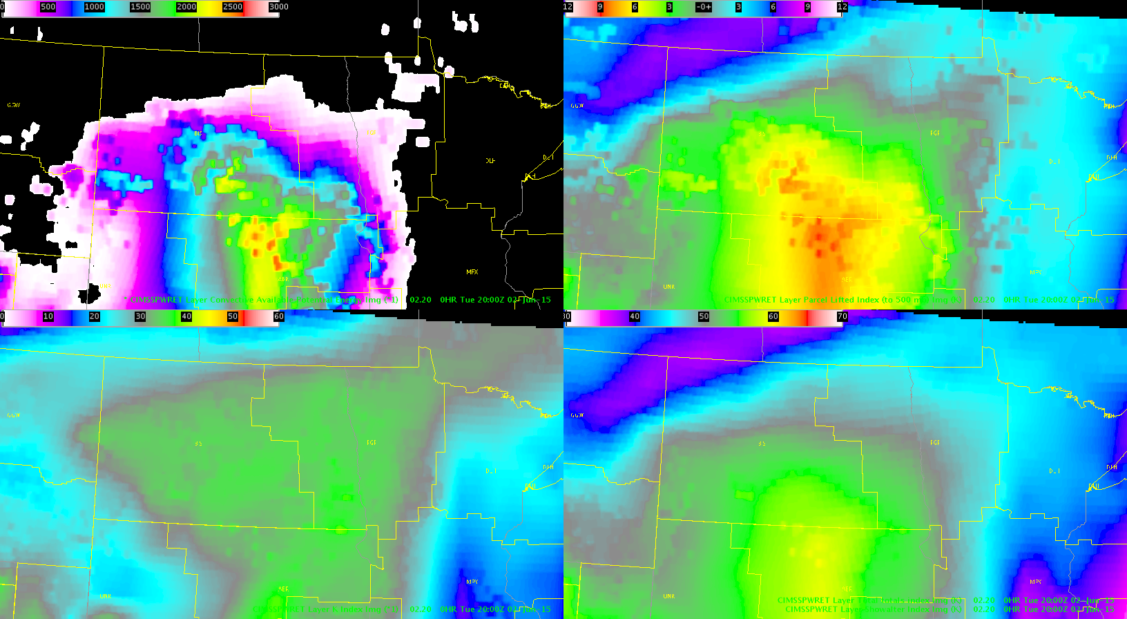
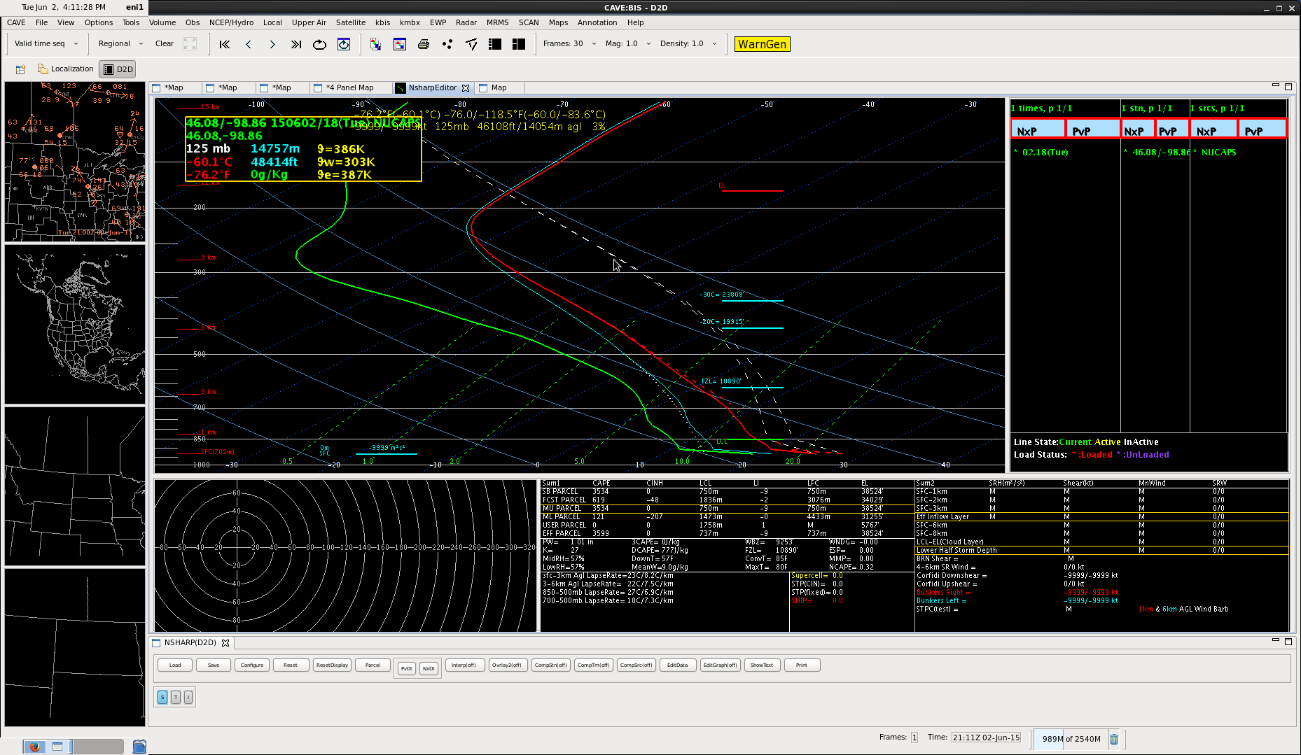
Trying to anticipate future convective development. Looked at a CIMSS CAPE (fig 1) plot and seeing that the best CAPE is shifting into the eastern CWA. Took the available NUCAPS sounding and modified  it with a nearby metar with a 77/66 surface reading.  See plenty of CAPE (3,500 J/kg). May be too much just simply modifying the surface points along, but nonetheless it shows it is plenty unstable.  This was also in a mostly clear region.  Plan on testing CI-East to see if this clues in on potential development in this area. –Cattywampus.

CIMSS_CAPE

Fig 1: CAPE shifting east along with surface low and southerly flow.

nucaps

fig 2. Modified NUCAPS sounding over cloud free SE portion of the CWA. Still quite unstable.

–Cattywampus

Tags: None

June 2 — Flash Rates vs. CG Ltng outside LMA Range of Efficiency (CYS)

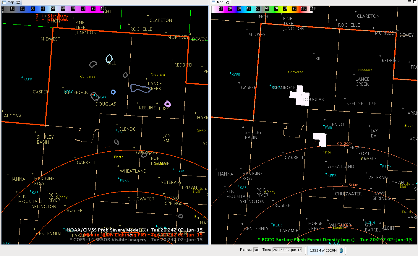
I had been noticing that the LMA Flash Density has been occasionally reporting outside the maximum range of efficiency well north of the sensor array in north central Colorado, over 200 km away.  Even though the flash rate is low (only around 1 flash/minute), it did pick up on one CG lightning stroke in the Douglas area this afternoon, which occurred coincident to the flash report.  See Figure 1 below.

DistantFlash_CGLtng_2Jun15_2024Z


Fig.1  One CG lightning strike near Douglas (KDGW) (L) and the Flash Density (R)

Appears this may be due to increasing cloud heights and possible glaciation rate aloft.

CoonieCatEye

Tags: None

CI Prob Success

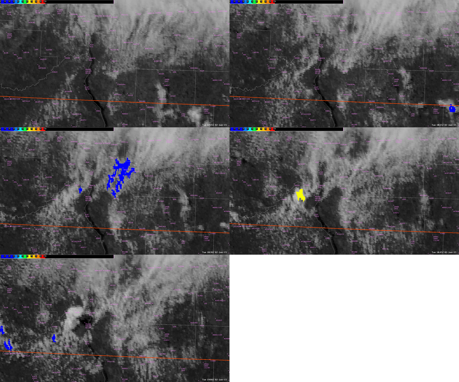
The image below (please click to animate) shows an example of when the CI probability product successfully predicted the onset of convection. At 1845Z, a yellow CI polygon appeared southwest of Solen indicating a 60% probability of convective initiation. In the next frame (1900Z), the visible satellite imagery shows intense cumulus growth in the vicinity. I also compared this to radar, and a cell popped up at 1858Z.

CIprob

-Helen Hunt

Tags: None

CI performs well on new Montana convection

CI_2020zradar_2027z

radar_2049z

CI product at 2020z climbed to 50% for the clouds south of BYZ. At 2027z, radar showed most of that zone had low reflectivity, with the exception of a northern cell that was resurrected from previous convection. However, by 2049z, much of the area that CI had indicated as a max had convection. Spatial area was very good!

Jason Williams

Tags: None