

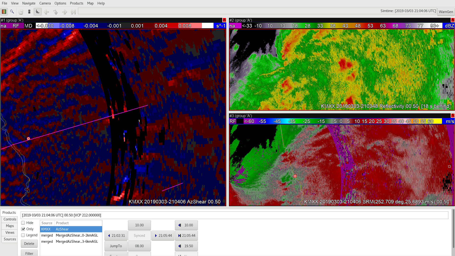
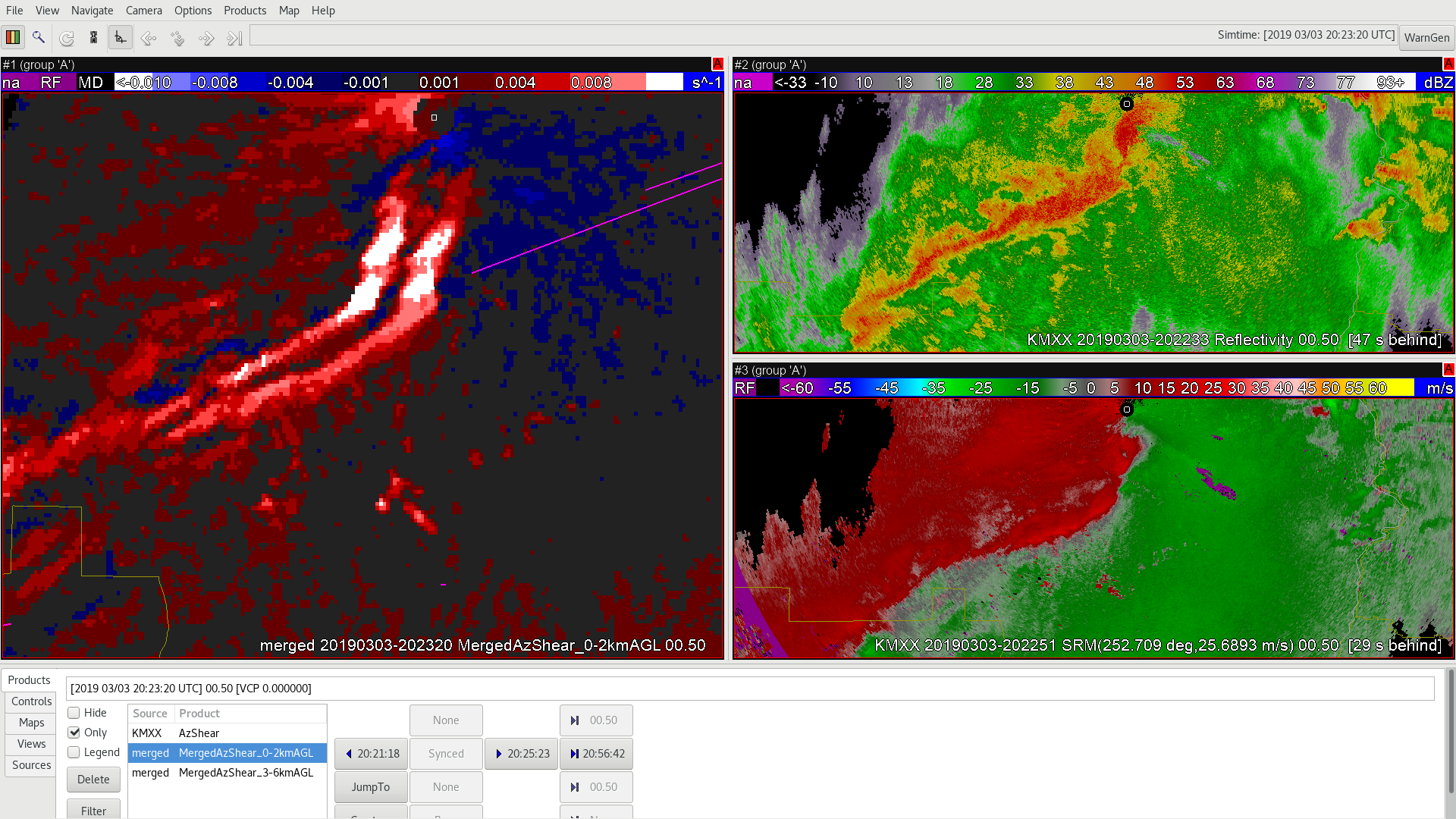
As the northern portion of this QLCS becomes oriented more north/south and perpendicular to the 0-3 km shear out of the SW, I would expect mesovortex genesis to become more likely. AzShear does a nice job of highlighting this zone several scans before tornado touchdown (pink line) Sandor Clegane
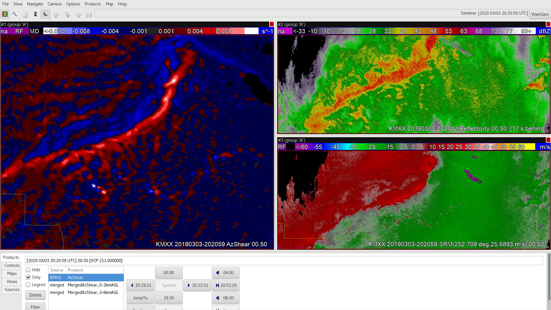
Highs and Lows of the Merged AzShear Product – Double Peaks vs. Viewing through the “purple haze”
In the image above you can see that the AzShear and the Velocity product from the single radar have the circulation now lost in the infamous ‘purple haze’. One of the benefits of any MRMS product and in this case the Merged AzShear product is visibility in times like this. Neighboring radars (either individually or in the Merged Product) would still show the ongoing circulation. So lets take a look!
In the merged product you can indeed still see the circulation going strong in the Merged AzShear product, continuing to follow the pink tornado track, while the velocity couplet remains hidden (we are also getting far from the radar so we are looking well aloft in the storm). BUT the one noticeable feature of the Merged AzShear is the triple maxima in this case due to the SAILS cuts making their way into the Merged AzShear product.
Again this triple maxima is an artifact that training and experience would negate, but does show some of the good and the bad in terms of the Merged AzShear.
-Alexander T.
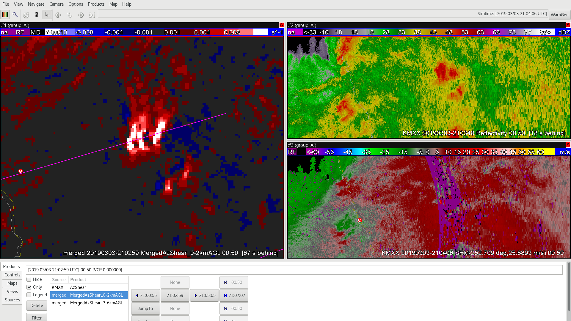
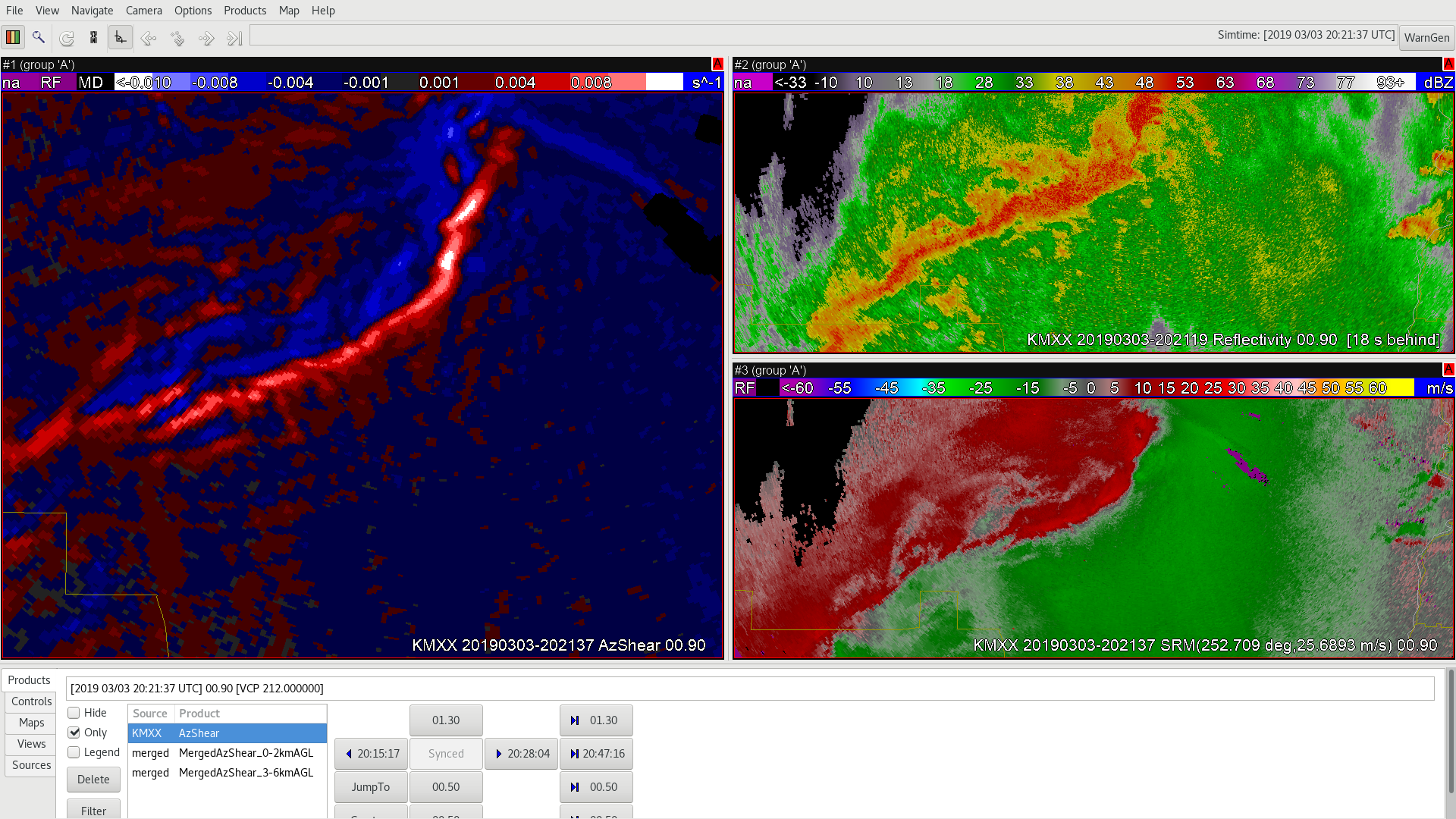
AzShear Remain High Even When Couplet Is Less Obvious
Later in the life of the storm, AzShear remains relatively high, even as the couplet in SRM is less obvious (though still there). This would boost confidence to keep a tornado warning going.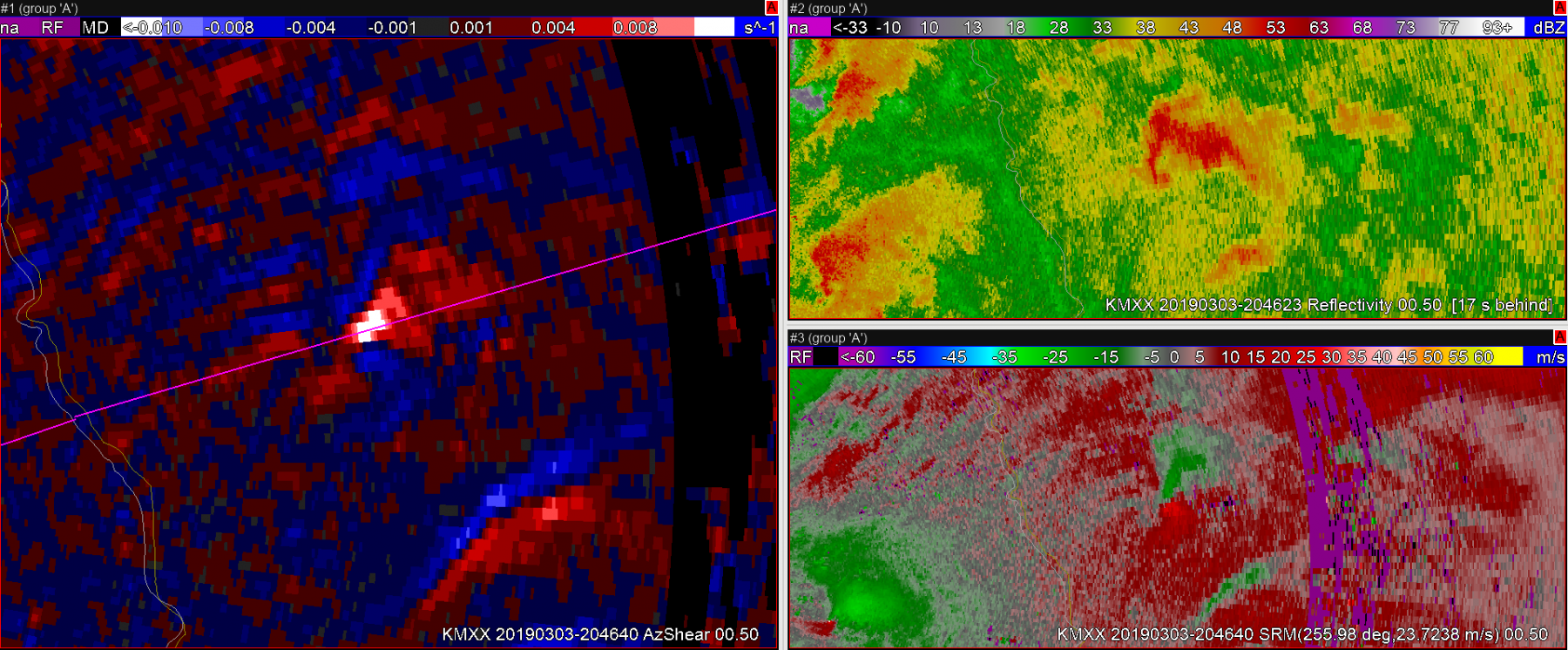 However, toward the end of the tornado track both velocity and AzShear wash out before the tornado ceases (pink line).
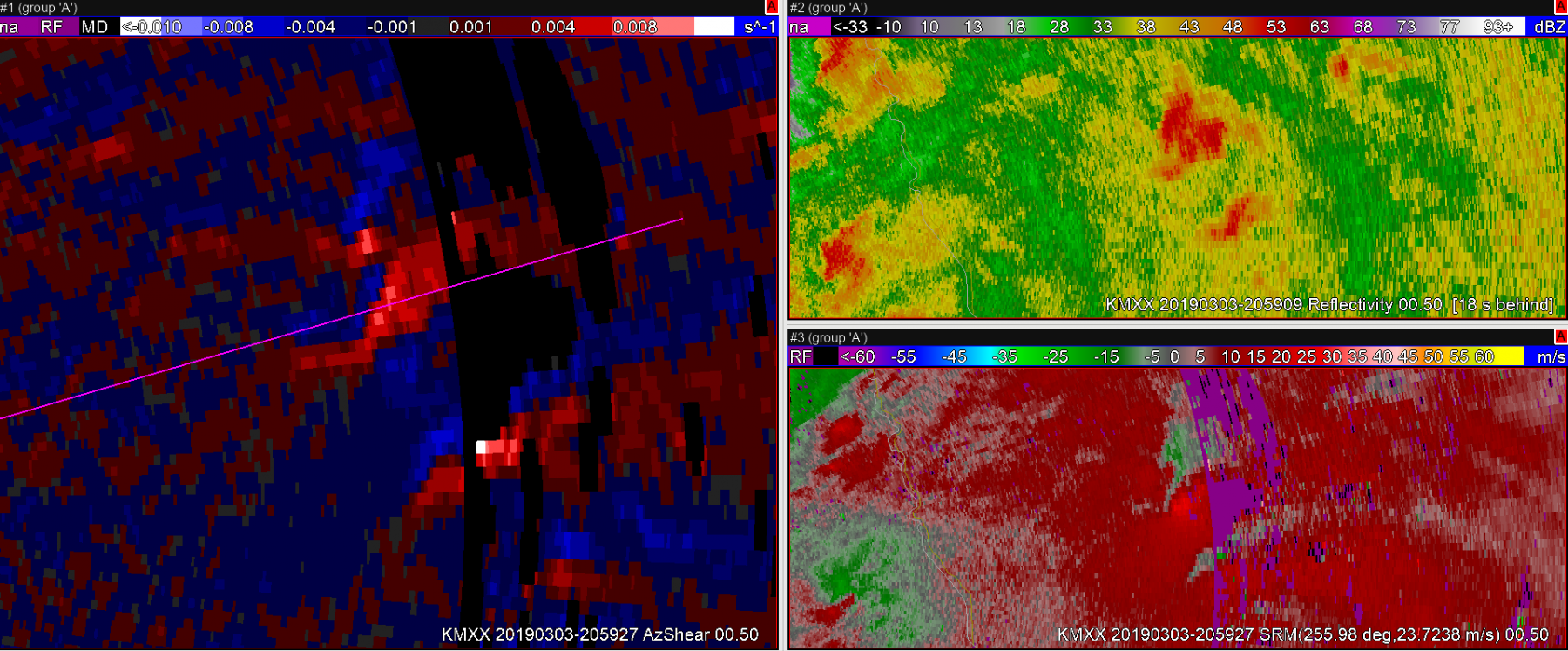 Sandor Clegane
AzShear Highlights Storm Top Divergence
While not at an ideal angle to view storm top divergence, AzShear very nicely highlights strong storm top divergence on this tornadic supercell.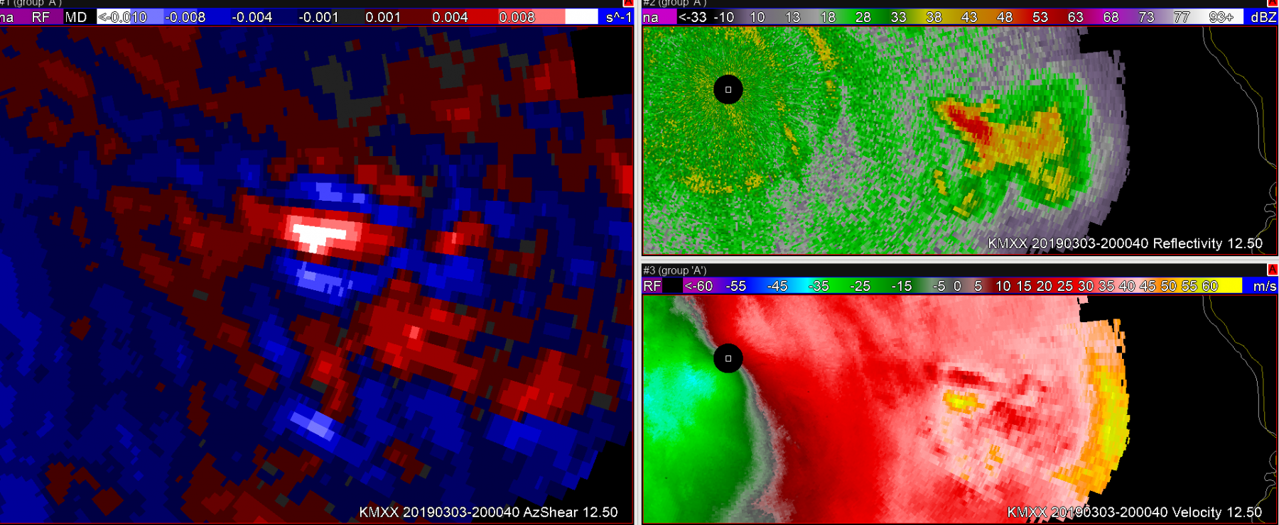 Sandor Clegane
Using Upper Tilts to Dismiss Errors in AzShear Single Radar 0.5 Degree/Merged 0-2km Data
One usefulness of the upper tilts in the Single Radar AzShear product is to be able to check and dismiss any erroneous data in the 0.5 degree tilt. In the image below you can see some speckled erroneous data in the 0.5 degree tilt ahead of the main line of storms. It could appear at a quick glance to be small spin ups in the AzShear data, but just quickly looking at the Velocity or Reflectivity shows that this is erroneous data.
Another check is just doing a quick check of the 0.9 degree tilt. Those local max in the AzShear are not present even just one tilt above. If these were to be real circulations you would expect depth in the circulation.
It is worth noting that these errors to at times make their way into the Merged AzShear product at least at the lower 0.2km AGL product. You can see that example below of the brighter reds below the large maxima in the center of the AzShear product. Even after only 2 days of looking at the AzShear products the large maxima keeps all of my attention, but someone looking at this product for the first time may see the brighter reds to the south and wonder about those.
-Alexander T.
AzShear First Clue For Tornado Warning?
In the first image below, there is clearly a strong supercell that undoubtedly warrants a severe thunderstorm warning. Without having a full picture of what the environment looks like, and without looking at additional radar products, I can’t say for certain whether or not it should have tornado warning, given the strong convergant but non-rotational signature.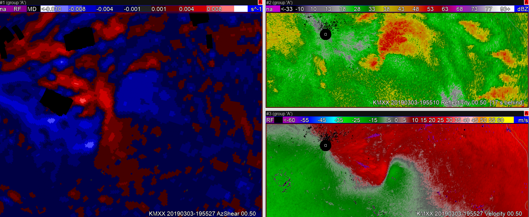 In this next image, a couple of AzShear features stand out to me. 1) Positive values of AzShear have begun spiking on the north side of the convergant zone. 2) I believe that you’ve seeing the RFD start to kick downstream.
 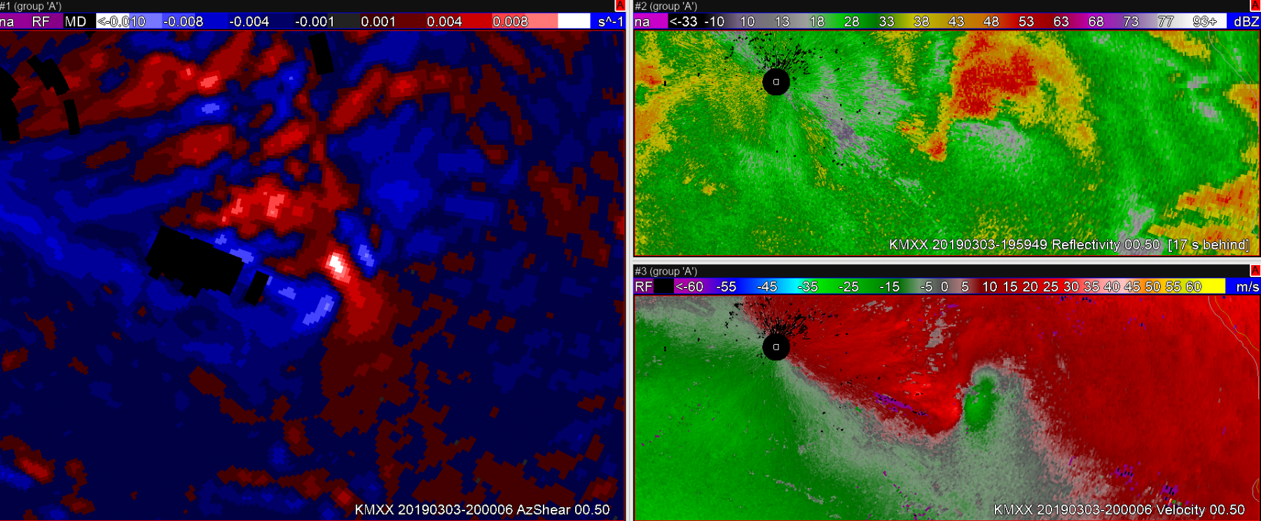 Shortly thereafter, the storm develops a very clear couplet and it is clear this storm deserves a tornado warning. The tornado survey revealed that the tornado began when the second image in this post was captured. AzShear did a nice job highlighting important features on this storm, and may have lead to additional lead time on a tornado warning.
 Sandor Clegane
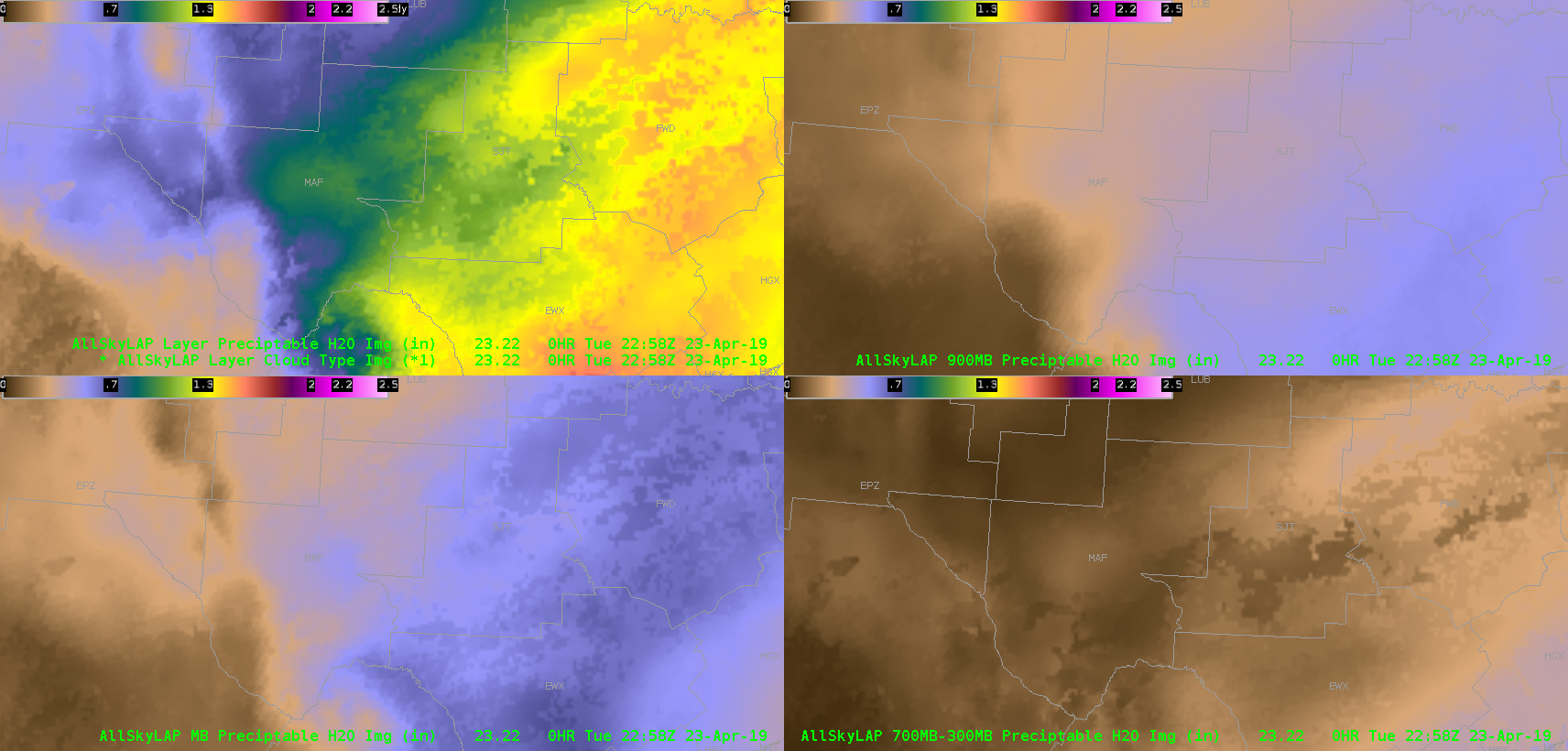
AllSkyLAP – CAPE vs RAP
Takeaway – CAPE on the AllSkyLAP shows a good comparison to RAP CAPE – perhaps even better near the mountainous areas of old Mexico. Think forecasters will consider using this.
AllSkyLAP CAPE – Trends
Noticed the trend of AllSkyLAP – CAPE was interesting – and bucked the trend of the GFS background.
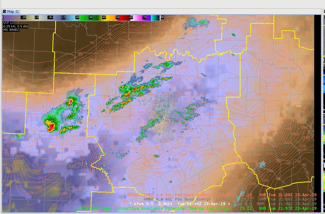
2157 UTC: LAP seemed to have a good handle on higher CAPE trends at this timeframe with over 1000 J/kg in a wide area – which seemed to match convective trends.
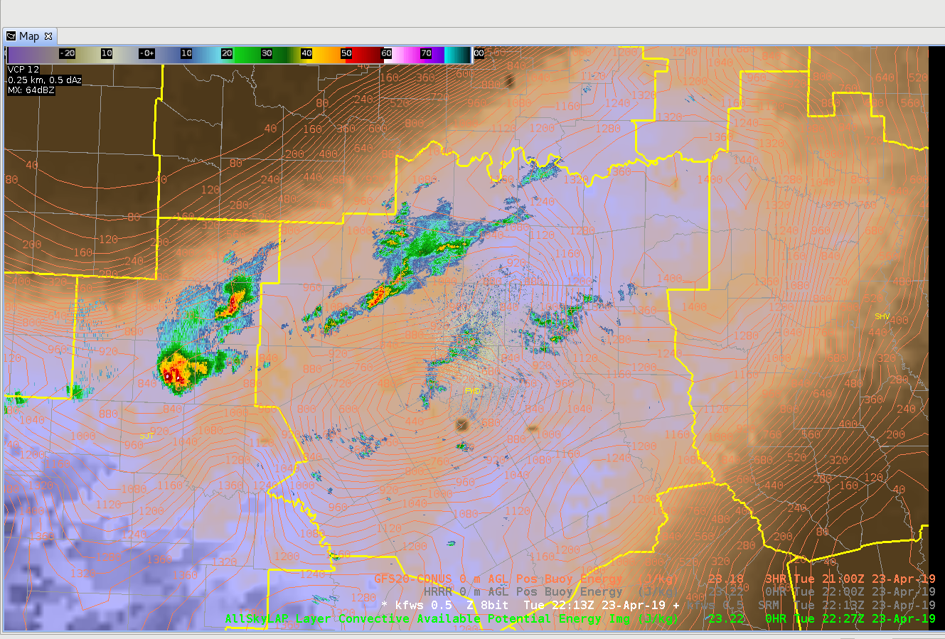
2227 UTC: LAP reduced CAPE over much of the area – even in areas that did not see storms. Skies were generally were generally partly/mostly cloudy – but the trend appeared to reduce values too quickly.
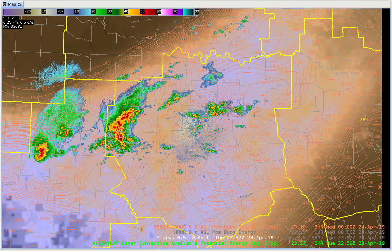
2258 UTC: LAP CAPE appeared boost again somewhat – but still less than the GFS CAPE. These sort of “bouncy” CAPE trends will be examined the remainder of the week – to see if this trend continues.
Revisiting the AllSky Products
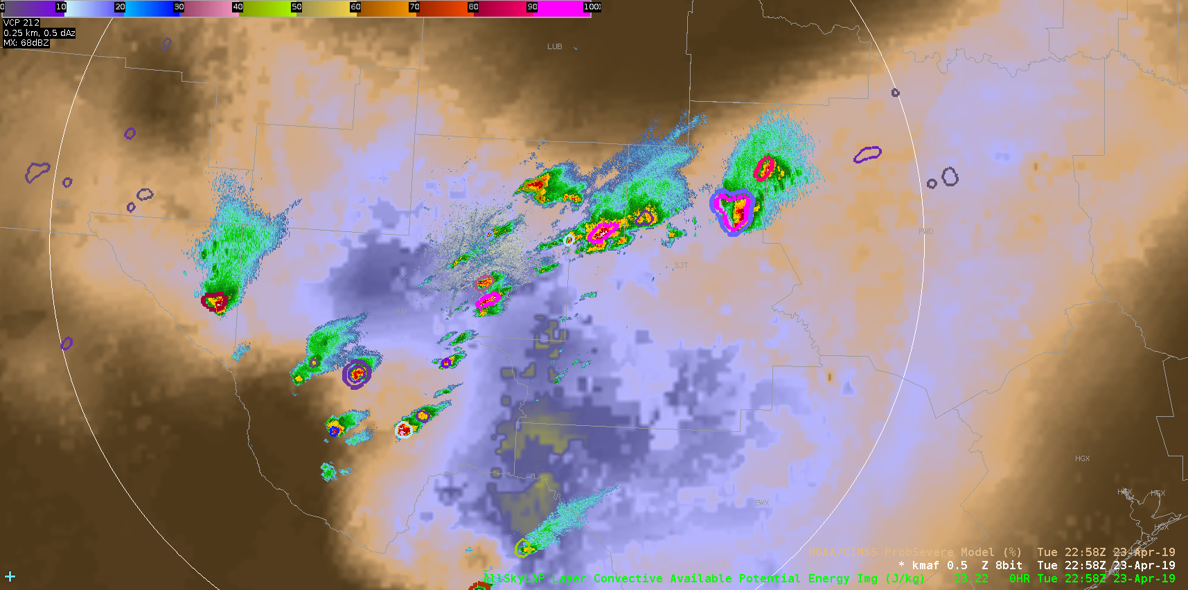
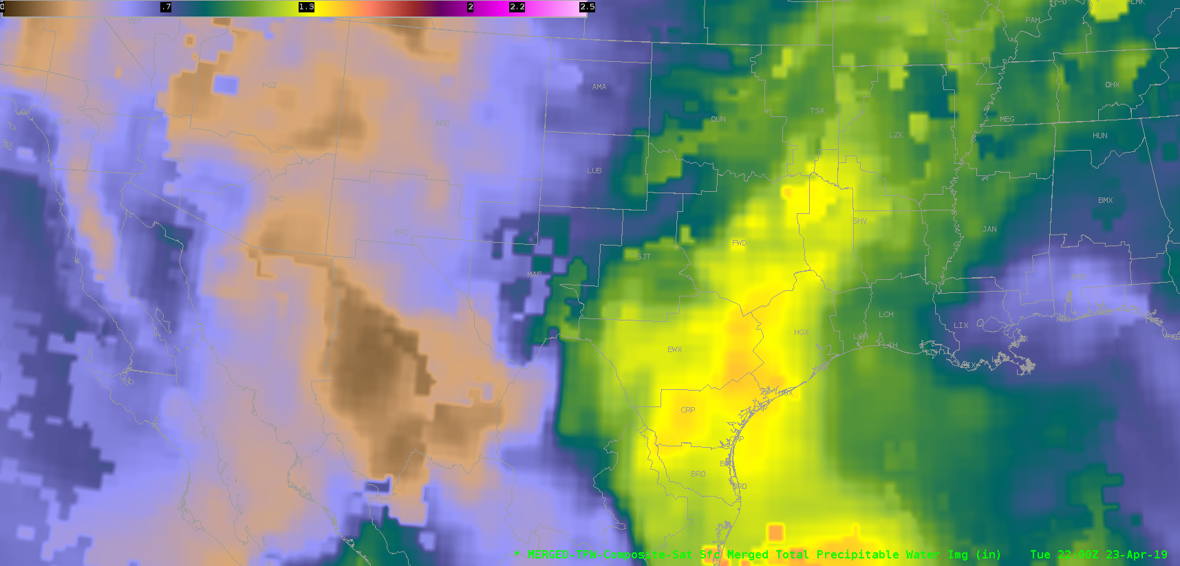
Went back to do a broader-scale mesoanalysis and noticed right away that storms are initiating right along the southwestern extent of a moisture/instability gradient, and following a SW to NE gradient between two areas of higher PWATs/CAPE, as depicted on the middle image below (reflectivity overlaid on AllSky CAPE). Just focusing on the trend aspect of these products is very useful in determining where storms may continue to develop and roll. I attempted to look at the merged TPW product, but unfortunately, the data I have is almost an hour old by the time of these screenshots, and the lower resolution isn’t as easy to work with in comparison. It’s possible the values of the TPW product may be closer to reality, but gravitating more toward the tendencies of the current state of the atmosphere found in the AllSky products seem to be more useful for this purpose.
~Gritty
Merged AzShear in West Texas – Large Distance from Radars
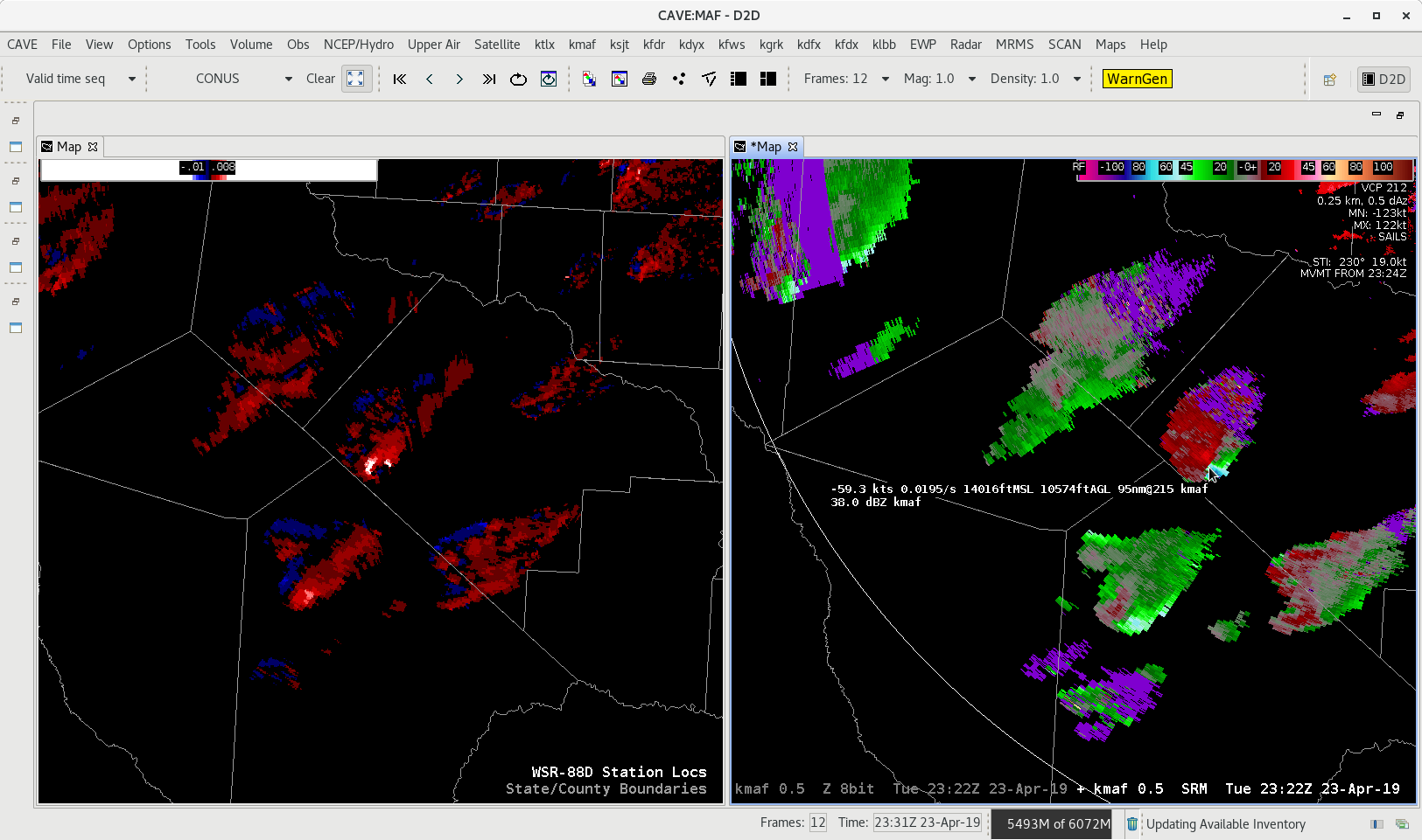
Looking at the Merged AzShear across West Texas the issue of how many radars are taken into account when calculating different MRMS parameters. You can see the SRM from KMAF, the closest radar to the storms. These storms are rotating in the mid-levels but the radar is looking between 10,000 and 16,000 feet depending on which storm you reference. The Merged AzShear is pegging the storm storms where the circulation is evident, but the question is since KMAF is closest is the AzShear product taking in more than one radar? If it is all the other neighboring radars (KEPZ, KDFX, and KSJT) are all as far or farther away, which means they would be looking even higher in the storm. The image below shows how far the radar are from the ongoing storms.
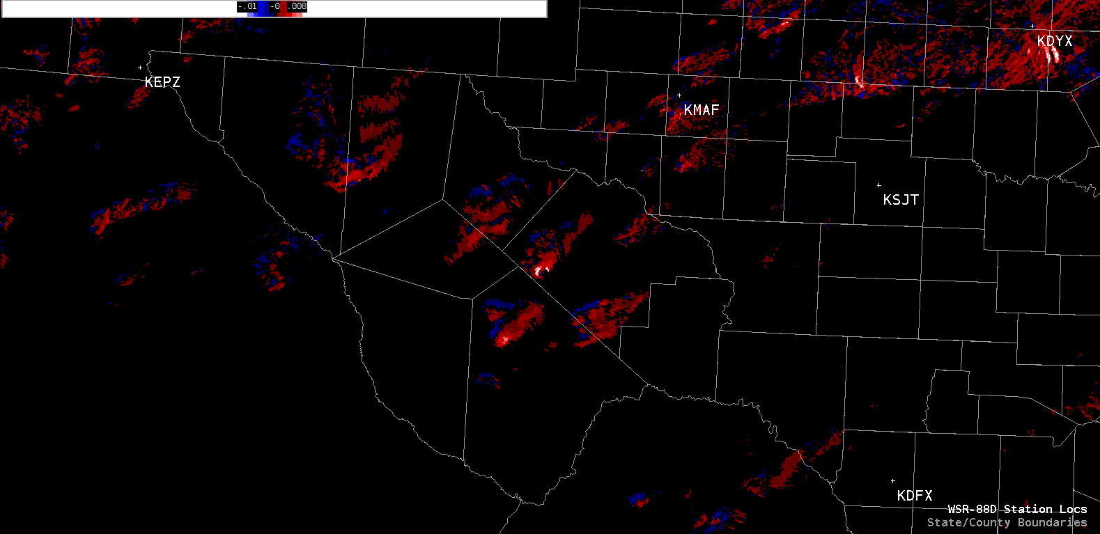
- Alexander T.