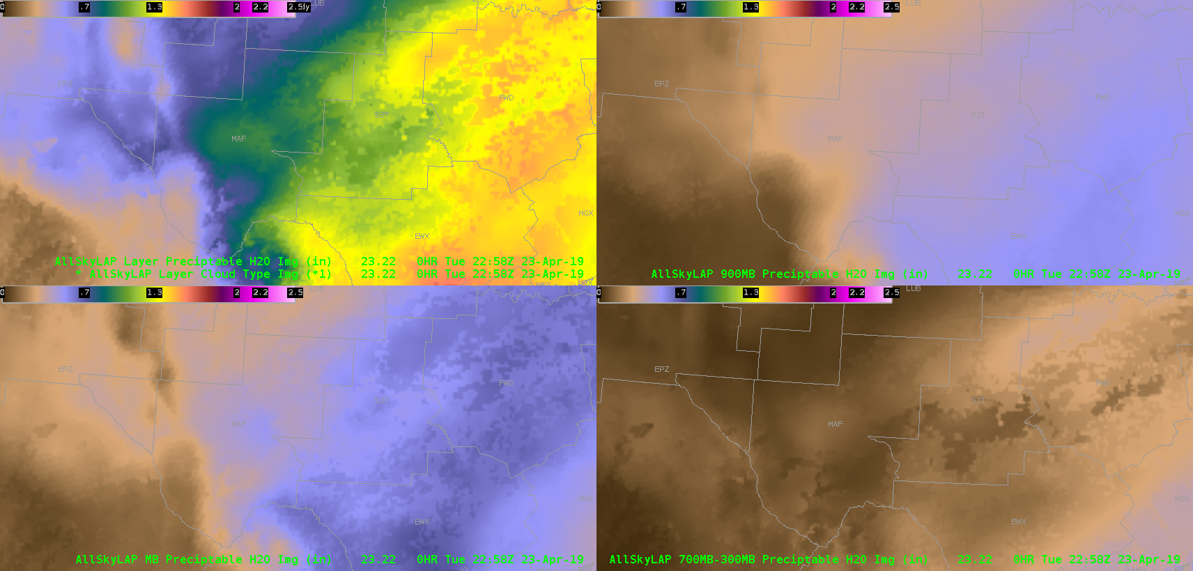
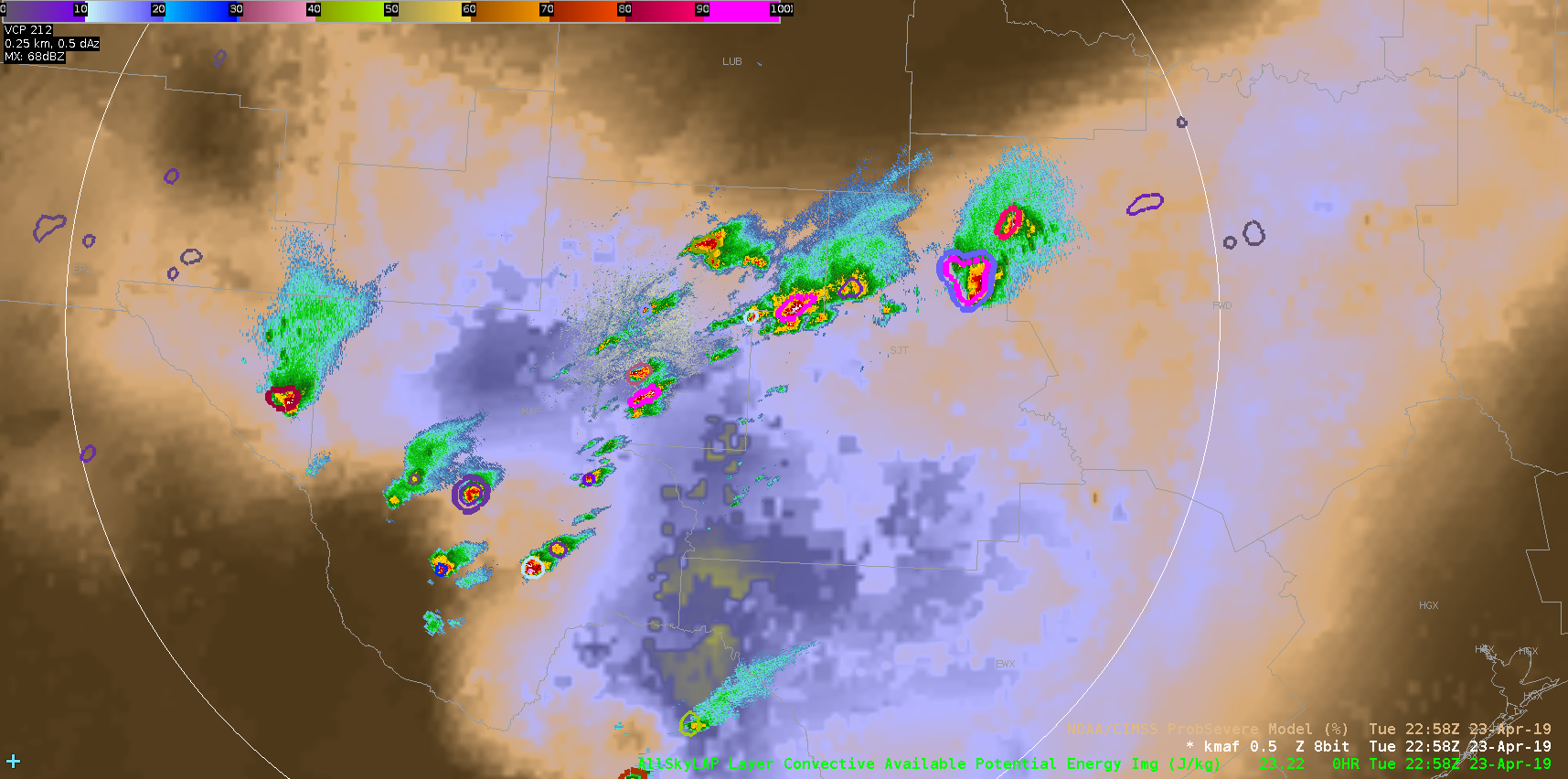
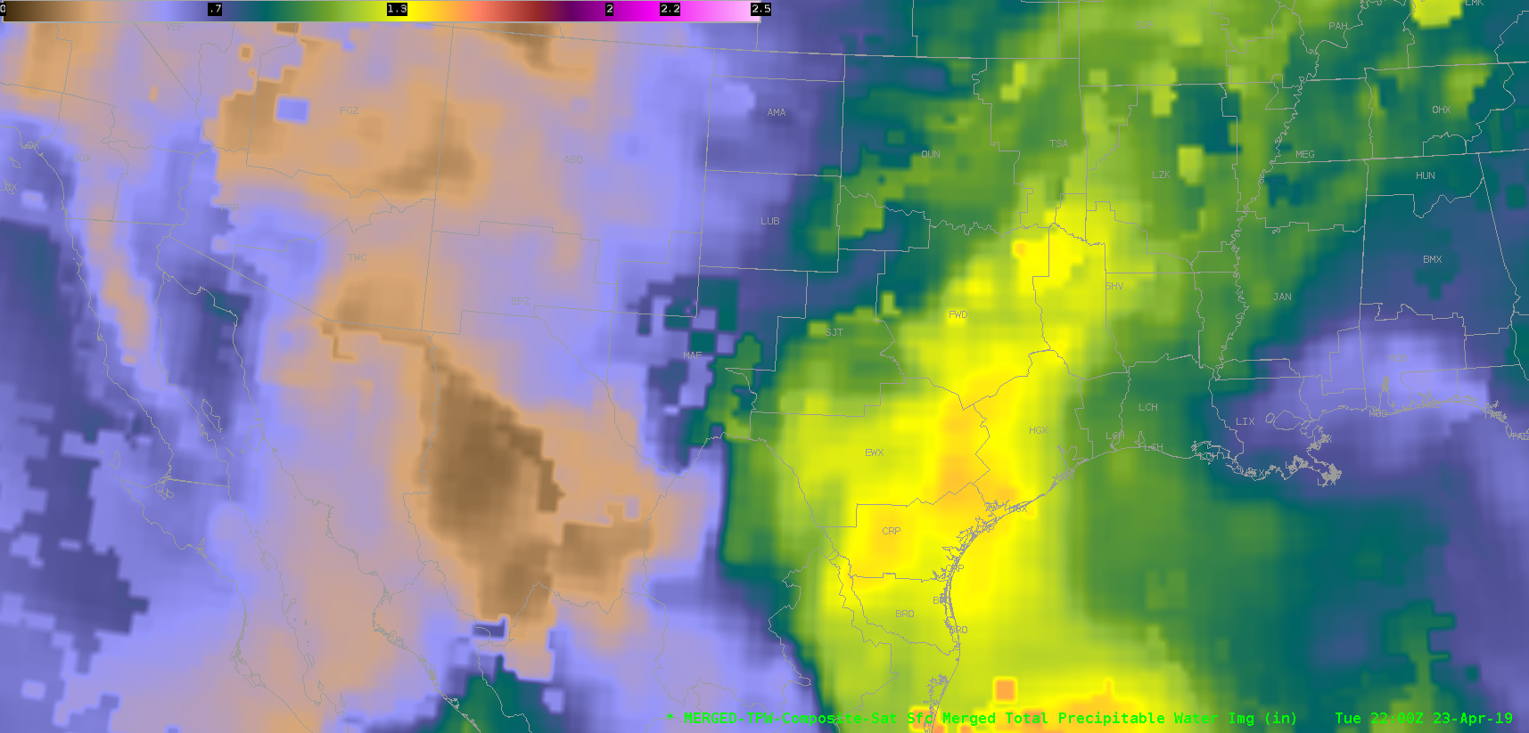
Went back to do a broader-scale mesoanalysis and noticed right away that storms are initiating right along the southwestern extent of a moisture/instability gradient, and following a SW to NE gradient between two areas of higher PWATs/CAPE, as depicted on the middle image below (reflectivity overlaid on AllSky CAPE). Just focusing on the trend aspect of these products is very useful in determining where storms may continue to develop and roll. I attempted to look at the merged TPW product, but unfortunately, the data I have is almost an hour old by the time of these screenshots, and the lower resolution isn’t as easy to work with in comparison. It’s possible the values of the TPW product may be closer to reality, but gravitating more toward the tendencies of the current state of the atmosphere found in the AllSky products seem to be more useful for this purpose.
~Gritty