
Fluctuating TORprob occurring within small group of weak updrafts. Nothing of note to show on AzShear.
ZDR_Arcophile
Official websites use .gov
A
.gov website belongs to an official government
organization in the United States.
Secure .gov websites use HTTPS
A
lock (
) or https:// means you’ve safely connected to
the .gov website. Share sensitive information only on official,
secure websites.

Fluctuating TORprob occurring within small group of weak updrafts. Nothing of note to show on AzShear.
ZDR_Arcophile
Here’s a case where the ProbTor model significantly increased in an area where tornado potential was extremely limited. Below are animations of the radar velocity at the closest radar (KGRK), the low-level Merged AzShear, and the time series of the ProbSevere product. The cell in question was small and behind the main line of storms in the more stable airmass, yet the ProbTor model jumped to 79% for several minutes. The time series seemed to indicated this was due to an increase in AzShear yet the Merged Low-Level AzShear product showed no distinct signature (same for Mid-Level AzShear not shown).


UPDATE:
After consulting with the fantastic Mr. Cintineo, he found that the false flags were likely from a jump in the Low-Level Rotation tracks in MRMS (shown below). These false signatures, however, were not making it into the aforementioned AzShear product.

#ProtectAndDissipate
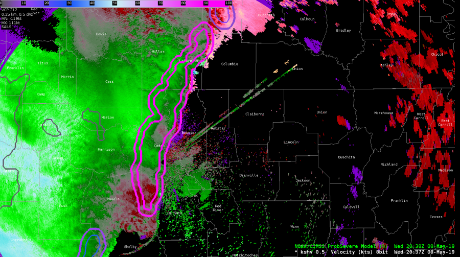
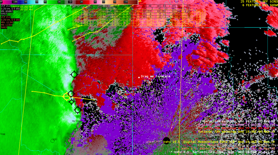
The Prob Tor is 97% for this long line in the SHV CWA. Is that useful as a forecaster? It might seem like it isn’t, but let’s discuss. We’ve been watching circulations along the line through the shift. Early on, we issued several TORs, but in a number of cases, the circulations have been short lived along the segment.
So, as a forecaster or a WFO, you’ve got two ways you can go here in the current environment….
1) You can issue a SVR for straightline wind for the whole segment for a longer length of time (45-60min) given that the environment the line is moving into isn’t changing, and try to keep up with shorter lived, individual TOR warnings for the circulations
-or-
2) You can issue a severe thunderstorm warning for a shorter period of time for straightline wind (30 min) and tag that “lines can produce tornadoes) and see if that characteristics of the leading edge show clearer tornadic signs at some point.
At least the ProbTor alerts you to a decision to be made. It goes both ways in WFO offices in this situation.
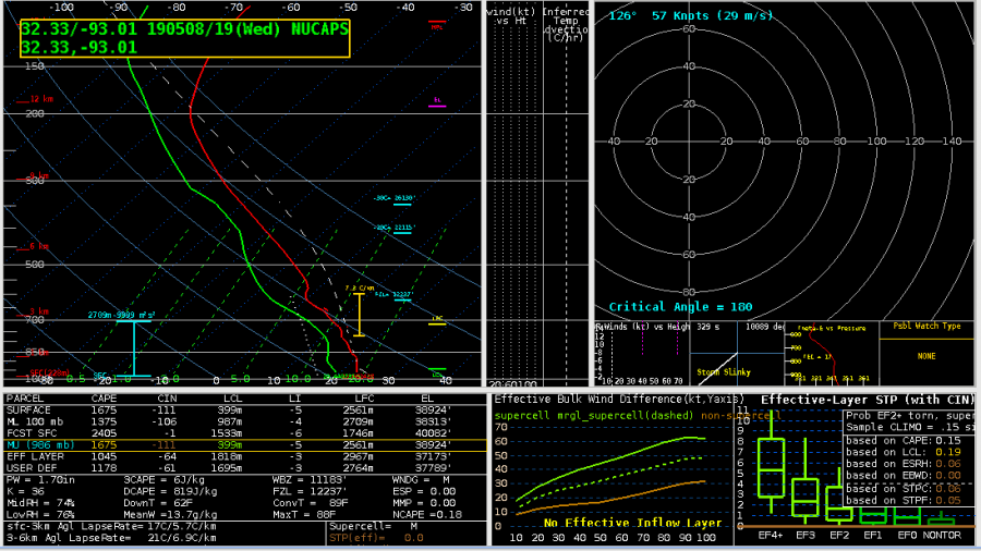
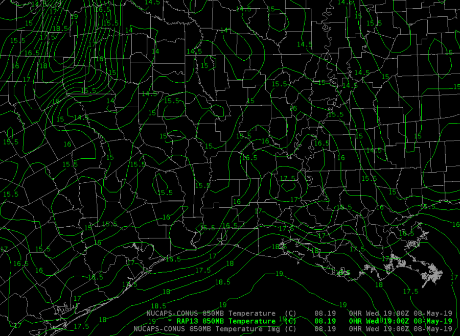
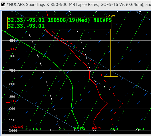
Comparison of NUCAPS soundings in pre-storm environment in SHV CWA. We’re warning for a bowing segment line with bookend vortices. There are several important differences between the generated soundings, including a better representative moisture profile from the modified sounding given the moist environment, linear convection, precip. loading processes. Also of note is the inversion shown between 900 and 850mb in the operational sounding. Analysis of the RAP13 850 temp fields suggest the modified sounding is more representative of what’s likely occurring. In this instance the NUCAPS modified sounding appears to be a better product for the current environment.
Here’s an exciting non-case. Hooary!
In this example, Houston County in the far Northern HGX CWA was in horrible radar coverage with 0.5 degree radar scans over 12kft AGL. With the success of GLM FED predicting severe storms earlier in the day this was used to give confidence NOT to issue a warning for this area, despite slight bowing in the sloppy reflectivity and an abundance of activity in the ENTLN network.

#ProtectAndDissipate
Another advantage of single radar AzShear – orientation to the radar.
Here is an ongoing tornado (according to the report shapefile from this event) as seen in the merged 0-2km AzShear product:
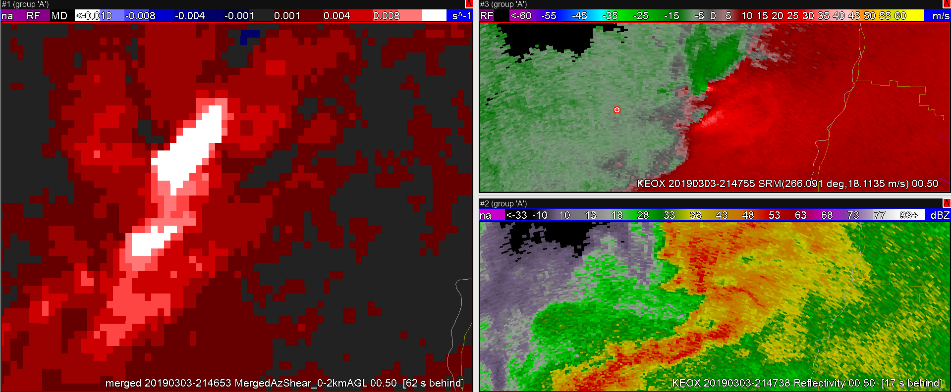
Yeah, likely TVS in the velocity data from KEOX (top right pane), Reflectivity is…messy…, and Merged AzShear shows an area of white (when sampled showed 0.023 s-1 values) associated with the TVS. That is pretty strong!
However, the Merged product loses some key information that could come in handy in figuring out details of the vortex; how is this oriented with respect to the radar? This is where the single-radar AzShear comes in handy:
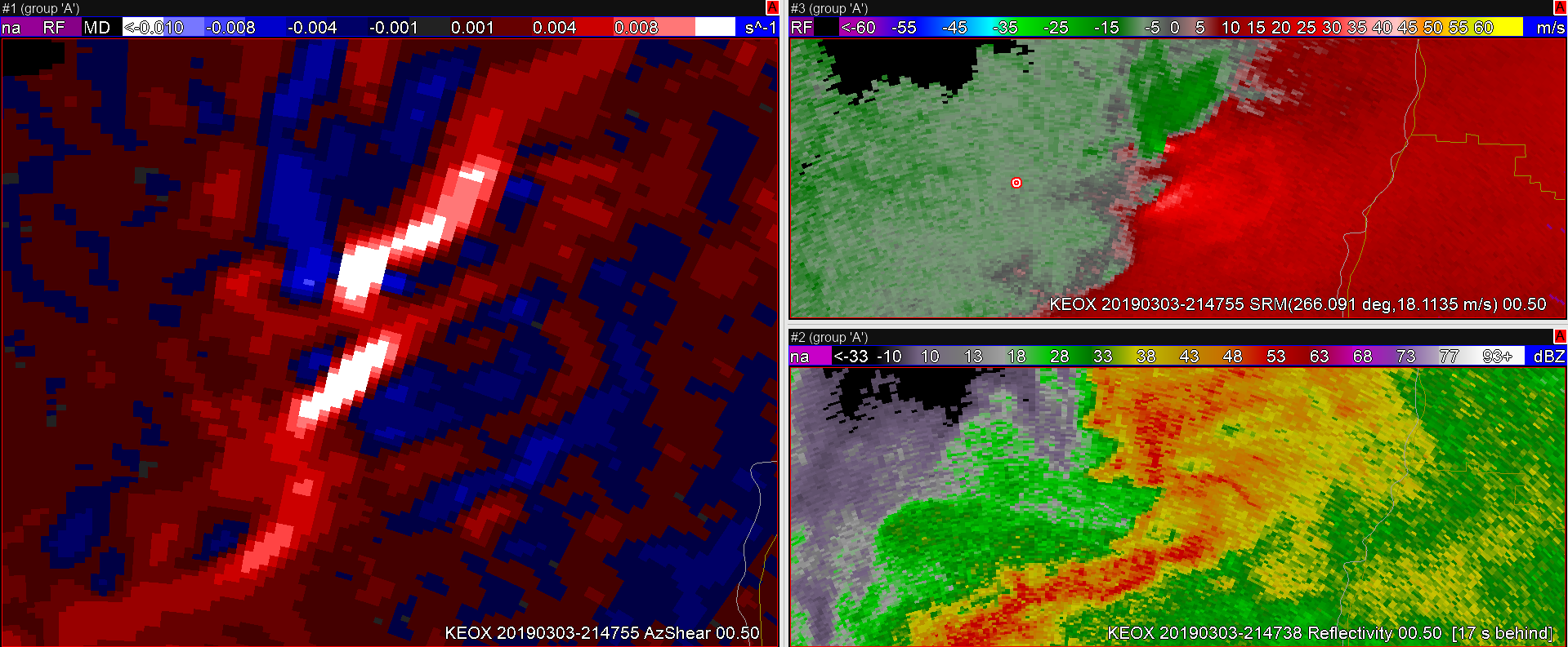
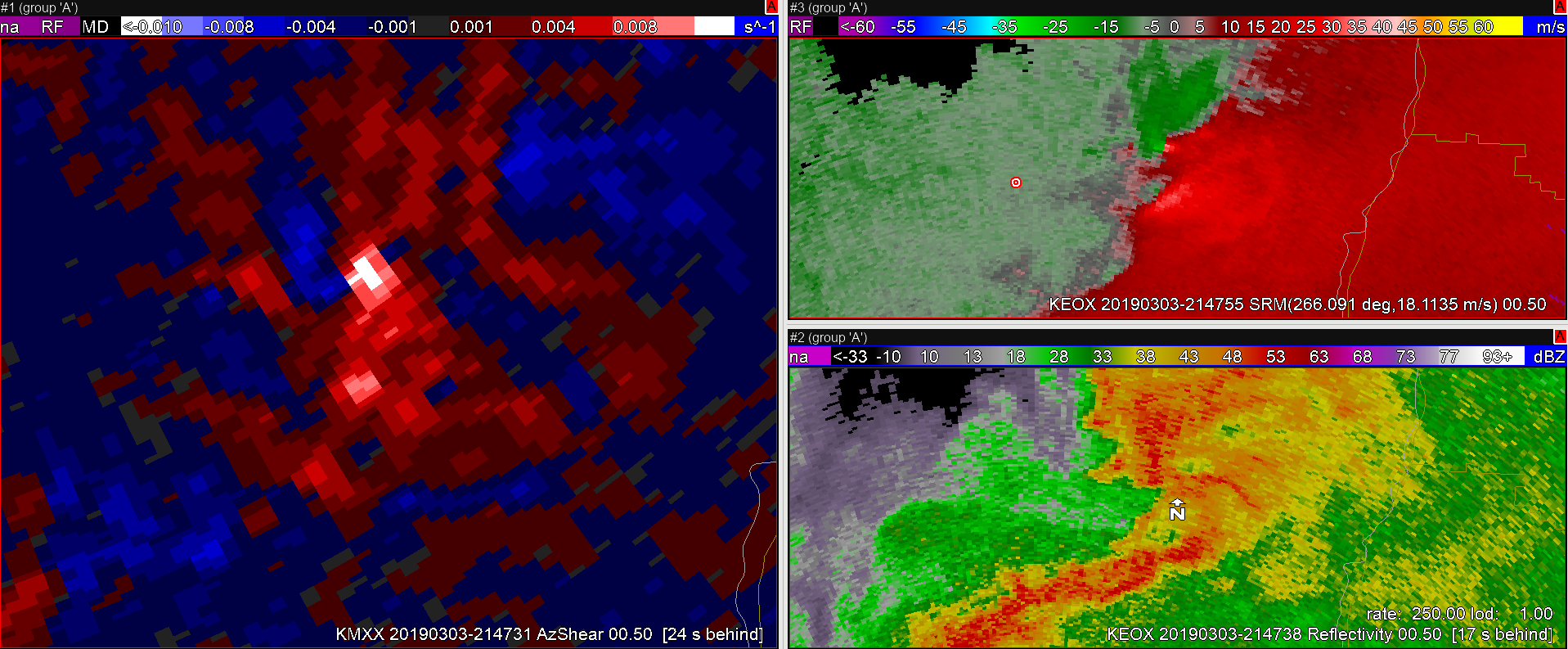
Each single-radar (KEOX top image, KMXX bottom image) now shows much better information on how the area of shear is oriented with respect to the radar. This becomes essential in situations where there are multiple areas of strong AzShear in and around a possible tornado; things like a new circulation in the flanking line that could eventually merge with the original tornado, mesocyclone occlusion with new development, weakening tornado rotating back into the core of the storm, anticyclonic tornado development, and so on. Many of these features may be lost in the merged products but will stand out to the discerning eye on the single-radar products. Add in the fact that these update scan-by-scan and during quickly evolving features in critical periods of the life cycle of small-scale vorticies, and single-radar becomes pretty valuable.
Have I mentioned yet that I would like this in my office? Now? Please…
-Dusty
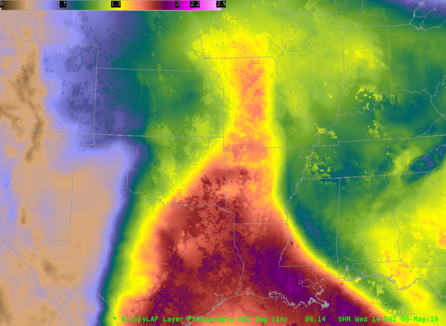
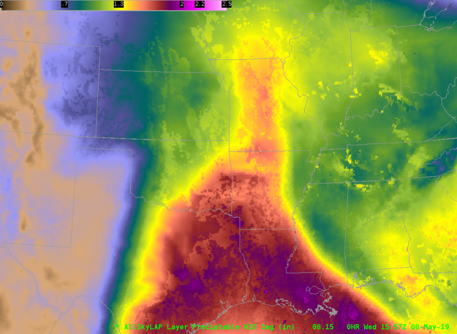
We’ve seen a couple of cases where the All-Sky LAP TPW surges back and forth unrealistically over a half hour intervals. Here are three frames 1/2 hour apart from 1458 / 1528 / 1557 UTC 8 May 2019. Note the surging TPW over the eastern OK / northwest AR region.
1458 UTC
 1528 UTC
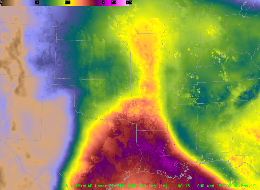
1557 UTC
1458 UTC Data type (yellow / gray cloudy)
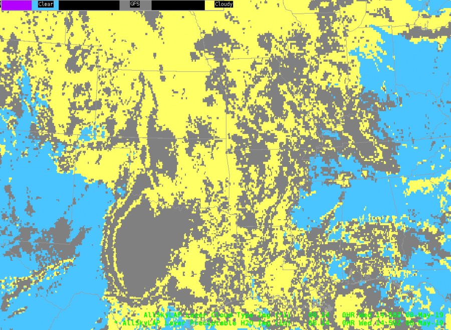
The data type indicates this is in a cloudy region. What’s odd is the middle frame is different, then the last frame is more like the first. Perhaps this is related to handling of the new 12 UTC GFS cycle?
JohnF
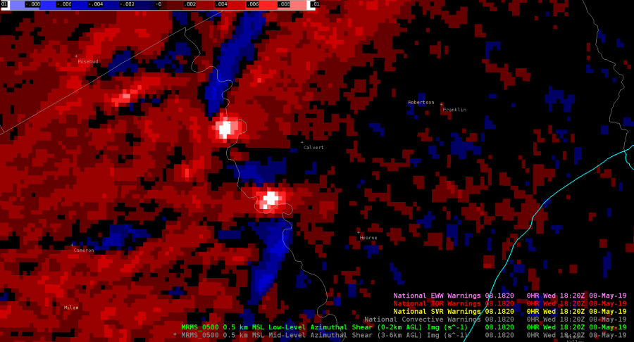
QLCS situation just outside of the HGX CWA where low-level combined AzShear spotted two areas of increased low-level shear entering Robertson County. The northern circulation eventually led to downed trees east of Calvert 12 minutes later, and may have been a tornado, according to the LSR. This product would have given me more confidence to at least have a severe thunderstorm warning out, if not a tornado warning, and would most likely have led to a greater amount of lead time than I would have had otherwise.
ZDR_Arcophile
What if you’re on shift and convection has become more widespread or robust than what was currently forecast? What if that happened during a time where staffing levels at the office were not ideal (for whatever reason)?
-Convection is rapidly developing.
-Minimal people around to sectorize radar/warning operations
– Limited time to interrogate all the storms, especially with a potentially tornadic situation developing.
Taking a look at Single-Radar AzShear, there are very high values near a velocity couplet north of the radar site. This couplet becomes your primary area of concern to where you want to focus most of your attention and analysis. However, there is also some bowing in the reflectivity signature coincident with some bowing/enhancement in the Single-Radar Az Shear output well to the northeast of the radar site. The angle of the radar beam with the bowing storm makes you question the strength of the storm and you realize the velocity values may be too low.
Would you consider issuing a SVR based solely on the enhanced bowing segment of the Single-Radar AzShear data, so that you can focus your attention on the tornadic storm? Something to think about…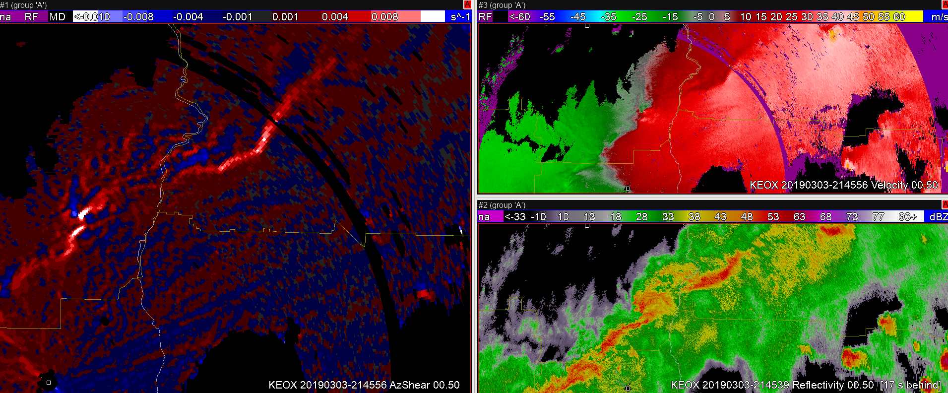

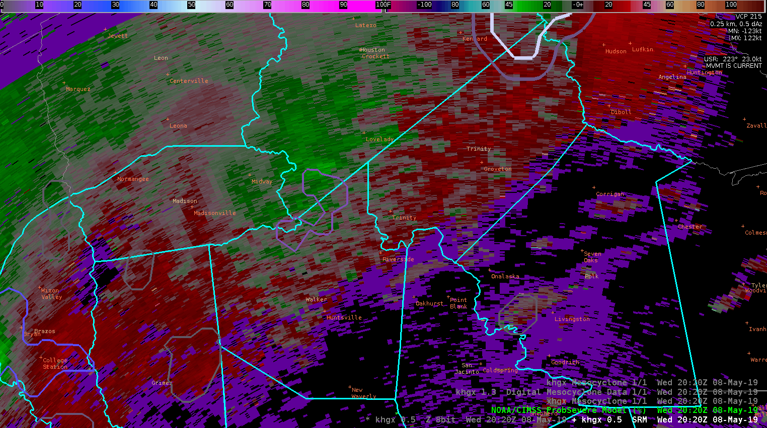
ProbTor and NMDA helping forecaster confidence for issuing TOR warnings along bowing segment in SHV CWA. This is a situation that I don’t deal with much and in consultation with my partner for today we issued another TOR within the line we have a SVR out for.
-icafunnel