
Click here, and navigate the picture!
http://photosynth.net/view.aspx?cid=a9d2d6da-4598-46df-8109-e87b38d8a7b0
Greg Stumpf, EWP2013 Operations Coordinator
Official websites use .gov
A
.gov website belongs to an official government
organization in the United States.
Secure .gov websites use HTTPS
A
lock (
) or https:// means you’ve safely connected to
the .gov website. Share sensitive information only on official,
secure websites.

Click here, and navigate the picture!
http://photosynth.net/view.aspx?cid=a9d2d6da-4598-46df-8109-e87b38d8a7b0
Greg Stumpf, EWP2013 Operations Coordinator
A strong to marginally severe thunderstorm tracked from west to east and passed over the KDDC Radome. If a forecaster were using the single radar, it would be hard to discern the storm’s chances to produce hail due to the highest beam being below the freezing level. MRMS comes into play here because it uses multiple radars to give the forecaster better information about the storm.

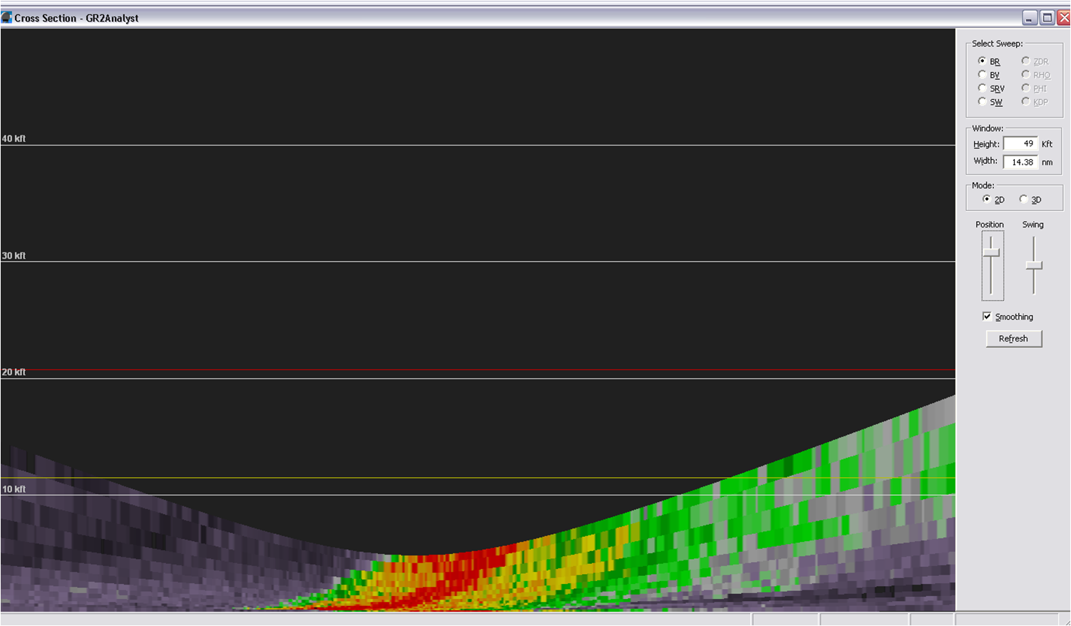
MESH was used to determine the estimated hail size as the storm tracked across the Radome. The algorithm was able to use other radars to sample the storm’s updraft and to estimate the hail size within the storm. This provided forecasters with useful information that would not otherwise be possible without the MRMS.
Hampshire
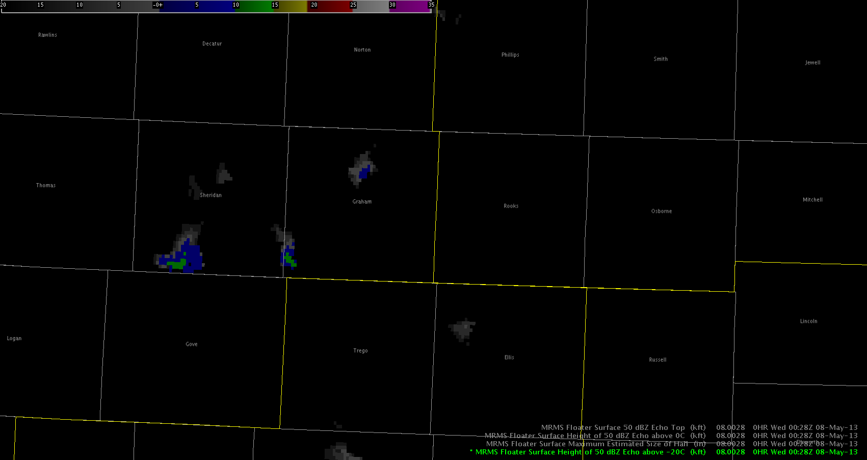
A strong to severe thunderstorm across northern Graham County, which previously warranted a Severe Thunderstorm Warning for quarter sized or larger hail, was replaced with a Significant Weather Advisory. This was due to a spotter report of dime sized hail as well as evaluation of the MRMS 50 dbZ Echo Height Above the -20C Product. The product showed a rapid decrease from near 20,000 feet to 6,500 feet before the warning expired. Subsequent product updates decreased this to 0 feet following advisory issuance.
Kurtz/Guseman
We continue to monitor isolated to widely scattered supercells extending from NW KS through SW KS/NW OK, with more isolated activity near LUB.
Recent sfc obs show area of backed winds over NW KS on northeast fringe of a broad lee trough drifting eastward from CO. Here, pooling moisture has contributed to modest instability per recent mesoanalysis with impressive wind fields, albeit somewhat weak in the upper levels. Some meager low level rotation has resulted from this area of backed surface flow, with a few reports of weakly rotating wall clouds. As LCLs decrease this evening, a very narrow window for tornadic development will exist, but low level shear will continue to limit this threat.
Further south, large hail and damaging winds have been the main threats with a few reports of up to golf ball sized hail. Deeply mixed boundary layer has resulted in high based storms within impressive steep mid level lapse rates favorable for hail production. Also, with inverted V nature of area soundings, would not be surprised if very strong winds are occurring with the most severe storms.
Even further south, areas in and around Lubbock have seen very isolated storm development this evening. One single slow moving supercell has been located near the border of Garza and Crosby counties. This storm also developed in a very localized area of backed surface winds, with enhanced surface convergence. Also, surface heating likely played a role in convective initiation, with temperatures climbing into the mid to upper 80s. This development was preceded by multiple CI and CTC signals, though they tended to be sporadic and indicated there may be many more storms than actually developed.
Heading into the evening, expect severe storms will generally persist through around 02z to 03z. Most activity appears to be diurnally driven. On exception to this will be parts of NW/N Cntrl KS, where an eastward propagating cluster may develop later this evening. Taking a look at Nearcast products, we observe that instability has taken a bit of a hit over the entirety of the area with ongoing convection, as has moisture depth. It still appears the most favored areas for persistent severe convection and supercellular activity will be over NW KS in Goodland’s CWA, eventually migrating into Hasting Nebraska’s area of responsibility.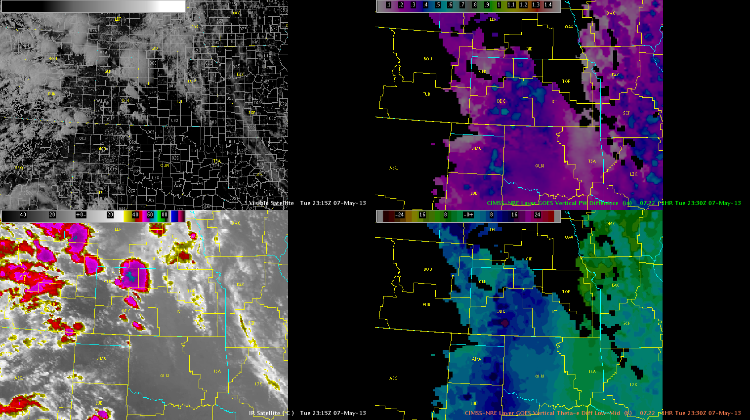
Lubbock’s convection has diminished in the last hour, and will discontinue operations there. Will keep operations at DDC and GLD active through end of day as activity is expected to continue.
Austin
The use of CTC was restricted quickly across the GLD CWA this evening as the cirrus shield from the first updraft quickly contaminated the region due to cloud ice. From this point on, the MRMS products became the primary aids in deducing severe hail development.
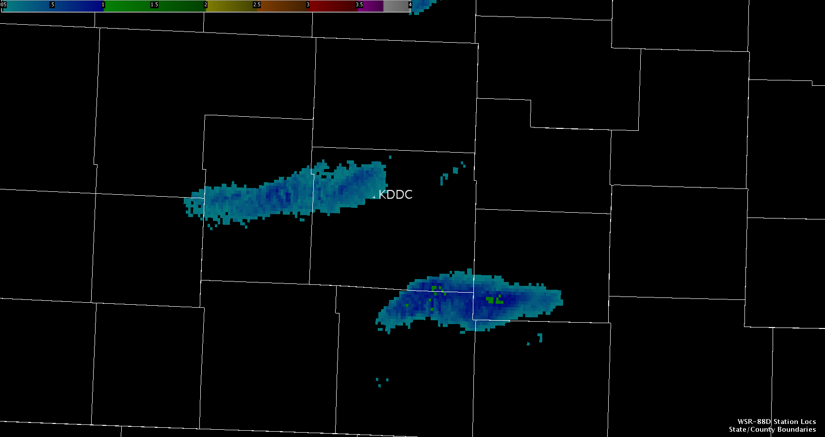
Note the lack of CTC within the GLD CWA, while new updrafts continue to be detected by the CTC across the northern portion of the DDC CWA.
Kurtz/Guseman
With multiple scans of CI/CTC showing iminent or ongoing convective initiation over Lubbock’s area, will localized one desk at the LUB wfo. This will give the testbed an opportunity to evaluate some of the PGLM products available in the LUB LMA. The image below from 2145 UTC shows where storms are developing in extreme south central parts of the CWA.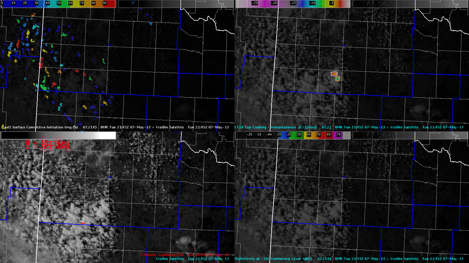
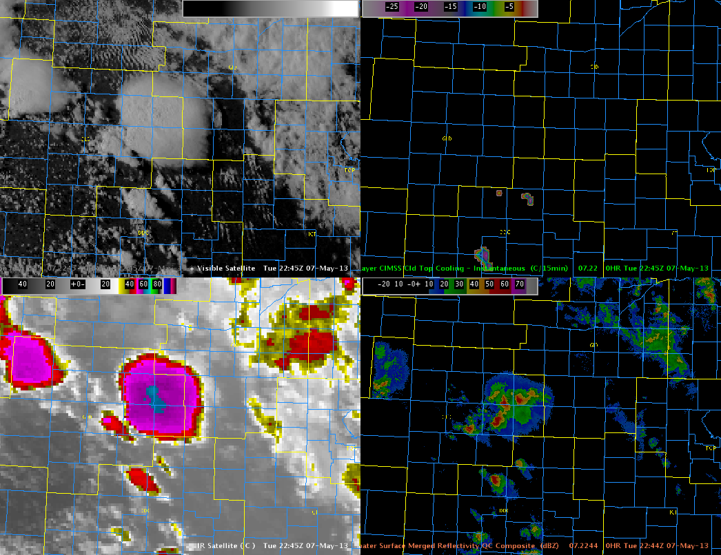
Radar trends show activity is also on the uptick at DDC, with ongoing supercells over GLD’s area. Will keep two teams stationed at these locations to optimize this marginal severe weather setup. The image below is a four panel of MESH products and composite reflectivity over the DDC and GLD CWAs.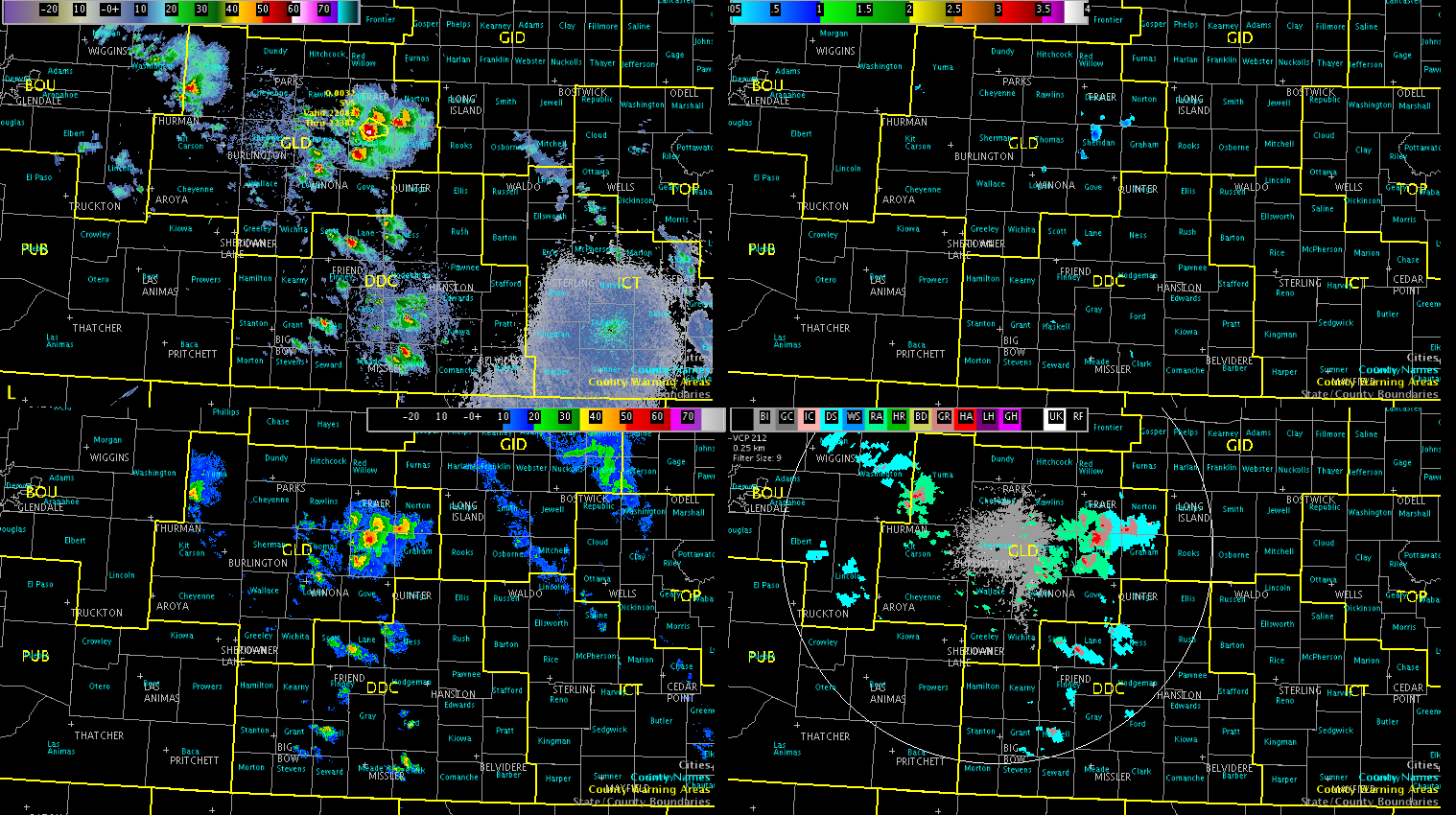
Will continue to monitor trends, but all areas appear to be covered at this time.
Austin
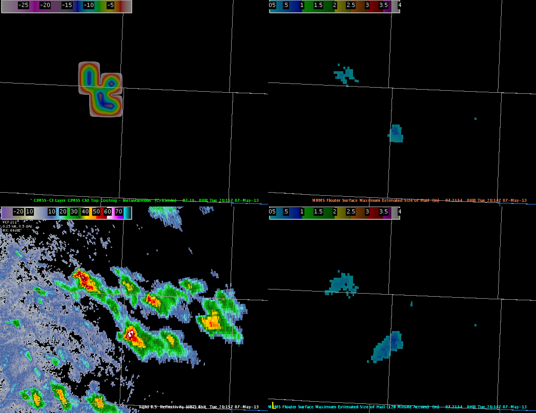
We continued to monitor Cloud Top Cooling (CTC) rates in combination with MESH from the MRMS to investigate a elevated storm in Sheridan County Kansas. CTC was able to provide 15 to 20 minutes of lead time before the MESH indicated .71 inch hail. Below is a four panel at 2115z of the CTC, instantaneous MESH, base reflectivity at KGLD, and 120 min MESH.
Continuing to monitor the storm, the HSDA has continued to indicate large (LH) to giant (GH) hail. With modest mid-level lapse rates (7.0-8.5 C/km) and decent mid-level shear, these storms continue to indicated mid and upper level rotation, indicative of large hail growth.
Guseman/Kurtz
As was anticipated, isolated to scattered thunderstorms developed over northern and western portions of KS. This area will continue to be monitored for additional storm development, and intensification of ongoing convection as backed low level flow continues in this region. The image below shows composite reflectivity, MRMS mid level rotation tracks and MESH, reflectivity at -20 C and the HHC. This cluster of storms is gradually intensifying, and MESH has indicated the presence of severe hail.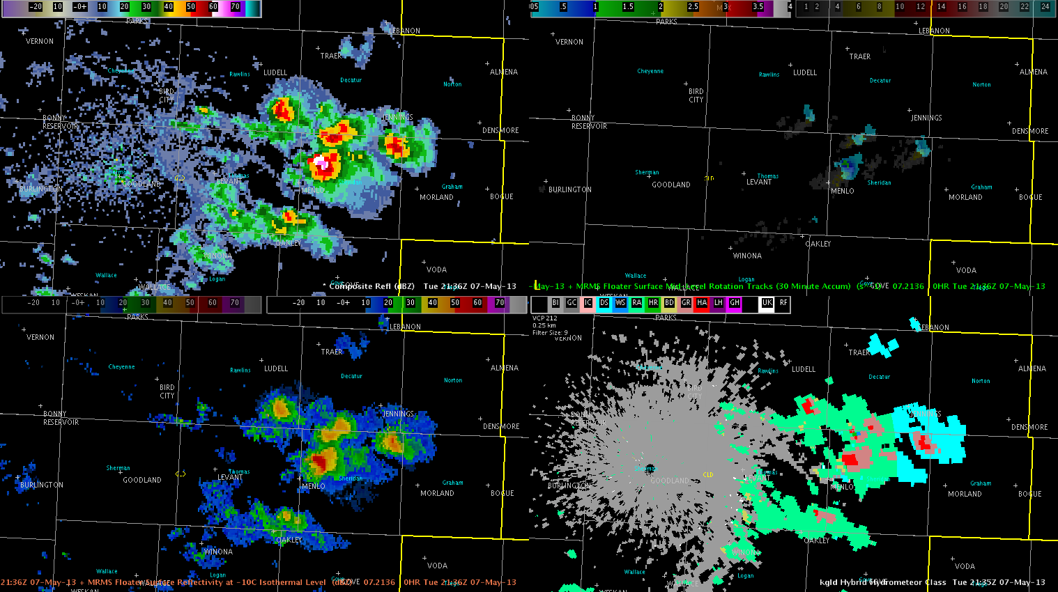
We are still monitoring CWAs further south, LUB in particular, for convective initiation in the next couple of hours. A large CU field has developed in the last hour and is showing some CI and CTC signals.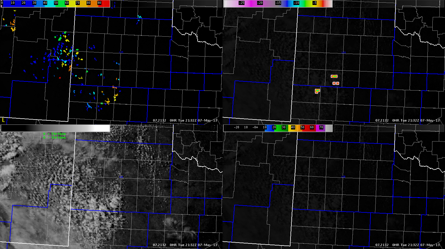
However, this activity has been slow to develop, and severe convection does not appear imminent.
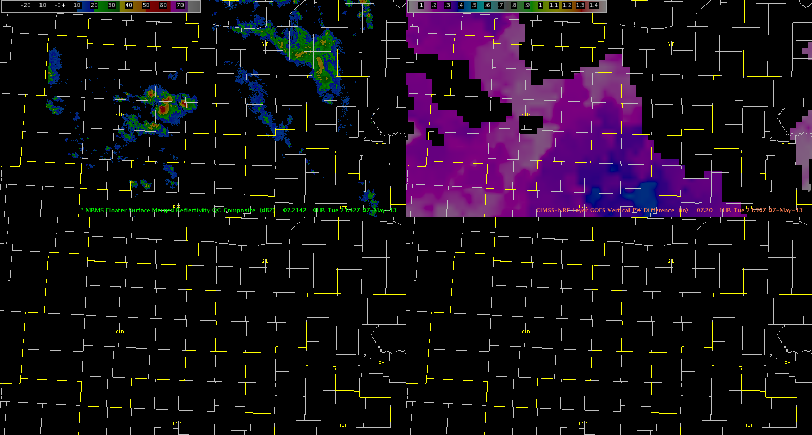
Austin/Frank
The updrafts have reached the airmass with higher low-level moisture as evident by the darker pink/purple colors in the GOES PW Difference product. The updrafts have become better organized with a marginally severe storm currently in Western Kansas.
Hampshire
At 2045z the Cloud-top-Cooling product signaled a 12 C/15min value. This is on the moderate scale and validation study states that this value should lead to a 33 minute lead time to non-severe hail.
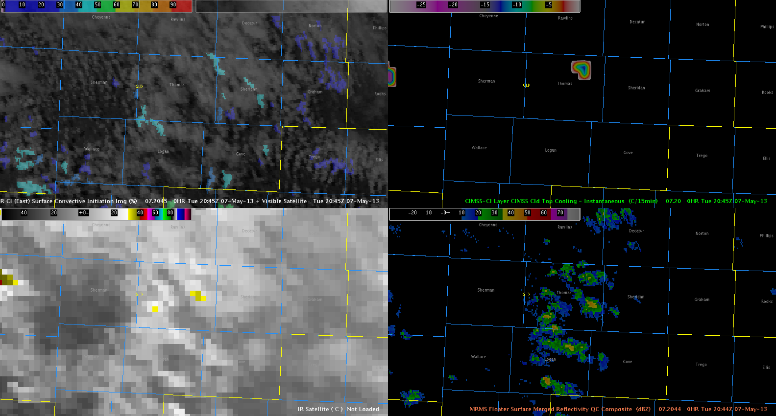
At 2112z the MESH product signaled a 0.71″ Maximum hail size which is close to what the product is suppose to signal for the forecaster.

Hampshire