EWP2012 PROJECT OVERVIEW:
The National Oceanic and Atmospheric Administration (NOAA) Hazardous Weather Testbed (HWT) in Norman, Oklahoma, is a joint project of the National Weather Service (NWS) and the National Severe Storms Laboratory (NSSL). The HWT provides a conceptual framework and a physical space to foster collaboration between research and operations to test and evaluate emerging technologies and science for NWS operations. The Experimental Warning Program (EWP) at the HWT is hosting the 2012 Spring Program (EWP2012). This is the fifth year for EWP activities in the testbed. EWP2012 takes place across five weeks (Monday – Friday), from 7 May through 15 June. There are no operations during Memorial Day week (28 May – 1 June).
EWP2012 is designed to test and evaluate new applications, techniques, and products to support Weather Forecast Office (WFO) severe convective weather warning operations. There will be three primary projects geared toward WFO applications this spring, 1) evaluation of 3DVAR multi-radar real-time data assimilation fields being developed for the Warn-On-Forecast initiative, 2) evaluation of multiple CONUS GOES-R convective applications, including pseudo-geostationary lightning mapper products when operations are expected within the Lightning Mapping Array domains (OK/west-TX, AL, DC, FL), and 3) evaluation of model performance and forecast utility of the OUN WRF when operations are expected in the Southern Plains.
WEEK 5 SUMMARY:
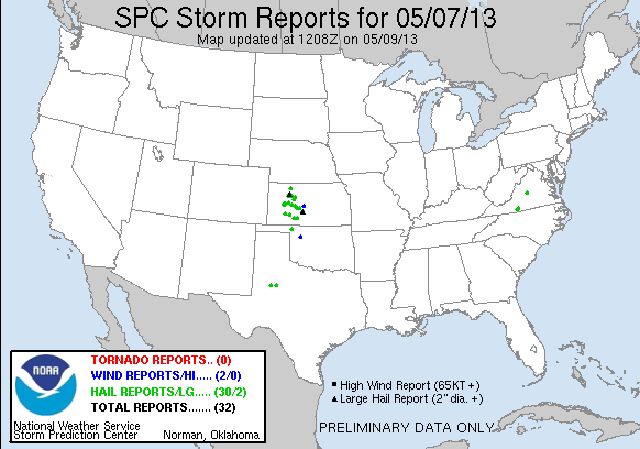
We had six visiting NWS forecasters this week: Tim Tinsley (WFO, Brownsville, TX), Michael Dutter (WFO, Marquette, MI), Ty Judd (WFO, Norman, OK), Steve Nelson (WFO, Peachtree City, GA), Randy Skov (CWSU, Atlanta, GA), and Jeff Garmon (WFO, Mobile, AL). Once again, we were all over the map with our severe weather events. But continuing the trend of a quiet spring, there were no large severe weather outbreaks.

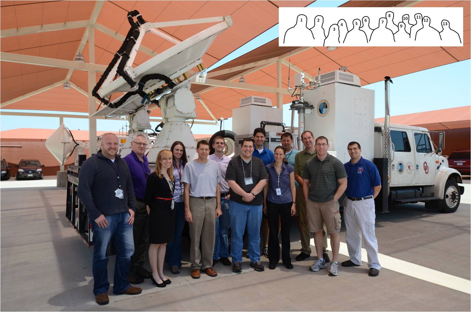
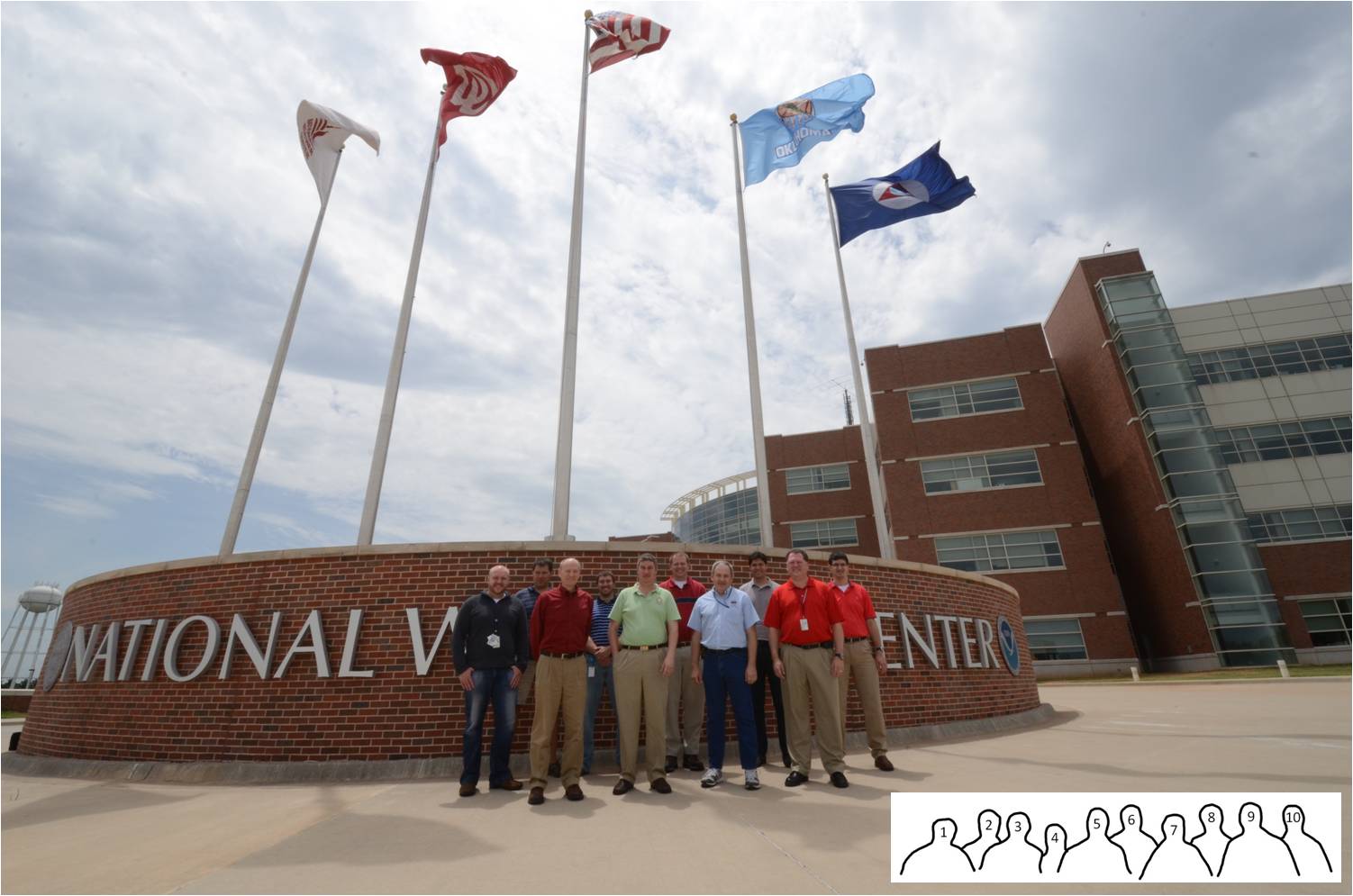
Photo: 1) Chris Siewert (CIMMS/SPC/GOES-R)c, 2) Travis Smith (CIMMS/NSSL), 3) Randy Skov (CWSU, Atlanta, GA), 4) Ty Judd (WFO, Norman, OK), 5) Steve Nelson (WFO, Peachtree City, GA), 6) Michael Dutter (WFO, Marquette, MI), 7) Tim Tinsley (WFO, Brownsville, TX), 8) Gabe Garfield (CIMMS/WFO Norman, OK), 9) Jeff Garmon (WFO, Mobile, AL), and 10) Jordan Gerth (UW-CIMSS). Photograph by Greg Stumpf (CIMMS/NWS-MDL).
REAL-TIME EVENT OVERVIEW:
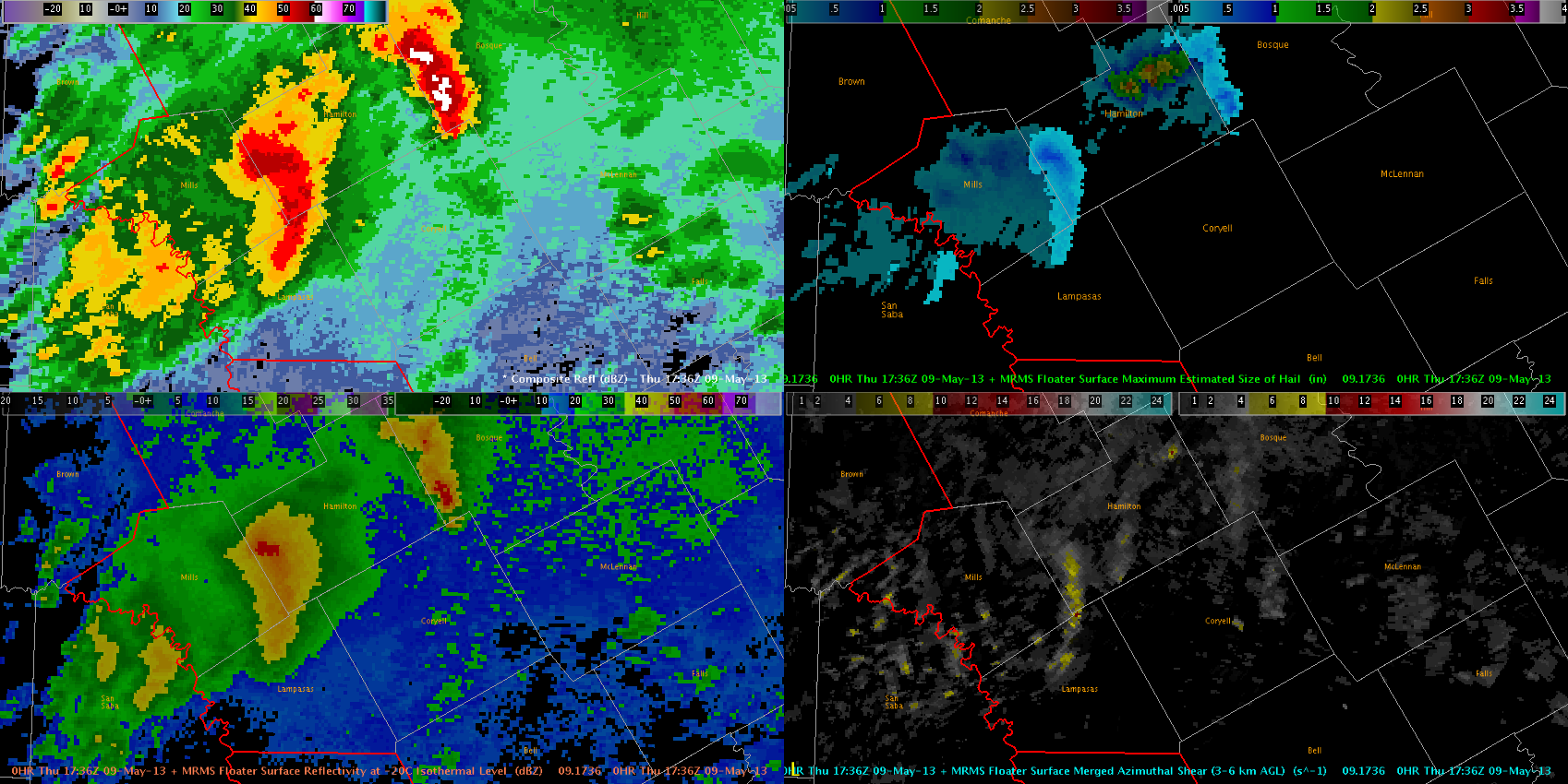
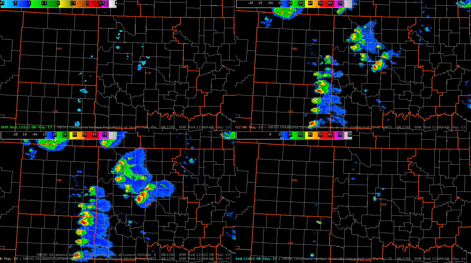
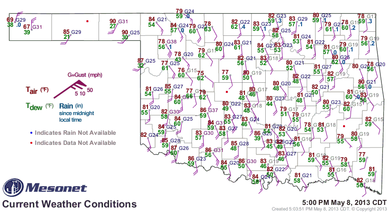
11 June: Memphis (MEG), Huntsville (HUN), Tulsa (OK), San Angelo (SJT), Jackson (JAN), Birmingham (BMX)
12 June: Albuquerque (ABQ), Midland (MAF), Lubbock (LBB), Amarillo (AMA)
13 June: Albuquerque (ABQ), Midland (MAF), Sioux Falls (FSD), Fort Worth (FWD)
14 June: Minneapolis (MPX), Sioux Falls (FSD), Hastings (GID), Omaha (OAX), Amarillo (AMA)
FEEDBACK ON EXPERIMENTAL PRODUCTS:
3DVAR:
- for ease of comparison, color tables should match other experimental products
- storm top divergence was helpful to determine if storm would strengthen
- four panel of divergence and updraft intensity is helpful
- MESH seemed to peak 5-10 minutes after maximum in updraft intensity/divergence
- suggest visualizing divergence/convergence/vorticity in an “all-tilts” format
- use “AGL” instead of “MSL”
- need a storm-based four-dimensional storm investigator for 3DVAR
- integrate CAPPI
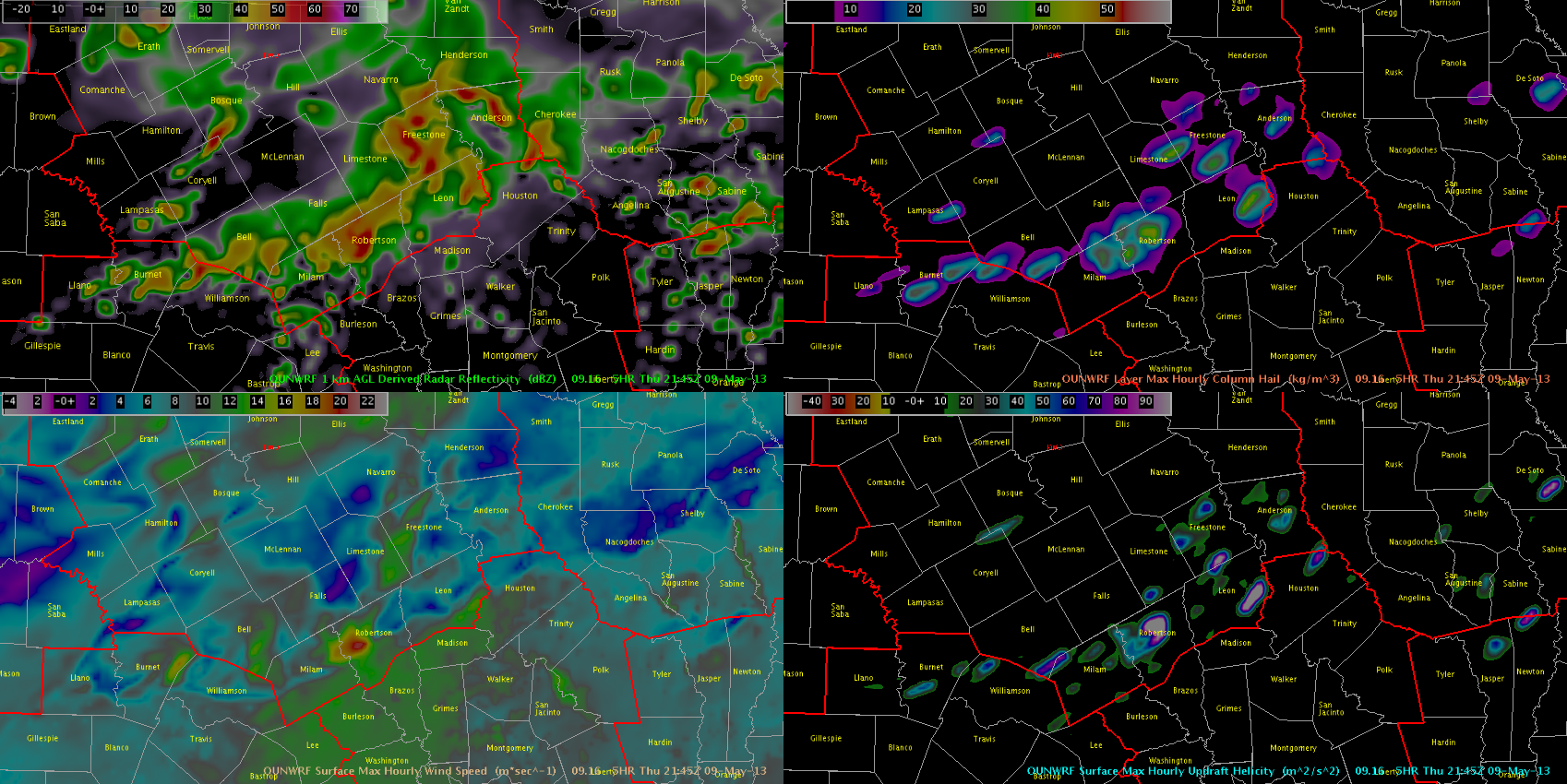
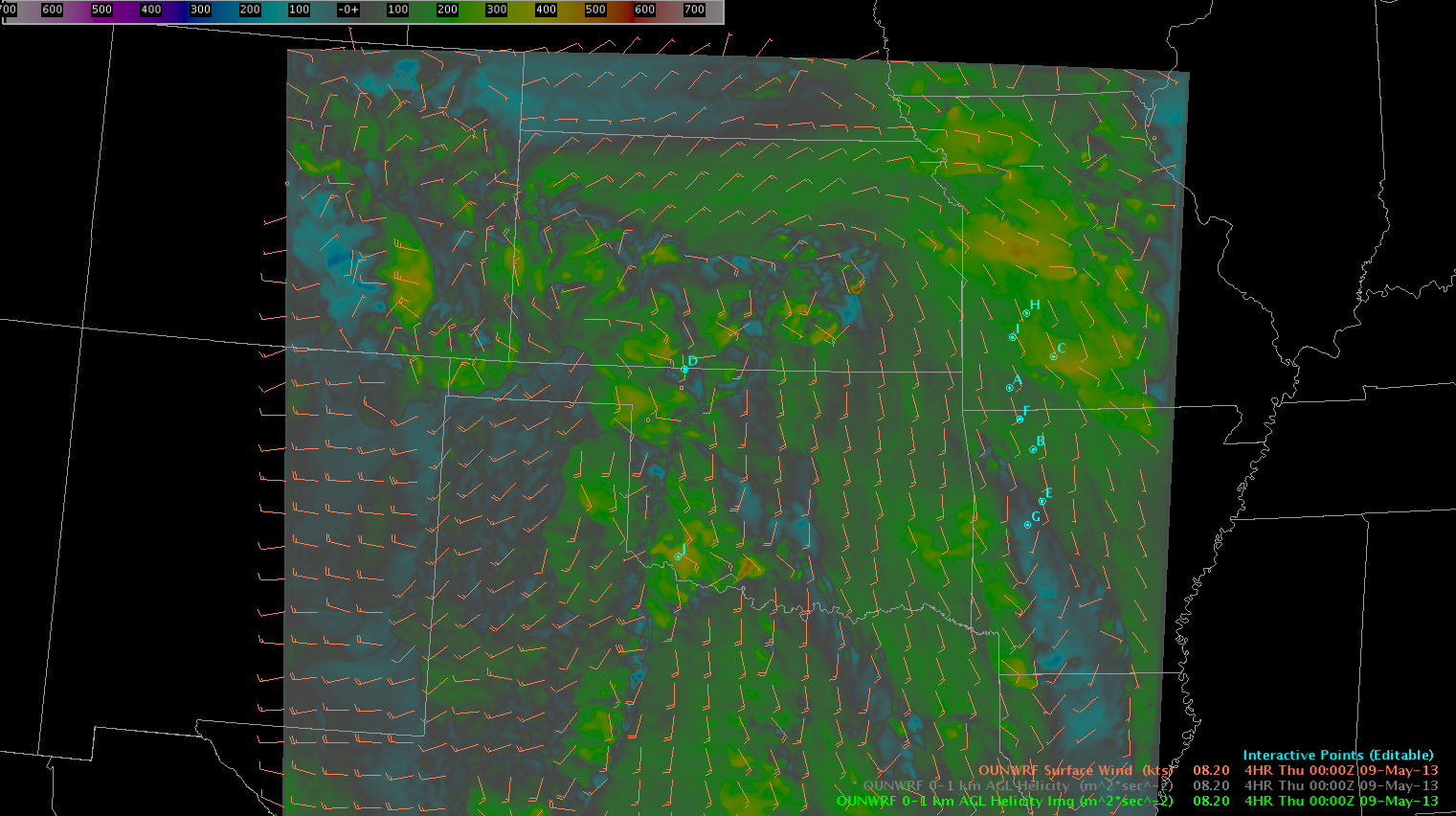
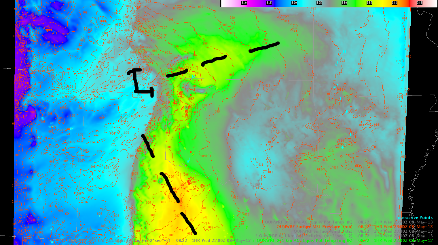
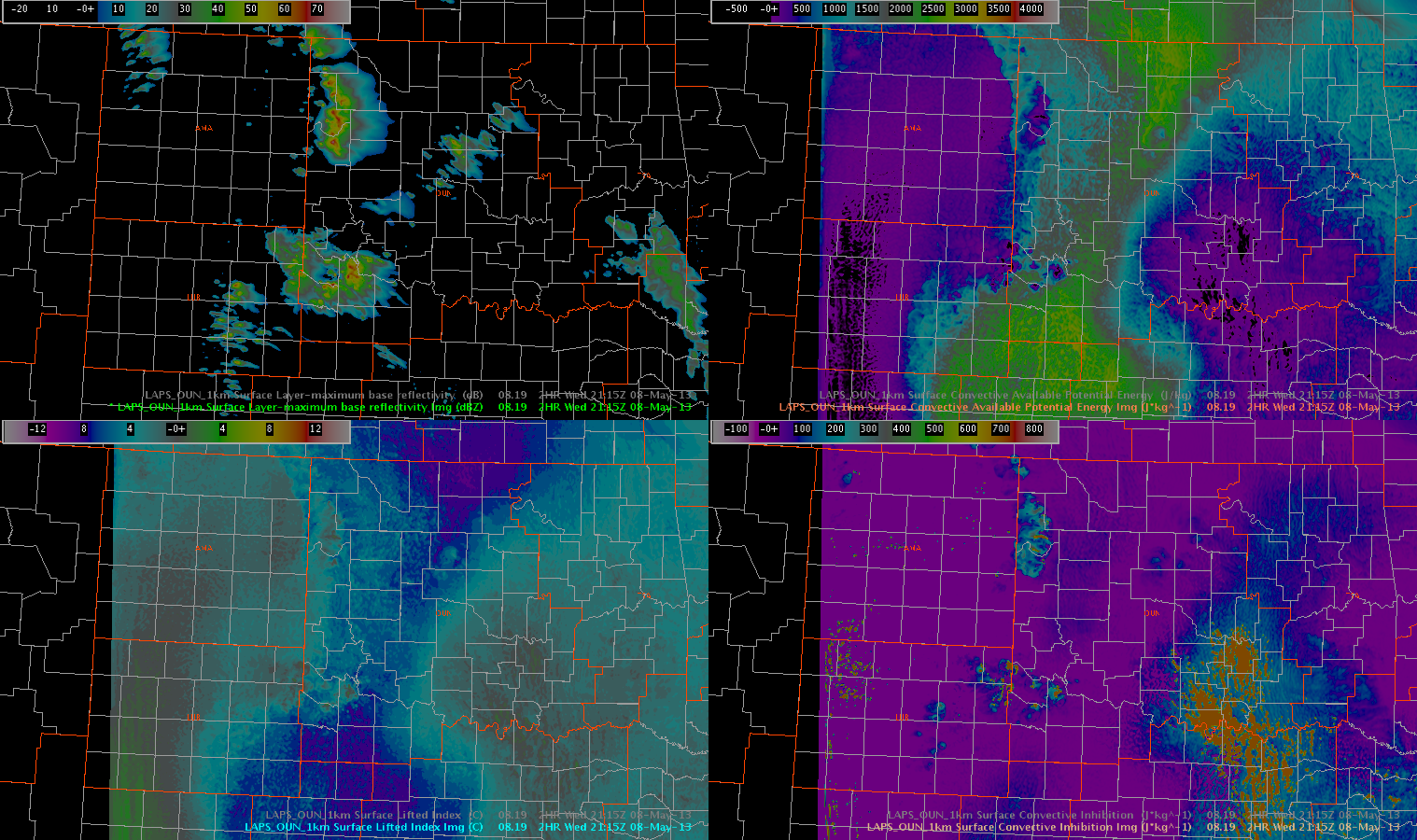
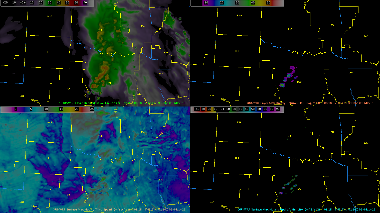
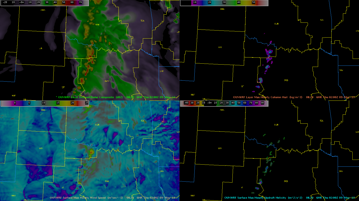
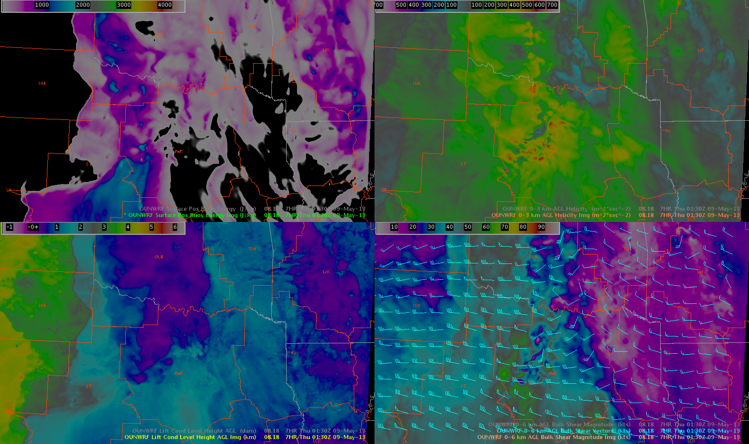
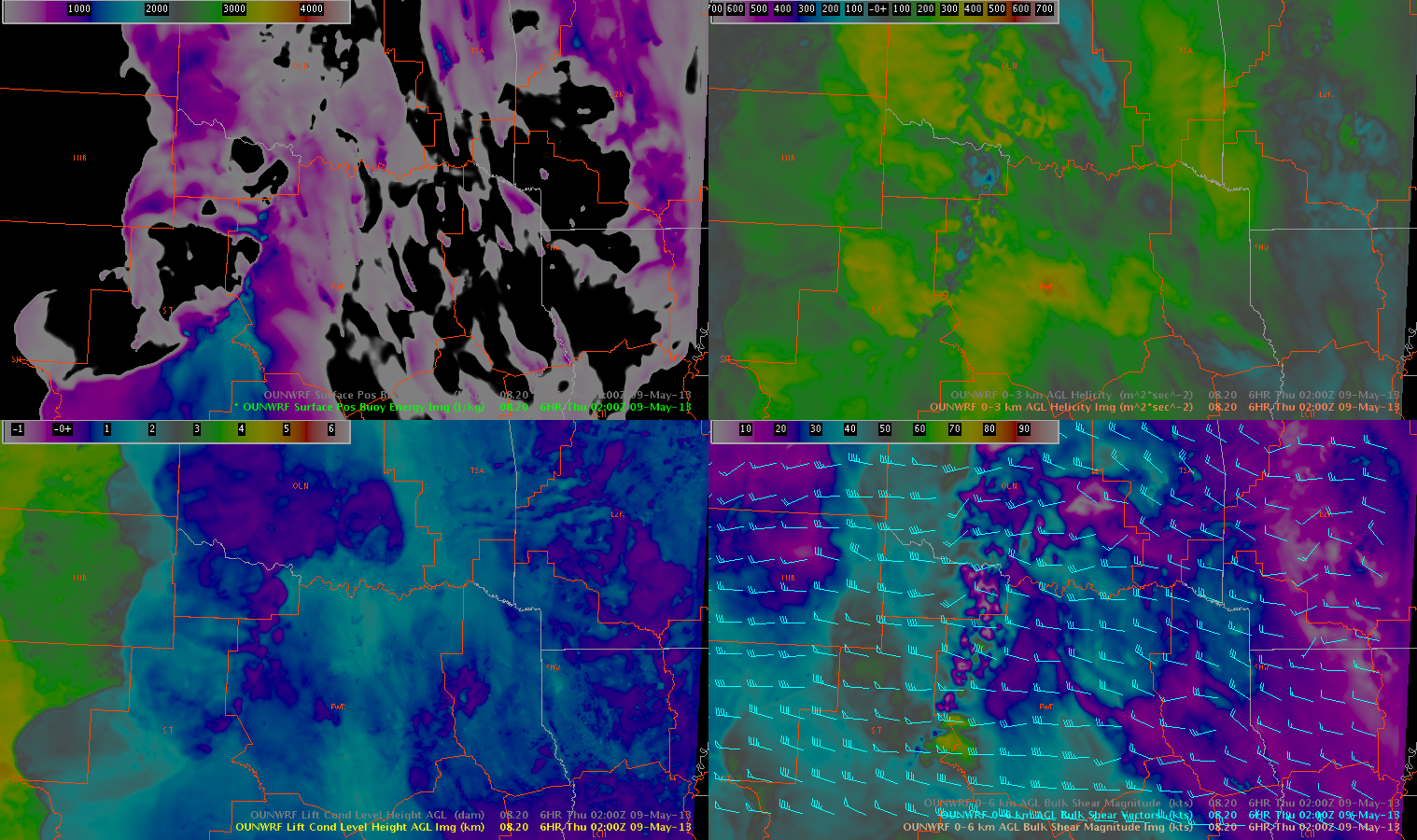
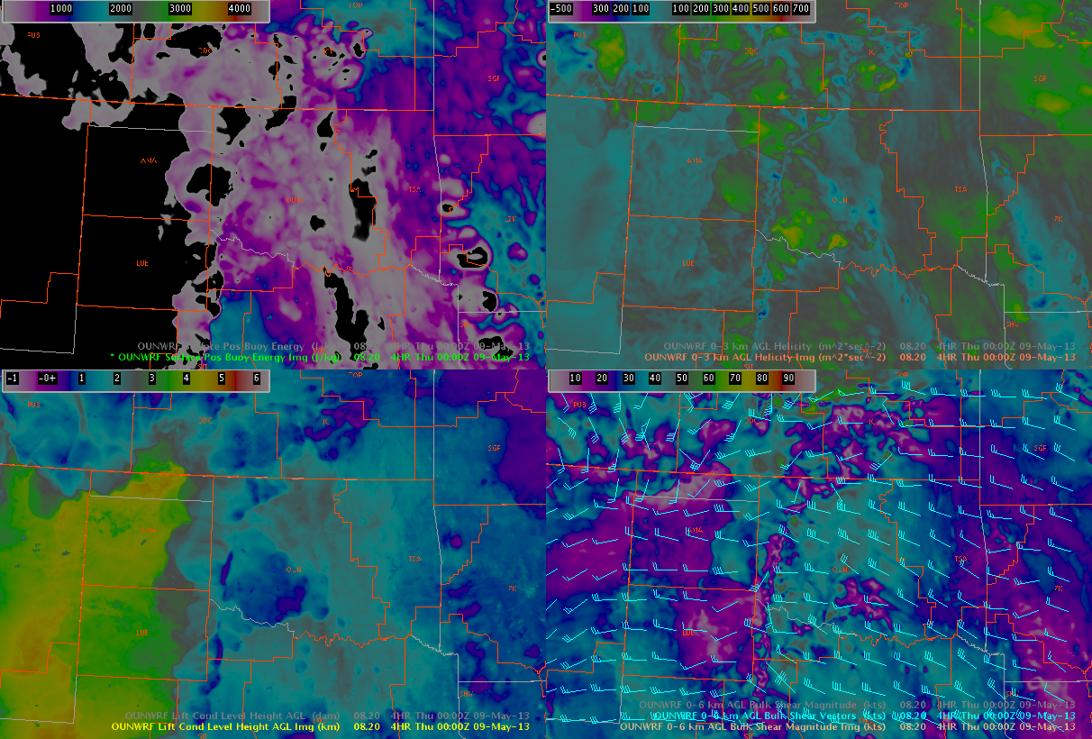
OUN WRF:
- generally good forecast
- cold pool event on Monday night was forecast well
- forecasters will need to be trained how to use it: don’t want them to dismiss the model because of timing and placement issues.
- model trends were helpful
- on Wednesday, forecasters felt convection was going to happen; OUN WRF developed nothing, and verified
- hourly column hail product worked well on at least two days
- updraft helicity was a little noisy
- did well on Thursday in the Dallas area
- it would be helpful if the color tables matched the 3DVAR
- suggest using high-resolution models to write aviation forecasts
- model might also be useful for lake-effect snow events, to determine future position of important boundaries
- suggest that more high-resolution models be set up; one for each region
GOES-R NearCast:
- useful up to 3-6 hours into the future — then, not so good
- on Thursday, showed unstable airmass northwest of Hastings after the front had clearly moved through
- to its credit, kept instability in central area when OUN WRF had moved it to the south
- theta-e difference product was considered to be the most accessible product
- proposed a merger of GOES-East and GOES-West to cover gap in coverage
- difficulty in using pressure changes owing to the changes in elevation from the Plains to the Rockies
- NearCast CAPE closely agrees/associates well with the model CAPE
- color scales for products could use contrast enhancement
GOES-R UAH SatCast/UW Cloud-Top Cooling:
- SatCast useful product, but might be good to filter lower signal
- some forecasters thought they would still appreciate seeing the low values in the CI product
- products complement each other
- products do not seem as useful over higher terrain
- some issues with CI false alarm rate, even when signal approached 70%
- CI false alarms decreased dramatically for signal greater than 80 or 90%
- neverthless, CI helped focus attention on areas that needed to be watched
- many detections in CI product can be overwhelming
- a few times, a lead time of 50 minutes was observed from convective initiation to hail observation
- categorical probabilities for CI is not preferred
- would like to see trends for each CI probability maxima; perhaps, a trend graph
- the timing of the full disk scan was frustrating; it occurs at the wrong time (during peak initiation time)
- might be helpful to see verification climatology
GOES-R PGLM:
- warned sooner on Monday in Huntsville, because of lightning jump
There are more GOES-R feedback details on the GOES-R HWT Blog Weekly Summary.
OVERALL COMMENTS:
- orientation was much better/organized this year
- pleased with the ability to change domains on the fly
- WES case was good, but it took a while to install
- another WES case might have been helpful
- it might be helpful to have a 2-3 hour (shorter) displayed real-time WES case at the experiment
- some difficulty setting up AWIPS procedures
- suggest having a “mentor” guide visiting forecaster through training on Mondays
CONTRIBUTORS:
Gabe Garfield, EWP2012 Week #5 Weekly Coordinator


