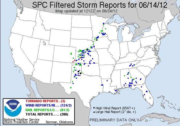
Today, we started operations in the Minneapolis (MN), Sioux Falls (SD), and Hastings (NE) county warning areas. An early morning mesoscale convective system persisted in the Minneapolis CWA, which limited destabilization. Nevertheless, the Minneapolis forecasters (Ty Judd and Mike Dutter) issued several severe thunderstorm warnings, with half-dollar size hail the most significant report among those received. These forecasters primarily evaluated the 3DVAR products.
The Sioux Falls forecasters (Steve Nelson and Tim Tinsley) saw no organized convection, which prompted a move to Omaha (NE). There, they issued several severe thunderstorm warnings and one tornado warning. Again, the forecasters primarily evaluated the 3DVAR products.
The Hastings forecasters (Jeff Garmon and Randy Skov) issued several severe thunderstorm warnings in their CWA for severe multicellular storms. Hail up to the size of tennis balls was reported. The Hastings forecasters were able to evaluate the OUN WRF, in addition to the 3DVAR products.
Finally, after the severe weather event in Minnesota transitioned to a heavy rain event, forecasters Ty Judd and Mike Dutter transferred to the Amarillo CWA. They issued a few severe thunderstorm warnings; hail up to the size of quarters was reported. They evaluated both the 3DVAR and OUN WRF experimental products.
-G. Garfield, Week 5 Coordinator

